
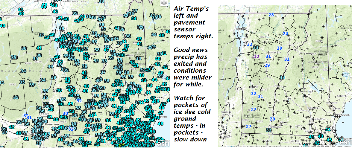
· Winds were fierce last night and were decreasing this morning… but the new wrinkle was the sudden icing that has taken place in spots where frost in the ground interacts with water and boom.
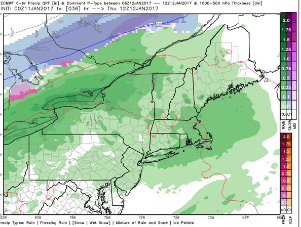
The map below looks harmless enough but DO NOT BUY IT! Light rain or rain showers will track into Vermont from the west-southwest before daybreak Thursday morning – Rain falling on sub-freezing ground (areas most likely where snow cover holds) will be a skating rink – yet again.
Tomorrow morning slow down…leave early and do watch the conditions.
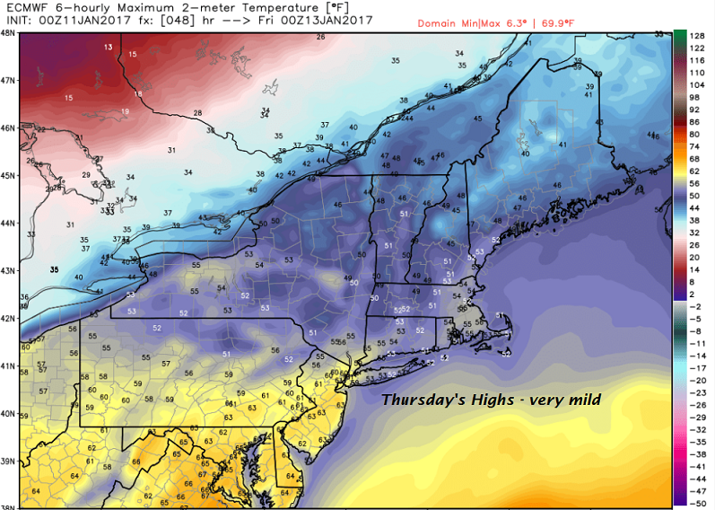
Eventually temperatures will rise Thursday afternoon late day maxes.
TODAY: Any early sprinkles exit to increasing amounts of sunshine. Milder and continued very blustery. A high in the lower 40s. Southwest winds 10 to 25 mph, with higher gusts this morning decreasing this afternoon.
TONIGHT: Fair this evening , then thickening clouds. Light rain showers developing before daybreak with a risk for pockets of freezing rain and treacherous travel. An evening low 32 to 35. South winds 10 to 15 mph.
Full Wolf Moon 6:34 AM Thursday
THURSDAY: Gray with intermittent rain or showers, moderate at times late. Areas of dense fog. A high around 50. South winds 10 to 20 mph.
Looking Further ahead…
THURSDAY NIGHT: Rain showers early, tapering off scattered sprinkles mixed with wet snow flakes. A low 20 to 25.
FRIDAY: Chance for a leftover flurry or mountain snow shower, otherwise partly sunny and blustery. A high 25 to 30.
SATURDAY: Filtered sunshine through high cloudiness at times. Colder. A low 5 below to 5 above. A high in the mid to upper teens.
SUNDAY: Partly to mostly sunny. Seasonably cold. A low 5 to 10. A high in mid 20s.
MONDAY: Mostly sunny. A low in the single digits. A high around 32.
Average lows in the single digits. Normal highs mid to upper 20s.
RH/1-11-17[end]
