Monday Night Weather — 12-9-24

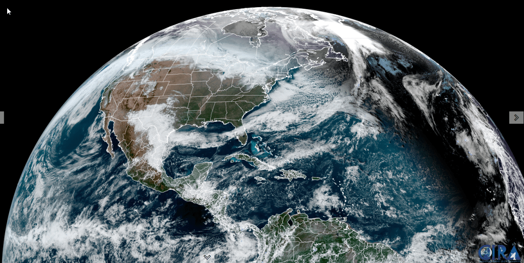
Roger Hill’s Radio Vermont forecast 3:00 PM Monday 12-9-24

Winter Weather Advisory thru 10 AM except for Champlain Valley

TONIGHT: Overcast. Periods of snow moderate to briefly heavy for a time this evening…tapering off to pockets of mixed precipitation and slick travel. A low mid-20s to around 30. East winds 10 mph.

TOMORROW: Gray. Scattered light rain showers. A high mid to upper 30s. Light southeast winds.

TUESDAY NIGHT: Cloudy. Periods of rain…a risk of freezing rain east of the Greens in the evening with slick travel. A low around 35. Southeast winds 10 mph.

WEDNESDAY: Overcast. Rain…moderate to heavy at times, with lots of snowmelt and rising rivers with potential for river flooding lower elevations. A high 40 to 45. Light southeast winds.

Looking further ahead

WEDNESDAY NIGHT: Rain, changing to wet accumulating snow elevated terrain, before exiting to some partial clearing overnight. Accumulations dusting to 2”. River levels maybe running moderately high. A low in the upper 20s.

THURSDAY: More sun than clouds. Chance for afternoon mountain snow showers or flurries with minor accumulations.                        A high in the low 30s.

FRIDAY: Mostly sunny. A low 10 to 15. A high 20 to 25.

SATURDAY: Lots of sunshine. A low in the single digits. A high in the mid to upper 20s.

Average lows teens to near 20. Average high upper 20s to mid-30s

RH/12-9forecast][end]

Friday Night Forecast —

Roger Hill’s Radio Vermont forecast 3:00 PM Friday 12-6-24

TONIGHT: Becoming mostly cloudy. Scattered light snow showers or flurries after midnight. A dusting to an inch. An early evening low 10 to 15. Light southwest winds.

TOMORROW: Mainly cloudy & rather cold. Scattered flurries early then drying up. Little accumulation. Continued colder than normal. A high near 25. Light west winds becoming southerly late.

SATURDAY NIGHT: Cloudy. Periods of snow likely late evening on, possibly moderate at times. Accumulations around an inch. A low around 15. South breeze 10 to 15 mph.

SUNDAY: Gray. Scattered light snow showers early tapering to isolated sprinkles. …dusting to an inch northern areas. Seasonable temperatures. A high 35 to 40. Winds becoming west to northwest 10 to 15 mph.

Looking further ahead

SUNDAY NIGHT: Lots of clouds. A low around 15.

MONDAY: Thickening clouds. Chance for rain or mixed precipitation developing with minor coatings. A high around 35

TUESDAY: Cloudy. Chance for early mixed precipitation tapering to sprinkles. A low near 32. A high upper 30s near 40.

WEDNESDAY: Overcast. Periods of rain…possibly moderate at times. Milder. A low mid-30s. A high 40 to 45.

Average low mid-teens to low 20s. Average high 35 to 40

This forecast and to be issued – Monday thru Friday.

RH/12-6forecast][end]

Thursday Night Weather

Roger Hill’s Radio Vermont forecast 3:00 PM Thursday 12-5-24

TONIGHT: Lots of clouds & blustery. Accumulating snow showers near the Green Mountains with lighter snowfalls or flurries elsewhere winding down overnight. Accumulations of a dusting…to locally 3” northern Green Mountain Ski Resorts. A low-upper teens. Northwest winds 10 to 20 mph and gusty.

TOMORROW: Morning clouds giving way to intervals of sunshine. Blustery and cold. A high in the upper teens to low 20s. Northwest winds 10 to 20 mph.

FRIDAY NIGHT: Considerable cloudiness. Scattered light lake effect snow showers or flurries after midnight. Minor accumulation. An early evening low around 15. Light southwest winds.

SATURDAY: Mainly cloudy & rather cold. Scattered flurries early then drying up. Little accumulation. A high in the low 20s. Light west winds.

Looking further ahead

SATURDAY NIGHT: Cloudy. Good chance for snow showers developing overnight, with accumulations around an inch. A low 5 to 10 above.

SUNDAY: Gray. Chance for light snow showers…dusting to an inch northern areas. A high near 40

MONDAY: Increasing clouds. Chance for rain or mixed precipitation developing in the afternoon. A low around 30. A high around 40.

TUESDAY: Cloudy. Chance for rain or mixed precipitation…possibly significant amounts with slick travel. A low around 32. A high low to mid 40s.

Average low mid-teens to low 20s. Average high 35 to 40

*This forecast and to be issued – Monday thru Friday.

RH/12-5forecast][end]

Roger Hill’s Radio Vermont forecast 3:00 PM Wednesday 12-4-24

Winter Weather Advisory thru late Thursday night…for multiple rounds of accumulating snow & slippery travel…

TONIGHT: Overcast. Occasional light accumulating snow or snow showers. Accumulations of an inch or two”. A low around 25. South winds 10 mph but gustier Champlain Valley. 

TOMORROW: Gray & becoming blustery late. Occasional light accumulating snow or snow showers continues. Accumulation about dusting to 2”…most off the valley floors. A high 32 to 35. Light south winds shifting to westerly and increasing late.

THURSDAY NIGHT: Lots of clouds & blustery. Light accumulating snow or snow showers with additional accumulation of 1 to locally 3”…most western slopes of the Greens. A low 10 to 15. Northwest winds 10 to 20 mph and gusty.

FRIDAY: Morning clouds giving way to intervals of sunshine. Blustery and colder with temperatures in the teens. Northwest winds 10 to 20 mph.

Looking further ahead

FRIDAY NIGHT: Considerable cloudiness. Scattered light lake effect snow showers or flurries after midnight with minor accumulation. A low 5 to 15 above.

SATURDAY: Mainly cloudy & rather cold. Chance for accumulating “lake effect” snow showers.. A high low to mid 20s.

SUNDAY: Gray. Chance for morning snow showers or flurries exiting in the afternoon. A low in the 20s. A high near 40

MONDAY: Increasing clouds. Chance for rain developing in the afternoon. A low in the 30s, highs in the lower 40s.

Average low mid-teens to low 20s. Average high 35 to 40

*This forecast and to be issued – Monday thru Friday.

RH/12-4forecast][end]

Tuesday night Forecast —

Roger Hill’s Radio Vermont forecast was updated 4 PM Tuesday 12-3-24

TONIGHT: Occasional flurries and mountain snow showers with a dusting to an inch ending toward midnight. Otherwise becoming partly to mostly cloudy. Light west winds. 

Winter Weather Advisory Wednesday Afternoon lasting into late Thursday night…multiple rounds of snow…

TOMORROW: A few breaks of morning sun, then clouding up. A rising chance for light accumulating snow or snow showers. The high upper 20s about 30. Winds becoming southerly 10 mph higher near Lake Champlain.

WEDNESDAY NIGHT: Overcast. Occasional light accumulating snow with an inch or two. A low near 25. Blustery out of the south.

THURSDAY: Gray skies with a peek or two of dim sun. Occasional accumulating light wet snow with about 1 to 2 inches especially higher northern terrain. A high 32 to 35. South winds 10 to 15 mph. 

Looking further ahead

THURSDAY NIGHT: Cloudy. Light snow accumulation up to 2” likely. A low around 15.

FRIDAY: More sun than clouds. Colder & blustery. A high 20 to 25.

SATURDAY: Mainly cloudy & rather cold. Chance for accumulating “lake effect” snow showers. Frigid with a morning low near 5 above. A high mid-20s.

Average low mid-teens to low 20s. Average high 35 to 40

*This forecast and to be issued – Monday thru Friday.

RH/12-3forecast][end]

December 2nd forecast details

Roger Hill’s Radio Vermont forecast 2:30 PM Monday 12-2-24

THIS AFTERNOON: Clouds with a few intervals of sun away from the mountains. Widely scattered mountain flurries. A high near 30.

TONIGHT: Variable clouds. Scattered snow showers and flurries especially northwestern Vermont with a dusting to a couple fluffy inches western slopes of the Greens. A low mid-teens to near 20. Light northwest winds.

TOMORROW: Mainly gray. Chance for snow showers/flurries mainly Champlain Valley. A high upper 20s to around 30. Light west winds.

Looking further ahead

TUESDAY NIGHT: Partly cloudy. A low around 15.

WEDNESDAY: A few breaks of morning sun, then clouding up leading to a rising chance for light accumulating snow or snow showers.A high upper 20s about 30.

THURSDAY: Gray skies with a peek or two of dim sun. Occasional accumulating light wet snow showers. A low near 25. A high 32 to 35 & breezy out of south.  

FRIDAY: Northern cloudiness with intervals of sun away from the mountains otherwise. Colder & blustery. Temperatures around 20, falling into the teens.

THIS WEEKEND: Unsettled and cold. Chance for accumulating snow showers especially Saturday. Lows in the teens, with highs in the 20s.   

Average low mid-teens to low 20s. Average high 35 to 40

*This forecast and to be issued – Monday thru Friday.

RH/12-2forecast][end]

Updated Monday Night Forecast — January 22nd, 2024

TONIGHT: Cloudy. Flurries likely developing with a minor coating overnight. A low in the mid-20s. Southwest winds 10 mph shifting to westerly overnight.

TOMORROW: Lots of clouds. Scattered flurries in the morning drying up in the afternoon. A high around 30. Light northwest winds.

TUESDAY NIGHT: Overcast. Light snow developing south to north later in the evening with light accumulations. A low near 20.Light northeast winds.

WEDNESDAY: Mainly cloudy.Light snow or snow showers likely in the morning. Around an inch of accumulation.A high in the upper 20s. Southeast winds 10 mph.

Looking further ahead

WEDNESDAY NIGHT: Cloudy.A good chance for periods of light rain or a wintry mix east of the Green Mountains with slick travel developing.An evening low around 30.

THURSDAY: Overcast.Chance for rain, becoming moderate at times, beginning early as a wintry mix with icy travel possible.Areas of fog. A high upper 30s.

FRIDAY: Cloudy.Chance for rain with pockets of freezing rain toward the Connecticut River Valley in the morning isolated rain showers in the afternoon. A low around 35. A high pushing to near 50.

SATURDAY: Mostly cloudy. Chance for a rain or snow shower. A low around 32. A high mid to upper 30s.

Average lows single digits. Average highs mid to upper 20s coldest period of winter.

RH/1-22forecast][end]

Updated Monday Morning Forecast — January 22nd, 2024

Coldest climatological period of winter…

TODAY: Periods of morning sunshine give way to more cloudiness this afternoon. A high jumps up into the low 30s. Light southwest winds, stronger near Lake Champlain.

TONIGHT: Gray skies. Flurries likely later this evening with a minor coating. A low in the mid-20s. Southwest winds 10 mph shifting to westerly overnight.

TUESDAY: Scattered flurries in the morning drying up in the afternoon. A high around 30. Light northwest winds.

Looking further ahead

TUESDAY NIGHT: Overcast. A rising chance for light snow developing south to north toward midnight with light accumulations. A low in the upper teens to low 20s.

WEDNESDAY: Chance for light snow or snow showers in the morning. Around an inch of accumulation.A high upper 20s to around 30.

THURSDAY: Overcast.Chance for rain, becoming moderate at times, beginning early as a wintry mix with icy travel possible.An early low around 30. A high reaching into the upper 30s.

FRIDAY: Cloudy.Chance for rain showers in the morning isolated in the afternoon.Areas of fog. A low in the low to mid 30s. A high pushing to near 50.

Average lows single digits. Average highs mid to upper 20s coldest period of winter.

RH/1-22forecast][end]

Updated Thursday morning Forecast — January 18th, 2024

TODAY: Variable morning clouds with breaks of sunshine, then clouding up. Scattered lake effect snow showers/flurries develop this afternoon, with a minor coating. A high in the lower 20s. West to southwest winds 10 mph.

TONIGHT: Mostly cloudy. Occasional mountain snow showers and valley flurries. A dusting to locally 2 inches of fluffy accumulation. A low 5 to 10 above. Little wind.

FRIDAY: Breaks or intervals of sun northern areas, otherwise clouding up. A stray flurry. A high near 15. Light north to northwest winds.

Looking further ahead

FRIDAY NIGHT: Lots of clouds.Chance for mountain snow showers, valley flurries overnight with a minor coating. A low about zero to 5 above.

SATURDAY: Gray & cold. Persistent scattered mountain snow showers and valley flurries. A dusting to couple inches of fluff. A high near just 10 degrees.

SUNDAY: Clouds with a few flurries early, then partly to mostly sunny in the afternoon. A low zero to 5 above. A high 10 to 15.

MONDAY: Some morning sun, then thickening clouds with more flurries northern areas. A low in the single digits. A high mid-20s.

TUESDAY: Mainly gray. Widely scattered flurries or mountain snow showers. A low in the upper teens to near 20. A high 25 to 30.

Average lows single digits. Average highs mid to upper 20s coldest period of winter.

RH/1-18forecast][end]

Updated Tuesday Morning Forecast — January 16th, 2024

Winter Weather Advisory thru 10 PM Tuesday evening…

TODAY: Gray. Light snow becoming likely mid to late morning on with 2 to locally 6” fluffy accumulation. A high in the low 20s. Light southeast winds.

TONIGHT: Light snow exits mid evening to a few stray flurries or “diamond dust”. Lingering clouds especially north. A low in the single digits above zero. Northwest winds 10 mph.

WEDNESDAY: Clouds with a few breaks of sun. A stray mountain flurry. A high 15 to 20. Southwest winds 10 mph.

Looking further ahead

WEDNESDAY NIGHT: Variable clouds.A low ranging thru the single digits.

THURSDAY: Clouding up. Occasional lake effect flurries, with minor coatings. A high upper teens to near 20.

FRIDAY: Variable cloudiness. Scattered light flurries with minor coatings. A low 5 below to 5 above. A high 10

to 15.

SATURDAY: Overcast & gray. Chance for a flurry. A low 5 below to 5 above. A high around 10 above.

Average lows single digits. Average highs mid-20s to upper 20s

RH/1-16forecast][end]