My Updated Wednesday Night Forecast — November 5th, 2025

Roger Hill’s Radio Vermont Forecast 3:00 PM TUESDAY 11-5-25

Wind Advisory thru 1 PM Thursday…

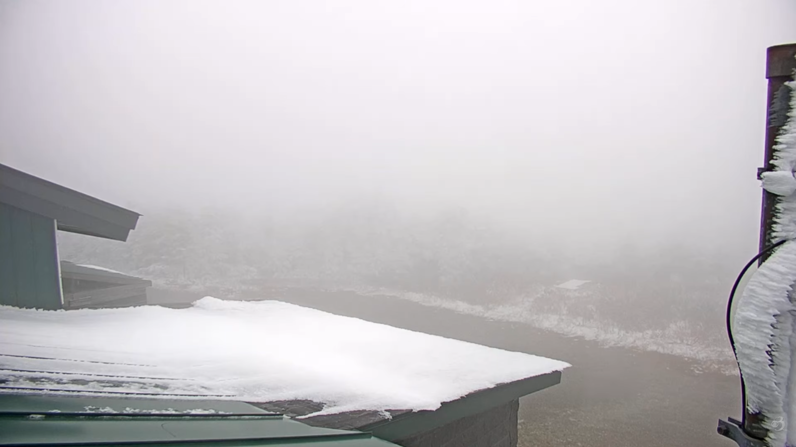
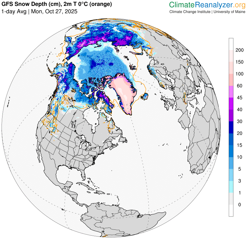
TONIGHT: Rain showers with wet snowflakes high terrain, changes to accumulating wet snow showers before midnight, with slushy travel in spots. A slushy dusting, to an inch or two – mostly up off valley floors. A low 32 to 35. Winds becoming northwesterly 10 to 25 mph with higher gusts late evening on.

TOMORROW: Flurries taper off with little accumulation, otherwise partly sunny. Blustery and colder. A high in the mid-30s. Northwest winds 10 to 25 mph & gusty.

THURSDAY NIGHT: Increasing clouds overnight. A freezing low in the low 20s. West winds 10 mph falling off overnight

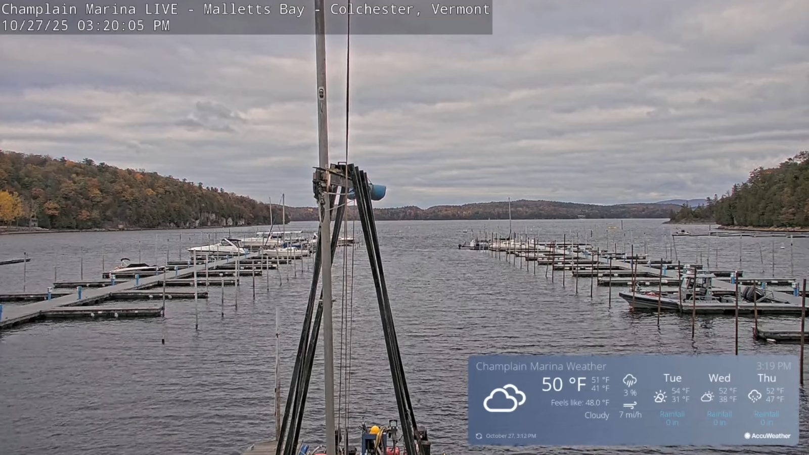
FRIDAY: Generally gray. Chance for light rain showers arriving late. A high in the low 40s. South winds 10 to 15 mph, stronger Lake Champlain.

Looking further ahead

FRIDAY NIGHT: Chance for light rain showers especially in the evening. Lows upper 30s around 40.

SATURDAY: Mostly cloudy. Scattered rain showers in the morning exiting in the afternoon. Highs around 50.

SUNDAY: Gray. Rising chance for rain showers, mixed with wet snowflakes high terrain. Morning lows upper 20s. Highs 40s.

MONDAY: Cloudy. Slight chance for a few sprinkles. Lows 30s. Highs 40 to 45.

Average low: upper 20s to low 30s Average high: mid 40s to around 50

Admin: No forecast Wednesday 12th of November

Admin: Time off (no forecast) November 17th thru 21st.

Meteorological winter begins December 12th

RH/11-4/forecast][end] Fox Trot Delta Tango

My Updated Tuesday Night Forecast — November 4th, 2025

Roger Hill’s Radio Vermont Forecast 3:00 PM TUESDAY 11-4-25

TONIGHT: Some evening clouds then mostly clear & fully moonlit. A frosty low in the upper 20s. Light west to southwest winds.

Full Beaver Moon at 8:19 AM

TOMORROW: Clouding up. Light rain showers about late morning on, mixed with wet snow flakes elevated terrain. A high in the mid-40s. Light south to southeast winds.

WEDNESDAY NIGHT: Rain showers likely moderate at times…changing to accumulating snow showers after midnight with slushy travel in spots. A dusting to 2” – most off valley floors. A low 32 to 35. Winds becoming northwesterly strong 10 to locally 30 mph with higher gusts elevated terrain.

THURSDAY: Snow showers or flurries taper off with minor additional accumulating early. Periods of afternoon sun. Blustery and notably colder. A high just mid-30s. Northwest winds 10 to 25 mph & gusty.

Looking further ahead

THURSDAY NIGHT: Increasing clouds overnight. A freezing low 20 to 25.

FRIDAY: Some morning sun then clouding up. Chance for rain showers arriving late. Highs 40 to 45.

SATURDAY: Overcast. Scattered rain showers passing through. Lows upper 30s. Highs 45 to 50.

SUNDAY: Grey. Chance for rain or showers. Morning lows 30 to 35. Highs 40s.

Average low: upper 20s to low 30s Average high: mid 40s to around 50

Admin: No forecast Wednesday 12th of November

Admin: Time off (no forecast) November 17th thru 21st.

Meteorological winter begins December 12th

RH/11-4/forecast][end] Fox Trot Delta Tango

My Updated Monday Night Forecast — November 3rd, 2025

Roger Hill’s Radio Vermont Forecast 3:00 PM MONDAY 11-3-25

TONIGHT: Considerable clouds.Rain showers…moderate at times this evening, becoming widely scattered overnight. A low 35 to 40. South to southwest winds shifting to westerly 10 to 15 mph.

TOMORROW: Partly to mostly cloudy. Blustery. Scattered mountain showers mixed with wet snow flakes higher terrain exiting later in the afternoon. A high around 45. Northwest winds 10 to 20 mph & gusty

TUESDAY NIGHT: Some evening clouds then mostly clear & fully moonlit. A frosty low upper 20s around 30. Light west to southwest winds.

Full Beaver Moon at 8:19 AM

WEDNESDAY: Mainly gray. Chance for light showers mid-day on, mixed with wet snow flakes elevated terrain late. A high 40 to 45. Light south to southeast winds shifting to easterly late.

Looking further ahead

WEDNESDAY NIGHT: Fair early, then clouding up. Chance for rain showers changing to accumulating snow showers and slippery travel. A dusting to 2” most in the higher terrain. A low near 32.

THURSDAY: Lots of clouds. Scattered mountain snow showers or flurries northern areas little accumulation. Well below normal in temperature. A high mid to upper 30s.

FRIDAY: Some morning sun then clouding up. A low 20 to 25. Highs 40 to 45.

SATURDAY: Overcast. Chance for periods of rain or rain showers. A low mid to upper 30s. Highs near 45.

Average low: upper 20s to low 30s Average high: mid 40s to around 50

Admin: No forecast Wednesday 12th of November

Admin: Time off (no forecast) November 17th thru 21st.

Meteorological winter begins December 12th

RH/11-3/forecast][end] Fox Trot Delta Tango

My updated Friday Night Forecast — October 31st, 20254

Roger Hill’s Radio Vermont Forecast 3:00 PM FRIDAY 10-31-25

TONIGHT: Halloween Eve: Cloudy & breezy to windy at times. Periods of rain mixing with wet snowflakes coating mountain summits. A low in the mid-30s. Winds shifting to northwesterly 10 to occasionally 25 mph.

TOMORROW: Any morning rain or wet snow showers exits early. Otherwise intervals of sun central and southern areas. Blustery remaining chilly. A high 40 to 45. Northwest winds 10 to 25 mph.

Eastern Standard Time (fall back)

SATURDAY NIGHT: Partly cloudy. Lows around 30. Northwest winds becoming light.

SUNDAY: Morning clouds then increasing afternoon sun. A high near 45. Northwest winds 10 to 15 mph.

Looking further ahead

SUNDAY NIGHT: Clear frosty, moonlit skies. A low in the upper 20s.

MONDAY: Morning sun gives way to lots of clouds. Rising chance for showers possibly moderate at times before dark. Highs 50 to 55.

TUESDAY: An early sprinkle/wet snowflake exits to increasing sunshine. Lows mid-30s. Highs around 45.

Full Beaver Moon at 8:19 AM

WEDNESDAY: Sunshine after morning fog…clouding up late. Lows around 30. Highs around 50.

Average low: upper 20s to low 30s Average high: upper 40s to mid-50s.

Admin: Time off (no forecast) November 17th thru 21st.

Meteorological winter begins December 12th

RH/10-31/forecast][end] Fox Trot Delta Tango

My updated Thursday Night Forecast — October 30th, 2025

Roger Hill’s Radio Vermont Forecast 3:00 PM THURSDAY 10-30-25

Wind Advisory thru 5 AM western Green Mountain slopes…

TONIGHT: Overcast. Periods of rain or showers redeveloping, moderate at times. Breezy to windy at times this evening. Temperatures holding in the 40s. East to southeast winds 10 to 20 mph and locally stronger western slopes, decreasing overnight.

TOMORROW: Mainly gray. Lingering showers. A high 50 to 55. Blustery, southwest winds 10 to 25 mph with higher gusts.

FRIDAY NIGHT Halloween Eve: Cloudy & breezy to windy at times. Good chance for showers mixing with wet snow with a light coating grassy surfaces higher terrain. A low in the mid-30s. Winds shifting to west northwesterly 10 to occasionally 25 mph.

SATURDAY: Any morning rain or wet snow showers exits early. Otherwise intervals of sun central and southern areas. Blustery remaining chilly. A high 40 to 45. Northwest winds 10 to 20 mph.

Looking further ahead

Eastern Standard Time (fall back)

SATURDAY NIGHT: Partly cloudy. Lows upper 20s.

SUNDAY: Mostly cloudy, then increasing afternoon sun. Highs around 45.

MONDAY: Morning sun gives way to lots of clouds. Rising chance for showers possibly moderate at times arrives toward dark. Lows 25 to 30. Highs mid to upper 40s.

TUESDAY: Scattered morning rain showers becoming isolated, with a few breaks of afternoon sun. Lows mid to upper 30s. Highs 45 to 50.

Average low: upper 20s to low 30s Average high: upper 40s to mid-50s.

Full Beaver Moon Wednesday November 5th, at 8:19 AM

Admin: Time off (no forecast) November 17th thru 21st.

Meteorological winter begins December 12th

RH/10-30/forecast][end] Fox Trot Delta Tango

My Updated Wednesday Night Forecast — October 29th, 2025

Roger Hill’s Radio Vermont Forecast 3:00 PM WEDNESDAY 10-29-25

TONIGHT: Fair early then thickening clouds overnight. A low around 32. Light southeast winds.

TOMORROW: Mainly gray & blustery. A round of showers in the morning, followed by a break with more showers arriving later on. A high upper 40s near 50. East to southeast winds 10 to 15 mph stronger southern areas.

THURSDAY NIGHT: Overcast. Periods of rain or showers likely, moderate at times. Windy at times. Temperatures holding 45 to 50. East to southeast winds 10 to 25 mph and gusty higher terrain.

FRIDAY Halloween: Unsettled with lots of clouds. Widely scattered showers. A high in the mid-50s. Windy again, southwest winds 10 to 20 mph with higher gusts.

Looking further ahead

FRIDAY NIGHT: Lots of clouds. Good chance for showers mixing with wet snow flakes northern mountains. Lows around 35.

SATURDAY: Clouds…maybe a break of sun. Any morning rain showers or wet snowflakes exits early. Highs mid-40s.

Eastern Standard Time (fall back)

SUNDAY: More sun than clouds. Maybe a sprinkle or wet snowflake northern Greens. Lows around 30. Highs around 45.

MONDAY: Morning sun gives way to afternoon clouds. Lows 25 to 30. Highs in the 40s.

Average low: upper 20s to low 30s Average high: upper 40s to mid-50s.

Full Beaver Moon November 5th, at 8:19 AM

Admin: Time off (no forecast) November 17th thru 21st.

Meteorological winter begins December 12th

RH/10-28/forecast][end] Fox Trot Delta Tango

My Updated Thursday Night Forecast — October 28th, 2025

Roger Hill’s Radio Vermont Forecast 3:00 PM TUESDAY 10-28-25

TONIGHT: Mostly clear with some high clouds. A low in the upper 20s around 30. Light northeast winds.

TOMORROW: Lots of sunshine with few high clouds. A high in the low 50s. Light northeast winds.

WEDNESDAY NIGHT: Fair early then thickening clouds. A low around 32. Light southeast winds.

THURSDAY: Mainly cloudy & blustery. Slight chance for late afternoon rain showers. A high 50 to 55. East to southeast winds 10 to 15 mph stronger southern areas.

Looking further ahead

THURSDAY NIGHT: Overcast. Good chance for periods of rain, moderate at times. A low in the mid-40s.

FRIDAY Halloween: Unsettled with lots of clouds. Chance for morning rain showers…becoming isolated widely scattered. A high near 55. Blustery southwest winds.

SATURDAY: More clouds than sun. Chance for morning rain showers mixed with wet snow flakes in the hills early. Lows 35 to 40. Highs in the 40s.

Eastern Standard Time (fall back)

SUNDAY: Mixed sun and clouds. Maybe a sprinkle or wet snowflake. Lows near 35. Highs 40 to 45.

Average low: upper 20s to low 30s Average high: upper 40s to mid-50s.

Full Beaver Moon November 5th, at 8:19 AM

Admin: Time off (no forecast) November 17th thru 21st.

Meteorological winter begins December 12th

RH/10-2897/forecast][end] Fox Trot Delta Tango

My updated Monday Night Forecast — October 27th, 2025

Roger Hill’s Radio Vermont Forecast 3:00 PM MONDAY 10-27-25

TONIGHT: A few evening clouds then clear & frosty. A low in the low 30s. Light northeast winds.

TOMORROW: Mostly sunny with some late day high clouds. A high near 50. Northeast winds 10 mph.

TUESDAY NIGHT: Mostly clear with some high clouds. A low in the upper 20s. Light northeast winds.

WEDNESDAY: Lots of sunshine with few high clouds. A high in the low 50s. Light east winds.

Looking further ahead

WEDNESDAY NIGHT: Fair early then thickening clouds. A low near 30.

THURSDAY: Mainly cloudy & blustery. A rising chance for late afternoon rain showers, possibly blending into periods of rain Thursday night. A high upper 40s near 50.

FRIDAY Halloween: Unsettled with lots of clouds. Scattered rain showers…possibly mixed with wet mountain snowflakes Halloween Eve. Blustery southwest winds. A low in the low to mid 40s.

Average low: upper 20s to low 30s Average high: upper 40s to mid-50s.

Eastern Standard Time (fall back) 2 AM Sun. November 2nd.

Full Beaver Moon November 5th, at 8:19 AM

Admin: Time off (no forecast) 11-17th thru 11-21-25

Meteorological winter begins December 12th

RH/10-27/forecast][end] Fox Trot Delta Tango

My Updated Friday Night Forecast — October 24th, 2025

Roger Hill’s Radio Vermont Forecast 3:00 PM FRIDAY 10-24-25

TONIGHT: A few passing evening sprinkles, then partly cloudy. Isolated valley fog. A low around 32. Light northwest winds.

TOMORROW: More clouds than sun. A couple sprinkles northern Greens. Continued below normal in temperature. A high in the mid-40s. Northwest winds 10 mph.

SATURDAY NIGHT: Variably cloudy. Chance for a shower, mixed with wet snow flakes in the hills. A low near 30. Light northwest winds.

SUNDAY: Mostly cloudy. Widely scattered light showers…mixed with wet snow flakes or ice pellets. A high just 45. Northwest winds 10 mph.

Looking further ahead

SUNDAY NIGHT: Partly cloudy to mostly clear. Patchy valley fog overnight. A low upper 20s/low 30s.

MONDAY: Considerable cloudiness. Maybe a sprinkle, or wet snow flake or ice pellet in the mountains. Some late day sun. Highs in the mid-40s.

TUESDAY: Partly to mostly sunny & dry after patchy morning fog. Lows around 30. Highs near 50.

WEDNESDAY: Mainly gray. Chance for a few showers possibly mixed with few ice pellets. Lows 35 to 40. Highs mid to upper 40s

Average low: 30 to 35 Average high: low to mid 50s.

Eastern Standard Time (fall back) 2 AM Sun. November 2nd.

Full Beaver Moon November 5, at 8:19 AM

Meteorological winter begins December 12th

RH/10-24/forecast][end] Fox Trot Delta Tango

My Updated Wednesday Night Forecast — October 22nd, 2025

Roger Hill’s Radio Vermont Forecast 3:00 PM WEDNESDAY 10-22-25

TONIGHT: A shower or two northern areas exits, otherwise becoming partly cloudy with patchy valley fog. A low in the upper 30s. South to southwest winds 10 mph, stronger near Lake Champlain.

TOMORROW: More clouds than sun. Chance for a shower or two in the afternoon. A high lower 50s. Southwest winds 10 to 15 mph.

THURSDAY NIGHT: Any early showers exit to partial clearing. A low in the mid-30s. Light west to southwest winds.

FRIDAY: Partly to mostly cloudy. Isolated showers or sprinkles, mixed with an ice pellet or two late. Highs about 50. Northwest winds 10 mph.

Looking further ahead

FRIDAY NIGHT: Partly cloudy. Patchy valley fog. A low in the low 30s.

SATURDAY: Clouds with a few breaks of sun. Slight chance for a sprinkle. Below normal in temperature. Highs in the mid-40s.

SUNDAY: Mostly cloudy. Widely scattered light showers…possible mixed with wet snow flakes higher mountains. A 30 to 35. Highs around 45.

MONDAY: Considerable cloudiness. Maybe a sprinkle or snow flake higher terrain. Lows 25 to 30. Highs in the

mid-40s.

Average low: 30 to 35 Average high: low to mid 50s.

Admin: No Forecast Tomorrow – Thursday

Eastern Standard Time (fall back) 2 AM Sun. November 2nd.

Full Beaver Moon November 5, at 8:19 AM

Meteorological winter begins December 12th

RH/10-22/forecast][end] Fox Trot Delta Tango