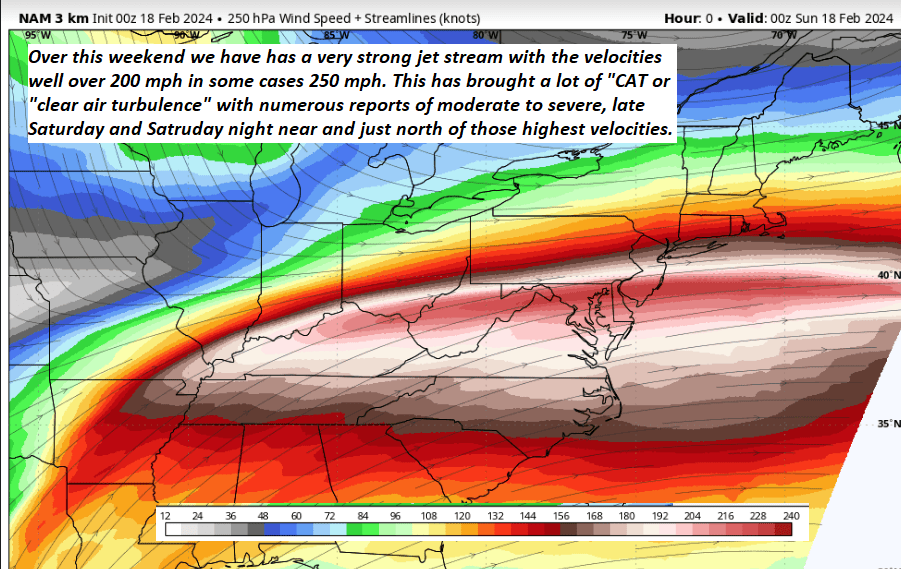
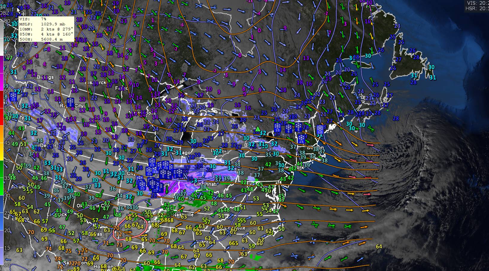
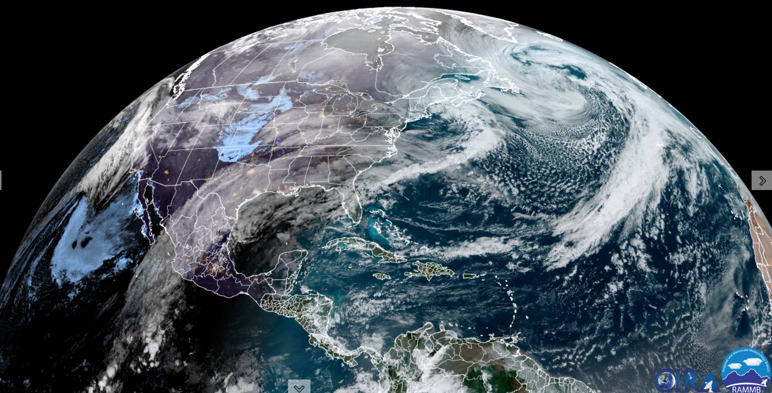
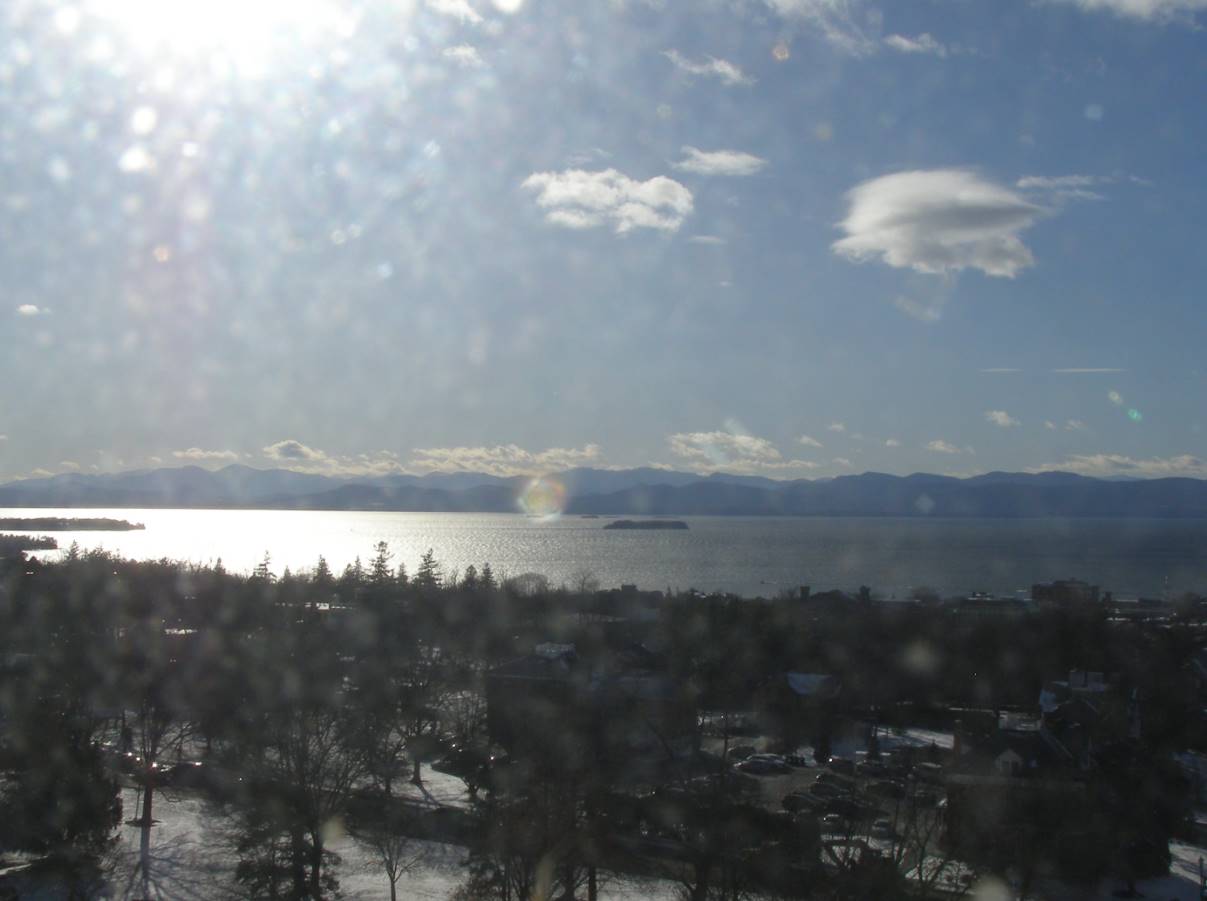
Strong Jet stream aloft with reports of moderate to severe turbulence due likely to velocity shear, or the differences in layers of wind as aviation ascends and descends thru these layers. The seat belt sign was likely lit and those strapped in…


TONIGHT: Considerable cloudiness. Scattered mountain flurries. A low around 15. Light southwest winds.
TOMORROW: Lingering flurries or periods of light accumulating snow. A dusting to an inch accumulation. Otherwise cloudy with some late day breaks. A high in the mid-20s. Northwest winds 10 mph.
SATURDAY NIGHT: Becoming mostly clear.A low zero to 10 above. Light northwest winds.
SUNDAY: Partly sunny early, then lots of clouds with scattered mountain flurries. A high in the mid to upper 20s. South to southwest winds 10 to 15 mph.

Looking further ahead
SUNDAY NIGHT: Mostly cloudy. Rising chance for scattered flurries. A low 10 to 15.
MONDAY: Chance for light accumulating snow showers or flurries in the morning with about an inch, partial afternoon clearing. A high near 25.
TUESDAY: Partly to mostly sunny. A low zero to 5 above. A high around 30.
WEDNESDAY: Partly to mostly sunny. A low in the mid-teens. A high around 45.
Average lows mid-single digits to mid-teens. Average highs upper 20s to mid-30s.
RH/2-15forecast][end]

Winter Weather Advisory expires toward mid-day
TODAY: Accumulating light snow northern areas early with up to an inch additional accumulation, otherwise scattered flurries and becoming blustery. A high about 25. Winds becoming west to northwesterly 10 to 25 mph.
TONIGHT: Considerable cloudiness. Scattered flurries with minor accumulation. A low around 15. Light southwest winds.
SATURDAY: Lingering flurries. Otherwise, a few breaks of afternoon sunshine. A high in the mid-20s. Northwest winds 10 mph.
Looking further ahead
SATURDAY NIGHT: Becoming mostly clear.A low zero to 10 above.
SUNDAY: Sunshine giving way to afternoon clouds. A high in the mid to upper 20s.
MONDAY: Chance for light accumulating snow showers or flurries in the morning with about an inch, partial afternoon clearing. A low 10 to 15. A high near 25.
TUESDAY: Partly to mostly sunny. A low zero to 5 above. A high around 30.
WEDNESDAY: Mostly sunny. A low in the mid-teens. A high around 45.
Average lows mid-single digits to mid-teens. Average highs upper 20s to mid-30s.
RH/2-15forecast][end]
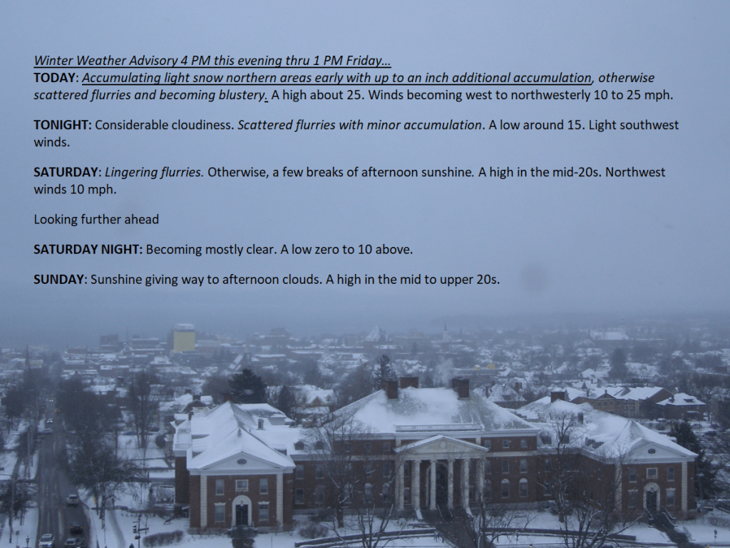

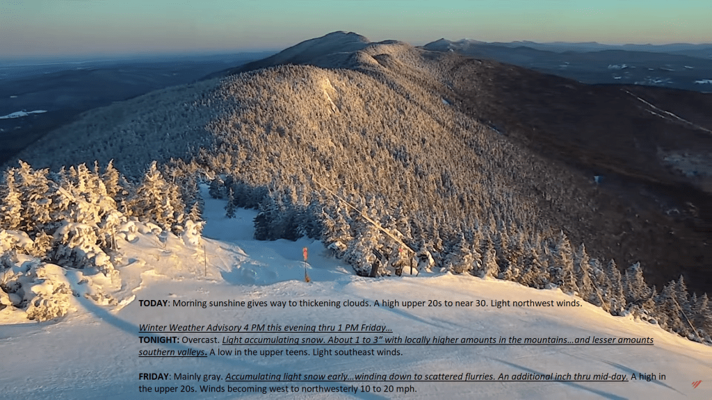
Winter Weather Advisory 4 PM this evening thru 1 PM Friday…
TONIGHT: Overcast. Light accumulating snow.About 1 to 3” with locally higher amounts in the mountains…and lesser amounts southern valleys.A low in the upper teens.Light southeast winds.
TOMORROW: Mainly gray. Accumulating light snow early…winding down to scattered flurries. An additional inch thru mid-day. A high about 25. Winds becoming west to northwesterly 10 to 20 mph.
FRIDAY NIGHT: Considerable cloudiness. Scattered flurries with minor accumulation. A low 10 to 15. Light southwest winds.
SATURDAY: Lingering flurries. Otherwise, a few breaks of afternoon sunshine. A high about 25. Northwest winds 10 mph.
Looking further ahead
SATURDAY NIGHT: Becoming mostly clear.A low 5 below to 5 above.
SUNDAY: Sunshine giving way to afternoon clouds. A high around 25.
MONDAY: Chance for light snow showers or flurries in the morning, partial afternoon clearing. A low 10 to 15. A high 20 to 25.
TUESDAY: Mostly sunny. A low 5 below to 5 above. A high 25 to 30.

Average lows mid-single digits to mid-teens. Average highs upper 20s to mid-30s.
RH/2-15forecast][end]

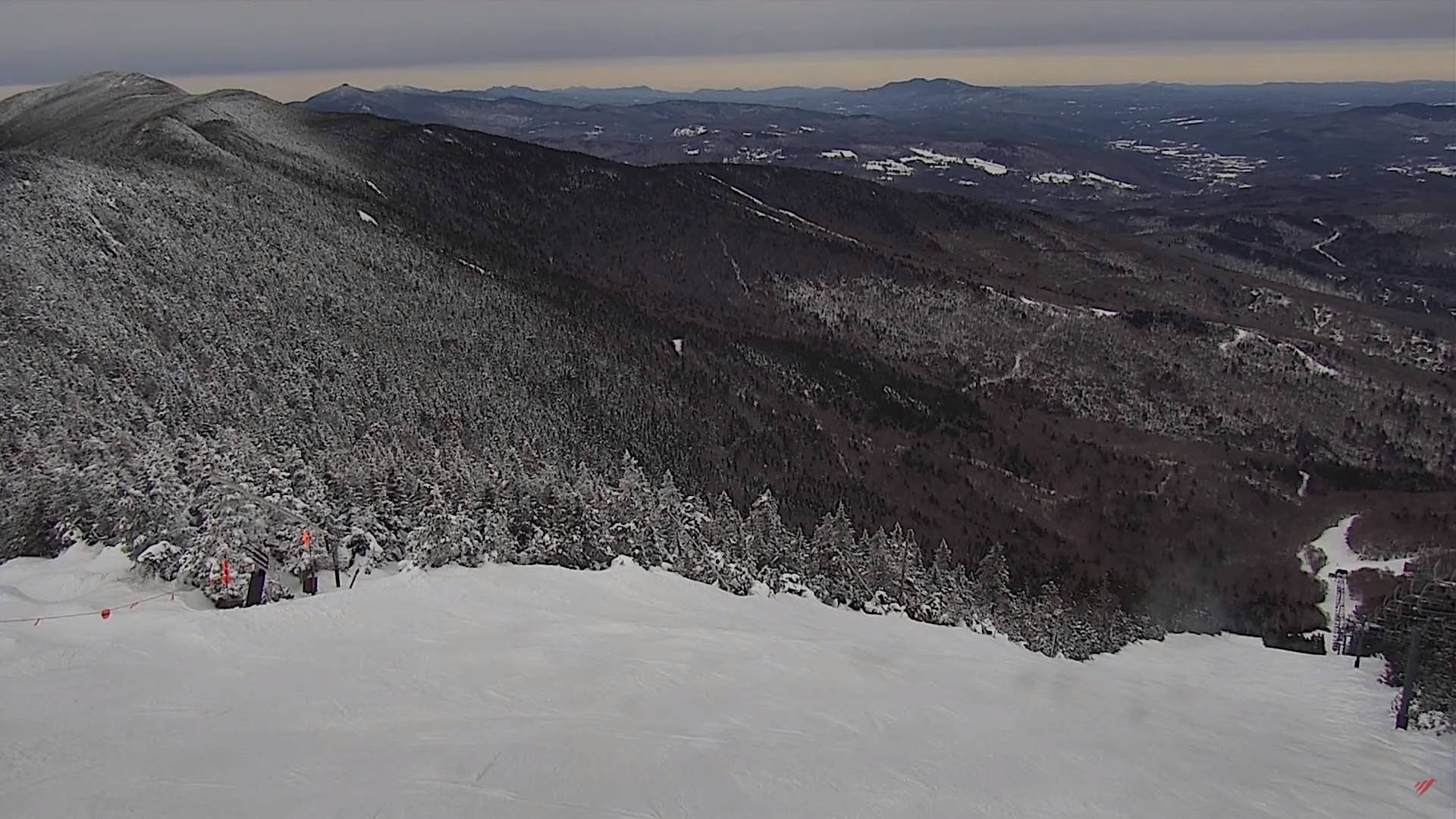
TODAY: Morning sunshine gives way to thickening clouds. A high upper 20s to near 30. Light northwest winds.
Winter Weather Advisory 4 PM this evening thru 1 PM Friday…
TONIGHT: Overcast. Light accumulating snow.About 1 to 3” with locally higher amounts in the mountains…and lesser amounts southern valleys.A low in the upper teens.Light southeast winds.
FRIDAY: Mainly gray. Accumulating light snow early…winding down to scattered flurries. An additional inch thru mid-day. A high in the upper 20s. Winds becoming west to northwesterly 10 to 20 mph.
Looking further ahead

FRIDAY NIGHT: Considerable cloudiness. Scattered flurries with minor accumulation. A low around 15.
SATURDAY: Lingering flurries. Otherwise, a few breaks of afternoon sunshine. A high around 25.
SUNDAY: Sunshine giving way to afternoon clouds. A low zero to 5 above. A high around 25.

MONDAY: Chance for light snow showers or flurries in the morning, partial afternoon clearing. A low around 15. A high in the upper 20s to around 30.
TUESDAY: Mostly sunny. A low 5 below to 5 above. A high around 30.
Average lows mid-single digits to mid-teens. Average highs upper 20s to mid-30s.

RH/2-15forecast][end]
TONIGHT: Some evening clouds, then becoming mostly clear. A low upper single digits to around 10. Northwest winds 10 to 15 mph early, falling off overnight.
TOMORROW: Morning sunshine gives way to thickening clouds. A high 25 to 30. Light northwest winds.

THURSDAY NIGHT: Overcast. Periods of light accumulating snow.Accumulations of about 1 to 3” northern areas and a dusting 2” south.A low in the upper teens.Light southeast winds.
FRIDAY: Mainly gray. Accumulating light snow early…winding down to scattered flurries. An additional inch or so of accumulation. A high in the mid-20s. Winds becoming west to northwesterly 10 to 20 mph.
Looking further ahead

FRIDAY NIGHT: Considerable cloudiness. A stray mountain flurry. A low in the mid-teens.
SATURDAY: Partly to mostly cloudy. Widely scattered flurries. A high around 25.
SUNDAY: Sunshine giving way to afternoon clouds. A low in the single digits. A high around 25.

MONDAY: Mostly cloudy. Chance for flurries. A low 10 to 15. A high mid to upper 20s.
Average lows mid-single digits to mid-teens. Average highs upper 20s to mid-30s.
RH/2-14forecast][end]
TODAY: Clouds with intervals of sun away from the mountains this morning. Otherwise blustery, occasional mountain flurries winding down. Little additional accumulation. Colder with a high 20 to 25. Northwest winds 10 to 25 mph, with higher gusts especially southern areas.
TONIGHT: Evening clouds, then mostly clear. A low near 10. Northwest winds 10 mph falling off overnight.
THURSDAY: Morning sun, then clouding up in the afternoon. A high in the mid to upper 20s. Light northwest winds.
Looking further ahead
THURSDAY NIGHT: Thickening clouds, leading to a good chance for light snow. A low in the upper teens.
FRIDAY: Mainly gray. Chance for accumulating snow in the morning, winding down to scattered flurries. Accumulations of 1 to locally 4”. A high in the mid-20s.

SATURDAY: Partly to mostly cloudy. Widely scattered flurries. A low in the mid-teens. A high around 25.
SUNDAY: Sunshine giving way to afternoon clouds. A low 5 to 10 above. A high around 25.
Average lows mid-single digits to mid-teens. Average highs upper 20s to mid-30s.

RH/2-14forecast][end]
