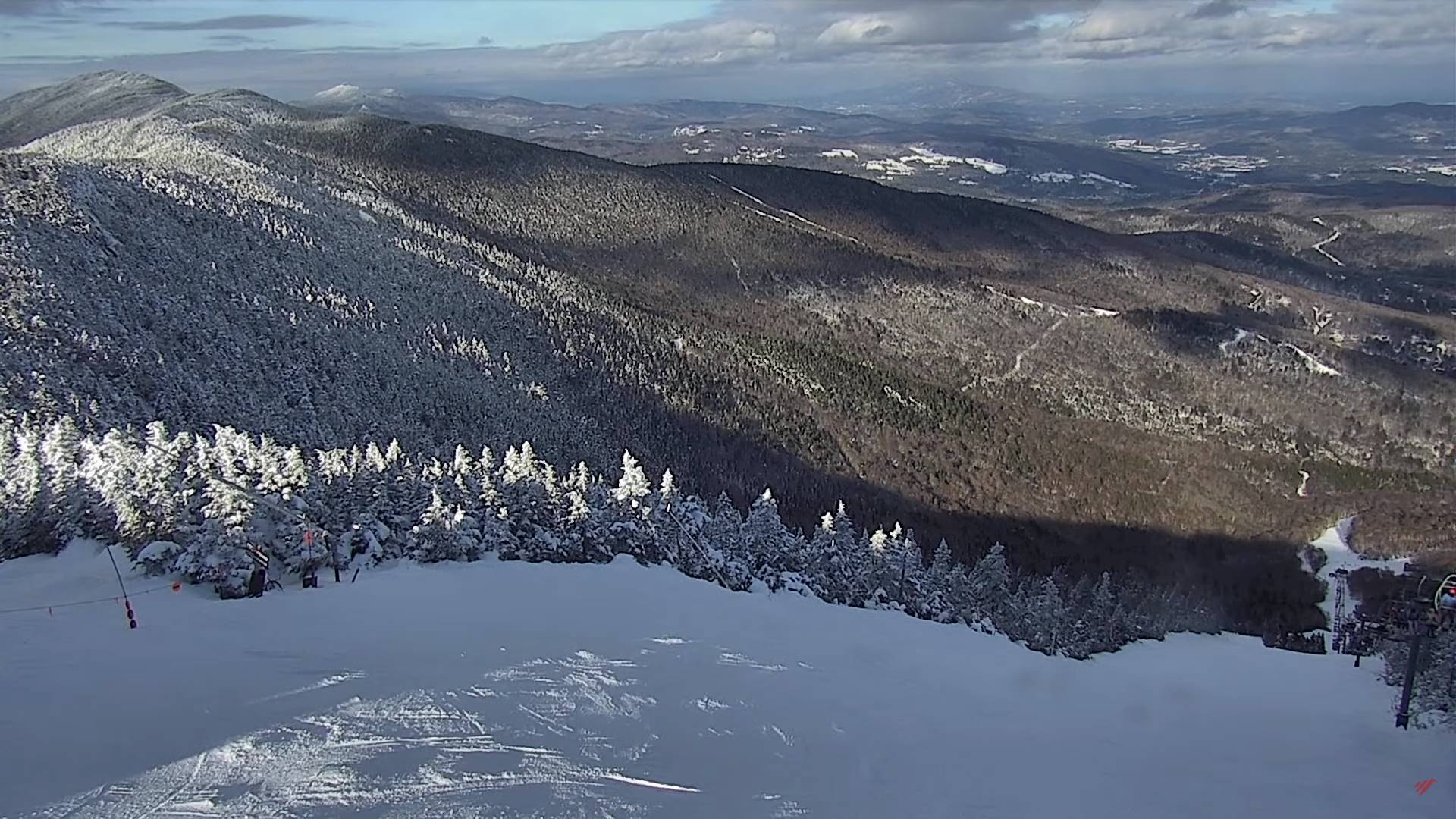
Milder push on the way where Sugar-makers should see some sap runs in more open exposed snow-less Sugarbush. An arctic front will remind us what late winter/early spring feels like again on Friday night and Saturday. Much warmer again next week.

![]()
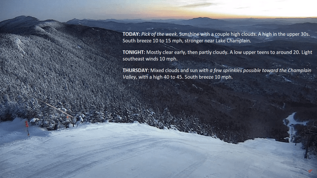
TONIGHT: Mostly clear early, then partly cloudy.A low upper teens to around 20. Light southeast winds.
TOMORROW: Mixed clouds and sun with a few sprinkles Champlain Valley. A high near 45. South breeze 10 mph.
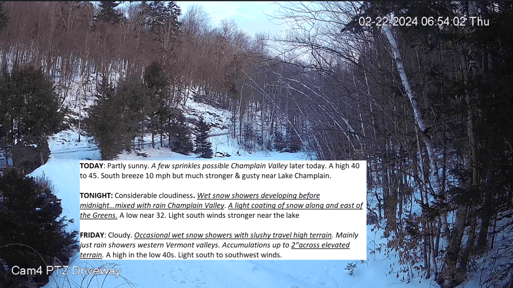
THURSDAY NIGHT: Lots of clouds. Wet snow showers becoming likely before midnight…mixed with rain Champlain Valley.A dusting to a slushy inch.A low near 30. Light south winds.
FRIDAY: Cloudy. Periods of light accumulating wet snow likely with slushy travel higher terrain. Snow mixed with rain western Vermont valleys. A dusting to 2”with the most in the higher terrain. A high in the upper 30s. Light southwest winds.
Looking further ahead
FRIDAY NIGHT: Scattered wet snow showers or flurries winding down. Additional minor accumulation. A low around 5 above.
SATURDAY: Turning blustery and sharply colder. Scattered snow showers with a risk of a snow squall early, otherwise mostly sunny. A high 10 to 15.
SUNDAY: Sunshine gives way to mostly cloudy skies. A low zero to 5 below. A high 25 to 30.
MONDAY: Morning clouds then partly sunny. Chance for a snow shower.A low in the 20s. A high mid-30s.
Average lows mid-single digits to mid-teens. Average highs in the low to mid 30s.
RH/2-20forecast][end]
TODAY: Pick of the week. Sunshine with a couple high clouds. A high in the upper 30s. South breeze 10 to 15 mph, stronger near Lake Champlain.
TONIGHT: Mostly clear early, then partly cloudy.A low upper teens to around 20. Light southeast winds 10 mph.
THURSDAY: Mixed clouds and sun with a few sprinkles possible toward the Champlain Valley, with a high 40 to 45. South breeze 10 mph.
Looking further ahead
THURSDAY NIGHT: Lots of clouds. A rising chance for wet snow.A low around 30.
FRIDAY: Gray. Chance for light accumulating wet snow mixed with rain western Vermont valleys. A dusting to 2”with the most in the higher terrain. A high in the mid-30s.
SATURDAY: Turning blustery and sharply colder. Scattered snow showers with a risk of a snow squall early, otherwise mostly sunny. A low zero to 10. A high in the mid to upper teens.
SUNDAY: Sunshine gives way to mostly cloudy skies. A low 5 below to 5 above. A high near 30.
Average lows mid-single digits to mid-teens. Average highs in the low to mid 30s.
RH/2-20forecast][end]
TONIGHT: Becoming mostly clear & cold. A low zero to 10 above. Light southeast winds.
TOMORROW: Sunshine with a couple high clouds. A high in the upper 30s. South breeze 10 to 15 mph, stronger near Lake Champlain.
WEDNESDAY NIGHT: Mostly clear early, then partly cloudy.A low 15 to 20. South to southeast winds 10 mph.
THURSDAY: Mixed clouds and sun with a few sprinkles possible toward the Champlain Valley, with a high 40 to 45. South breeze 10 mph.
Looking further ahead
THURSDAY NIGHT: Thickening clouds. A rising chance for wet snow.A low in the upper 20s.
FRIDAY: Gray. Chance for accumulating wet snow across elevated terrain…mixed with rain lower valley floors. A dusting to 2”mainly elevated terrain. A high upper 30s.
SATURDAY: Chance for a few snow showers or squalls early, otherwise increasing afternoon sunshine, blustery and sharply colder. A low in the mid to upper teens. Temperatures in the mid to upper teens.
SUNDAY: Sunshine gives way to mostly cloudy skies. A low in the single digits. A high near 30.
Average lows mid-single digits to mid-teens. Average highs in the low to mid 30s.
RH/2-20forecast][end]

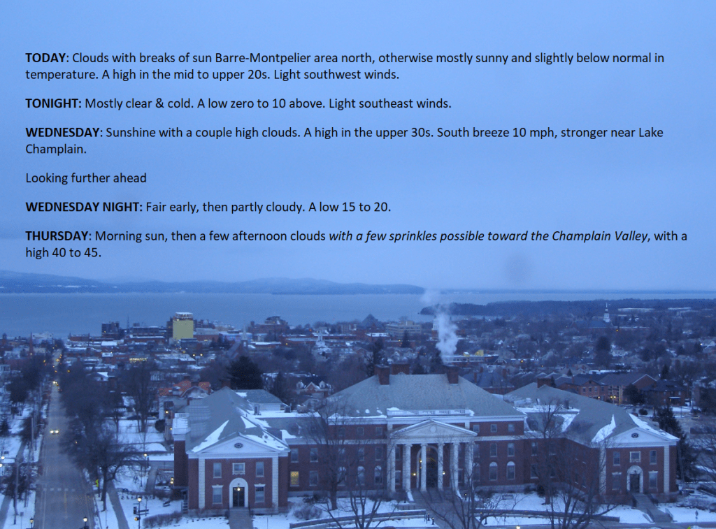
TODAY: Clouds with breaks of sun Barre-Montpelier area north, otherwise mostly sunny and slightly below normal in temperature. A high in the mid to upper 20s. Light southwest winds.
TONIGHT: Mostly clear & cold.A low zero to 10 above. Light southeast winds.
WEDNESDAY: Sunshine with a couple high clouds. A high in the upper 30s. South breeze 10 mph, stronger near Lake Champlain.
Looking further ahead
WEDNESDAY NIGHT: Fair early, then partly cloudy.A low 15 to 20.
THURSDAY: Morning sun, then a few afternoon clouds with a few sprinkles possible toward the Champlain Valley, with a high 40 to 45.
FRIDAY: Gray. Rising chance for accumulating wet snow across elevated terrain…mixed with rain drops valley floors. A dusting to 2”mainly elevated terrain. A low in the upper 20s. A high upper 30s.

SATURDAY: Chance for a few snow showers or squalls early, otherwise increasing sunshine, blustery and sharply colder. A low in the mid to upper teens. Temperatures in the mid to upper teens.
SUNDAY: Sunshine gives way to mostly cloudy skies. A low in the single digits. A high near 30.
Average lows mid-single digits to mid-teens. Average highs in the low to mid 30s.

RH/2-20forecast][end]
TONIGHT: Clear skies with a few more clouds toward daybreak. A low 5 below to 5 above. Light northwest winds.
TOMORROW: Northern mountain cloudiness, otherwise sunny. A high in the upper 20s. Light southwest winds.
TUESDAY NIGHT: Mostly clear with a few high clouds.A low zero to 10 above. Light southeast winds.
WEDNESDAY: Sunshine with variable high clouds. A high in the upper 30s near 40. South breeze 10 mph, stronger near Lake Champlain.
Looking further ahead
WEDNESDAY NIGHT: Fair early, then partly cloudy.A low in the upper teens
THURSDAY: Variable cloudiness. Maybe a few flurries or sprinkles toward the Champlain Valley, with a high in the low 40s.
FRIDAY: Gray. Scattered showers of wet snow mixed with rain drops valley floors. A low in the upper 20s. A high upper 30s.
SATURDAY: Chance for a few snow showers or squalls early, otherwise increasing sunshine, blustery and sharply colder. A low in the mid to upper teens. Temperatures in the mid to upper teen
Average lows mid-single digits to mid-teens. Average highs in the low to mid 30s
RH/2-19forecast][end]

TODAY: Northern Mountain clouds with isolated flurries…gives way to increasing sunshine. A high 15 to 20. Northwest winds 10 mph.
TONIGHT: Clear skies with a few more clouds toward daybreak. A low zero 10 below. Light northwest winds.
TUESDAY: Northern mountains cloudiness, otherwise mostly sunny. A high in the upper 20s. Light west winds.

Looking further ahead
TUESDAY NIGHT: Mostly clear with a few high clouds.A low 5 to 15 above.
WEDNESDAY: Sunshine with a few high clouds. A high upper 30s to around 40.

THURSDAY: Variable cloudiness. A rising chance for a few flurries or sprinkles toward the Champlain Valley. A low in the upper teens, with a high in the low 40s.
FRIDAY: Considerable cloudiness. Scattered showers of wet snow, freezing rain or rain northern and western areas. A low in the upper 20s to around 30. A high in the low 40s.

Average lows mid-single digits to mid-teens. Average highs in the low to mid 30s
RH/2-19forecast][end]
