
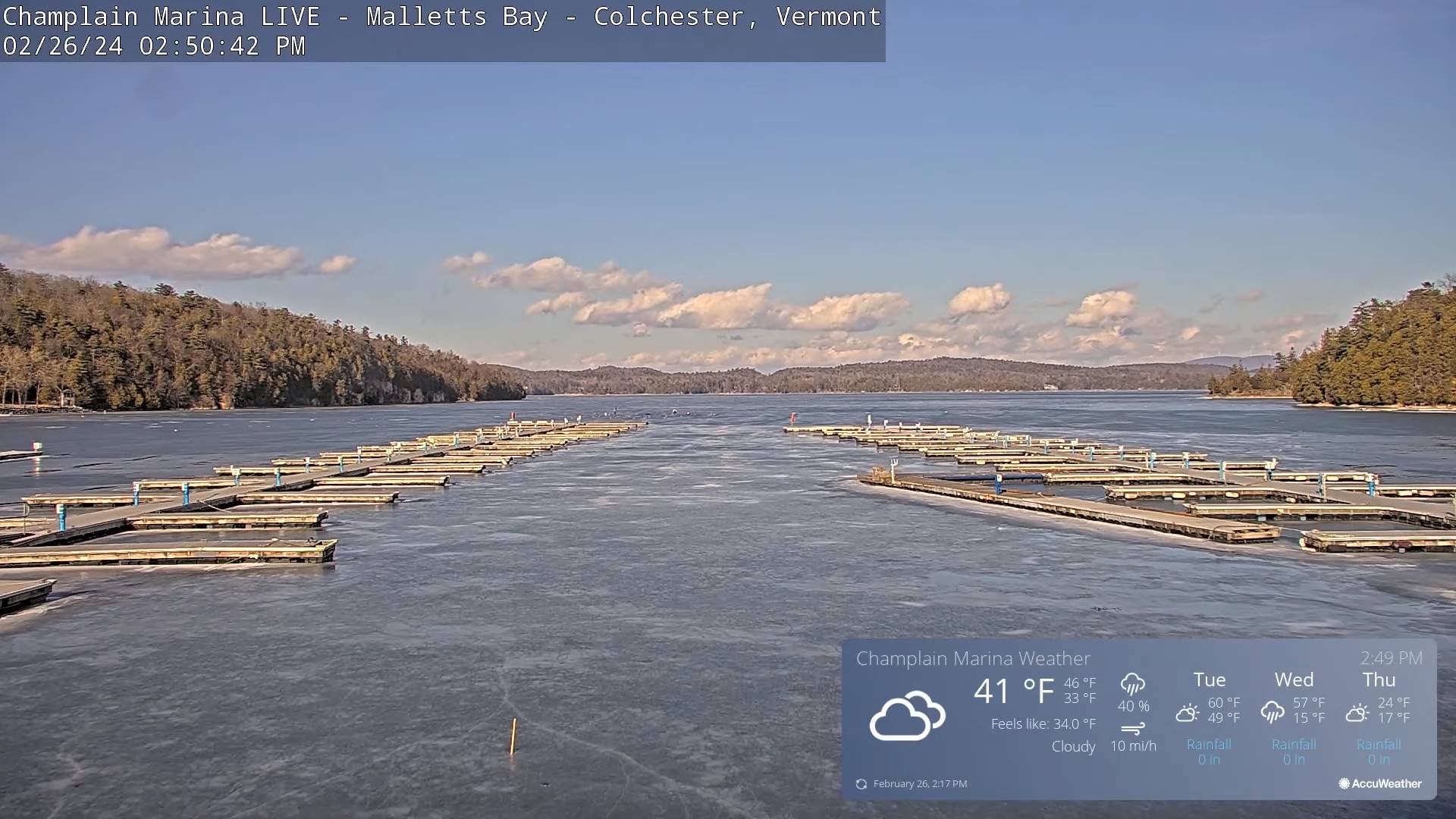
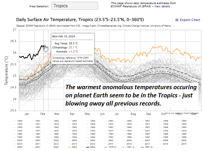
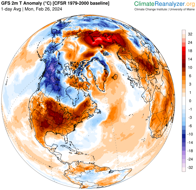
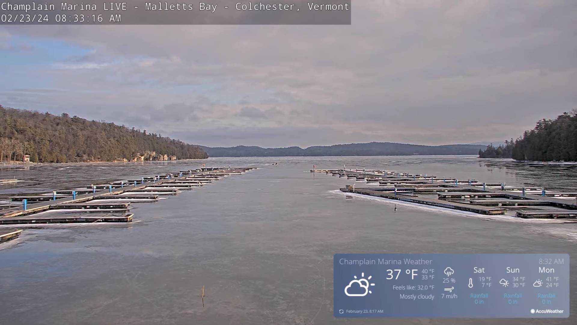
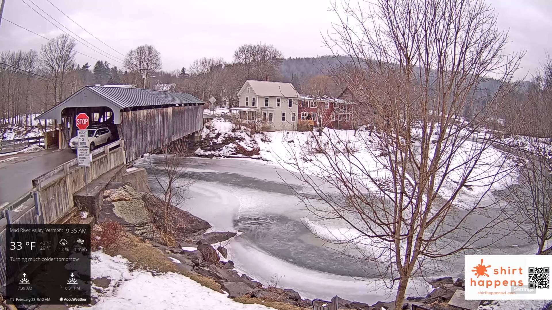
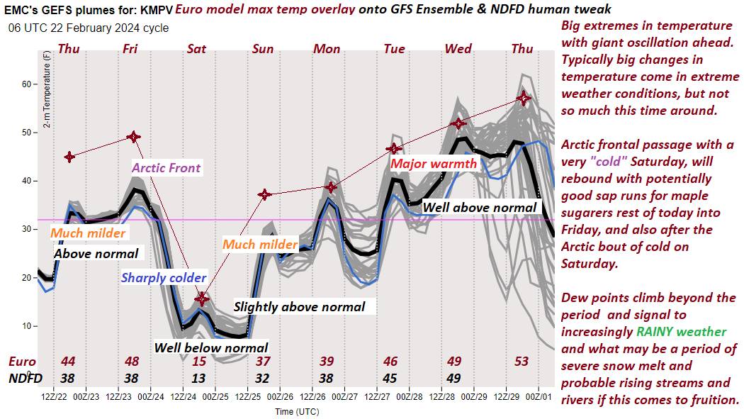
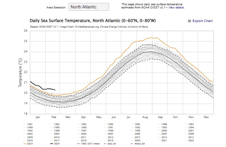
An amazingly April-like day, well in the end of February. We could see some records broken, just like what has been occurring to our southwest. Clouds and sprinkle rain showers arrive this evening. Think snow melt and waterworks folks.

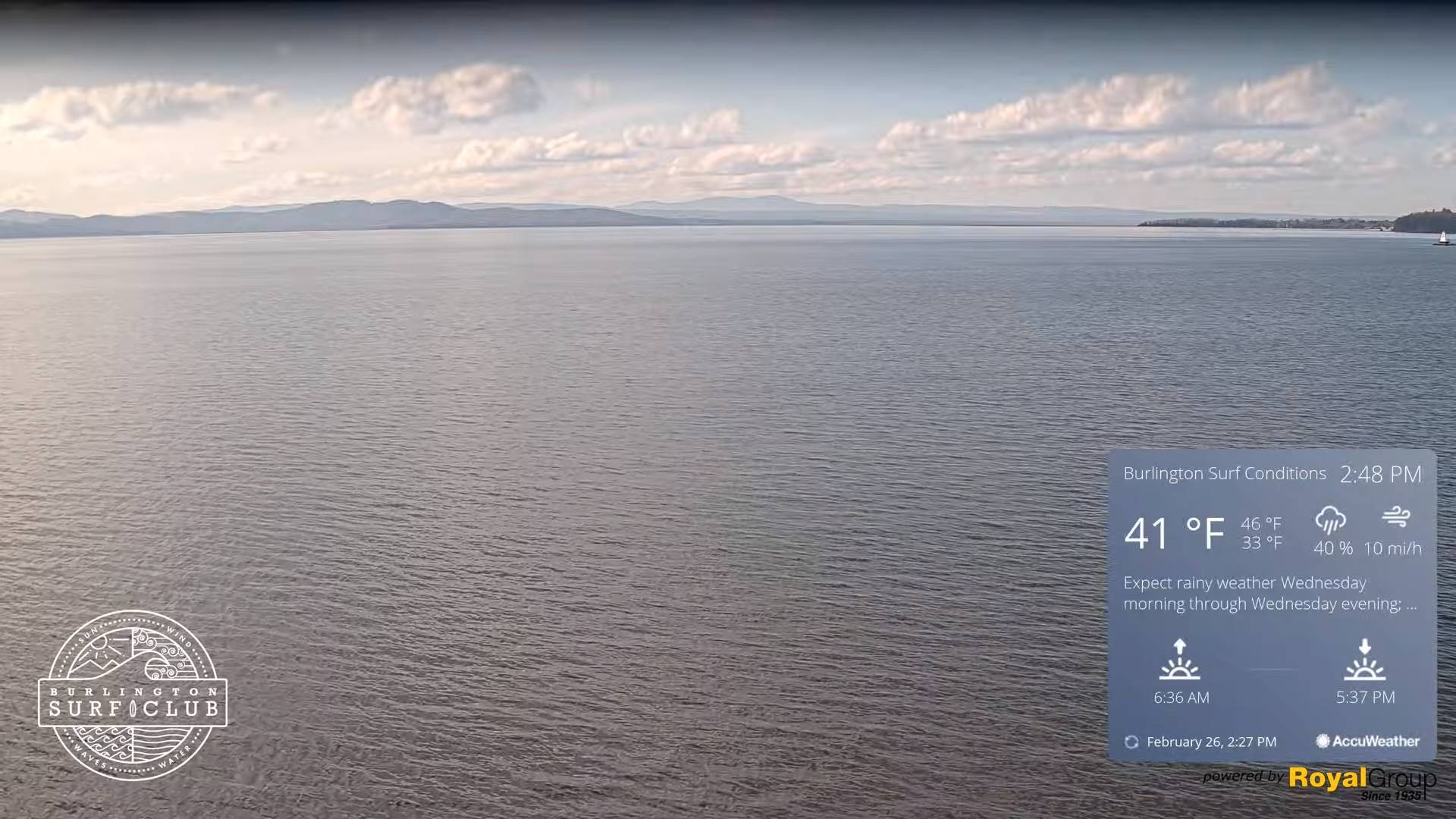
TONIGHT: Becoming mostly clear and moonlit with some high cloudiness.A low in the mid-20s. Light southeast winds.
TOMORROW: Lots of sunshine, mild and spring-like.A high pushing to near 55.Southeast winds 10 to occasionally 20 mph.
TUESDAY NIGHT: Clouding up.Rain showers likely in the evening.A low around 40.South breeze 10 mph.
WEDNESDAY: Mainly gray. Scattered rain showers late morning on. A high in the upper 40s to near 50. Southeast winds 10 to 15 mph.
Looking further ahead
WEDNESDAY NIGHT: Overcast.Rain showers likely moderate at times…changing to snow showers, with up to an inch of accumulation. Increasingly blustery to windy. A low 10 to 15. Gusty northwest winds developing.
THURSDAY: More sun than clouds, blustery to windy & colder. A high around 25. Gusty northwesterly winds.
FRIDAY: A few morning clouds, then mostly sunny. A low 10 to 15. A high rebounding to around 40.
SATURDAY: Sunshine gives way to increasing clouds. A low around 30. A high near 50.
Average lows upper-single digits to upper-teens. Average highs mid to upper 30s.
RH/2-26forecast][end]
TODAY: Clouds mixed with sunny periods with a chance for a rain shower or brief mountain wet snow flurry far northern areas. A high about 45. Southwest breeze 10 mph shifting to northwesterly this afternoon.
TONIGHT: Becoming mostly clear and moonlit with some high cloudiness.A low in the mid-20s. Little wind.
TUESDAY: Lots of sunshine, mild and spring-like.A high 50 to 55.South to southeast winds 10 to occasionally 20 mph.
Looking further ahead
TUESDAY NIGHT: Clouding up.Rain showers becoming likely.A low around 40.
WEDNESDAY: Gray. Scattered rain showers. A high in the upper 40s to near 50.
THURSDAY: Rain showers…changing to snow showers, moderate at times with minor accumulation early. Blustery to windy & sharply colder with more sun than clouds late morning into the afternoon. A low 10 to 15. A high around 25.
FRIDAY: Mostly sunny. A low 10 to 15. A high rebounding to around 40.
SATURDAY: Sunshine gives way to increasing clouds. A low around 30. A high near 50.
Average lows upper-single digits to upper-teens. Average highs mid to upper 30s.
RH/2-26forecast][end]


TONIGHT: Becoming mostly cloudy.Widely scattered snow showers with a risk of a snow squall northern areas. Minor accumulation. A low ranging from the upper single digits Canadian border to mid-teens. Northwesterly 10 to 15 mph.
Full Snow moon 7:30 AM
TOMORROW: Morning cloudiness, blustery and colder, gives way to mostly sunny skies. A high around 15. Northwest winds 10 to 15 mph lowering wind chills.

SATURDAY NIGHT: Clear and fully moonlit.A low ranging 5 below to 5 above. Light northwest winds.
SUNDAY: Sunny. More clouds arriving late. A high 30 to 32. Light south winds.
Looking further ahead

SUNDAY NIGHT: Mostly cloudy. Chance for flurries overnight, minor accumulation.A low upper 20s.
MONDAY: Morning clouds with a possible stray flurry, then mostly sunny. A high 35 to 40 warmer southern areas.
TUESDAY: Partly to mostly cloudy and milder. Slight chance for a sprinkle in the afternoon. Milder and breezy. A low in the 20s. A high around 45.

WEDNESDAY: Gray, mild and breezy to windy. Chance for rain, possibly moderate at times.A low mid to upper 30s. A high 50 to 55.
Average lows mid-single digits to mid-teens. Average highs in the low to mid 30s.
RH/2-23forecast][end]
TODAY: A few leftover wet snow showers/flurries exiting southern areas this morning, otherwise intervals of sunshine and milder this afternoon. A high around 45. Light southwest winds.
TONIGHT: Variable clouds.Widely scattered snow showers with a risk of a snow squall northern areas. Minor accumulation. A low ranging from the upper single digits to mid-teens. Winds becoming northwesterly 10 to 15 mph.
Full Snow moon 7:30 AM
SATURDAY: Morning cloudiness, blustery and colder, gives way to mostly sunny skies. A high around 15. Northwest winds 10 to 15 mph lowering wind chills.
Looking further ahead
SATURDAY NIGHT: Clear and fully moonlit.A low ranging 5 below to 5 above.
SUNDAY: Sunny. More clouds arriving later on in the afternoon. A high 30 to 32.
MONDAY: Morning clouds with possible stray flurry, then mostly sunny. A low upper 20s. A high 35 to 40 warmer southern areas.

TUESDAY: Partly to mostly cloudy and milder. Slight chance for a sprinkle in the afternoon. Milder and breezy. A low in the 20s. A high around 45.
WEDNESDAY: Gray, mild and breezy to windy. Chance for rain, possibly moderate at times.A low mid to upper 30s. A high 50 to 55.
Average lows mid-single digits to mid-teens. Average highs in the low to mid 30s.
RH/2-23forecast][end]

TONIGHT: Considerable cloudiness. Wet snow showers…mixed with rain across western Vermont valleys.A light snow coating east of the Greens.A low 32 to 35. Light south winds but stronger near Lake Champlain.
TOMORROW: A few leftover wet snow showers & flurries, exiting early to intervals of sunshine. A high upper 30s to near 40. Light southwest winds.
FRIDAY NIGHT: Variable clouds.Widely scattered snow showers with a risk of a snow squall northern areas. Minor accumulation. A low 10 to 15. Winds becoming northwesterly 10 to 15 mph.
Full Snow moon 7:30 AM
SATURDAY: Blustery and sharply colder with increasing sunshine. A high around 15. Northwest winds 10 to 15 mph lowering wind chills.
Looking further ahead
SATURDAY NIGHT: Clear and fully moonlit.A low zero to 5 above.
SUNDAY: Sunny. More clouds arriving later on in the afternoon. A high around 32.
MONDAY: Morning clouds with possible stray flurry, then mostly sunny. A low upper 20s. A high 35 to 40.
TUESDAY: Partly cloudy. Milder and breezy. A low 15 to 20. A high around 45.
Average lows mid-single digits to mid-teens. Average highs in the low to mid 30s.
RH/2-20forecast][end]
TODAY: Partly sunny. A few sprinkles possible Champlain Valley later today. A high 40 to 45. South breeze 10 mph but much stronger & gusty near Lake Champlain.
TONIGHT: Considerable cloudiness. Wet snow showers developing before midnight…mixed with rain Champlain Valley.A light coating of snow along and east of the Greens.A low near 32. Light south winds stronger near the lake
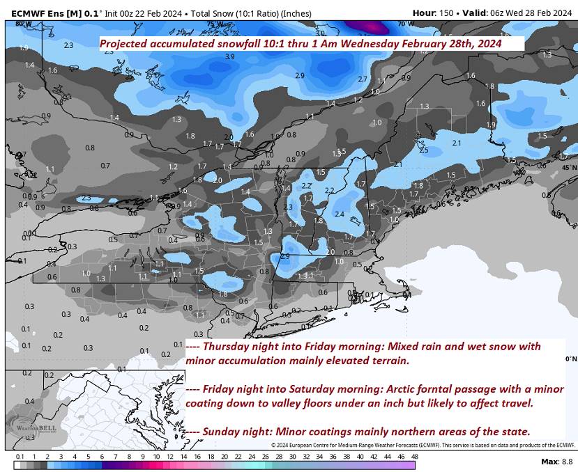
FRIDAY: Cloudy. Occasional wet snow showers with slushy travel high terrain. Mainly just rain showers western Vermont valleys. Accumulations up to 2”across elevated terrain. A high in the low 40s. Light south to southwest winds.
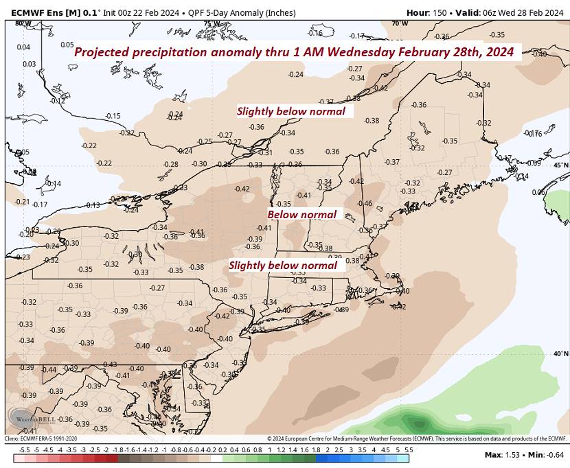
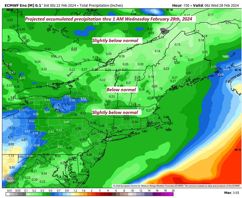
Looking further ahead
FRIDAY NIGHT: Variable clouds.Scattered snow showers with a risk of a snow squall overnight minor accumulations. A low 10 to 15.

SATURDAY: Blustery and sharply colder with increasing sunshine. A high around 15.
SUNDAY: Sunny. More clouds arriving later on in the afternoon. A low 5 below to 5 above. A high around 32.
MONDAY: Morning clouds with possible stray flurry, then mostly sunny. A low upper 20s. A high 35 to 40.
Average lows mid-single digits to mid-teens. Average highs in the low to mid 30s.
RH/2-20forecast][end]
