
Updated Wednesday Evening Forecast — April 17th, 2024
TONIGHT: High cloudiness, thickening up western and southern Vermont overnight with a few sprinkles. A low in the upper 30s. Light east winds.
TOMORROW: Mostly cloudy, but with some sunny intervals Northeast Kingdom. A little cooler. Light rain showers arriving mid-day Barre-Montpelier area and late afternoon Northeast Kingdom. A high upper 40s around 50. Southeast breeze 10 mph.
THURSDAY NIGHT: Lots of clouds. Chance for early evening sprinkles with a wet snowflake mountain summits. A low upper 30s. Light southeast winds.
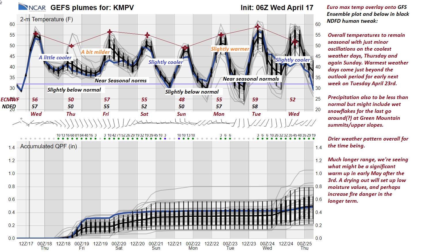
FRIDAY: Mainly gray. Chance for a few sprinkles late. A high about 55. Southeast breeze 10 to 15 mph.
Looking further ahead
FRIDAY NIGHT: Cloudy. Scattered showers.A low 40 to 45.
SATURDAY: Mixed clouds and sun, chance for a shower late. A high in the low 50s.
SUNDAY: Considerable cloudiness. Scattered afternoon showers, possibly mixed with a wet snow flake after dark higher terrain. A low 32 to 35 with a chance for frost. A high in the upper 40s.
MONDAY: Mostly sunny. A low around 35. A high in the mid-50s.
TUESDAY: Thickening clouds. A low upper 20s. A high 55 to 60.
Average lows upper 20s to mid-30s. Average highs in the mid to upper 50s.
Start of meteorological summer June 6th
RH/4-16forecast][end]
Updated Wednesday Morning Forecast — April 17th, 2024
TODAY: Morning sunshine gives way to occasional high cloudiness. A high in the mid-50s. Light north winds.
TONIGHT: High cloudiness, thickening up western and southern Vermont late with a sprinkle. A low 35 to 40. Light east winds.
THURSDAY: Mostly cloudy, but with some sunny intervals Northeast Kingdom. A little cooler. A rising chance for light rain showers late morning into the afternoon. A high near 50. Southeast breeze 10 mph.
Looking further ahead
THURSDAY NIGHT: Lots of clouds. Chance for an evening sprinkle. A low upper 30s near 40.
FRIDAY: Mainly gray. Scattered light rain showers or sprinkles. A high about 55.
SATURDAY: A few early mountain sprinkles then clouds mixing with periods of sunshine. A low 40 to 45. A high about 50.
SUNDAY: Mostly cloudy. Scattered afternoon showers, possibly mixed with a wet snow flakes northern Greens. A low 32 to 35 with a chance for frost. A high mid to upper 40s.
MONDAY: Variable cloudiness. A low 30 to 35. A high in the mid-50s.
TUESDAY: Partly sunny. A low 32 to 35. A high 55 to 60.
Average lows upper 20s to mid-30s. Average highs in the mid to upper 50s.
Start of meteorological summer June 6th
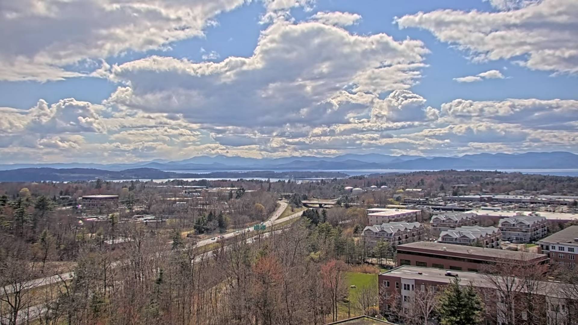
Very nice spring weather day across the #GreenMountainState today. The first bits of moisture work in bumping into a ridge of pressure. The two make battle weakening the next incoming weather system…with minimal amounts of rain or #Aprilshowers, but a fair amount of cloudiness over the next few days.
Updated Tuesday Evening Forecast — April 16th, 2024
TONIGHT: Partly to mostly cloudy across northern areas this evening, then clearing.A low 30 to 35 with scattered frost. Light north winds.
TOMORROW: Morning sunshine with some high cloudiness in the afternoon. A high in the mid-50s. Light north winds.
WEDNESDAY NIGHT: High cloudiness, thickening up western and southern Vermont late with a sprinkle. A low 35 to 40. Light east winds.
THURSDAY: Increasing clouds with some sun far northeastern areas. An isolated sprinkle or two. A high in the low to mid 50s. Southeast breeze 10 mph.
Looking further ahead
THURSDAY NIGHT: Lots of clouds. Chance for an evening sprinkle. A low around 40.
FRIDAY: Mainly gray. Rising chance for light showers. A high in the mid-50s.
SATURDAY: Clouds with intervals of sunshine. Maybe be a few mountain sprinkles. A low in the low 40s. A high about 50.
SUNDAY: Mostly cloudy. Scattered afternoon showers, possibly mixed with a wet snow flakes northern Greens. A low around 35. A high upper 40s.
Average lows upper 20s to mid-30s. Average highs in the mid to upper 50s.
Start of meteorological summer June 6th
RH/4-16forecast][end]
Updated Tuesday Morning Forecast — April 16th, 2024
TODAY Mostly sunny, with more clouds northern areas this afternoon. A high 50 to 55. Winds become northwest 10 to 15 mph.
TONIGHT: Scattered clouds Champlain Valley with a possible sprinkle early, then clearing.A low mid to upper 30s. Light north winds.
WEDNESDAY: Filtered sunshine with some high cloudiness. A high around 55. Light north winds.
Looking further ahead
WEDNESDAY NIGHT: High overcast. A low mid to upper 30s.
THURSDAY: Sunshine filtered thru high clouds clouding up late. A high mid to upper 50s. Chance for an evening sprinkle.
FRIDAY: Mainly gray. Maybe a sprinkle. A low upper 30s to around 40. A high in the mid-50s.
SATURDAY: Clouds with intervals of sunshine. Slight chance for a few showers. A low 40 to 45. A high in the low 50s.
SUNDAY: More clouds than sun. Scattered afternoon showers, possibly mixed with a wet snow flakes northern Greens. A low in the mid-30s. A high mid to upper 40s.
Average lows upper 20s to mid-30s. Average highs in the mid to upper 50s.
Start of meteorological summer June 6th
RH/4-16forecast][end]
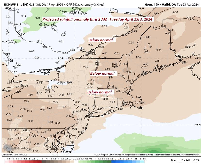
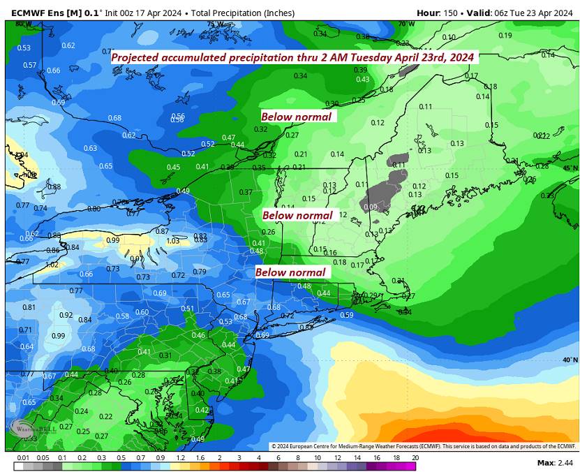
Not a bad forecast next couple/three days. Still a couple late day early evening sprinkles Champlain Valley. Overall, we continue to dry out gradually. No significant amounts of moisture, but wetter, damper conditions perhaps Friday and later over this weekend.

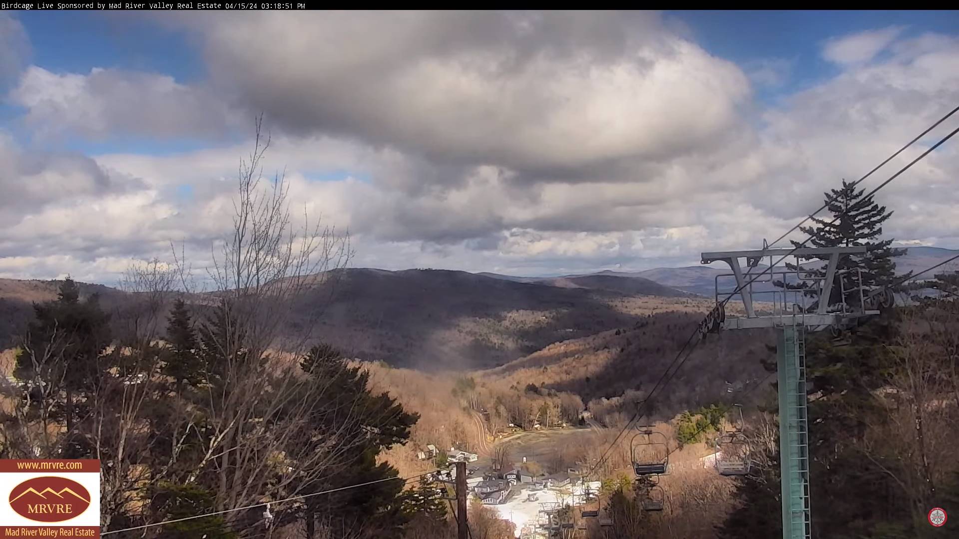
Updated Monday Evening Forecast — April 15th, 2024
TONIGHT: Clouds with an isolated sprinkle early, then mostly clear skies with dense patchy valley fog. A low around the mid-30s maybe isolated frost colder areas. Light southwest winds.
TOMORROW: Mostly sunny, with more afternoon clouds especially northern areas. A high in the lower 50s. Winds become northwest 10 to 15 mph.
TUESDAY NIGHT: Mostly clear with areas of frost.A low upper 20s near 30. Light north winds.
WEDNESDAY: Sunshine filtered thru high clouds. A high 50 to 55. Light north winds.
Looking further ahead
WEDNESDAY NIGHT: High overcast. A low in the mid-30s.
THURSDAY: Sunshine filtered thru high clouds clouding up late. A high mid to upper 50s. Chance for an evening shower.
FRIDAY: Gray. Maybe a sprinkle. A low in the 30s. A high around 55.
SATURDAY: Chance for a morning shower, then increasing sunshine. A low in the 40s. A high in the 50s.
Average lows upper 20s to mid-30s. Average highs in the mid to upper 50s.
Start of meteorological summer June 6th
RH/4-15forecast][end]
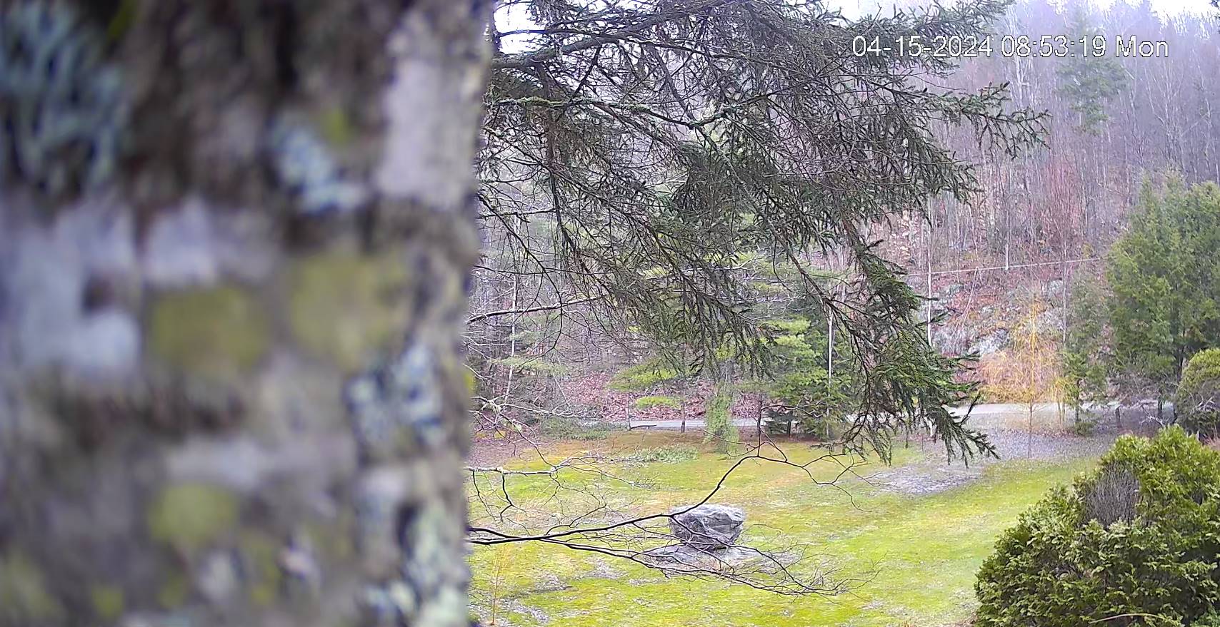
Updated Monday morning forecast — April 15th, 2024
TODAY: Patchy dense valley fog, with more clouds than sun this morning. A few passing light rain showers. Partly to mostly sunny this afternoon. A high in the lower 50s. West to southwest breeze 10 mph.
TONIGHT: Clear skies with dense patchy valley fog. A low 32 to 35 with scattered frost. Light west to southwest winds.
TUESDAY: Mostly sunny, with more afternoon clouds across northern areas. A high 50 to 55. Northwest 10 to 15 mph
Looking further ahead
TUESDAY NIGHT: Mostly clear with areas of frost.A low upper 20s to around 30.
WEDNESDAY: Sunshine becoming filtered thru high clouds. A high in the lower 50s.
THURSDAY: Sunshine filtered thru high clouds thickening up in the afternoon. A low near 30. A high mid to upper 50s.
FRIDAY: Cloudy. Scattered April showers. A low 35 to 40. A high mid to upper 50s.
Average lows upper 20s to mid-30s. Average highs in the mid to upper 50s.
Start of meteorological summer June 6th
RH/4-15forecast][end]
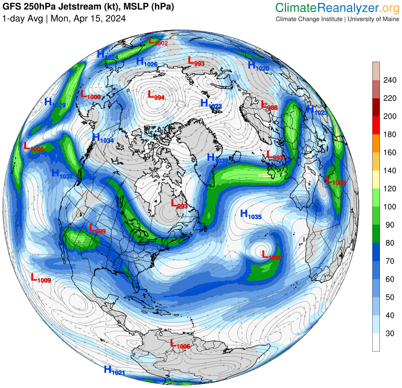
Dreary start to the day but a much better finish with passing rain showers and dense fog. An active northern branch of the polar jet stream will deliver periodic cloudy periods but in general, below normal precipitation in the form of rain showers especially this morning, and again Friday. Maybe some wet snow flakes this weekend.

