
Friday Night Forecast — 12-20-24
Roger Hill’s Radio Vermont forecast 3:00 PM Friday 12-20-24
Winter Solstice 4:21 AM
TONIGHT: Lots of clouds. Periods of light snow or flurries. Less than an inch. A low about the mid-teens. Light north to northwest winds, stronger near Lake Champlain.
TOMORROW: Lingering flurries with little accumulation. Otherwise lots of clouds & colder. Temperatures holding in the mid teens. Northwest winds 10 to 15 mph lowering wind chills.
SATURDAY NIGHT: Considerable cloudiness. A few mountain flurries, drying up with a dusting to a fluffy inch. A low 5 below to 5 above. Northwest winds 10 mph…lowering wind chills
SUNDAY: A stray mountain flurry with lingering morning clouds, then increasing afternoon sunshine. Frigidly cold. A high just to 5 above. Northwest winds 10 mph lowering wind chills.
Looking further ahead
SUNDAY NIGHT: Clear & frigid with the coldest night so far this season. A low ranging minus 5 to minus 15 degrees.
MONDAY: Sunshine giving way to high cloudiness. A high near 15.
TUESDAY: A period of light snow or snow showers…1 to 3” of fluffy accumulation tapering exiting late to breaks of sun. A low in the single digits. A high near 20.
WEDNESDAY Christmas Day: Morning clouds, then bright sun and blue skies. A low 5 to 15. A high in the low 20s.
Average lows upper single digits to mid-teens. Average high mid-20s to low 30s
RH/12-20forecast][end]
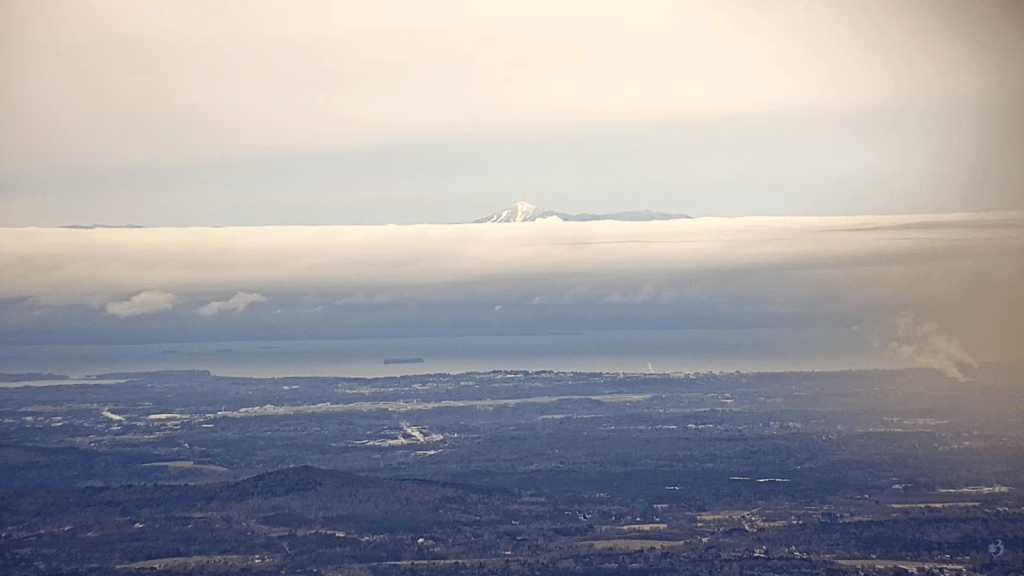
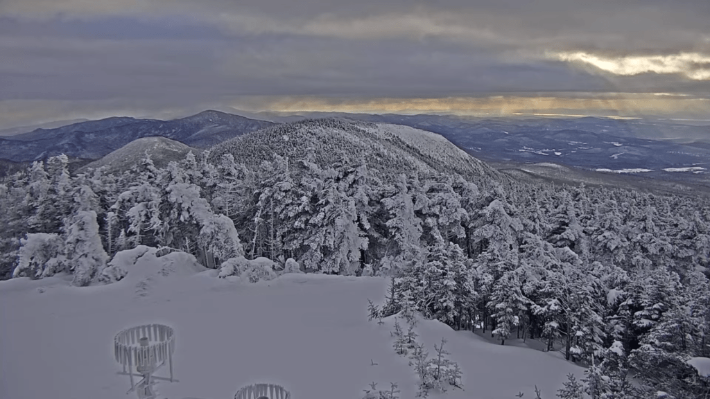
Cool shot from the WCAX Mt Mansfield Web Cam looking at Whiteface in the the Adirondack Mountains this Friday Morning.
Thursday Night Forecast — 12-19-24

TONIGHT: Mainly cloudy. A low 10 to 15. Light northeast winds.
TOMORROW: Mainly gray. Scattered flurries develop in the afternoon with less than an inch of accumulation. A high of about 25. Light east winds.
Winter Solstice 4:21 AM
FRIDAY NIGHT: Lots of clouds. Scattered flurries…with less than an inch. A low in the mid-teens. Light north winds stronger near Lake Champlain.
SATURDAY: Lingering northern mountain flurries with little accumulation. Otherwise lots of clouds & colder. Temperatures holding in the mid to upper teens. Light northwest winds.
Looking further ahead
SATURDAY NIGHT: Considerable cloudiness with a few flurries drying up. A low 5 below to 5 above.
SUNDAY: A stray mountain flurry with lingering morning clouds, then increasing afternoon sunshine. Highs 5 to 10 above.
MONDAY: Mostly sunny with a few high clouds. A low zero to 10 below. A high 10 to 15.
TUESDAY: Cloudy skies with a chance for flurries…giving way to intervals of afternoon sun. A dusting in spots. A low in the single digits. A high 15 to 20.
Average lows upper single digits to mid-teens. Average high mid-20s to low 30s
RH/12-19forecast][end]
Wednesday Night Forecast — 12-18-24
TONIGHT: Cloudy. Occasional light wet snow with 1 to 2”…more mountain summits mixed with rain western Vermont valleys tapering to scattered flurries overnight.A low 30 to 32. Light west winds.
TOMORROW: Scattered mountain flurries mainly in the morning. Blustery & turning colder with temperatures falling thru the 20s. Northwest winds 10 to 20 mph.
THURSDAY NIGHT: Overcast with a stray mountain flurry. A low 10 to 15. Light northeast winds.
FRIDAY: Gray. Scattered snow shower activity with minor accumulation. A high about 25. Light east winds.
Looking further ahead
Winter Solstice 4:21 AM
FRIDAY NIGHT: Cloudy. Scattered light snow showers or flurries…dusting to an inch. A low mid-teens.
SATURDAY: Lingering northern mountain flurries with minor accumulation. Otherwise lots of clouds & progressively colder. Temperatures holding in the mid to upper teens.
SUNDAY: Lingering mountain cloudiness gives way to increasing sunshine in the afternoon. A low ranging 5 below to 5 above. Highs in the upper single digits.
MONDAY: Sunshine with a few high clouds. A low zero to 10 below. A high near 15.
Average lows upper single digits to mid-teens. Average high mid-20s to low 30s
RH/12-187forecast][end]
Tuesday Night Forecast — 12-17-24

Roger Hill’s Radio Vermont forecast 3:00 PM Tuesday 12-17-24
TONIGHT: Maybe a stray mountain flurry this evening, otherwise lots of clouds. A low in the upper 20s. West to southwest winds 10 to 15 mph.
TOMORROW: Gray skies and a little cooler. Chance for light wet snow…mixed with rain arriving toward dark. A high 35 to 40. Light southwest winds.
WEDNESDAY NIGHT: Clouds with breaks developing overnight. Occasional light wet snow mixed with rain western Vermont valleys. Dusting to 3 inches…most elevated terrain. A low about 30. Light west winds.
THURSDAY: A few sunny breaks in the morning then clouding up. A few widely scattered mountain flurries. Blustery at times & turning colder with temperatures falling thru the 20s. Northwest winds 10 to 15 mph.
Looking further ahead
THURSDAY NIGHT: Overcast. A low 10 to 15.
FRIDAY: Lots of clouds. Scattered snow shower activity with a dusting to an inch. A high 20 to 25.
SATURDAY: Considerable cloudiness & progressively colder with mountain flurries. A low in the low teens. A high about 15.
SUNDAY: Lingering mountain cloudiness in the morning, then increasing sun in the afternoon. A low ranging 5 below to 10 above.
Average lows upper single digits to mid-teens. Average high mid-20s to low 30s
RH/12-17forecast][end]
Monday Night Forecast — 12-16-24
Roger Hill’s Radio Vermont forecast 3:00 PM Monday 12-16-24
TONIGHT: Cloudy & gradually milder. Rising chance for rain showers with possible icy spots early. An early evening low in the mid-30s, rising toward 40 daybreak. Southeast winds 10 to 15 mph.
TOMORROW: Considerable cloudiness & milder. Passing sprinkles mixed with wet snow flakes late in the hills. A high in the mid-40s. Southwest winds 10 to 20 mph and gusty.
TUESDAY NIGHT: A few breaks in the clouds early otherwise cloudy. A stray flurry or two possible. A low around 30. West winds 10 to 15 mph.
WEDNESDAY: Gray skies and a little cooler. A high in the upper 30s. Light southwest winds.
Looking further ahead
WEDNESDAY NIGHT: Cloudy with a chance for occasional light snow mixed with rain lower valleys. A low near 30.
THURSDAY: Lingering clouds give way to late intervals of sun. Progressively colder. Temperatures falling thru the 20s.
FRIDAY: Clouds with intervals of afternoon sun. Chance for light snow showers with minor accumulation. A low 10 to 15. A high low 20s.
SATURDAY: Considerable low cloudiness & progressively colder with mountain flurries. A low 5 to 10. A high in the low to mid-teens.
Average lows upper single digits to mid-teens. Average high mid-20s to low 30s
RH/12-16forecast][end]
Friday Night Forecast — 12-13-24
TONIGHT: Partly cloudy to mostly clear & moonlit skies. A low ranging 5 to 15 above. Light west winds.
TOMORROW: Morning clouds then lots of afternoon sunshine. Rather chilly. A high 20 to 25. Light northwest winds.
Full Cold Moon 4:02 AM
SATURDAY NIGHT: Mostly clear, moonlit & frigid. A low ranging 5 below to 10 above. Little wind.
SUNDAY: Sunshine becoming filtered through high clouds. A high mid to upper 20s. Light south winds.
Looking further ahead
SUNDAY NIGHT: Mainly cloudy. Chance for flurry southern areas. A low mid-teens to low 20s.
MONDAY: Variable cloudiness with more sunshine eastern areas. Seasonal temperatures. A high in the mid-30s.
TUESDAY: Gray. Chance for rain…moderate at times, tapering to scattered showers in the afternoon. Possible icy spots. An early low 32 to 35. A high in the mid-40s.
WEDNESDAY: Considerable mid and high cloudiness. A low in the low to mid 30s. A high around 35.
Average lows teens to near 20. Average high upper 20s to mid-30s
RH/12-13forecast][end]
Thursday Night Weather — 12-12-24

Roger Hill’s Radio Vermont forecast 3:00 PM Thursday 12-12-24
TONIGHT: Scattered northern flurries with little accumulation,otherwise partially moonlit and colder. A low 10 to 15 above. West to southwest winds 10 to 15 mph becoming light overnight.
TOMORROW: More sun than clouds & continued cold. A stray flurry far northern areas. A high in the mid-20s. Westerly winds 10 to 15 mph in the afternoon.
FRIDAY NIGHT: Mostly clear with a few more clouds overnight. A low ranging 5 to 15 above. Light west to northwest winds.
SATURDAY: A few morning clouds otherwise lots of sunshine. Rather chilly. A high near 25. Light northwest winds.
Looking further ahead
Full Cold Moon 4:02 AM
SATURDAY NIGHT: Clear & moonlit skies. A low in the single digits.
SUNDAY: Sunshine becoming filtered through high clouds. A high upper 20s.
MONDAY: Sunshine with high cloudiness. Seasonal temperatures. A low 15 to 20. A high near 35.
TUESDAY: Gray. Chance for rain with spotty mixed precipitation early. An early low around 32. A high 40 to 45.
Average lows teens to near 20. Average high upper 20s to mid-30s
RH/12-12forecast][end]
