Low overcast with patchy drizzle and fog many lower valleys…and adjacent slopes, but summits clear bright and sunny for a short period this Sunday morning. Strong temperature inversion ahead of a warm front gets erased with rain later.


TONIGHT: Some high cloudiness otherwise mostly clear. A low upper single digits to around 15 above. Little wind.
TOMORROW: Thickening clouds. Maybe a sprinkle or two central & southern areas. Maybe an icy spot. A high 35 to 40. Light southeast winds, but breezier Lake Champlain.
SATURDAY NIGHT: Cloudy. Chance for a sprinkle especially southern areas. Maybe an icy spot. A low 30 to 35. Light south winds, but breezier Lake Champlain.
SUNDAY: Gray. A rising likelihood for rain showers…shifting south to north. A high in the low 40s. Light southeast winds, but breezier Lake Champlain.
Looking further ahead
SUNDAY NIGHT: Lots of clouds with scattered light rain showers especially late. Becoming rather breezy western slopes. Milder. An early low near 40 rising toward 50 overnight.
MONDAY: Chance for rain showers…moderate at times mid-day. Otherwise gray & breezy to windy western slopes of Green Mountains…with partial clearing late. Above normal in temperature. A high upper 40s to around 50.
TUESDAY: Morning cloudiness, then increasing sunshine.A low near 35. A high near 40.
WEDNESDAY: Gray. Chance for rain…mixing with wet slushy snow…possibly significant in the mountains. A low near 30. A high mid to upper 30s.
Average low 5 to 15. Average high mid-20s to near 32.
RH/12-27forecast][end]
TONIGHT: Mostly clear. A low ranging 5 below to 10 above. Little wind.
TOMORROW: Sunshine filtered thru high clouds with a warming trend. A high about 25. Little wind.
FRIDAY NIGHT: High clouds otherwise mostly clear. A low 5 to 15 above. Light southeast winds.
SATURDAY: Thickening clouds. Maybe a late day sprinkle or two. A high 35 to 40. Light south winds, but breezier Lake Champlain
Looking further ahead
SATURDAY NIGHT: Cloudy. Slight chance for a sprinkle southern areas. A low in the low to mid 30s.
SUNDAY: Gray. Rising chance for rain or showers…moderate at times. A high in the low 40s.
MONDAY: Overcast. Chance for rain…moderate at times. A low upper 30s around 40.
Average low 5 to 15. Average high mid-20s to near 32.
RH/12-260forecast][end]

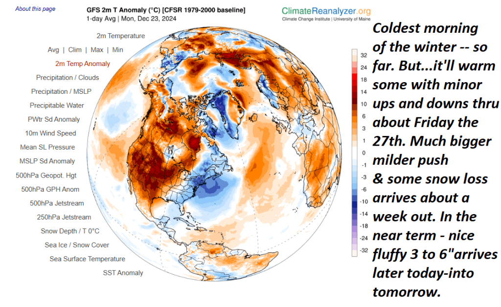
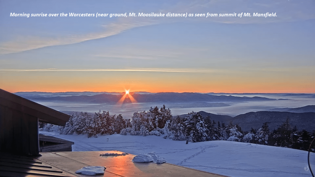
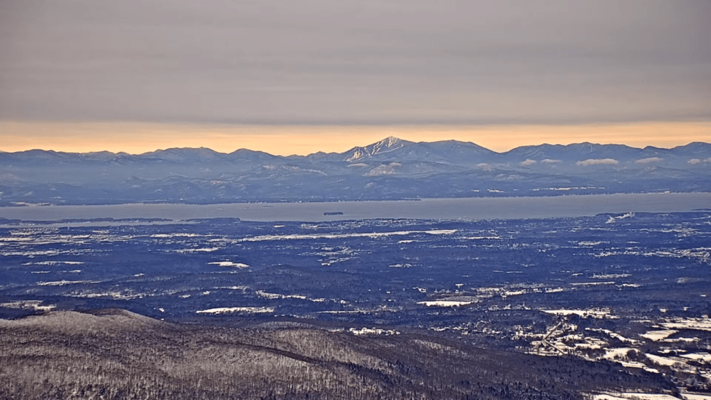
Looking across the Champlain Valley from Mount Mansfield Vermont to Whiteface New York where there is a lot of great snow in the mountains for this Christmas Holiday with more to add tonight into tomorrow morning. Looking longer range – we may see a lot of our snow wane toward the New Year and beyond.
Winter Weather Advisory thru 1 PM Tuesday…
TONIGHT: Overcast. Snow… moderate for a time. Temperatures holding in the low to mid-teens. South winds about 10 mph.
TOMORROW: Light snow or snow showers exit to a stray flurry or two. Total accumulation about 3 to locally 8” of fluff most in the Green Mountains less Champlain Valley. Otherwise, predominantly gray. Not so cold. A high in the mid-20s. Winds becoming light northwesterly
TUESDAY NIGHT CHJRISTMAS EVE: Lots of clouds with a stray mountain flurry. A low mid to upper single digits. Light north to northwest winds.
WEDNESDAY CHRISTMAS DAY: Morning clouds, then becoming mostly sunny. A high around 20. Light northwest wind.
Looking further ahead
WEDNESDAY NIGHT: Partly cloudy to mostly clear. Frigid again. A low 5 below to 5 above.
THURSDAY: A few mountain clouds early then mostly sunny. A high low to mid 20s.
FRIDAY: Sunshine with a few high clouds. Warming trend. A low zero to 5 above rebounding into the mid to upper 20s.
Average low about 5 to 15. Average high mid-20s to low 30s
RH/12-230forecast][end]