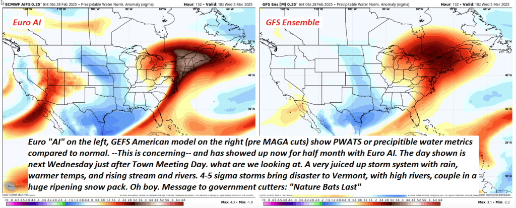
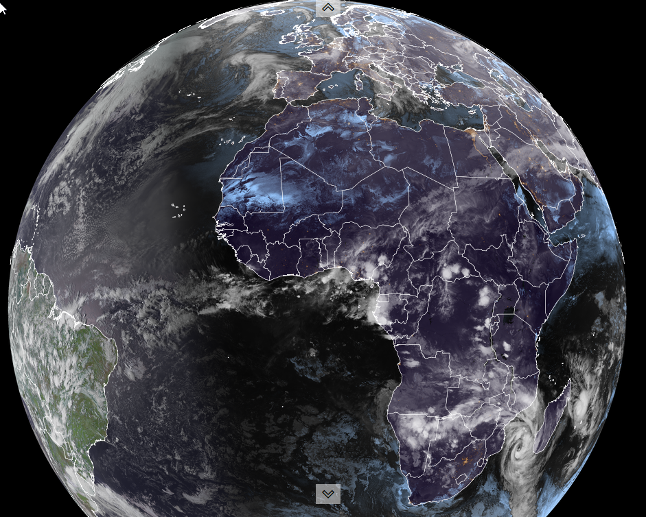
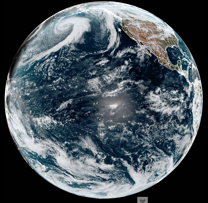
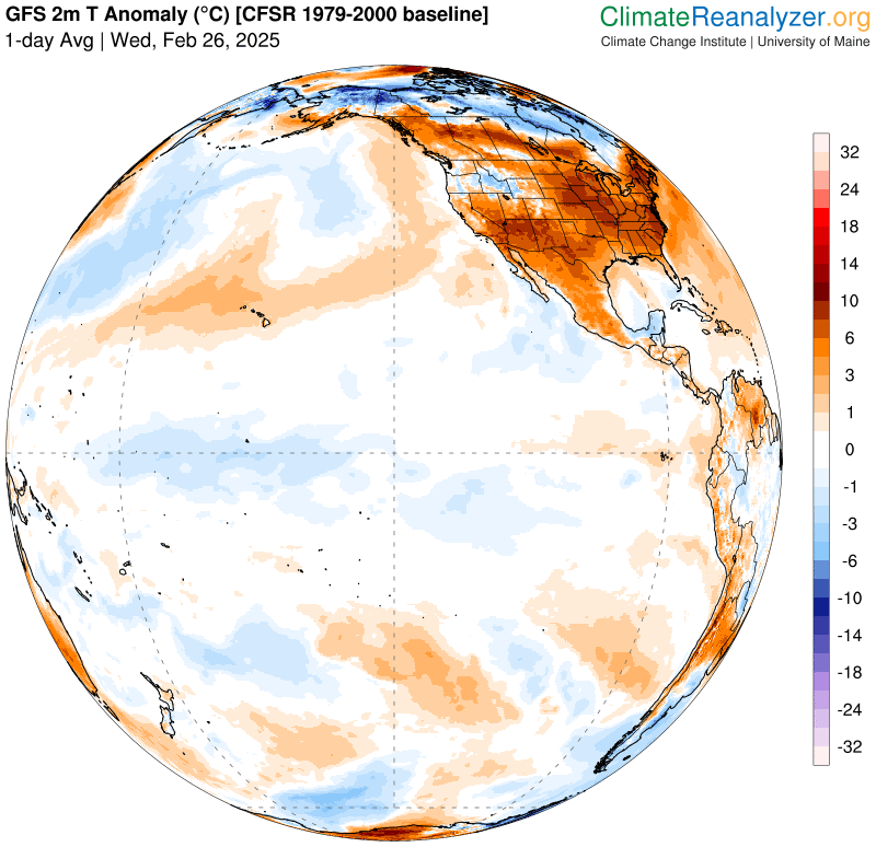
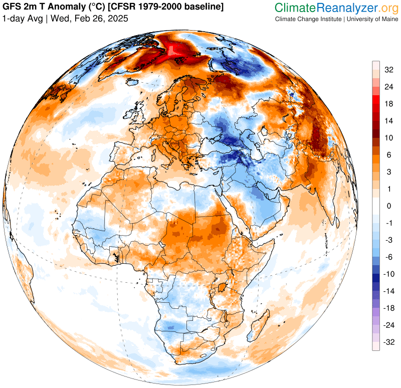
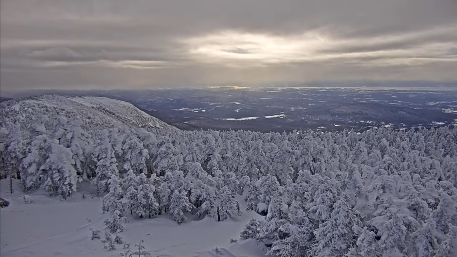
Yikes, potential flood signal for next Wednesday, holds strong. Think “prep” in the back of your mind folks…

TONIGHT: Scattered snow showers north with a few sprinkles valleys this evening. Minor accumulation. Otherwise considerable cloudiness. A low upper 20s near 30. West winds 10 to 20 mph.
TOMORROW: Snow showers…maybe a squall early. Minor accumulation, exiting in the afternoon. Turning blustery with intervals of afternoon sunshine. Colder. Temperatures falling through the teens. Gusty northwest winds 10 to 25 mph with higher gusts southern Green Mountains.

FRIDAY NIGHT: Overcast. Periods of light accumulating snow becoming likely toward midnight. A light coating. An evening low 5 to 10 above. South winds 10 to 15 mph, stronger near Lake Champlain.
SATURDAY: Gray skies. Occasional snow showers…mixed with rain valleys. Around an inch central and northern areas. A late day high pushing 40. Increasing west to southwest winds 10 to 20 mph in the afternoon.
Looking further ahead
SATURDAY NIGHT: Lots of clouds with lingering mountain flurries…giving way to partial clearing overnight. A low 5 below to 5 above
SUNDAY: Morning clouds then increasingly sunny. A high 10 to 15.

MONDAY: Sunny. A few late afternoon clouds. A low 5 to 10 below. Highs in the upper teens.
TUESDAY: Overcast. Chance for wet snow showers mixed with rain valleys. A low around 5. A high in the mid to upper 30s.
Average low ranging mid-single digits to mid-teens. Average high ranging thru the 30s.
RH/2-27[forecast][end]
TONIGHT: Mostly clear briefly, before more clouds push in. Rising chance for accumulating wet snow southern area toward daybreak. A little colder. A low in the teens north and 20s central and south. Little wind, becoming light southeasterly.
TOMORROW: Gray. Wet snow…moderate at times southern and central areas. A dusting to 2”accumulation north with 2 to 4” south, changing over to scattered sprinkles later in the afternoon. A late day high in the upper 30s/40. Southeast winds 10 mph shifting to southwesterly.
THURSDAY NIGHT: Scattered snow showers north with a few sprinkles, give way quick round of snow showers late overnight with a light coating. Otherwise considerable cloudiness. A low 25 to 30. West to southwest winds 10 to 15 mph.
FRIDAY: A round of accumulating snow showers with a risk for a snow squall in the morning with minor accumulation, drying up in the afternoon. Becoming blustery & partly to mostly sunny. Temperatures falling through the teens. Gusty northwest winds 10 to 25 mph with higher gusts especially central and southern Green Mountains.
Looking further ahead
FRIDAY NIGHT: Clouding up. Rising chance for light snow showers developing overnight. A light coating. A low 5 below to 10 above.
SATURDAY: Gray. Chance for snow showers mixed with rain valleys. A high rising to near 40 late. (Sap run?)
SUNDAY: Mostly sunny. A low ranging 5 below to 10 above. A high in the low teens.
MONDAY: Sunny but frigid in the morning. A low zero to 15 below. Highs rebound into the teens.
Average low ranging mid-single digits to mid-teens. Average high ranging thru the 30s.
RH/2-25[forecast][end]
TONIGHT: Lots of clouds. Occasional rain showers, mixing with wet snow in the elevated terrain with a minor coating overnight in the mountains. A low 32 to 35. Light west to southwest winds.
TOMORROW: Scattered sprinkles or flurries northern and western slopes drying up in the afternoon with increasing sun. A little cooler. A high in the mid-30s. Northwest winds 10 mph.
WEDNESDAY NIGHT: Thickening clouds. Rising chances for accumulating wet snow late. A little colder. A low in the teens north and in the 20s central and south. Little wind.
THURSDAY: Mainly gray. Wet snow…moderate at times southern and central areas. A dusting to 2”accumulation, changing over to scattered sprinkles in the afternoon. A late day high around 40. (Sap run?) Southeast winds 10 mph.
Looking further ahead
THURSDAY NIGHT: Scattered snow showers north. Flurries and sprinkles otherwise cloudy. A low around 25.
FRIDAY: A round of accumulating snow showers in the morning with minor accumulation, drying up in the afternoon. Becoming blustery with increasing sunshine. Temperatures falling through the teens. Gusty northwest winds.
SATURDAY: Gray. Chance for rain showers…with wet accumulating snow in the mountains. A low zero to 10 above A high rising to near 40 late. (Sap run?)

SUNDAY: Maybe a leftover flurry early, then partial clearing with a cooling trend. A low 5 below to 5 above. A high in the low teens.
Average low ranging mid-single digits to mid-teens. Average high ranging thru the 30s.
RH/2-25[forecast][end]

TONIGHT: Variable clouds. A few valley sprinkles or wet snow flakes far north this evening. A low 30 to 35. South to southwest winds 10 to 15 mph, stronger near Lake Champlain.
TOMORROW: Mainly cloudy.Rising chances for rain showers…mixed with wet snowflakes high terrain, later in the afternoon. A high 40 to 45. Light southwest winds.
TUESDAY NIGHT: Lots of clouds. Good chance for valley rain showers and wet snow showers in the higher terrain with a minor coating. A low in the lower 30s. Light southwest winds.
WEDNESDAY: Considerable clouds. Scattered rain or wet snow showers northern areas drying up late. A high 35 to 40. Northwest winds 10 mph.
Looking further ahead
WEDNESDAY NIGHT: Overcast. Rising chances for accumulating wet snow late. A little colder. A low mid to upper 20s.
THURSDAY: Mainly gray. Wet snow…moderate at times with a dusting to 2” accumulation, changing over to scattered sprinkles in the afternoon. A late day high in the lower 40s.
FRIDAY: Widely scattered snow showers or flurries early. Becoming blustery with partial clearing. An early high mid 20s daybreak falling into the upper single digits late with gusty northwest winds.
SATURDAY: Gray. Chance for more rain showers mixed with wet snowflakes in the mountains. A low in the single digits. A high rising in the 30s late.
Average low ranging mid-single digits to mid-teens. Average high ranging thru the 30s.
RH/2-24[forecast][end]
TONIGHT: A few mountain clouds otherwise mostly clear. A low 5 below to 5 above. Light northwest winds.
TOMORROW: Lots of sun. A high in the upper 20s near 30. Light southwest winds, stronger near Lake Champlain.
SATURDAY NIGHT: Cloudy. Occasional flurries. A dusting with an inch in few northern areas. A low upper teens to low 20s. Light southwest winds, stronger near Lake Champlain.
SUNDAY: Chance for morning flurries with a dusting, otherwise mainly gray. A high 25 to 30. Northwest winds 10 to 15 mph.
Looking further ahead
SUNDAY NIGHT: Mostly cloudy. A stray flurry. A low mid-teens.
MONDAY: Breaks of early sun, then cloudy. Rising chance for light wet snow mixed with rain drops valley floors late. Minor slushy accumulation elevated terrain Monday Night. A high 32 to 35.
TUESDAY: Gray with few passing sprinkles in the afternoon. An early low in the upper 20s. A high 40 to 45, some snowmelt &…maybe a sap run.
WEDNESDAY: A few breaks of early sun otherwise cloudy with a sprinkle. A low 30 to 35. A high near 40.
Average low ranging mid-single digits to mid-teens. Average high upper 20s to mid-30s.
RH/2-21[forecast][end]

TONIGHT: Considerable clouds. Scattered flurries developing late evening on. Dusting in spots. A low upper single digits into the mid-teens. Northwest winds developing 10 mph overnight.
TOMORROW: Morning clouds with a leftover mountain flurry, then becoming partly sunny. A high 15 to 20. A bit blustery northwest winds 10 to 15 mph.

FRIDAY NIGHT: A few clouds otherwise mostly clear. A low 5 below to 5 above. Light northwest winds.
SATURDAY: Lots of sun, giving way to more clouds late. A few flurries/light snow showers developing toward dark. A high mid to upper 20s. Light southwest winds.
Looking further ahead

SATURDAY NIGHT: Cloudy periods with scattered flurries. Light coating in spots. A low mid to upper teens.
SUNDAY: Chance for morning flurries, otherwise mainly gray. A high 25 to 30.
MONDAY: Breaks of early sun, then cloudy. Rising chance for light wet snow mixed with rain drops valley floors. Minor slushy accumulation elevated terrain. A low around 15. A high 32 to 35.

TUESDAY: Gray with few sprinkles possible late morning on. An early low around 30. A high around 40…maybe a sap run.
Average low ranging mid-single digits to mid-teens. Average high upper 20s to mid-30s.
RH/2-20[forecast][end]
TONIGHT: Clear skies with a few high clouds later overnight. A low zero to 10 below. Little wind.
TOMORROW: Morning sun then increasing clouds. Chance for a northern flurry late. A high in the lower 20s. Light northwest winds.
THURSDAY NIGHT: Overcast. Good chance for flurries or light snow showers. Minor accumulation. A low 10 to 15. Light northwest winds.

FRIDAY: Morning clouds, then increasing sunshine. A high in the upper teens. Blustery northwest winds 10 to 20 mph.
Looking further ahead
FRIDAY NIGHT: Mostly clear. A low 5 below to 5 above.
SATURDAY: Mostly sunny. Chance for snow showers or flurries after dark. A high mid to upper 20s.
SUNDAY: Considerable cloudiness. Chance for morning flurries, A low in the teens. A high 25 to 30.
MONDAY: Breaks of early sun, then lots of clouds. Rising chance for light wet snow. Minor slushy accumulation. A low in the single digits. A high low to mid 30s.
Average low ranging mid-single digits to mid-teens. Average high upper 20s to mid-30s.
RH/2-19[forecast][end]

TONIGHT: A few cloudy periods’ northern and central mountains with scattered flurries.A low ranging zero to 10 below. Northwest winds 10 to 15 mph decreasing overnight.
TOMORROW: A few more clouds especially northern areas otherwise mostly sunny. A high mid to upper teens. Northwest winds 10 mph.
WEDNESDAY NIGHT: Partly cloudy. A low 5 below to 5 above. Little wind.
THURSDAY: A few intervals of sun then clouding up. Chance for a northern flurry. A high around 20. Light south winds.
Looking further ahead
THURSDAY NIGHT: Overcast. Good chance for flurries or light snow showers. Minor accumulation. A low around 10.
FRIDAY: Morning clouds, then partly to mostly sunny. A high in the upper teens.
SATURDAY: Becoming partly to mostly cloudy. Chance for snow showers or flurries toward evening. A low 5 below to 5 above. A high around 25.
SUNDAY: Considerable cloudiness. Chance for morning flurries, A low around 10. A high near 30.
Average low ranging mid-single digits to mid-teens. Average high upper 20s to mid-30s.
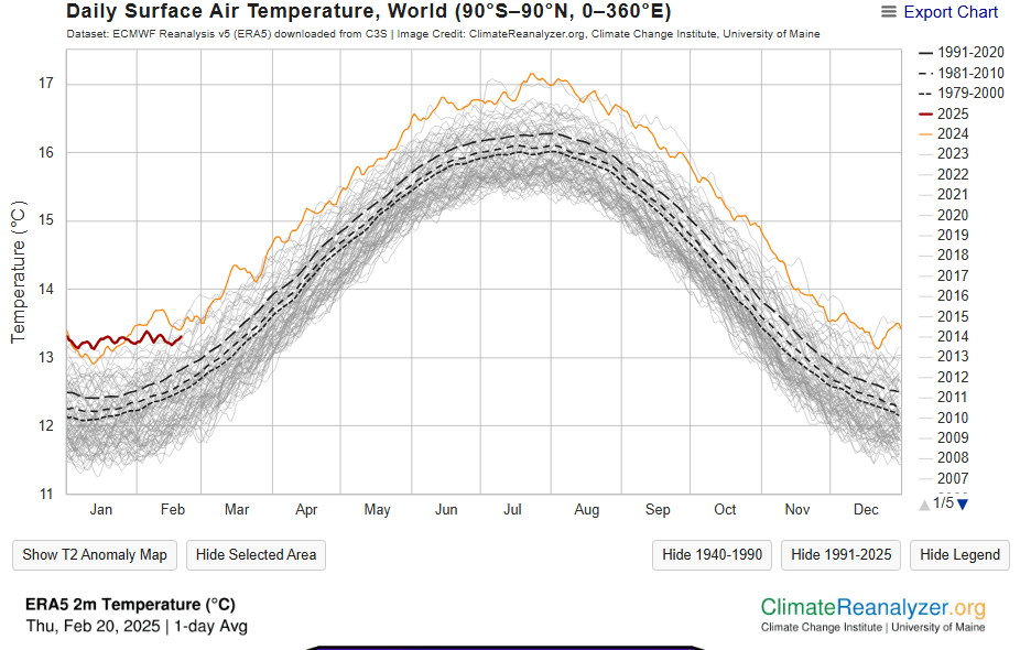
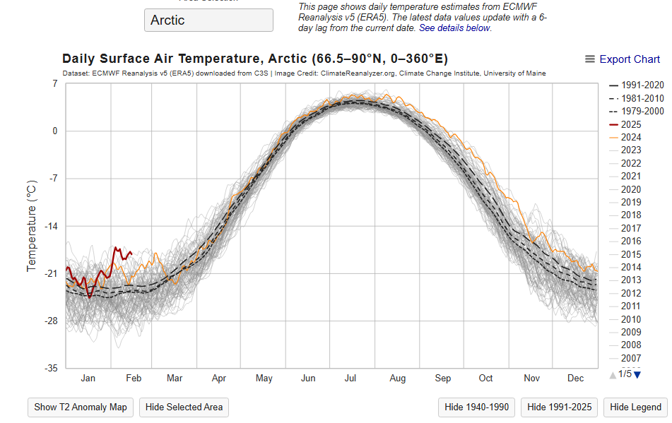
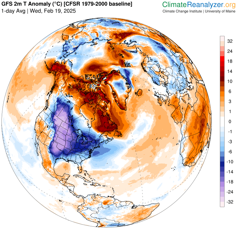
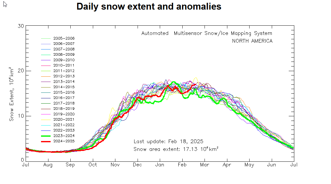
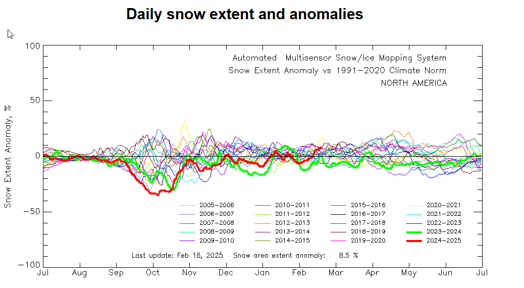
Climate data and worries ahead…
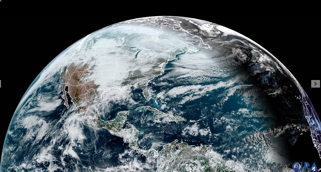
S. Quebec weather data: So, in Montreal their average annual snowfall is 82.5". Areas of southern Quebec have been in the path of heavy snowfall from the past two storm systems on February 13 and 16th.
Montreal (CYUL) received a total of 70.8 cm (28") on February 13 (34.0 cm) and 15" (36.8 cm). This brings the total for Feb 1-16 to 93 cm or 36.6" as compared to only 39 cm or 15.3" during the entire month of January 2025 and 37.6 cm or 15.3" in December 2024.

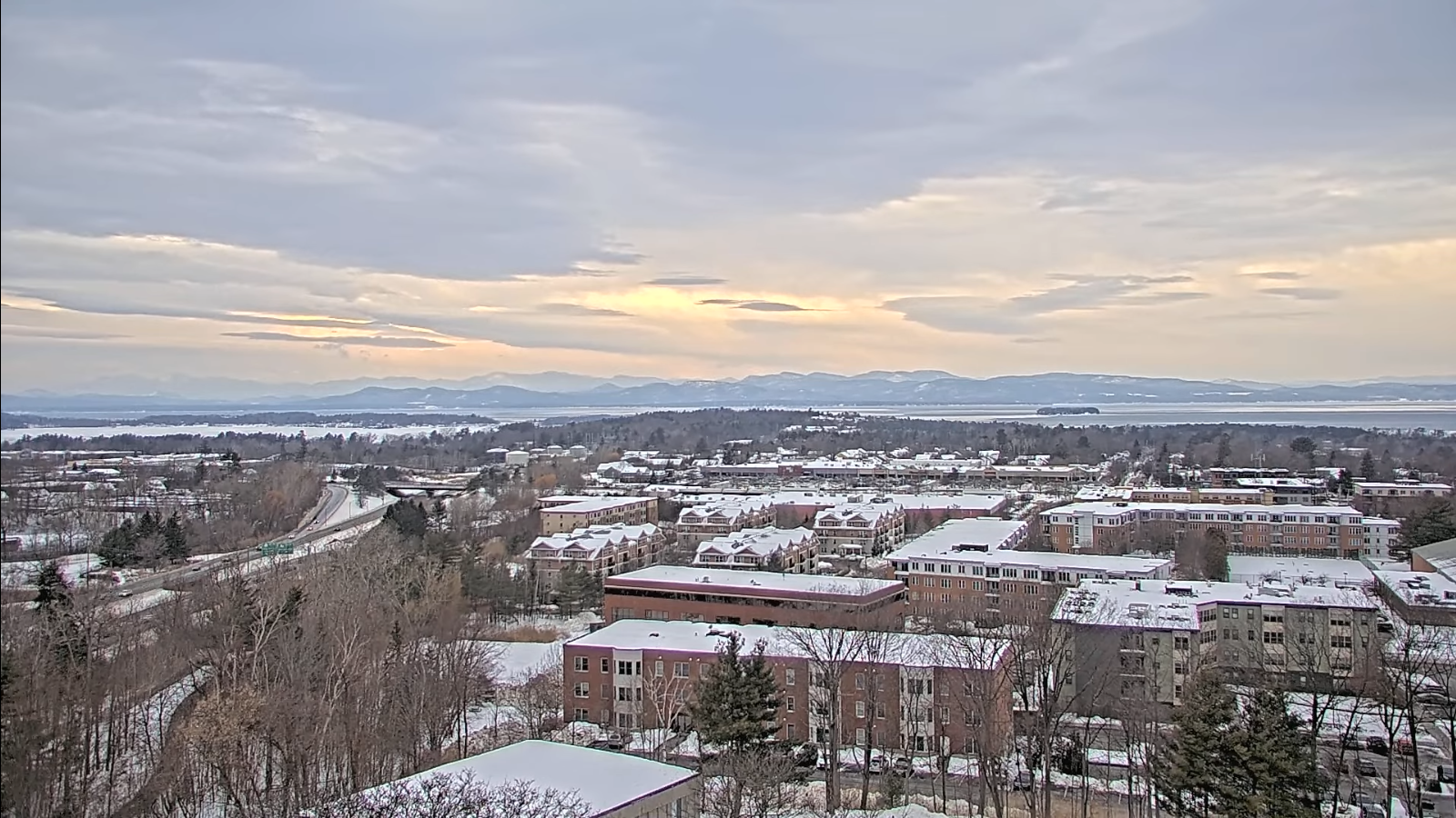
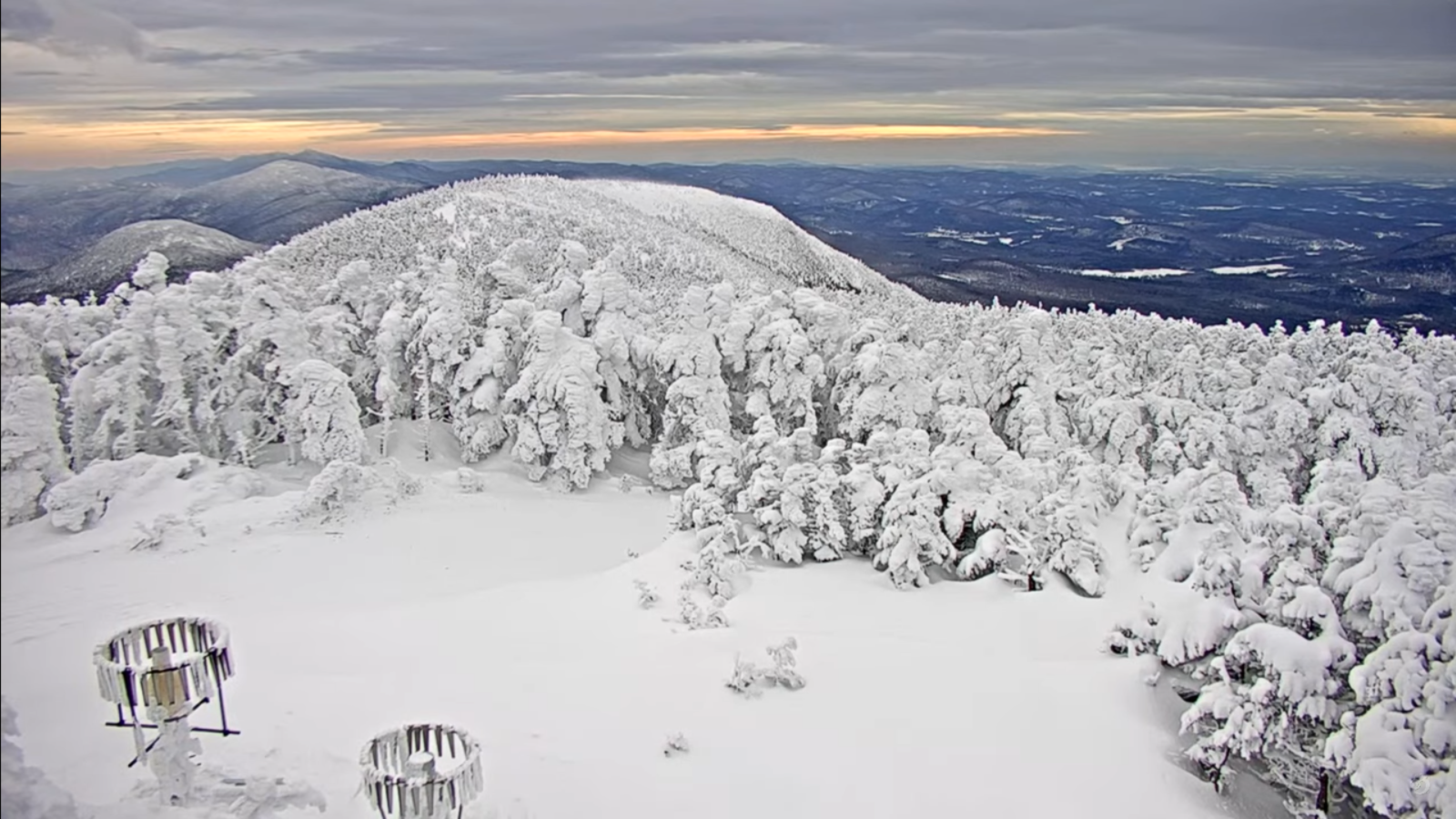
In other words Montreal is about to surpass their entire average annual snowfall. Yes its been a colder than normal, heavy snow winter, and this is reflected here in especially Norther Vermont.
One outstanding note: 72" was recorded at Jay Peak with just the last snowfall. This storm being the biggest in quite a few years.

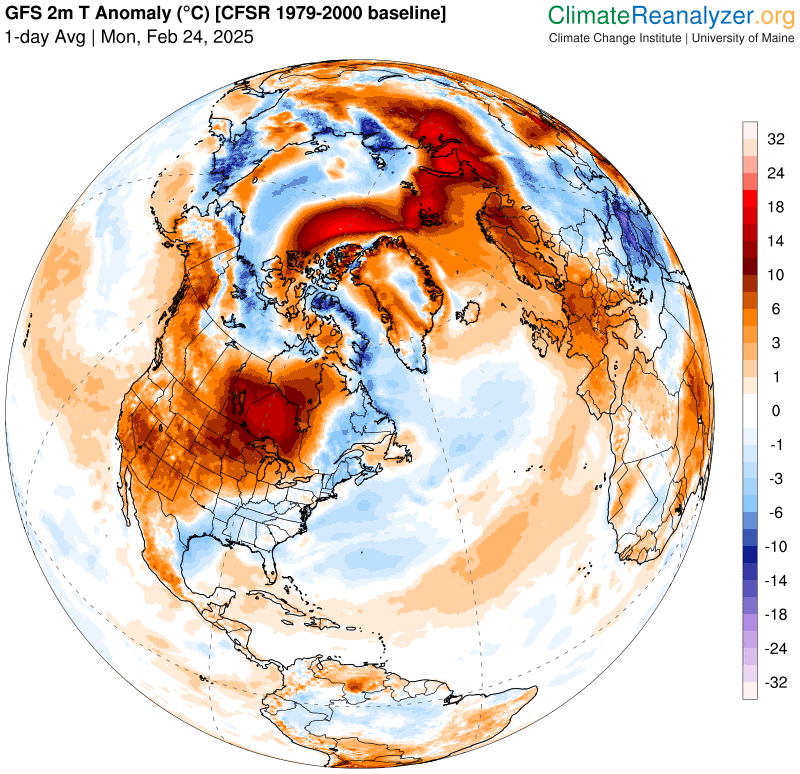
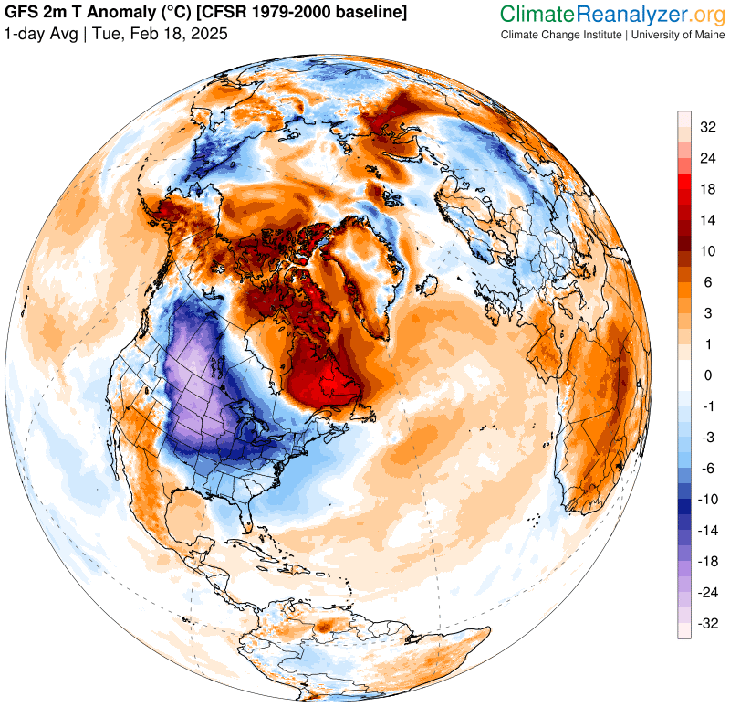
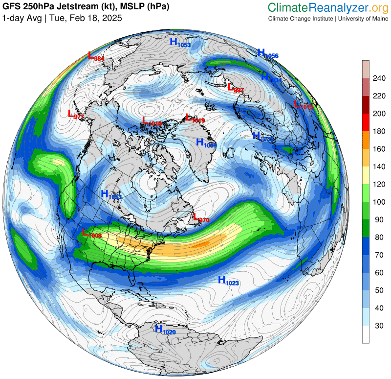
Problems Ahead: Please be aware…. if we get warmth and rain, this could be very problematic for flooding. Everybody should start thinking "spring and milder temperatures" in a week or two. There is one "super loaded 4-5 sigma" standard deviation of juiced up precipitable water signal in the longer range modeling that if comes to fruition could really raise river levels. Do not panic or freak out over this, as it may not be so bad. Let’s just slowly get a handle with the idea of snow removal and prepare for ice jams, heavy snowmelt…combined with (…hate to say this) but Rain.
There is a real science behind how much rain? what temperature? etc. goes into first absorbing by the snow pack before it ripens and lets loose as water or run-off.
Bottom line let’s hope for good sugaring weather in March, with easing highs and freezing overnight lows. If that happens we’ll probably be OK. But if there’s extremes, temperatures go up 45 to 55 or higher with heavy rain over a shorter time scale, well God Help Us as they say, but we are on our own in light of the Federal Government’s purposeful failures ahead.

RH/2-18[forecast][end]
