Updated Tuesday Evening Forecast — October 5th, 2021

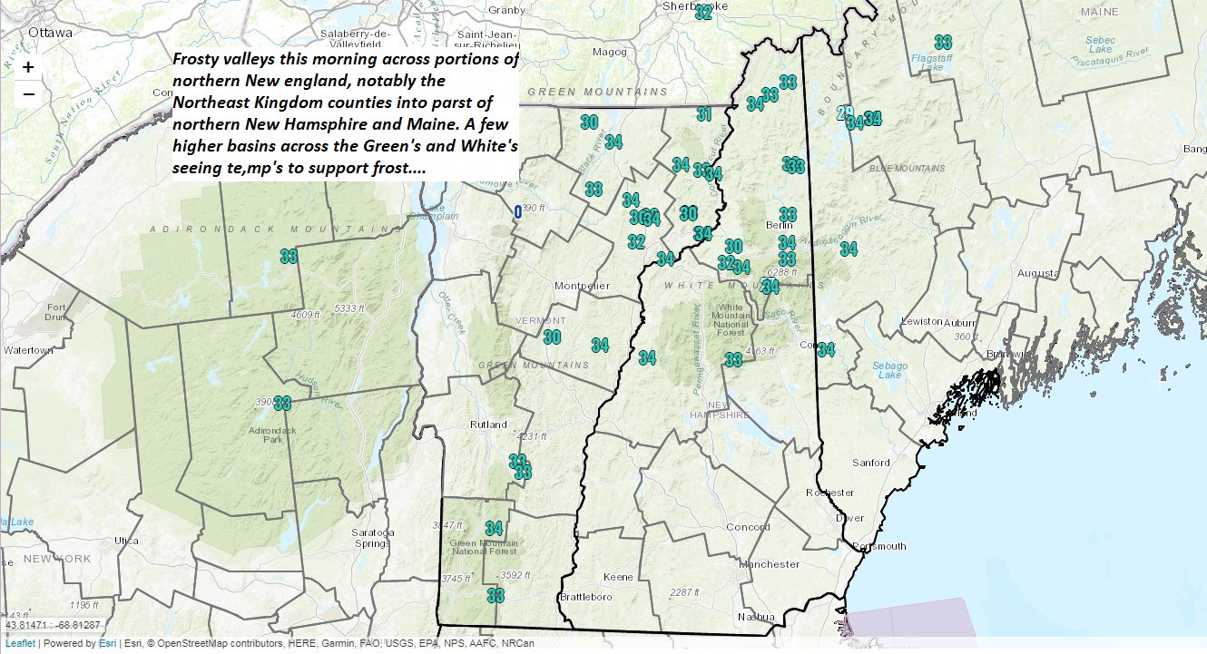
TONIGHT: Partly cloudy, before clearing overnight. Areas dense valley fog. A low in the mid to upper 40s. Little wind.

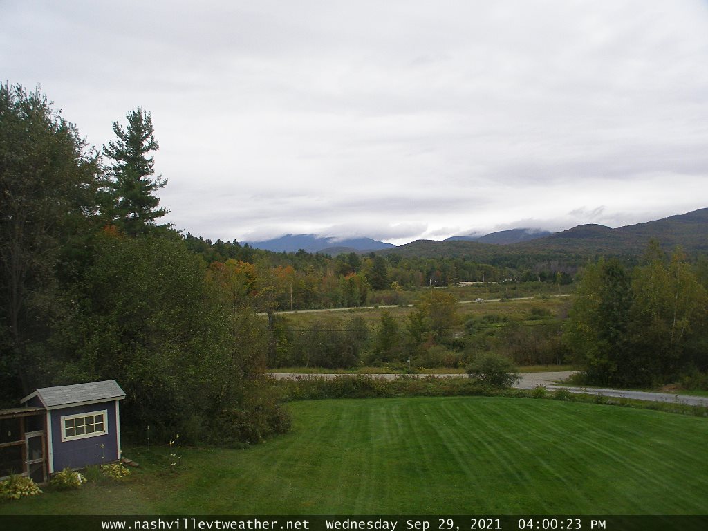
TOMORROW: Morning fog then periods of sunshine mixed with clouds. A high mid to upper 60s. Light north winds.

WEDNESDAY NIGHT: Mostly clear. Dense valley fog. A low mid-40s. Little wind.

THURSDAY: Partly to mostly sunny. A high near 70. Light northwest winds.

Looking further ahead…

THURSDAY NIGHT: Mostly clear. Patchy dense valley fog. A low around 45.

FRIDAY: Morning fog then, sunshine and blue skies. A high in the upper 60s to around 70.

SATURDAY: Mixed clouds and sun, giving way to more clouds in the afternoon. Isolated sprinkles far southern areas. A low 45 to 50. A high upper 50s to around 60.

SUNDAY: Considerable cloudiness, maybe a brief sprinkle, gives way to intervals of afternoon sunshine. A low 45 to 50. A high 60 to 65.

MONDAY: Partly to mostly sunny after morning fog. A low in the upper 40s. A high around 70.

Average low 35 to 40. Average highs upper 50s to low 60s.

RH/10-5forecast][end]

Updated Tuesday Morning Forecast — October 5th, 2021

TODAY: Scattered morning sprinkles or areas of drizzle, drying up this later this morning. Otherwise considerable cloudiness, isolated breaks of sun this afternoon. Warming trend begins. A high upper 50s to around 60. Little wind.

TONIGHT: Becoming mostly clear. Areas dense valley fog. A low in the mid-40s. Little wind.

WEDNESDAY: Morning fog then periods of sunshine mixed with clouds. A high in the mid-60s. Little wind.

Looking further ahead…

WEDNESDAY NIGHT: Mostly clear. Patchy dense valley fog. A low near 45.

THURSDAY: Partly to mostly sunny. A high in the upper 60s to around 70.

FRIDAY: Morning fog then, sunshine and blue skies. A low mid-40s.A high in the upper60s to around 70.

SATURDAY: Mixed clouds and sunshine. A low around 50. A high in the 60s.

SUNDAY: Mostly cloudy. Chance for afternoon showers. A low in the 40s. A high mid to upper 50s.

Average low 35 to 40. Average highs upper 50s to low 60s.

RH/10-5forecast][end]

Updated Monday Evening Forecast — October 4th, 2021

TONIGHT: Damp and overcast. Light showers and areas of drizzle this evening dry up overnight, lingering some southern areas. A low near 50. Light east to southeast winds.

TOMORROW: Considerable cloudiness. Scattered morning showers or areas of drizzle south of Rutland, drying up. Warming trend begins. A high upper 50s to around 60. Little wind.

TUESDAY NIGHT: Becoming mostly clear. Areas dense valley fog. A low in the mid-40s. Little wind.

WEDNESDAY: Morning fog then periods of sunshine. A high mid to upper 60s. Little wind.

Looking further ahead…

WEDNESDAY NIGHT: Mostly clear. Patchy dense valley fog. A low near 45.

THURSDAY: Partly to mostly sunny. A high around 70.

FRIDAY: Morning fog then, sunshine and blue skies. A low mid to upper 40s. A high upper 60s to near 70.

SATURDAY: Mixed clouds and sunshine. A low around 50. A high in the 60s.

Average low 35 to 40. Average highs upper 50s to low 60s.

RH/10-4forecast][end]

Updated Monday Morning Forecast — October 4th, 2021

TODAY: Overcast with areas of fog. Showers across southern areas this morning, spread north into the Barre-Montpelier area this afternoon. Remaining dry northern areas. A high in the mid-50s. Light east to southeast winds.

TONIGHT: Widely scattered light showers or sprinkles central and southern areas. A low near 50. Light east to southeast winds.

TUESDAY: Maybe a sprinkle early central and southern areas. Otherwise, intervals of afternoon sunshine. Warming trend. A high around 60. Little wind.

Looking further ahead…

TUESDAY NIGHT: Scattered clouds with areas of dense valley fog northern and central areas. A low in the mid-40s.

WEDNESDAY: Partly to mostly sunny northern areas, otherwise partly cloudy south. A high in the mid-60s.

THURSDAY: Partly to mostly northern areas, Otherwise clouds mixed with sun south. A low near 45. A high upper 60s to around 70.

FRIDAY: Morning fog burns off to lots of sunshine and blue skies. A low upper 40s. A high around 70.

Average low 35 to 40. Average highs upper 50s to low 60s.

RH/10-4forecast][end]

Updated Friday Evening Forecast — October 1st, 2021

TONIGHT: Partly cloudy thru mid-evening, then cloudy. Showers becoming likely around midnight northern and central areas. Patchy valley fog. A low near 45. Light southwest winds.

TOMORROW: Gray and damp. Periods of rain…moderate at times northern and western areas. A high 55 to 60. Light southwest winds.

SATURDAY NIGHT: Overcast. An occasional shower. Areas of fog. A low 50 to 55. Little wind.

SUNDAY: Mainly gray. Scattered showers. Areas of fog. A high around 60. Light winds.

Looking further ahead…

SUNDAY NIGHT: Overcast. Areas of fog. Periods of rain likely. A low 50 to 55

MONDAY: Overcast with areas of fog. Chance for periods of rain or showers…moderate at times. A high 55 to 60.

TUESDAY: Mainly gray. Scattered showers. A low near 50. A high upper 50s to around 60.

WEDNESDAY: Clouds with a possible sprinkle in the morning. Partial late day sun. A low 55 to 60. A high near 65.

Average low 35 to 40. Average highs 60 to 65.

RH/10-1forecast][end]

Updated Friday Morning forecast — October 1st, 2021

TODAY: Morning fog burns off to intervals of sun followed by considerable afternoon cloudiness. A high upper 50s to around 60. Northwest breeze 10 mph.

TONIGHT: Partly cloudy thru mid-evening, then cloudy. Showers becoming likely after midnight northern and central areas. A low near 45. Light southwest winds.

SATURDAY: Gray and damp. Periods of rain likely moderate at times. A high 55 to 60. Light south to southwest winds.

Looking further ahead…

SATURDAY NIGHT: Overcast. An occasional shower likely. A low 50 to 55.

SUNDAY: Clouds with breaks of sunshine. Widely scattered light showers. A high around 60.

MONDAY: Overcast. Chance for periods of rain or showers…moderate at times. A low 50 to 55. A high 55 to 60.

TUESDAY: Mostly gray. Scattered showers. A low near 50. A high upper 50s to around 60.

WEDNESDAY: Mainly cloudy. Slight chance for a morning shower. A low 55 to 60. A high near 65.

Average low 35 to 40. Average highs 60 to 65.

RH/10-1forecast][end]

Updated Thursday Evening Forecast — September 30th, 2021

TONIGHT: Leftover mountain cloudiness eventually clearing overnight. Patchy valley fog. A low 40 to 45. Light west winds.

TOMORROW: Morning fog burns off to intervals of sun followed by more cloudiness. A high 55 to 60. Northwest breeze 10 mph.

FRIDAY NIGHT: Partly cloudy, then thickening clouds leading to a chance for showers. A low around 45. Light southwest winds.

SATURDAY: Gray and damp. Periods of rain likely moderate at times thru early afternoon. A high in the upper 50s to around 60. Light south to southwest winds.

Looking further ahead…

SATURDAY NIGHT: Overcast. Chance for showers. A low 50 to 55.

SUNDAY: Clouds with breaks of sunshine. Chance for showers. A high near 60.

MONDAY: Overcast. Chance for periods of rain or showers…moderate at times. A low 50 to 55. A high mid-50s to around 60.

TUESDAY: Mostly gray. Scattered showers. A low near 50. A high mid-50s to around 60.

WEDNESDAY: Partly to mostly cloudy. A low near 50. A high near 65.

Average low upper 30s to low 40s. Average highs low to mid 60s.

RH/9-30forecast][end]

Updated Thursday Morning Forecast — September 30th, 2021

TODAY: Considerable cloudiness with scattered light showers or sprinkles northern areas giving way to some periods of afternoon sunshine. A high 50 to 55. Northwest winds 10 mph.

TONIGHT: Scattered clouds this evening, a few more clouds overnight. Patchy valley fog. A low 40 to 45. Light northwest winds.

FRIDAY: Morning fog burns off to intervals of sun followed by more cloudiness with isolated sprinkles. A high 55 to 60. Northwest breeze 10 mph.

Looking further ahead…

FRIDAY NIGHT: Partly cloudy, then thickening clouds leading to a chance for showers. A low around 45.

SATURDAY: Mainly gray and damp. Chance for showers. A high 55 to 60.

SUNDAY: Periods of sunshine becoming mostly cloudy. Chance for showers developing in the afternoon. A low 50 to 55. A high in the low 60s.

MONDAY: Overcast. Chance for periods of rain or showers. A low in the upper 40s. A little more humid with a high upper 60s to around 70.

TUESDAY: Mostly gray. Scattered showers. A low in the mid-50s. A high 60 to 65.

Average low upper 30s to low 40s. Average highs low to mid 60s.

RH/9-30forecast][end]

Updated Wednesday Evening Forecast — September 29th, 2021

TONIGHT: Mostly cloudy. Widely scattered light showers…most numerous southern Lake Champlain. Showers briefly mixed with wet snowflakes high terrain overnight. A low upper 30s to low 40s. Light northwest winds.

TOMORROW: Mixed clouds and sun. Scattered showers mainly northern areas…mixed with wet snow flakes elevated terrain. A high 50 to 55. Northwest winds 10 mph.

THURSDAY NIGHT: Mostly clear in the evening, a few more clouds overnight. Patchy valley fog. A low around 40. Light northwest winds.

FRIDAY: Morning fog mixing gives way to breaks of sun but with a lot of clouds. Isolated sprinkles. A high 55 to 60. Northwest breeze 10 mph.

Looking further ahead…

FRIDAY NIGHT: Partly cloudy. A low 40 to 45.

SATURDAY: Mixed sun and clouds, thickening up late. Slight chance for late day showers. A high around 60.

SUNDAY: Periods of sunshine becoming mostly cloudy. Chance for showers developing in the afternoon. A low 45 to 50. A high around 60.

MONDAY: Overcast. Chance for periods of rain or showers. A low in the mid-50s. A little more humid with a high upper 60s to around 70

TUESDAY: Mostly gray. Scattered showers. A low in the mid-50s. A high 60 to 65

Average low upper 30s to low 40s. Average highs low to mid 60s.

RH/9-29forecast][end]

Updated Wednesday morning Forecast — September 29th, 2021

TODAY: Intervals of morning sun gives way to mostly cloudy skies. Widely scattered showers developing mainly this afternoon across northern areas. A high in the mid-50s. Light northwest winds.

TONIGHT: Mostly cloudy. Widely scattered mountain sprinkles mixed with a few wet snowflakes. A low upper 30s to low 40s. Light northwest winds.

THURSDAY: Clouds with intervals of sun. Scattered showers…mixed with wet snow flakes high elevations in the morning. A high 50 to 55. Northwest winds 10 mph.

Looking further ahead…

THURSDAY NIGHT: Mostly clear in the evening, then increasing clouds. Patchy valley fog. A low around 40.

FRIDAY: Morning fog mixing gives way to breaks of sun but with a lot of clouds. Widely scattered sprinkles. A high in the upper 50s.

SATURDAY: More clouds than sun. A low 40 to 45. A high near 60.

SUNDAY: Increasing clouds leading the chance for rain or rain showers. A low around 50. A high upper 50s to low 60s.

MONDAY: Overcast. Chance for light rain or showers. A low in the mid-50s. Clammy with a high in the mid-60s.

Average low upper 30s to low 40s. Average highs low to mid 60s.

RH/9-29forecast][end]