TONIGHT: Clear & moonlit. A low in the low to mid-30s with a scattered frost. Light north winds.
TOMORROW: Sunny, with a few afternoon clouds. A high in the upper 50s. North to northwest winds 10 mph.
TUESDAY NIGHT: Clear and partially moonlit. A low 32 to 35 with areas of frost. Little wind.
WEDNESDAY: Sunshine mixed with some afternoon clouds. A high near 65. Northwest breeze 10 mph.
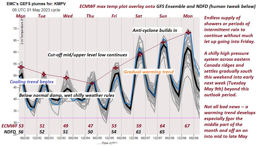
Looking further ahead
WEDNESDAY NIGHT: Clear & partially moonlit. A low 40 to 45.
THURSDAY: Lots of sunshine with a few high clouds. A high in the lower 70s.
FRIDAY: Partly sunny. Chance for passing showers and thunderstorms. A low 40 to 45. A high reaching the mid-70s.
SATURDAY: Filtered sunshine thru high cloudiness. A low 45 to 50. A high near 65.
SUNDAY: Hints of sunshine thru high cloudiness. A low in the mid to upper 30s. A high upper 50s.
Average lows ranging upper 30s to mid-40s. Average highs low to mid 60s
Start of Meteorological summer June the 6th.
RH/5-8 forecast][end]