Updated Tuesday morning Forecast — June 6th, 2023

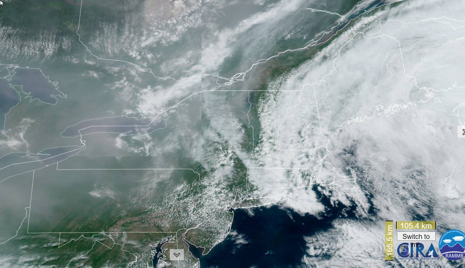
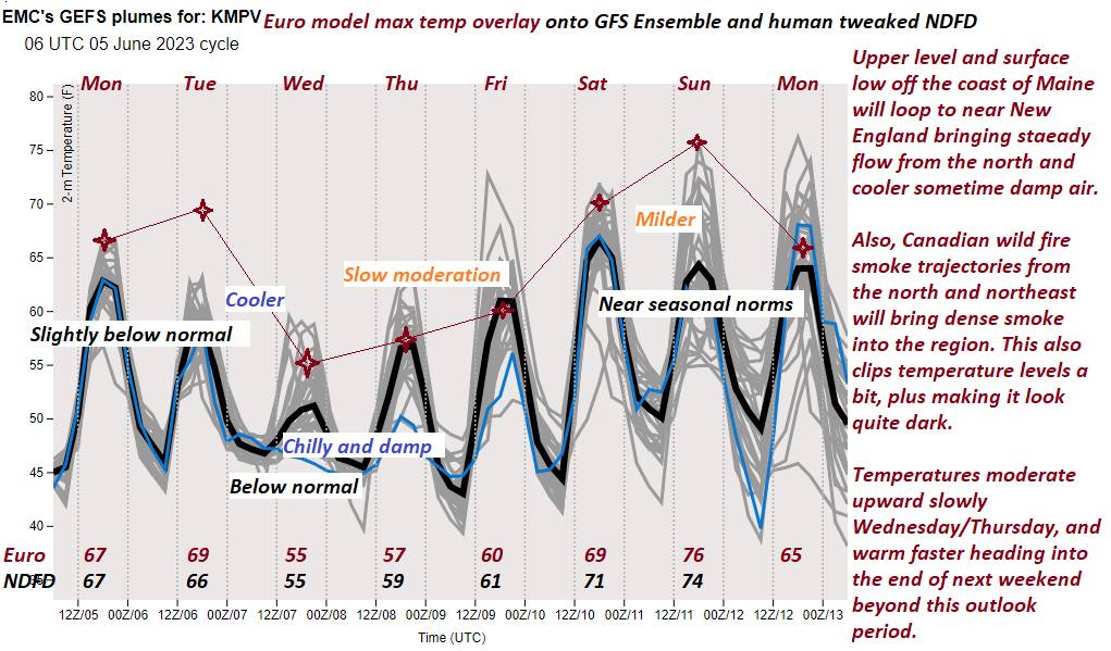
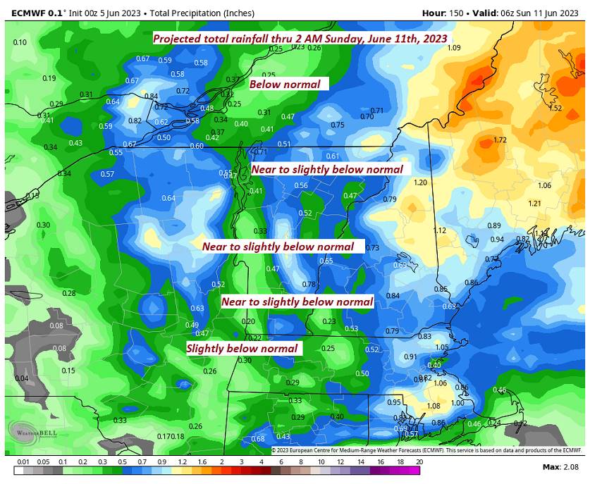
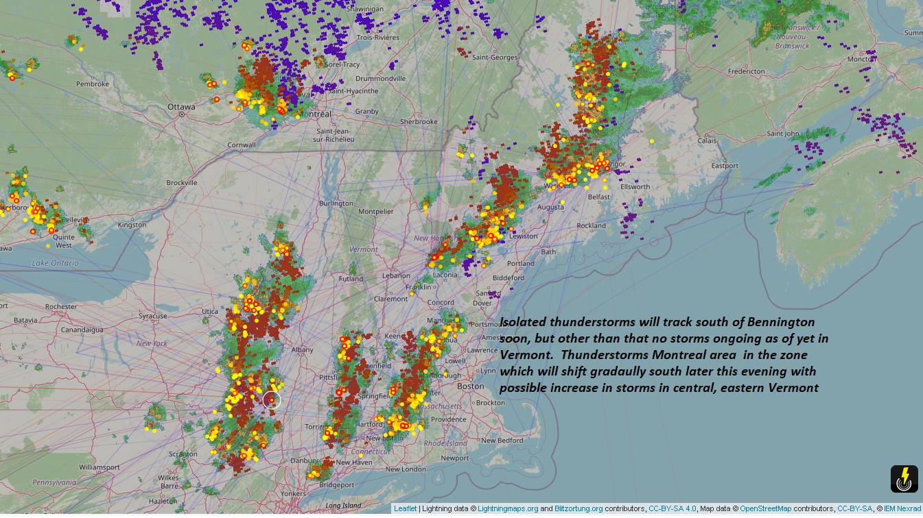
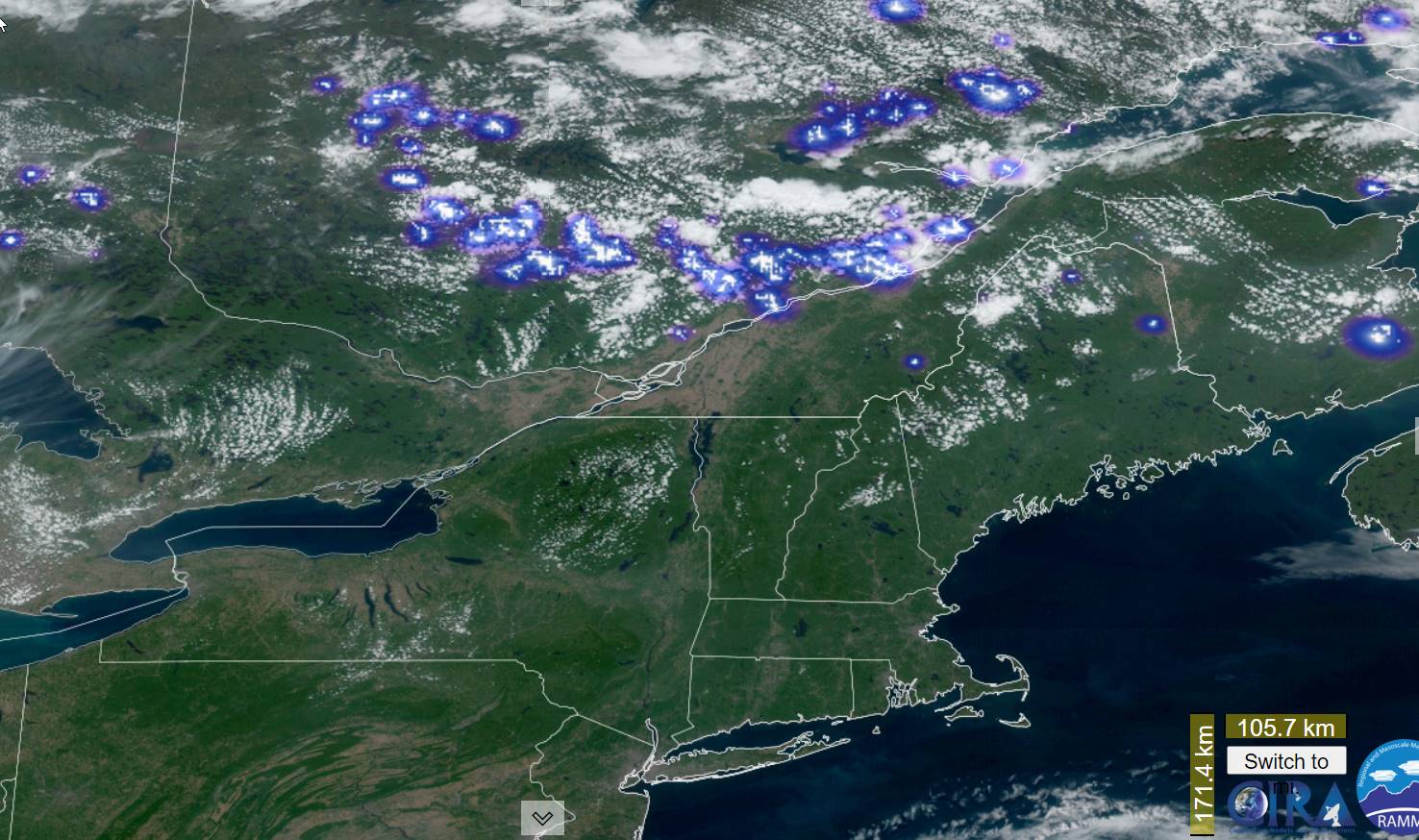
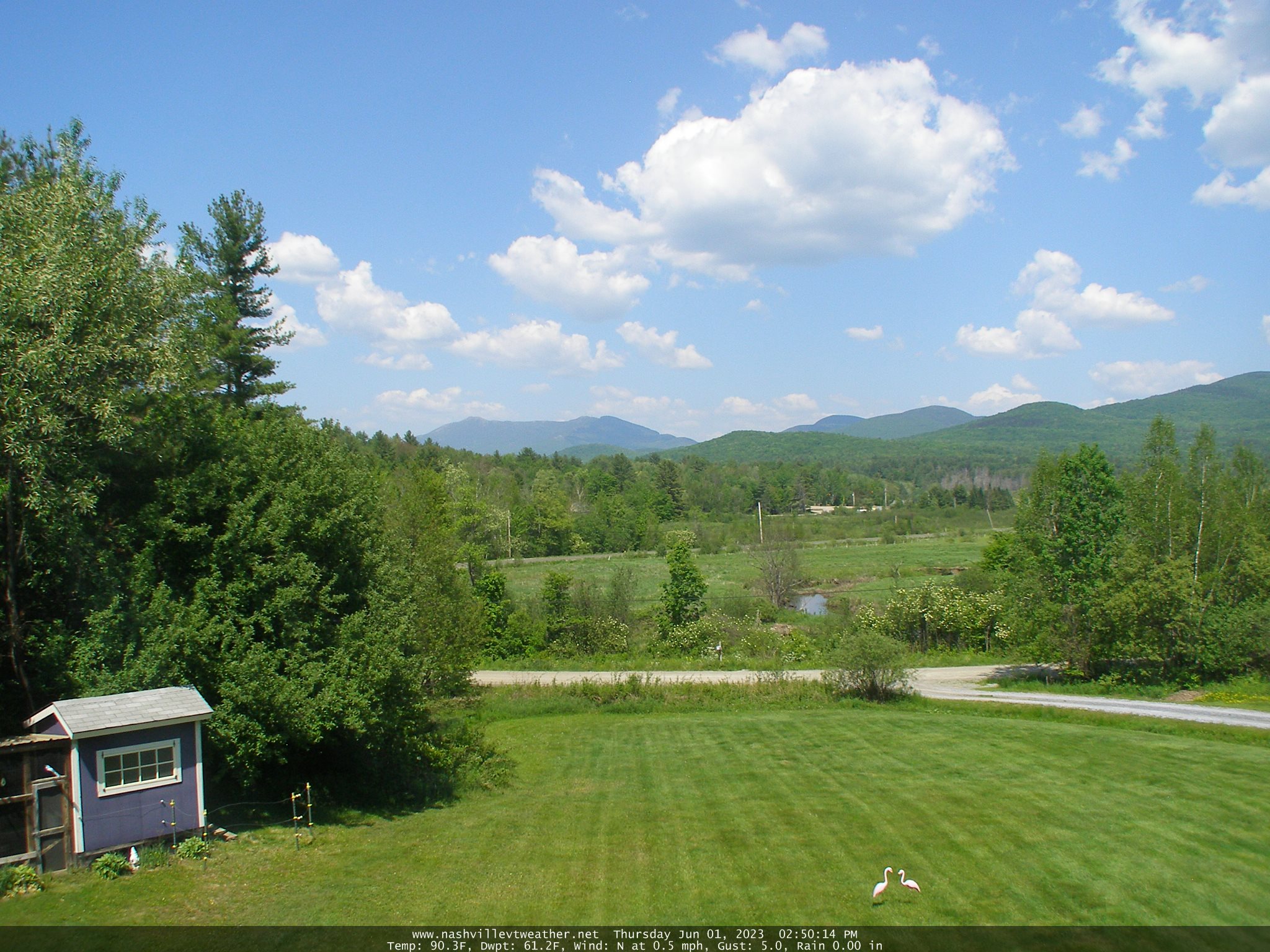
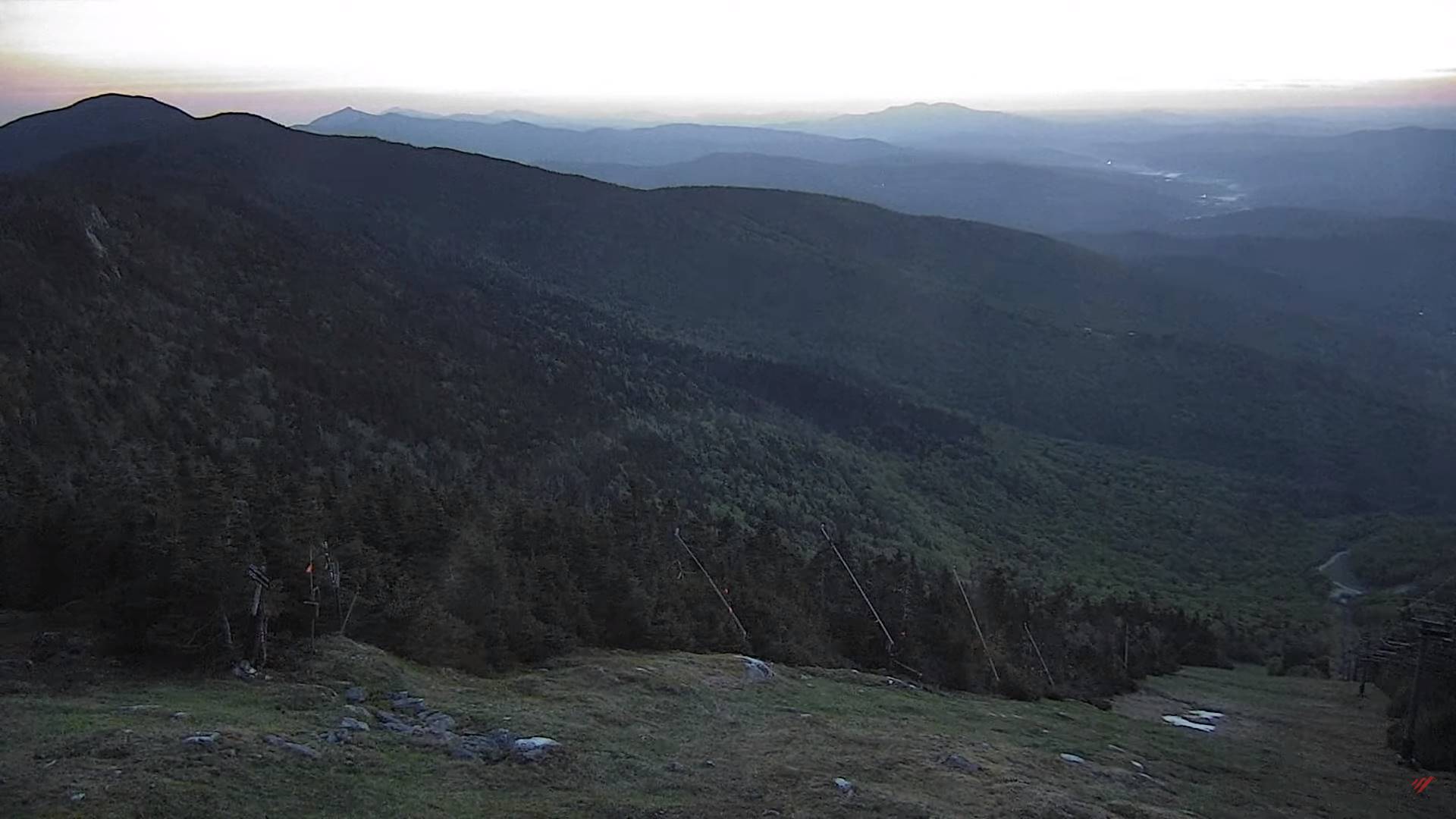
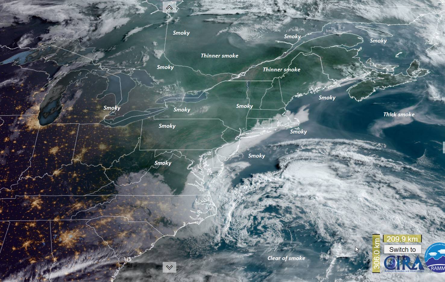
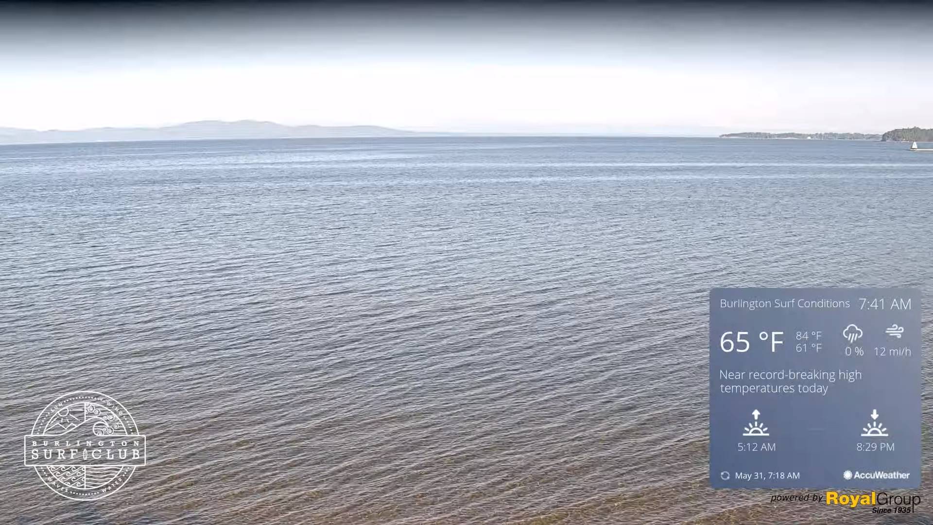
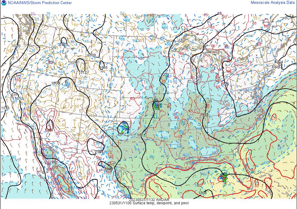
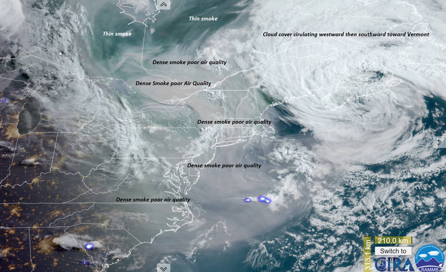
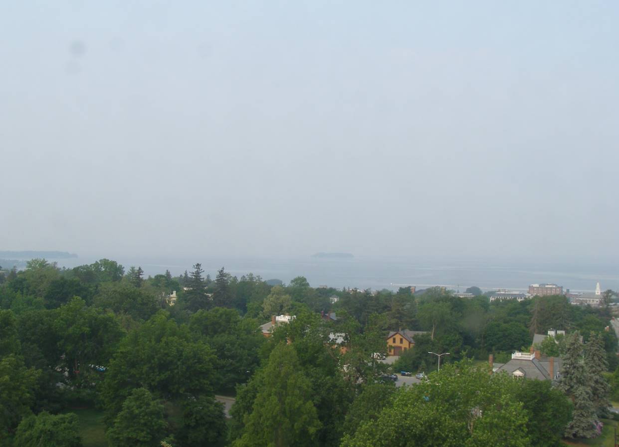
TODAY: Hazy sunshine and smoky this morning. Scattered afternoon showers and possible rumbles of thunder western and southern Vermont this afternoon. A high in the mid-60s. North winds 10 to 15 mph.

TONIGHT: Overcast, damp with patchy valley fog. Showers likely. A low upper 40s. Light northwest winds.

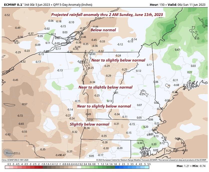
WEDNESDAY: Considerable cloudiness with showers likely. Partial afternoon sun south. A high near 55. Northwest winds 10 mph.

Looking further ahead

WEDNESDAY NIGHT: Overcast cool & damp, with an occasional shower. A low around 45.

THURSDAY: Clouds & breaks of sun. Chance for showers. A high in the mid to upper 50s.

FRIDAY: Mostly cloudy. Scattered showers and a few rumbles of thunder in the afternoon. A low in the lower 40s. A high 60 to 65.

SATURDAY: Mostly cloudy. Scattered showers maybe a rumble of thunder. A low around 45. A high mid to upper 60s.

SUNDAY: Partly to mostly sunny and finally near seasonable in temperature. A low 50 to 55. A high near 75.

Average lows ranging mid-40s to low 50s. Average highs low to mid 70s

Start of Meteorological summer today Summer Solstice hits June 21st

Approx. Peak of summer July 22nd

RH/6-5 forecast][end]

Updated Monday Evening Forecast — June 6th, 2023

TONIGHT: Lots of clouds with a sprinkle or two, gives way to partial clearing later overnight. A low 45 to 50. Light northwest winds.

Approximate start of meteorological summer…

TOMORROW: Periods of morning sun then clouding up. Scattered afternoon showers and possible rumbles of thunder western and southern areas. A high 60 to 65. North winds 10 to 15 mph.

TUESDAY NIGHT: Cloudy and damp. Showers likely. A low upper 40s. Light northwest winds.

WEDNESDAY: Considerable cloudiness with showers likely. Partial afternoon sun south. A high around 55. Northwest winds 10 mph.

Looking further ahead

WEDNESDAY NIGHT: Overcast cool & damp, with an occasional shower. A low around 45.

THURSDAY: Clouds with a break of sun now and then. Chance for showers. A high in the upper 50s.

FRIDAY: Mostly cloudy. Scattered showers and a few rumbles of thunder in the afternoon. A low 40 to 45. A high in the lower 60s.

SATURDAY: Mixed sun and clouds. Isolated showers maybe a rumble of thunder. A low around 45. A high near 70.

Average lows ranging mid-40s to low 50s. Average highs low to mid 70s

Start of Meteorological summer tomorrow June 6th Summer Solstice hits June 21st

Approx. Peak of summer July 22nd

RH/6-5 forecast][end]

Updated Monday Morning Forecast — June 5th, 2023

TODAY: Clouds with breaks of sunshine. Chance for sprinkles near the Connecticut River valley. A high mid to upper 60s. North to northwest winds 10 to 15 mph.

TONIGHT: Lots of clouds with a sprinkle or two, gives way to partial clearing later overnight. A low 45 to 50. Light northwest winds.

Approximate start of meteorological summer…

TUESDAY: Periods of morning sunshine then more clouds than sun in the afternoon. Scattered afternoon showers and possible rumbles of thunder western and southern areas. A high in the low 60s. North winds 10 to 15 mph.

Looking further ahead

TUESDAY NIGHT: Cloudy and damp. Chance for a showers. A low upper 40s.

WEDNESDAY: Considerable cloudiness with a few showers likely. Partial afternoon sun south. A high around 55.

THURSDAY: Clouds with a break of sun now and then. Chance for showers. A low around 45. A high in the upper 50s to near 60.

FRIDAY: Mostly cloudy. Scattered showers and a few rumbles of thunder in the afternoon. A low 40 to 45. A high around 60.

SATURDAY: Mixed sun and clouds. Isolated showers maybe a rumbles of thunder. A low 40 to 45. A high near 70.

Average lows ranging mid-40s to low 50s. Average highs low to mid 70s

Start of Meteorological summer tomorrow June 6th Summer Solstice hits June 21st

Approx. Peak of summer July 22nd

RH/6-5 forecast][end]

Updated Friday Evening Forecast — June 2nd, 2023

TONIGHT: Variable cloudiness. A few leftover evening showers and thunderstorms. A low 50 to 55. Northeast winds 10 mph.

TOMORROW: Clouds with a chance for morning showers especially toward Rutland. Otherwise periods of afternoon sunshine, but sharply cooler.A high in the mid to upper 60s. Northeast breeze 10 to 15 mph.

Full strawberry Moon 11:42 PM Saturday…

SATURDAY NIGHT: Becoming mostly clear, “fully moonlit” & cool. A low 40 to 45. Light northeast winds.

SUNDAY: Morning sun then lots of clouds. A high in the mid-60s. North winds 10 to 20 mph.

Looking further ahead

SUNDAY NIGHT: Scattered clouds and moonlit skies. A low in the 40s.

MONDAY: Thickening clouds leading to shower threat. A high upper 60s.

Approximate start of meteorological summer…

TUESDAY: Gray skies. Scattered showers with partial clearing developing later on. A low 45 to 50. A high in the low 60s.

WEDNESDAY: Lots of clouds northern areas. Partial afternoon sunshine southerly areas. A low mid to upper 40s. A high about the mid-60s.

Average lows ranging 45 to 50. Average highs 70 to 75

Start of Meteorological summer this next Tuesday June 6th Summer Solstice hits June 21st

RH/6-1 forecast][end]

Updated Friday Morning Forecast — June 2nd, 2023

TODAY: Morning sun, then partly sunny and more humid. Showers and thunderstorms likely mid- afternoon…one or two strong and locally heavy. Record to near record warmth and muggy this afternoon. A high 85 to 90. North breeze 10 mph.

TONIGHT: Variable cloudiness. Isolated mainly evening showers and thunderstorms. A low 50 to 55. Northeast winds 10 mph.

SATURDAY: Lots of clouds with a few showers central and southern areas. Intervals of afternoon sunshine much cooler with below normal temperatures.A high mid to upper 60s. Northeast breeze 10 to 15 mph.

Looking further ahead

Full strawberry Moon 11:42 PM Saturday…

SATURDAY NIGHT: Partial clearing east of the Greens, mostly clear elsewhere and “fully moonlit”. A low

around 45.

SUNDAY: Morning sun then lots of clouds. A high around 65.

MONDAY: Considerable cloudiness. A low in the 40s. A high upper 60s.

Approximate start of meteorological summer…

TUESDAY: Gray skies. Scattered showers with partial clearing developing later on. A low 45 to 50. A high near 65.

WEDNESDAY: Lots of clouds northern areas. Partial afternoon sunshine southerly areas. A low in the 40s. A high around 65.

Average lows ranging 45 to 50. Average highs 70 to 75

Start of Meteorological summer this next Tuesday June 6th Summer Solstice hits June 21st

RH/6-1 forecast][end]

Updated Thursday Evening Forecast — June 1st , 2023

TONIGHT: Clear & partially moonlit. Not as cool. A low in the upper 50s to around 60. Little wind.

TOMORROW: Morning sun, then partly sunny and more humid. Showers and thunderstorms likely by mid- afternoon…one or two strong and locally heavy. Near record high in the 85 to 90 range. North winds 10 mph.

FRIDAY NIGHT: Considerable cloudiness. Isolated evening showers and thunderstorms, flare up toward midnight. A low in the low to mid 50s. Light northeast winds.

Full strawberry Moon 11:42 PM Saturday night…

SATURDAY: Lots of clouds with a few showers central and southern areas. Intervals of afternoon sunshine much cooler with below normal temperatures.A high mid to upper 60s. Northeast breeze 10 to 15 mph.

Looking further ahead

SATURDAY NIGHT: Partial clearing east of the Greens, mostly clear otherwise. A low in the mid-40s.

SUNDAY: Morning sun then lots of clouds. A high in the upper 60s.

MONDAY: Mostly cloudy. A threat for a shower. A low in the mid to upper 40s. A high upper 60s.

Approximate start of meteorological summer…

TUESDAY: Gray skies. Scattered showers. A low in the mid-40s. A high 60 to 65.

Average lows ranging 45 to 50. Average highs 70 to 75

Start of Meteorological summer this next Tuesday June 6th Summer Solstice hits June 21st

RH/6-1 forecast][end]

Updated Thursday Morning Forecast — June 1st, 2023

TODAY: Sunny, a few afternoon clouds. A record high in the lower 90s with low to moderate humidity levels. Light northwest winds.

TONIGHT: Clear & partially moonlit. Not as cool. A low near 60. Little wind.

FRIDAY: Morning sun, then partly sunny and more humid. Showers and thunderstorms likely by mid- afternoon…one or two strong and locally heavy. A near record high mid to upper 80s. North to northwest winds 10 mph.

Looking further ahead

FRIDAY NIGHT: Considerable cloudiness. Isolated evening showers and thunderstorms, flare up toward midnight. A low in the low to mid 50s.

Full strawberry Moon 11:42 PM Saturday night…

SATURDAY: Lots of clouds with a few showers central and southern areas. Intervals of afternoon sunshine much cooler with below normal temperatures. Chance for showers especially eastern and southern areas. A high 60 to 65.

SUNDAY: Morning sun, then more clouds eastern areas. A low in the mid-40s. A high in the upper 60s.

MONDAY: Mostly cloudy. A threat for a shower. A low in the mid to upper 40s. A high upper 60s.

Approximate start of meteorological summer…

TUESDAY: Gray skies. Scattered showers. A low in the mid-40s. A high 60 to 65.

Average lows ranging 45 to 50. Average highs 70 to 75

Start of Meteorological summer this next Tuesday June 6th Summer Solstice hits June 21st

RH/6-1 forecast][end]

Updated Wednesday evening Forecast — May 31st, 2023

TONIGHT: Clear & starlit. A low near 55. Little wind.

TOMORROW: Sunny with a few afternoon clouds. A high in the lower 90s. Light northwest winds.

THURSDAY NIGHT: Clear & starlit. Not as cool. A low down to around 60. Little wind.

FRIDAY: Morning sun then partly sunny and a tad more humid. Showers and thunderstorms likely…one or two strong and locally heavy. A high 85 to 90. North to northwest winds 10 mph.

Looking further ahead

FRIDAY NIGHT: Mostly cloudy. Scattered showers and isolated thunderstorms. A low around 55.

SATURDAY: Considerable cloudiness and much cooler with below normal temperatures. Chance for showers especially eastern and southern areas. A high in the low to mid-60s.

SUNDAY: Lots of clouds. Chance for showers eastern areas. A low in the mid-40s. A high 65 to 70.

MONDAY: Sun then partly to mostly cloudy. Maybe a shower late. A low in the mid to upper 40s. A high upper 60s.

Approximate start of meteorological summer…

TUESDAY: Mixed sun and clouds. Isolated showers or thunderstorm possible. A low around 50. A high around 70.

Average lows ranging 45 to 50. Average highs 70 to 75

Start of Meteorological summer this next Tuesday June 6th Summer Solstice hits June 21st

RH/5-31 forecast][end]

Updated Wednesday morning Forecast — May 31st, 2023

TODAY: Sunny. A high mid to upper 80s. A light west breeze.

TONIGHT: Clear & starlit. A low near 55. Little wind.

THURSDAY: Sunny with a few afternoon clouds. A high in the low 90s. Light north winds.

Looking further ahead

THURSDAY NIGHT: Clear & starlit. Not as cool. A low down to around 60.

FRIDAY: Morning sun then partly sunny and a tad more humid. Scattered afternoon showers & thunderstorms…one or two possibly strong. A high 85 to 90.

SATURDAY: Scattered mainly morning showers exiting. Partly to mostly sunny but much cooler. A low around 55. A high near 70.

SUNDAY: Sunny. A low 45 to 50. A high in the low 70s.

MONDAY: Sun then partly to mostly cloudy. Maybe a shower late. A low in the mid to upper 40s. A high in the mid-70s.

TUESDAY: Mixed sun and clouds. Isolated showers or thunderstorm possible. A low around 50. A high near 70.

Average lows ranging 45 to 50. Average highs 70 to 75

Start of Meteorological summer June the 6th.

RH/5-30 forecast][end]

Updated Tuesday Evening Forecast — May 30th, 2023

TONIGHT: Clear and starlit skies. A low in the low 50s. Light south winds, breezier near Lake Champlain.

TOMORROW: Sunny. A high in the mid to upper 80s. A light west breeze.

WEDNESDAY NIGHT: Clear & starlit. A low around 55. Light south winds.

THURSDAY: Sunny with a few afternoon clouds. A high upper 80s to around 90. Light north winds.

Looking further ahead

THURSDAY NIGHT: Clear & starlit. A low near 60.

FRIDAY: Morning sun then partly sunny. Scattered afternoon showers & thunderstorms…one or two possibly strong. A high upper 80s to near 90.

SATURDAY: Any morning showers exiting to bright sunshine. A low 55 to 60. A high 70 to 75.

SUNDAY: Sunny. A low around 45. A high near 75.

MONDAY: Mixed sun and clouds. Maybe a sprinkle. A low near 50. A high in the mid-70s.

Average lows ranging 45 to 50. Average highs 70 to 75

Start of Meteorological summer June the 6th.

RH/5-30 forecast][end]