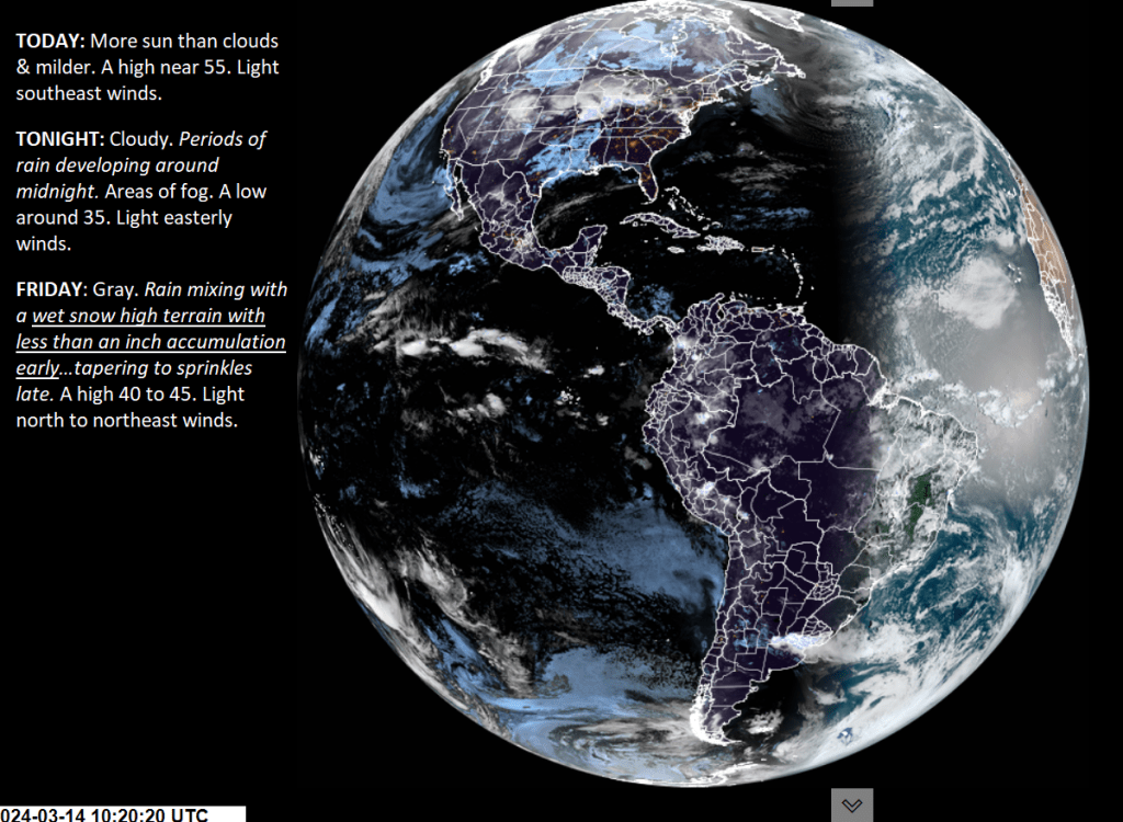
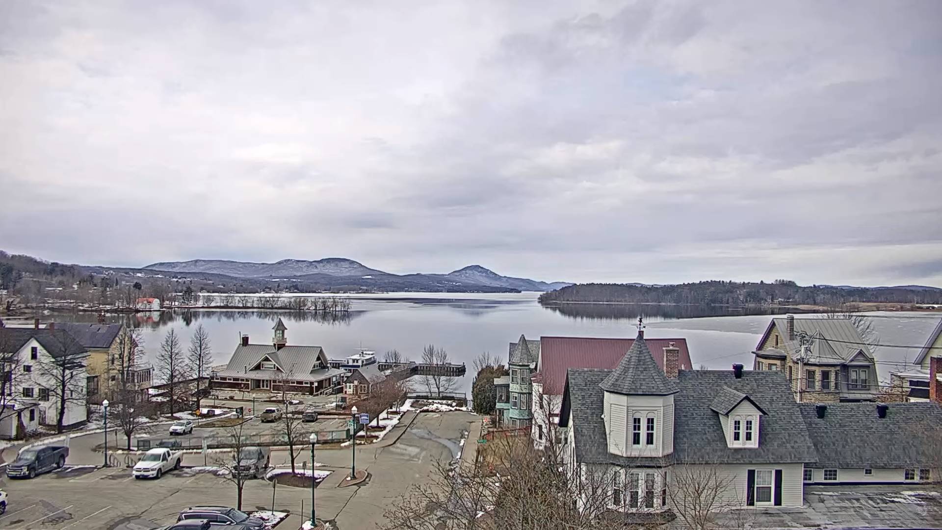
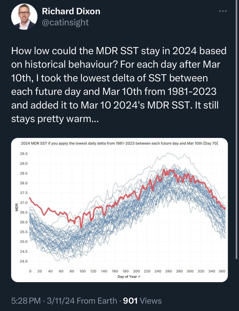
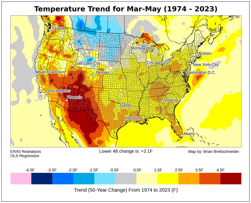
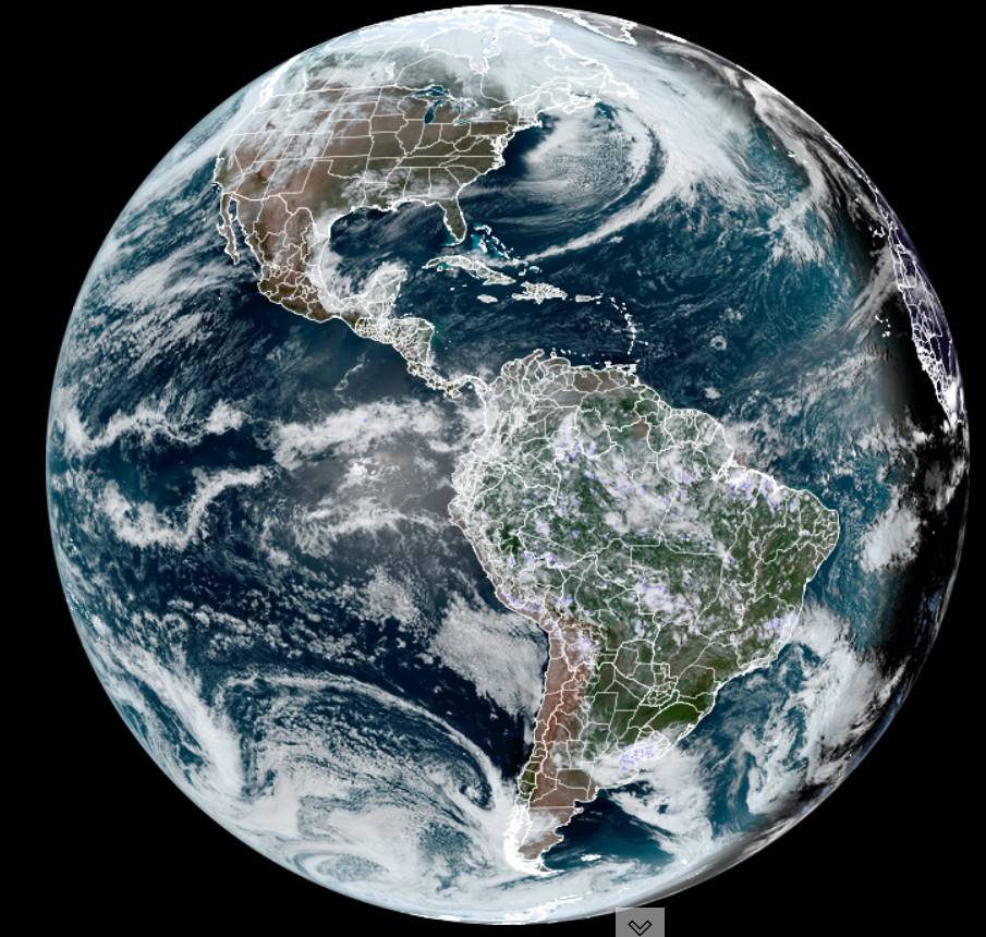
Do your back road travels early as the ground to be a whole lot firmer indeed. We’ll see full-out mud season this afternoon as temps climb above 50. Rainy after midnight maybe some wet snow accumulation on higher terrain Friday morning.


TONIGHT: Variable clouds. A few showers this evening. Watch for possible icy spots.A low in the low 30s. Light southeast winds.
TOMORROW: More sun than clouds & milder. A high 50 to 55. Light southeast winds.

THURSDAY NIGHT: Cloudy. Periods of light rain becoming likely overnight.A low around 35. Light easterly winds.
FRIDAY: Gray. Rain or rain showers tapering to sprinkles late. A risk of a wintry mix east of the Green Mountains briefly early.A high mid-40s. Light north to northeast winds.

Looking further ahead
FRIDAY NIGHT: Variable cloudiness.Chance for a few rain showers mixed with wet snow flakes higher terrain.A low 30 to 35.

SATURDAY: Mostly cloudy. Widely scattered rain showers mixed with wet snowflakes in the mountains. A high around 45.
SUNDAY: Lots of clouds.Rising chance for rain showers mixed with wet snow mountain summits.A low 30 to 35. A high around 45.
MONDAY: Clouds some intervals of sun. Chance for a few passing snow showers or flurries. A low upper 20s. A high upper 30s to near 40.
Average lows mid-teens to low 20s. Average highs mid-30s to low 40s
RH/3-13forecast][end]

TODAY: Partial morning sun, then more afternoon cloudiness. A few passing sprinkles especially far northern areas and far south. A high in the low 50s.Light winds.
TONIGHT: Partly cloudy, with more clouds overnight. Chance for a passing rain shower with risk for icy spots.A low in the low 30s. Light southeast winds.
THURSDAY: Partly sunny & milder. A high 50 to 55. Southeast breeze 10 mph.

Looking further ahead
THURSDAY NIGHT: Cloudy. Periods of light rain becoming likely overnight. A risk of a wintry mix east of the Green Mountains.A low around 35.
FRIDAY: Rain or rain showers likely mixed with wet snow flakes high terrain.A high mid-40s.

SATURDAY: Mostly cloudy. Widely scattered rain showers mixed with wet snowflakes in the mountains. A low 30 to 35. A high around 45.
SUNDAY: Lots of clouds.Rising chance for rain showers mixed with wet snow mountain summits.A low 30 to 35. A high around 45.

MONDAY: Clouds some intervals of sun. Chance for a few passing snow showers or flurries. A low upper 20s. A high upper 30s to near 40.
Average lows mid-teens to low 20s. Average highs mid-30s to low 40s

RH/3-12forecast][end]
TONIGHT: Mostly clear with a few high clouds.A low mid-20s. Little wind.
TOMORROW: Morning sun, then afternoon cloudy periods with a scattered light passing sprinkles or rain showers. A high near 50.Light winds.
WEDNESDAY NIGHT: Partly cloudy, with more clouds overnight. Chance for a passing rain shower with risk for icy spots.A low 30 to 35. Light southeast winds.
THURSDAY: Maybe a northern mountain sprinkle early, then partly sunny & milder. A high in the lower 50s. Southeast breeze 10 mph.
Looking further ahead
THURSDAY NIGHT: Cloudy. A rising chance for periods of light rain, with a risk of a wintry mix east of the Green Mountains.A low around 35.
FRIDAY: Gray. Chance for rain showers mixed with wet snow flakes high terrain.A high mid-40s.
SATURDAY: Mostly cloudy. Widely scattered rain showers mixed with wet snowflakes in the mountains. A low around 32. A high in the mid-40s.
SUNDAY: Lots of clouds.Scattered rain showers in the afternoon. A low 30 to 35. A high upper 40s.
MONDAY: Partly sunny. Chance for a few passing flurries or sprinkles. A low 30 to 32. A high around 40 to 45.

Average lows mid-teens to low 20s. Average highs mid-30s to low 40s
RH/3-12forecast][end]
TODAY: Pick of the week. Gorgeous, bright sun and blue skies & milder. A high in the low 40s. Northwest winds 10 to 15 mph.
TONIGHT: Mostly clear with a few high clouds.A low mid-20s. Little wind.
WEDNESDAY: Morning sun, then more afternoon clouds. Widely scattered sprinkles late in the afternoon. A high around 50.Light winds.

Looking further ahead
WEDNESDAY NIGHT: Variable clouds. Chance for a passing rain shower with risk for an icy spots.A low 30 to 35.
THURSDAY: Mixed sun and clouds & milder. A high in the lower 50s.
FRIDAY: Increasingly cloudy.A rising chance for rain showers in the afternoon with a few wet snow flakes high terrain.A low around 35. A high mid-40s.
SATURDAY: Mostly cloudy. Widely scattered rain showers mixed with wet snowflakes in the mountains. A low around 32. A high in the mid-40s.

SUNDAY: Lots of clouds.Scattered rain showers in the afternoon. A low 30 to 35. A high upper 40s.
MONDAY: Partly sunny. Chance for a few passing flurries or sprinkles. A low 30 to 32. A high around 40 to 45.
Average lows mid-teens to low 20s. Average highs mid-30s to low 40s

RH/3-12forecast][end]
Winter Storm Warnings and Advisories thru 8 PM, & Wind Advisories thru 2 AM Tuesday morning…
TONIGHT: Mountain flurries wind down this evening, then mostly clear with a couple of clouds overnight. A low 20 to 25. Northwest winds 10 to 20 mph becoming light overnight.
TOMORROW: A beauty with bright sun and blue skies. Warming trend. A high near 40. Northwest winds 10 to 15 mph.
TUESDAY NIGHT: Mostly clear with a few high clouds.A low 20 to 25. Little wind.
WEDNESDAY: Morning sun, then more afternoon clouds. Widely scattered sprinkles late in the afternoon. A high pushing to near 50.Light winds.
Looking further ahead
WEDNESDAY NIGHT: Partly cloudy.A low 32 to 35.
THURSDAY: Mixed sun and clouds. A high in the lower 50s.
FRIDAY: Increasingly cloudy.A rising chance for rain showers in the afternoon.A low in the mid to upper 30s. A high 45 to 50.
SATURDAY: Mainly cloudy. Scattered rain and wet snow showers in the higher terrain. A low around 32. A high 45 to 50.
Average lows mid-teens to low 20s. Average highs mid-30s to low 40s
RH/3-11forecast][end]
