Updated Wednesday morning Forecast — May 1st, 2024

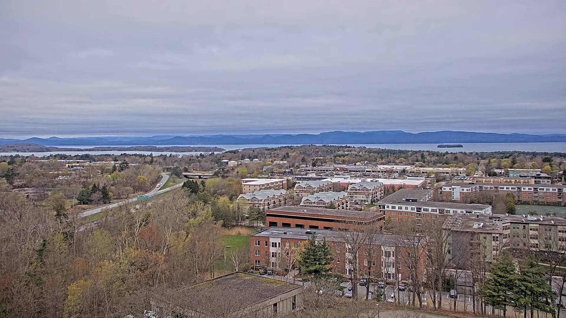
TODAY: Gray and damp with areas of fog this morning & misty sprinkles east of the Green Mountains. Breaks of late afternoon sun western areas.A high in the upper 50s near 60. Winds light and variable.

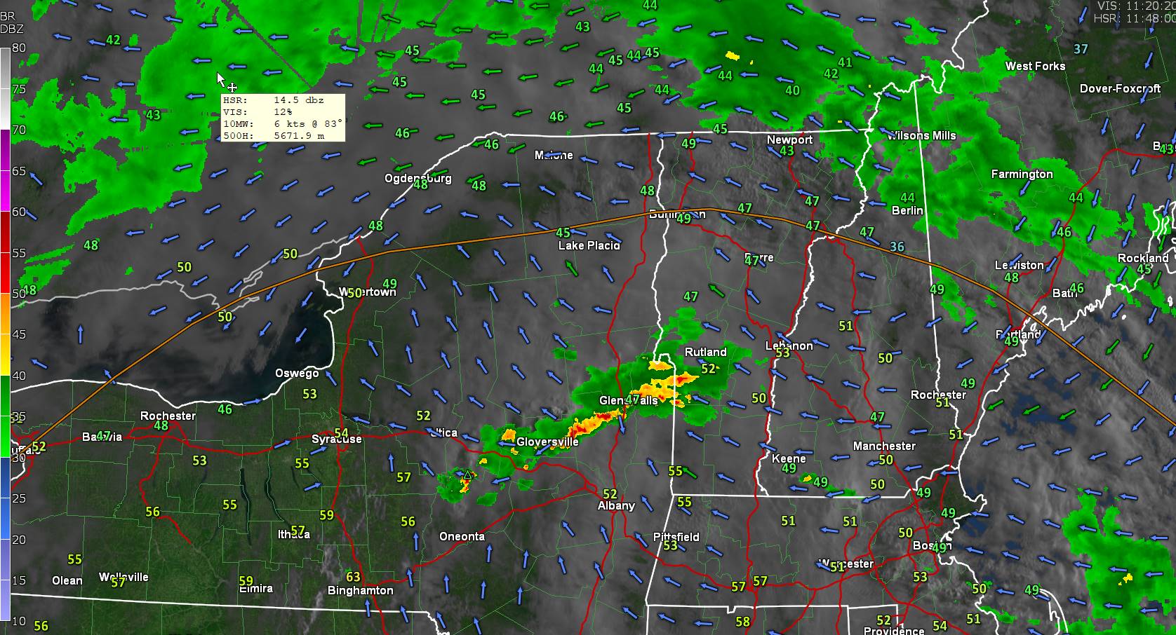
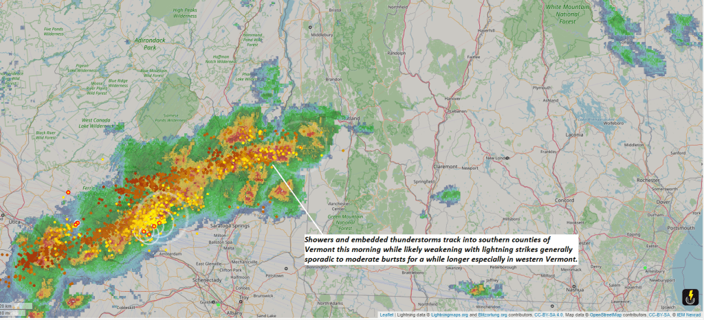
TONIGHT: Partly cloudy for a time then clouding up. Good chance for showers, maybe a rumble of thunder toward daybreak.A low in the mid to upper 40s. Light southeast winds.

THURSDAY: More clouds than sun & becoming breezy. Showers, moderate at times exiting mid to late morning. A second round of showers some moderate in the afternoon. A few rumbles of thunder possible. A high 60 to 65. Winds becoming west to northwesterly 10 to 20 mph.

Looking further ahead

THURSDAY NIGHT: Mostly cloudy.A few misty showers drying up by late evening.A low mid to upper 40s.

FRIDAY: Lots of clouds maybe a break or two. Maybe a misty sprinkle. A high near 65.

SATURDAY: Variable mainly high cloudiness. A low in the mid-40s. A high upper 50s.

SUNDAY: Lots of clouds. Chance for showers. A low 40 to 45. A high around 55.

MONDAY: Morning low clouds then intervals of afternoon sun. A low upper 40s. A high around 65.

Average lows low 30s to near 40. Average highs upper 50s to mid-60s.

Start of meteorological summer June 6th

RH/5-1forecast][end]

Updated Tuesday Evening Forecast — April 30th, 2024

TONIGHT: Cloudy.Showers, moderate at times, drying up after midnight. A low in the mid-40s. Light southeast winds.

TOMORROW: Mainly gray with a threat for a few misty sprinkles near the mountains, with a few breaks of afternoon sun.A high in the lower 60s. Winds light and variable.

WEDNESDAY NIGHT: Partly cloudy then clouding up. Good chance for showers, maybe a rumble of thunder toward daybreak.A low around 45. Light south winds.

THURSDAY: Clouds mixing with intervals of sunshine. Scattered showers, some moderate at times with a rumble of thunder. A high 60 to 65. Winds becoming westerly 10 to 15 mph.

Looking further ahead

THURSDAY NIGHT: Mostly cloudy.A few misty sprinkles.A low mid to upper 40s.

FRIDAY: Lots of clouds maybe a break or two. A few mountain sprinkles. A high 60 to 65.

SATURDAY: Partial sunshine, early then more clouds in the afternoon. A low in the mid-40s. A high low to mid 60s.

SUNDAY: Lots of clouds. Scattered showers late morning on. A low 40 to 45. A high 55 to 60.

Average lows low 30s to near 40. Average highs upper 50s to mid-60s.

Start of meteorological summer June 6th

RH/4-30forecast][end]

Updated Tuesday Morning Forecast — April 30th, 2024

TODAY: Considerable clouds. Scattered showers…moderate at times maybe a rumble of thunder. A high mid-50s to low 60s warmest western Vermont valleys. Southeast winds 10 mph.

TONIGHT: Cloudy.Showers, moderate at times, drying up after midnight. A low in the mid-40s. Light southeast winds.

WEDNESDAY: Mainly gray with a threat for a few misty sprinkles near the mountains, with a few breaks of afternoon sun.A high in the lower 60s. Winds light and variable.

Looking further ahead

WEDNESDAY NIGHT: Partly cloudy.A low around 45.

THURSDAY: Clouds mixing with intervals of sunshine. Scattered showers, some moderate at times with a rumble of thunder. A high 60 to 65.

FRIDAY: Thickening clouds. Isolated mountain sprinkles. A low mid to upper 40s. A high 60 to 65.

SATURDAY: Partial sunshine, early then more clouds in the afternoon. A low in the mid-40s. A high low to mid 60s.

SUNDAY: Lots of clouds. Scattered showers late morning on. A low 40 to 45. A high 55 to 60.

Average lows low 30s to near 40. Average highs upper 50s to mid-60s.

Start of meteorological summer June 6th

RH/4-29forecast][end]

Updated Monday Evening Forecast — April 29th, 2024

TONIGHT: Partly to mostly cloudy. Rising chance for showers late toward daybreak. A low 40 to 45. Light east winds.

TOMORROW: Considerable clouds. Showers likely, western and northern areas…moderate at times maybe a rumble of thunder. A high mid-50s to low 60s western Vermont valleys. Light southeast winds.

TUESDAY NIGHT: Cloudy.Showers, moderate at times, exiting after midnight. A low in the mid-40s. Light southeast winds.

WEDNESDAY: Mainly gray with a threat for a few misty sprinkles, with a few breaks of afternoon sun.A high in near 60. Winds light and variable.

Looking further ahead

WEDNESDAY NIGHT: Lots of clouds, a rising chance for showers.A low 45 to 50.

THURSDAY: Clouds, a few breaks of sunshine. Chance for lingering showers. A high near 60.

FRIDAY: Sunshine filtered by high cloudiness with more clouds in the afternoon. A low 45 to 50. A high near 65.

SATURDAY: Considerable clouds. A rising chance for rain showers toward evening. A low in the mid-40s. A high in the lower 60s.

Average lows low 30s to near 40. Average highs upper 50s to mid-60s.

Start of meteorological summer June 6th

RH/4-29forecast][end]

Updated Monday Morning Forecast — April 29th, 2024

TODAY: Lots of clouds with a few hints or breaks of sun. An afternoon sprinkle across southern areas. A high mid to upper 50s. Light north winds.

TONIGHT: Partly to mostly cloudy. Rising chance for showers overnight. A low in the low to mid 40s. Light east winds.

TUESDAY: Considerable clouds. Showers likely moderate at times with a rumble or two of thunder. A high 55 to 60 warmest western valleys. Light southeast winds.

Looking further ahead

TUESDAY NIGHT: Mainly cloudy.Scattered showers exiting in the evening. A low in the mid-40s.

WEDNESDAY: Mainly gray patchy drizzle early, with a few breaks of afternoon sun.A high in the upper 50s around 60.

THURSDAY: Clouds, a few breaks of sunshine. Widely scattered showers. A low around 45. A high around 65.

FRIDAY: Sunshine filtered by high cloudiness. A low 45 to 50. A high around 65.

Average lows low 30s to near 40. Average highs upper 50s to mid-60s.

Start of meteorological summer June 6th

RH/4-29forecast][end]