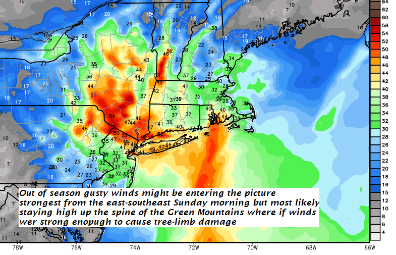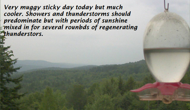
TODAY: Considerable cloudiness with an occasional break of sun. Muggy. Scattered showers with an isolated thunderstorm or two especially southern Vermont this afternoon. A high 75 to 80. South to southeast winds 10 to 15 mph.
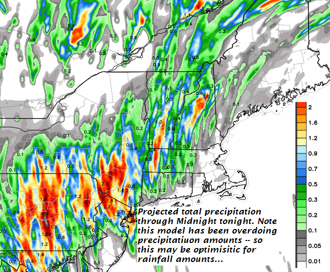
TONIGHT: Chance for an early evening shower or storm, Otherwise mostly cloudy and sticky. Lows in the upper 60s to around 70. Southeast breeze 10 mph.
TUESDAY: Morning fog then mixed clouds and sunshine. Slight chance for a shower. A high around 85. South breeze 10 to 15 mph.
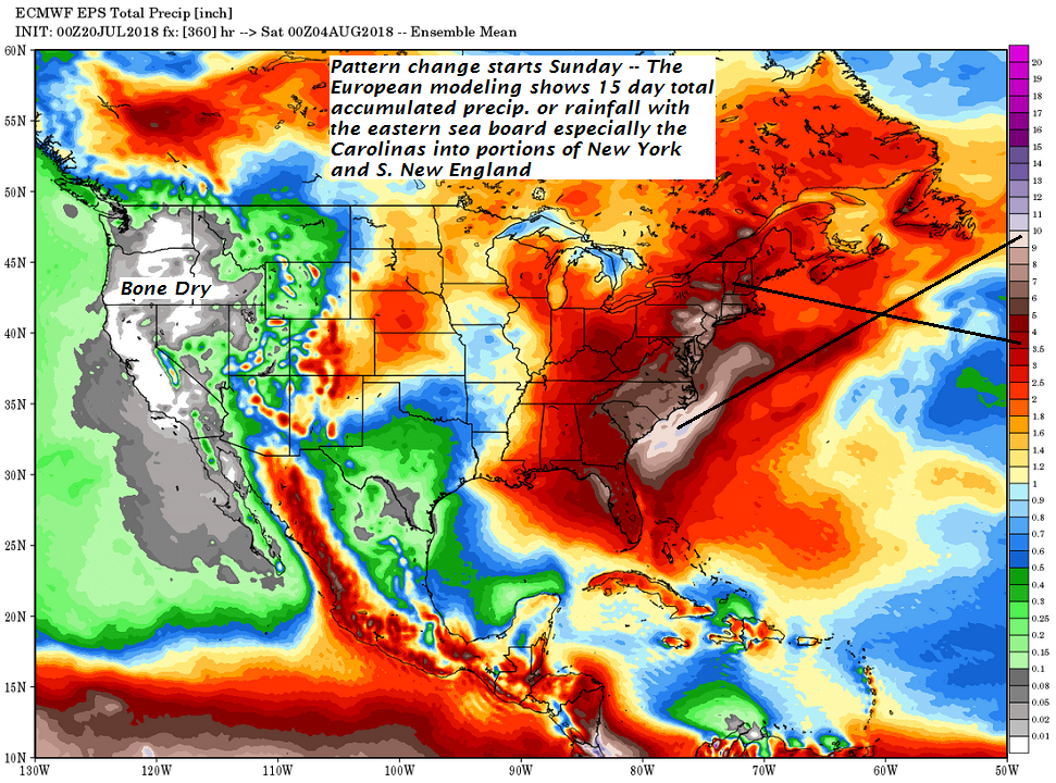
Looking further ahead…
TUESDAY NIGHT: Partly cloudy. Patchy valley fog. A low around 70.
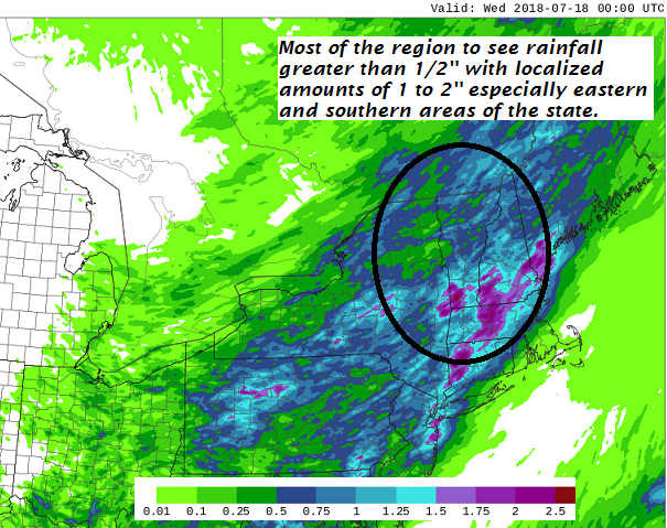
WEDNESDAY: Morning fog, then sunshine giving way to afternoon clouds. Widely scattered late afternoon & evening showers and thunderstorms. Some locally heavy. A high 80 to 85.
THURSDAY: Lots of with chance for showers and thunderstorms some locally heavy. A low 65 to 70. A high upper 70s to low 80s.
FRIDAY: More sun than clouds continued warm and sticky. Scattered late afternoon and evening showers and thunderstorms. A low 60 to 65. A high in the upper 70s to mid 80s.
Average lows in the upper 50s to low 60s, Normal highs in the upper70s to mid 80s.
RH/7-23[end]
| Virus-free. www.avast.com |