Updated Monday Morning Forecast — April 12th, 2021

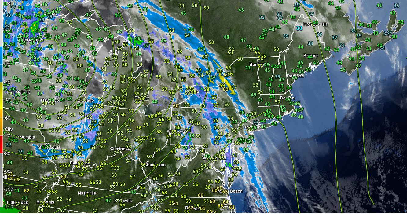
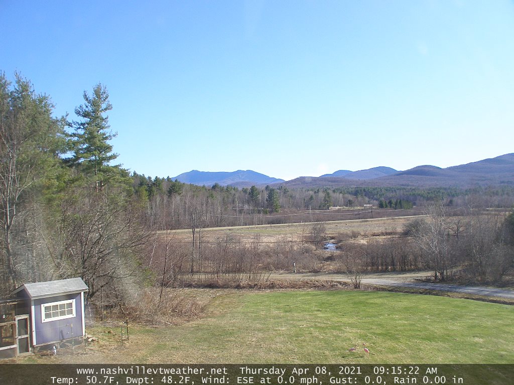
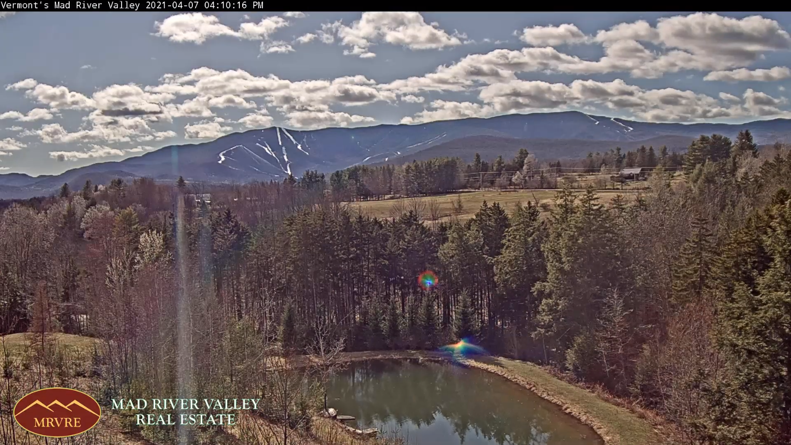
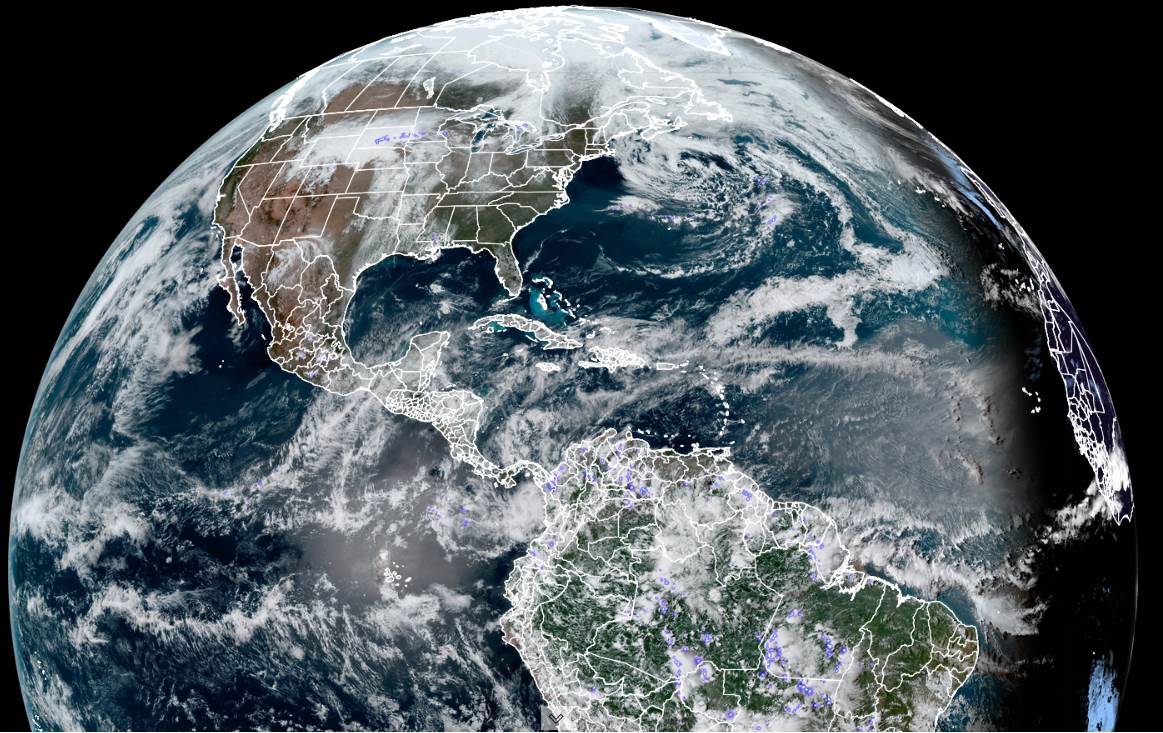
TONIGHT: Clouds early this evening, gives way to gradual clearing. A low around 35. Light northeast winds.

TOMORROW: Periods of morning sun then more clouds in the afternoon. Remaining very mild with a high 60 to 65. Northeast winds 10 mph.

TUESDAY NIGHT: Scattered clouds or mostly clear. A low 35 to 40. Little wind.

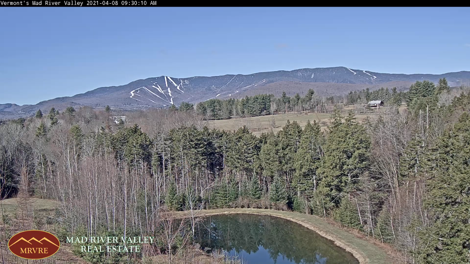
WEDNESDAY: Variable cloudiness. A high 60 to 65. Light southeast winds.

Looking further ahead…

WEDNESDAY NIGHT: Mostly clear northern areas, otherwise partly cloudy. A low 40 to 45.

THURSDAY: Briefly morning sun then cloudy. Maybe a few sprinkles toward Rutland. A high 55 to 60.

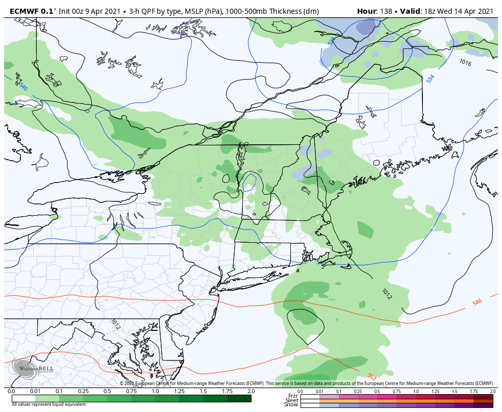
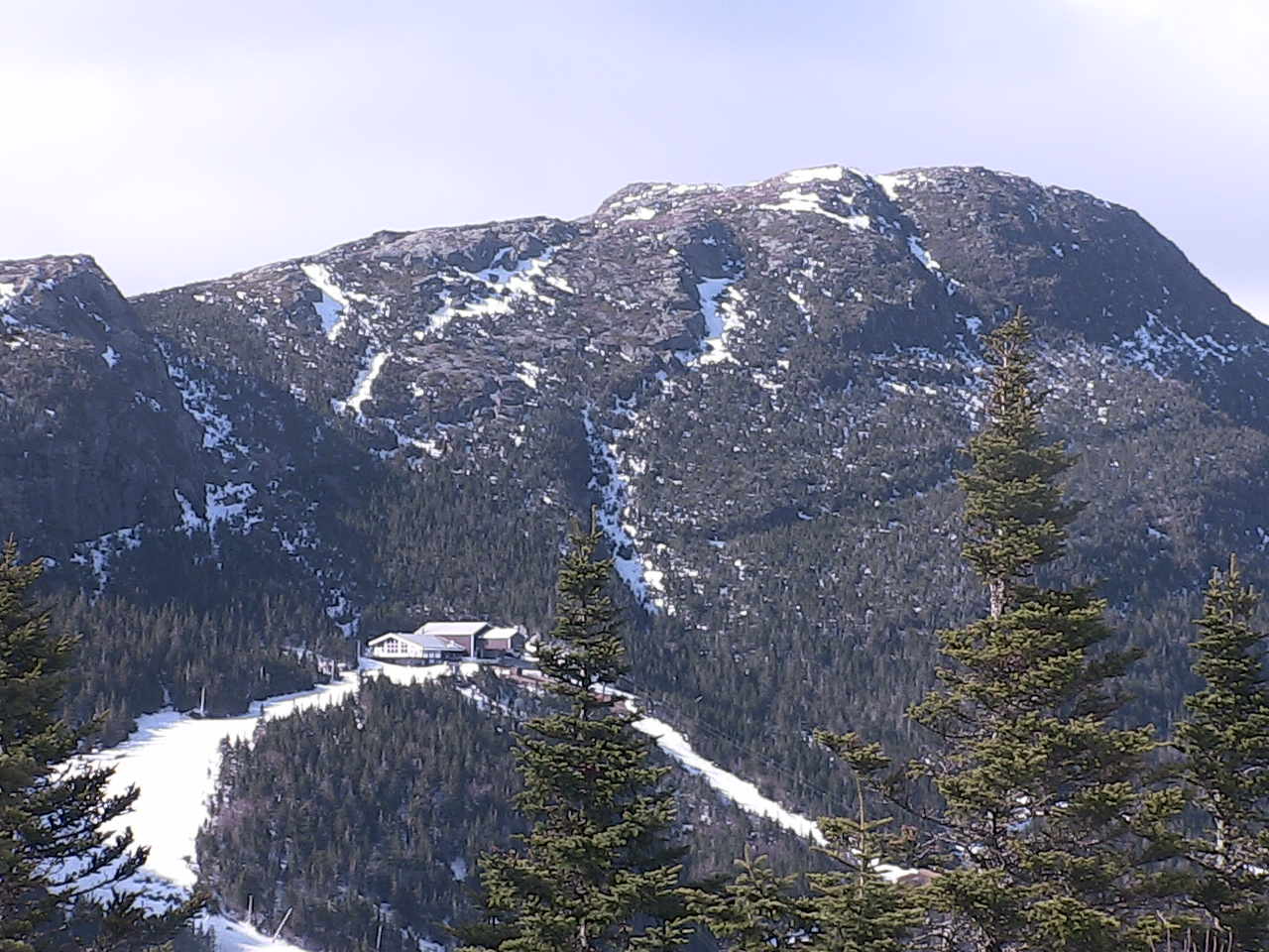
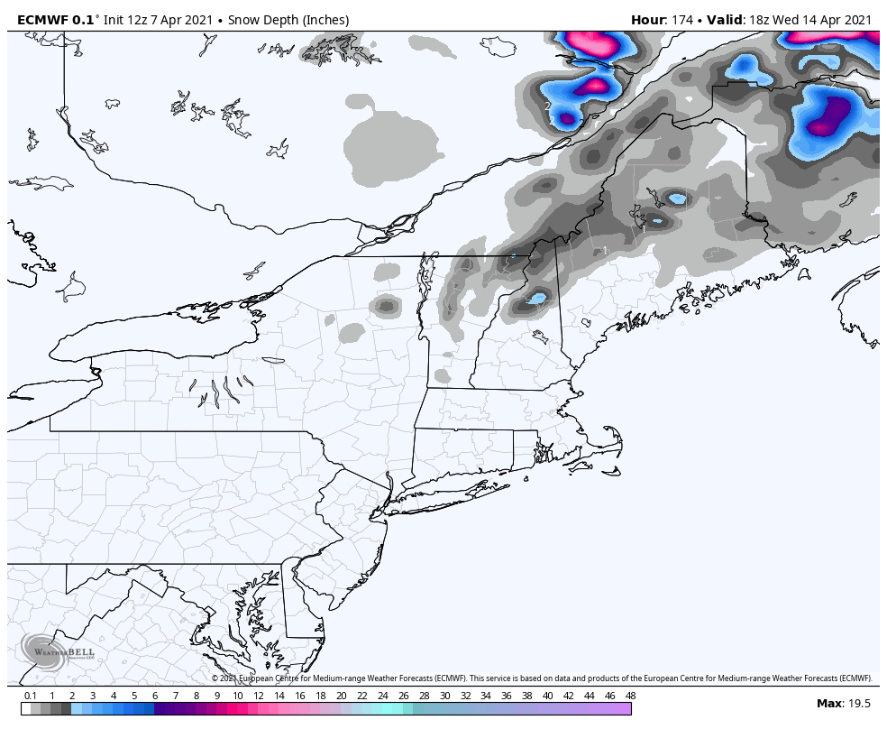
FRIDAY: Overcast. Chance for rain showers…with possible wet snow higher terrain with minor accumulation. A low near 35. Much cooler in the day with a high in the mid-40s.

SATURDAY: Clouds, with a few breaks of afternoon sun. A low near 32. A high mid to upper 40s.

Average low in the 30s. Average highs low to mid 50s.

Start of Meteorological Summer June 6th… Summer peaks approx.. July 22nd based off local climatology.

RH/4-12category forecast][end]

Updated Monday Morning Forecast — April 12th, 2021

TODAY: Lots of clouds, with intervals of sun Barre-Montpelier and north. Cooler. A high ranging around 50 south of the Barre Montpelier area, and mid to upper 50s toward Canadian border. East winds 10 mph.

TONIGHT: Partly cloudy skies gives way to gradual clearing. A low around 35. Light northeast winds.

TUESDAY: Partly sunny. A high around 60. Northeast winds 10 mph.

Looking further ahead…

TUESDAY NIGHT: Scattered clouds or mostly clear. A low in the low to mid 30s.

WEDNESDAY: Variable clouds. A high 60 to 65.

THURSDAY: Mixed clouds & sun. A low 35 to 40. A high upper 50s to near 60.

FRIDAY: Overcast. Chance for rain showers…maybe some wet snow flakes mixed in the high terrain. A low near 35. A high upper 40s to around 50.

Average low in the 30s. Average highs low to mid 50s.

Start of Meteorological Summer June 6th… Summer peaks approx.. July 22nd based off local climatology.

RH/4-12category forecast][end]

Updated Friday Evening Forecast — April 9th, 2021

TONIGHT: Mostly clear early this evening then clouding up. Isolated patches of fog. A low ranging thru the 40s. Light south winds.

TOMORROW: Clouds mixed with periods of sunshine. A high in the low 70s. Light south winds.

SATURDAY NIGHT: Increasing clouds. Patchy valley fog east of the Greens. A low ranging thru the 40s. Little wind.

SUNDAY: Mainly cloudy. Isolated late day sprinkles southern areas. Not quite as mild. A high in the lower 60s.West breeze 10 mph.

Looking further ahead…

SUNDAY NIGHT: Overcast. Scattered light rain showers toward southern and western areas. A low 40 to 45.

MONDAY: Some morning sunshine then more clouds. Cooler. A high upper 50s to around 60.

TUESDAY: Mainly cloudy. Maybe…a late day rain shower western areas. A low 35 to 40. A high upper 50s.

WEDNESDAY: Cloudy. Scattered rain showers. Possibly a few wet snowflakes mountain summits. A low 40 to 45. A high 50 to 55.

Average low in the 30s. Average highs upper-40s to low 50s.

Start of Meteorological Summer June 6th… Summer peaks approx.. July 22nd based off local climatology.

RH/4-9category forecast][end]

Updated Friday Morning Forecast — April 9th, 2021

TODAY: A beauty. Sunshine, with high cloudiness arriving later this afternoon. A high in the low 70s. A light south breeze.

TONIGHT: Fair, but with considerable cloudiness. Isolated patches of fog. A low ranging thru the 40s. Light south winds.

SATURDAY: Clouds mixed with periods of sunshine. A high around 70. Light southeast winds.

Looking further ahead…

SATURDAY NIGHT: Partly to mostly cloudy. Patchy valley fog east of the Greens. A low 40 to 45.

SUNDAY: Periods of morning sun, then thickening cloudiness. Isolated late day showers or sprinkles southern and western areas. Cooler. A high in the low 60s.

MONDAY: Some morning sunshine then clouding up. A low around 40. Cooler. A high 55 to 60.

TUESDAY: Mainly cloudy. Maybe…a late day rain shower western areas. A low around 35. A high around 55.

WEDNESDAY: Cloudy. Scattered rain showers possibly wet snowflakes mountain summits. A low 35 to 40.

A high 50 to 55.

Average low in the 30s. Average highs upper-40s to low 50s.

Start of Meteorological Summer June 6th… Summer peaks approx.. July 22nd based off local climatology.

RH/4-9category forecast][end]

Updated Thursday Evening Forecast — April 8th, 2021

TONIGHT: Mostly clear with a few high clouds. Isolated valley fog. A low 40 to 45. Southeast winds 10 mph

TOMORROW: Mostly sunny with high cloudiness arriving in the afternoon. A high around 70. A light south breeze.

FRIDAY NIGHT: Fair with patchy high clouds. Patchy valley fog. A low in the low to mid 40s. Light south winds.

SATURDAY: Periods of sun with increasing clouds later on. A high in the low 70s. Light southeast winds.

Looking further ahead…

SATURDAY NIGHT: Partly cloudy. A low 40 to 45.

SUNDAY: Periods of morning sun, then thickening cloudiness. A rising chance for rain showers later in the afternoon, mainly western areas. A high in the low 60s.

MONDAY: Lots of clouds. Chance for light rain showers especially western areas. A low around 40. Cooler. A high 55 to 60.

TUESDAY: Mainly cloudy. Chance for light rain showers. A low around 35. A high around 55.

WEDNESDAY: Considerable cloudiness. Scattered rain showers possibly wet snowflakes mountain summits. A low 35 to 40. A high 50 to 55.

Average low in the 30s. Average highs upper-40s to low 50s

Start of Meteorological Summer June 6th… Summer peaks approx.. July 22nd based off local climatology.

RH/4-8category forecast][end]

Updated Thursday Morning Forecast — April 8th, 2021

TODAY: A few clouds northern areas otherwise mostly sunny. A high 65 to 70. Light northeast winds.

TONIGHT: Mostly clear with a few high clouds. Isolated valley fog. A low around 40. Southeast winds 10 mph

FRIDAY: Mostly sunny with high cloudiness arriving in the afternoon. A high in the upper 60s to around 70. A light south breeze.

Looking further ahead…

FRIDAY NIGHT: Fair with patchy high clouds. Patchy valley fog. A low around 45.

SATURDAY: Periods of sun with increasing clouds later on. A high around 70.

SUNDAY: Periods of morning sun, then thickening cloudiness. A rising chance for rain showers later in the afternoon, mainly western areas. A low 40 to 45. A high around 60.

MONDAY: Gray. Chance for light rain showers. Areas of fog. A low around 40. Cooler. A high around 55.

TUESDAY: Overcast. Chance for light rain showers. A low around 35. A high around 50.

WEDNESDAY: Mostly cloudy. Scattered rain showers possibly mixed with wet snow in the higher terrain. A low in the mid-30s. A high 45 to 50.

Average low in the 30s. Average highs upper-40s to low 50s

Start of Meteorological Summer June 6th… Summer peaks approx.. July 22nd based off local climatology.

RH/4-8category forecast][end]

Updated Wednesday Evening Forecast — April 7th, 2021

TONIGHT: Mostly clear this evening then partly cloudy overnight. Patchy valley fog. A low upper 30s to mid-40s. Light east winds.

TOMORROW: More sunshine than clouds. A high 65 to 70. Light northeast winds.

THURSDAY NIGHT: Mostly clear. Isolated valley fog. A low 40 to 45. Southeast winds 10 mph

FRIDAY: Partly to mostly sunny. A high in the upper 60s to around 70. A light south breeze.

Looking further ahead…

FRIDAY NIGHT: Patchy valley fog. A low in the 40s

SATURDAY: Periods of morning sun with increasing clouds later on. A high around 70.

SUNDAY: Thickening cloudiness. A rising chance for rain showers in the afternoon, southern and western areas, dry toward the Northeast Kingdom. A low 40 to 45. A high upper 50s to near 60.

MONDAY: Clouds with intervals of sun northern areas. Chance for rain showers mainly southern and western areas. A low 40 to 45. A little cooler. A high in upper 50s to around 60.

Average low in the upper 20s to low 30s. Average highs upper-40s to low 50s

Start of Meteorological Summer June 6th… Summer peaks approx.. July 22nd based off local climatology.

RH/4-7 category forecast][end]

Updated Wednesday Morning Forecast — April 7th, 2021

TODAY: Morning cloudiness mixing with intervals of sunshine this afternoon. A high in the low 60s. Light north winds.

TONIGHT: Scattered clouds. A low upper 30s to mid-40s. Light northeast winds.

THURSDAY: Morning sun…then cloudy periods. A high 65 to 70. Light east winds.

Looking further ahead…

THURSDAY NIGHT: Mostly clear. A low 40 to 45.

FRIDAY: Morning sun, then partly sunny in the afternoon. A high in the upper 60s to around 70.

SATURDAY: Periods of morning sun with increasing clouds later on. A low in the 40s. A high around 70.

SUNDAY: Thickening cloudiness. A rising chance for rain showers in the afternoon, southern and western areas, dry toward the Northeast Kingdom. A low 40 to 45. A high upper 50s to near 60.

MONDAY: Clouds with intervals of sun northern areas. Chance for rain showers mainly southern and western areas. A low 40 to 45. A little cooler. A high in upper 50s to around 60.

Average low in the upper 20s to low 30s. Average highs upper-40s to low 50s

Start of Meteorological Summer June 6th… Summer peaks approx.. July 22nd based off local climatology.

RH/4-7 category forecast][end]

Updated Tuesday Evening forecast — April 6th, 2021

TONIGHT: Mostly clear except cloudiness toward the Northeast Kingdom. A low around 35 degrees. Light north to northeast winds.

TOMORROW: High cloudiness, then mostly sunny. A high near 60. Light north winds.

WEDNESDAY NIGHT: Scattered clouds or mostly clear. Patchy valley fog. A low mid to upper 30s. Light northeast winds.

THURSDAY: Morning sun…then few more afternoon clouds. A high around 65. Light east winds.

Looking further ahead…

THURSDAY NIGHT: Mostly clear. A low 35 to 40.

FRIDAY: Morning sun, then more afternoon clouds. A high in the mid-60s.

SATURDAY: Partly to mostly sunny. A low in the low to mid 40s. A high mid to upper 60s.

SUNDAY: Thickening cloudiness. A rising chance for rain showers in the afternoon. A low 40 to 45. A high upper 50s to near 60.

MONDAY: Mainly cloudy. Chance for rain showers. A low 40 to 45. A high upper 40s to near 50.

Average low in the upper 20s to low 30s. Average highs upper-40s to low 50s

Start of Meteorological Summer June 6th… Summer peaks approx.. July 22nd based off local climatology.

RH/4-6 category forecast][end]

Updated Tuesday Morning Forecast — April 6th, 2021

TODAY: Partly sunny, except considerable cloudiness Northeast Kingdom with a sprinkle or two northeast of Island Pond. A high near 55. Northwest winds 10 to 15 mph.

TONIGHT: Partly cloudy. A low around 35 degrees. Light north to northeast winds.

WEDNESDAY: Considerable high cloudiness mixed with intervals of sun. A high upper 50s to near 60. Light north winds.

Looking further ahead…

WEDNESDAY NIGHT: Scattered clouds or mostly clear. Patchy valley fog. A low around 35.

THURSDAY: Morning sun…then variable cloudiness. A high near 65.

FRIDAY: Partly sunny. A low in the upper 30s. A high in the mid-60s.

SATURDAY: Mostly sunny in the morning then partly cloudy. A low in the low to mid 40s. A high in the pushing toward 70.

SUNDAY: Considerable cloudiness. A rising chance for rain showers. A low around 45. A high 60 to 65.

Average low in the upper 20s to low 30s. Average highs upper-40s to low 50s

Start of Meteorological Summer June 6th… Summer peaks approx.. July 22nd based off local climatology.

RH/4-6 category forecast][end]