Updated Monday Evening Forecast — October 11th, 2021

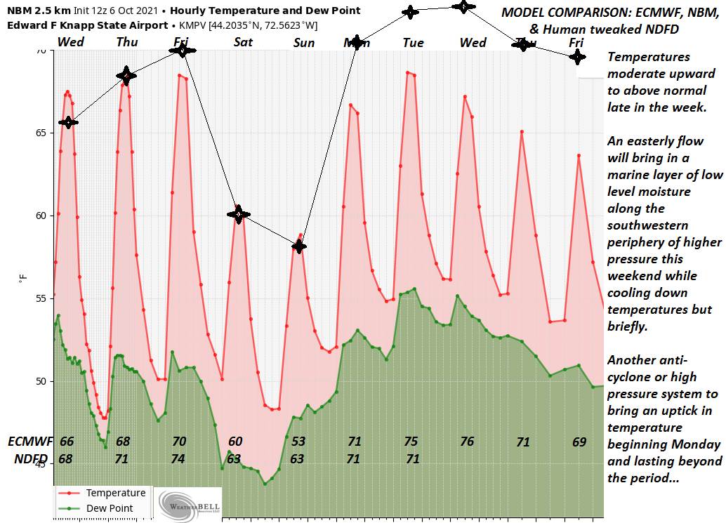
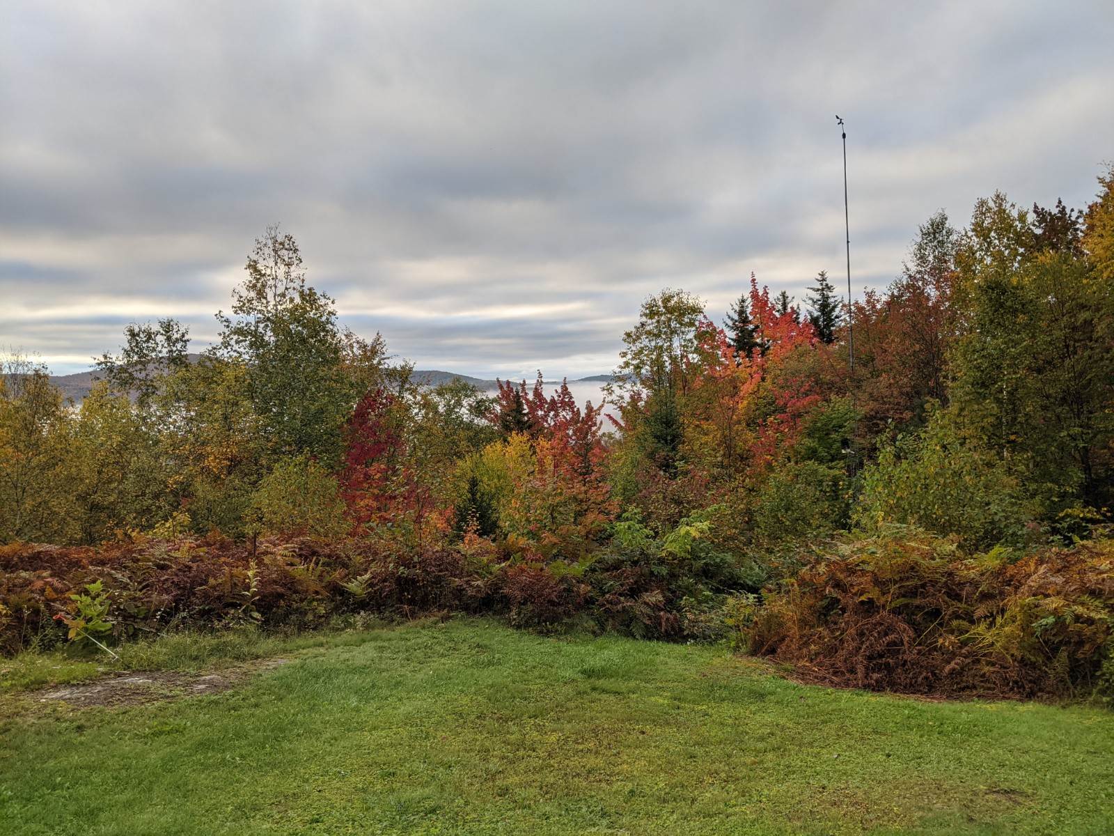
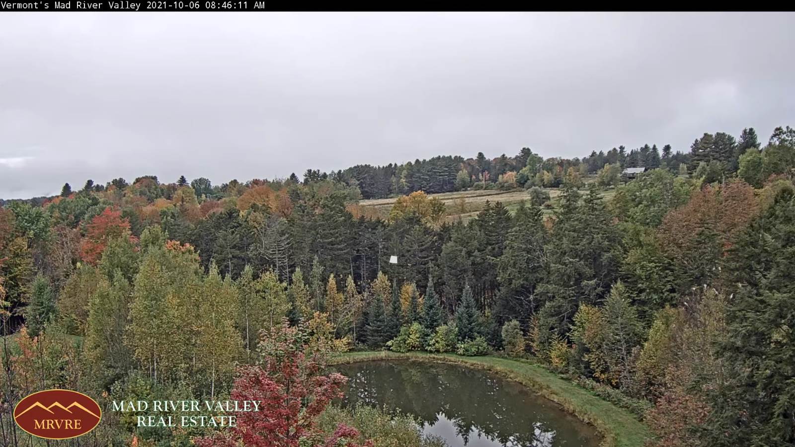
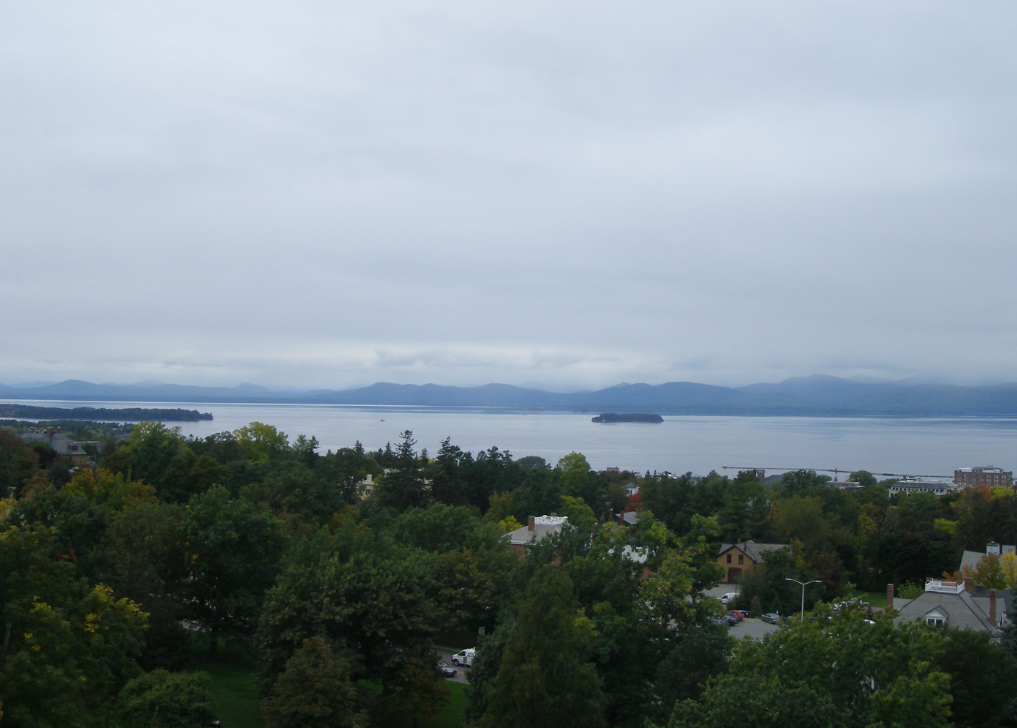
TONIGHT: Clear for a time this evening, before high cloudiness arrives. Patchy valley fog. A low upper 40s or around 50. Light south winds.

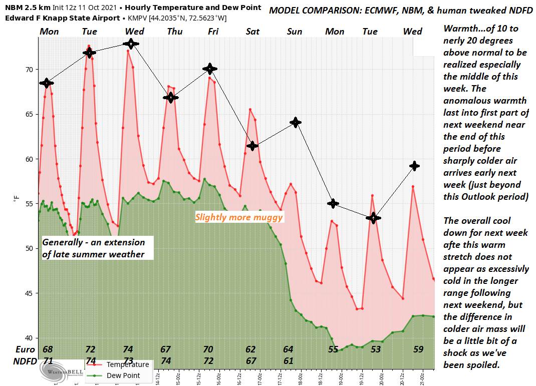
TOMORROW: Considerable high cloudiness with periods of sunshine. A high 70 to 75. Light south winds.

TUESDAY NIGHT: Partly cloudy. Patchy valley fog. A low near 50. Light south winds.

WEDNESDAY: Morning fog then clouds giving way to periods of sunshine. Kind of muggy with a late day shower. Well above normal in temperature, with a high in the mid-70s. Light southwest winds.

Looking further ahead…

WEDNESDAY NIGHT: Mostly clear with more clouds overnight. Patchy valley fog. A low in the low to mid 50s.

THURSDAY: A few breaks of morning sun, then mainly gray and cloudy. Isolated sprinkles. A high upper 60s to near 70.

FRIDAY: Mixed clouds and sun. Widely scattered showers. A low near 55. A high in the low 70s.

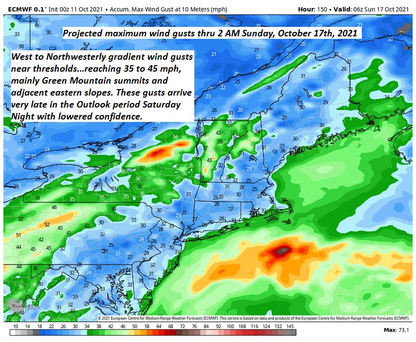
SATURDAY: Lots of clouds & breezy to windy at times. Chance for showers, some possibly moderate. A low 50 to 55. A high 65 to 70.

Average lows low to mid 30s. Average highs mid to upper 50s

RH/10-11forecast][end]

Updated Monday Morning Forecast — October 11th, 2021

TODAY: Isolated valley fog, otherwise clouds mixing with some sunshine. A little warmer today. A high near 70. Light south winds.

TONIGHT: Mainly high clouds otherwise fair and dry. Isolated valley fog. A low upper 40s or around 50. Light south winds.

TUESDAY: High cloudiness with periods of sunshine. A high 70 to 75. Light south winds.

Looking further ahead…

TUESDAY NIGHT: Mostly clear with a few high clouds. Patchy valley fog. A low near 50.

WEDNESDAY: Morning fog then lots of clouds and a bit more humid. Scattered afternoon showers. Mild with a high near 75.

THURSDAY: Variable clouds. Isolated sprinkles. A low in the low to mid 50s. A high near 65.

FRIDAY: Mostly cloudy. Widely scattered showers. A low near 55. A high around 70.

SATURDAY: Lots of clouds. Chance for showers, some possibly moderate at times. A low 50 to 55. A high in the 60s.

Average lows low to mid 30s. Average highs mid to upper 50s

RH/10-11forecast][end]

Updated Friday Evening Forecast — October 8th, 2021

TONIGHT: Mostly clear northern areas with patchy valley fog. Increasing clouds southern areas. A low mid to upper 40s. East to southeast breeze 10 mph.

TOMORROW: Partly sunny northern areas, but lots of clouds Barre-Montpelier area south. Brief sprinkles southern Greens. A high in the low 60s. Southeast breeze 10 mph.

SATURDAY NIGHT: Considerable cloudiness. A low mid to upper 40s. Light southeast winds.

SUNDAY: Mainly cloudy with a few intervals of late day sun. A high 60 to 65. South to southeast winds

10 mph.

Looking further ahead…

SUNDAY NIGHT: Partly cloudy north and cloudy southern areas. A low around 50.

MONDAY: Morning fog, then variable cloudiness. Milder. A high around 70.

TUESDAY: High cloudiness. A low around 50. A high near 75.

WEDNESDAY: Morning fog then periods of sunshine mixed with clouds. A low near 50. Mild with a high near 75

Average low mid to upper 30s. Average highs mid-50s to around 60

RH/10-8forecast][end]

Updated Friday Morning Forecast — October 8th, 2021

TODAY: Morning fog then, mostly sunny with a few afternoon clouds. A high in the lower 70s. Light northeast winds.

TONIGHT: Mostly clear northern areas with patchy valley fog. Mostly cloudy south. A low in the upper 40s. Light east winds.

SATURDAY: Considerable cloudiness Barre-Montpelier area south, other partly sunny far northern areas. A high in the lower 60s. Southeast breeze 10 mph.

Looking further ahead…

SATURDAY NIGHT: Considerable cloudiness. A low mid-40s.

SUNDAY: Considerable cloudiness giving way to a few late breaks of sunshine. A high in the lower 60s.

MONDAY: Morning fog, then sun and clouds. A low around 50. Warmer. A high lower 70s.

TUESDAY: High cloudiness. A low around 50. A high near 75

WEDNESDAY: Morning fog then periods of sunshine mixed with clouds. A low 50 to 55. Continued warmer than normal. A high near 75

Average low mid to upper 30s. Average highs mid-50s to around 60

RH/10-8forecast][end]

Updated Thursday Evening Forecast — October 7th, 2021

TONIGHT: Mostly clear. Patchy dense valley fog. A low in the upper 40s. Light north winds.

TOMORROW: Morning fog then, sunshine and blue skies. A high in the low 70s. Light northeast winds.

FRIDAY NIGHT: Mostly clear northern areas with patchy valley fog. Mostly cloudy south. A low around 50. Light east winds.

SATURDAY: Considerable cloudiness Barre-Montpelier area south, other partly sunny far northern areas. Maybe a sprinkle in the southern Greens. A high in the lower 60s. Southeast breeze 10 mph.

Looking further ahead…

SATURDAY NIGHT: Considerable cloudiness. A low mid to upper 40s.

SUNDAY: Considerable cloudiness giving way to a few late breaks of sunshine. Slight chance for a few showers far southern areas. A high 60 to 65.

MONDAY: Morning fog, then sun and clouds. A low around 50. Warmer. A high in the low 70s.

TUESDAY: Lots of high cloudiness. A low around 50. A high 70 to 75.

WEDNESDAY: Morning fog gives to partial sunshine. A low 50 to 55. Continued above normal in temperature. A high 70 to 75.

Average low 35 to 40. Average highs upper 50s to low 60s.

RH/10-7forecast][end]

Updated Thursday Morning forecast — October 7th, 2021

TODAY: Morning fog, then mostly sunny, with more afternoon cloudiness. Above normal in temperature. A high near 70.

Light west winds.

TONIGHT: Mostly clear. Patchy dense valley fog. A low in the upper 40s. Light northwest winds.

FRIDAY: Morning fog then, sunshine and blue skies. A high in the low 70s. Light northeast winds.

Looking further ahead…

FRIDAY NIGHT: Fair early then increasing cloudiness. A low around 50.

SATURDAY: Considerable high cloudiness northern areas, cloudy southern areas, with a risk for a sprinkle far southern areas. A high near 60.

SUNDAY: Considerable cloudiness. A few widely scattered showers southern areas in the afternoon. A low mid to upper 40s. A high in the low 60s.

MONDAY: Clouds with a few intervals of sunshine after morning fog. Slight chance for a sprinkle southern areas. A low around 50. A high in the lower 70s.

TUESDAY: Variable clouds after morning fog. A low around 50. A high 70 to 75.

WEDNESDAY: Mixed clouds and sun. A low upper 50s A high 70 to 75.

Average low 35 to 40. Average highs upper 50s to low 60s.

RH/10-7forecast][end]

Updated Wednesday evening Forecast — October 6th, 2021

TONIGHT: Mostly clear. Dense valley fog. A low mid-40s. Little wind.

TOMORROW: Partly to mostly sunny. A high near 70. Light west winds.

THURSDAY NIGHT: Mostly clear. Patchy dense valley fog. A low around 45. Light northwest winds.

FRIDAY: Morning fog then, sunshine and blue skies. A high in the low 70s. Light northeast winds.

Looking further ahead…

FRIDAY NIGHT: Fair early then increasing cloudiness. A low upper 40s to around 50.

SATURDAY: Mixed clouds and sun, giving way to more clouds in the afternoon. Maybe a sprinkle far southern areas. A high near 60.

SUNDAY: Considerable cloudiness, scattered afternoon showers about Barre-Montpelier area south. A low in the mid-40s. A high in the lower 60s.

MONDAY: Mixed sun and clouds after morning fog. A low in the upper 40s to around 50. A high in the lower 70s.

TUESDAY: Partly sunny after morning fog. A low around 50. A high 70 to 75.

Average low 35 to 40. Average highs upper 50s to low 60s.

RH/10-6forecast][end]

Updated Wednesday Morning Forecast — October 6th, 2021

TODAY: Damp with a few areas of fog and low clouds, giving way to periods of late morning & afternoon sun. A high 65 to 70. Light north winds.

TONIGHT: Mostly clear. Dense valley fog. A low mid-40s. Little wind.

THURSDAY: Partly to mostly sunny. A high upper 60s to about 70. Light northwest winds.

Looking further ahead…

THURSDAY NIGHT: Mostly clear. Patchy dense valley fog. A low around 45.

FRIDAY: Morning fog then, sunshine and blue skies. A high around 70.

SATURDAY: Mixed clouds and sun, giving way to more clouds in the afternoon. Isolated sprinkles far southern areas. A low near 50. A high 60 to 65.

SUNDAY: Considerable cloudiness, maybe a brief sprinkle, gives way to intervals of afternoon sunshine. A low in the mid-40s. A high ranging upper 50s to mid-60s.

MONDAY: Mixed sun and clouds after morning fog. A low in the upper 40s to around 50. A high in the lower 70s.

TUESDAY: Partly sunny after morning fog. A low around 50. A high 70 to 75.

Average low 35 to 40. Average highs upper 50s to low 60s.

RH/10-6forecast][end]

Updated Tuesday Evening Forecast — October 5th, 2021

TONIGHT: Partly cloudy, before clearing overnight. Areas dense valley fog. A low in the mid to upper 40s. Little wind.

TOMORROW: Morning fog then periods of sunshine mixed with clouds. A high mid to upper 60s. Light north winds.

WEDNESDAY NIGHT: Mostly clear. Dense valley fog. A low mid-40s. Little wind.

THURSDAY: Partly to mostly sunny. A high near 70. Light northwest winds.

Looking further ahead…

THURSDAY NIGHT: Mostly clear. Patchy dense valley fog. A low around 45.

FRIDAY: Morning fog then, sunshine and blue skies. A high in the upper 60s to around 70.

SATURDAY: Mixed clouds and sun, giving way to more clouds in the afternoon. Isolated sprinkles far southern areas. A low 45 to 50. A high upper 50s to around 60.

SUNDAY: Considerable cloudiness, maybe a brief sprinkle, gives way to intervals of afternoon sunshine. A low 45 to 50. A high 60 to 65.

MONDAY: Partly to mostly sunny after morning fog. A low in the upper 40s. A high around 70.

Average low 35 to 40. Average highs upper 50s to low 60s.

RH/10-5forecast][end]

Updated Tuesday Morning Forecast — October 5th, 2021

TODAY: Scattered morning sprinkles or areas of drizzle, drying up this later this morning. Otherwise considerable cloudiness, isolated breaks of sun this afternoon. Warming trend begins. A high upper 50s to around 60. Little wind.

TONIGHT: Becoming mostly clear. Areas dense valley fog. A low in the mid-40s. Little wind.

WEDNESDAY: Morning fog then periods of sunshine mixed with clouds. A high in the mid-60s. Little wind.

Looking further ahead…

WEDNESDAY NIGHT: Mostly clear. Patchy dense valley fog. A low near 45.

THURSDAY: Partly to mostly sunny. A high in the upper 60s to around 70.

FRIDAY: Morning fog then, sunshine and blue skies. A low mid-40s.A high in the upper60s to around 70.

SATURDAY: Mixed clouds and sunshine. A low around 50. A high in the 60s.

SUNDAY: Mostly cloudy. Chance for afternoon showers. A low in the 40s. A high mid to upper 50s.

Average low 35 to 40. Average highs upper 50s to low 60s.

RH/10-5forecast][end]