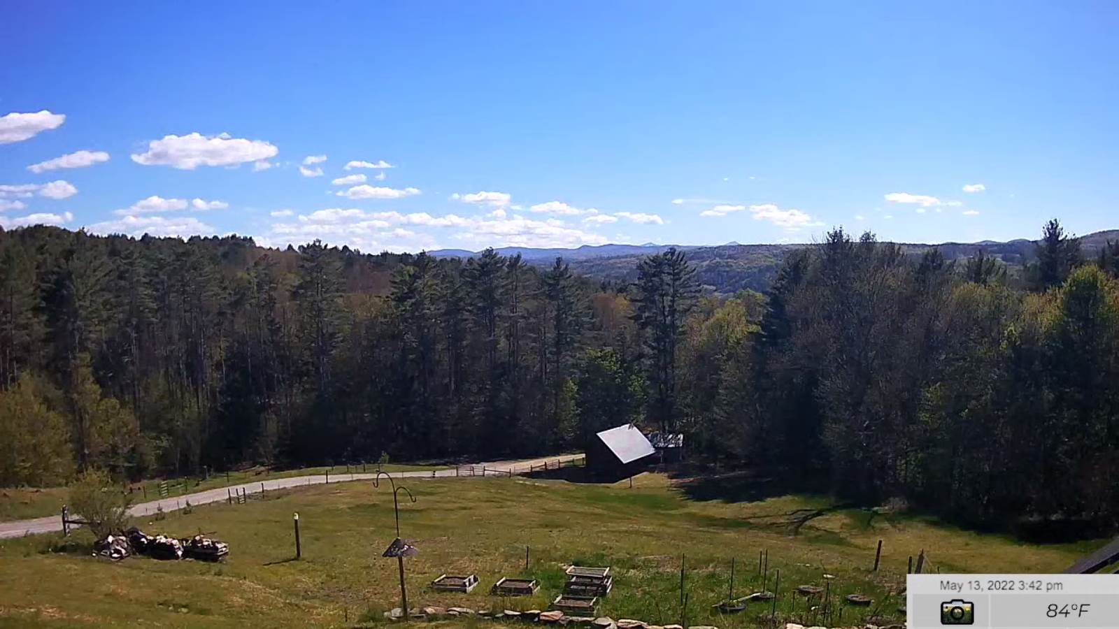
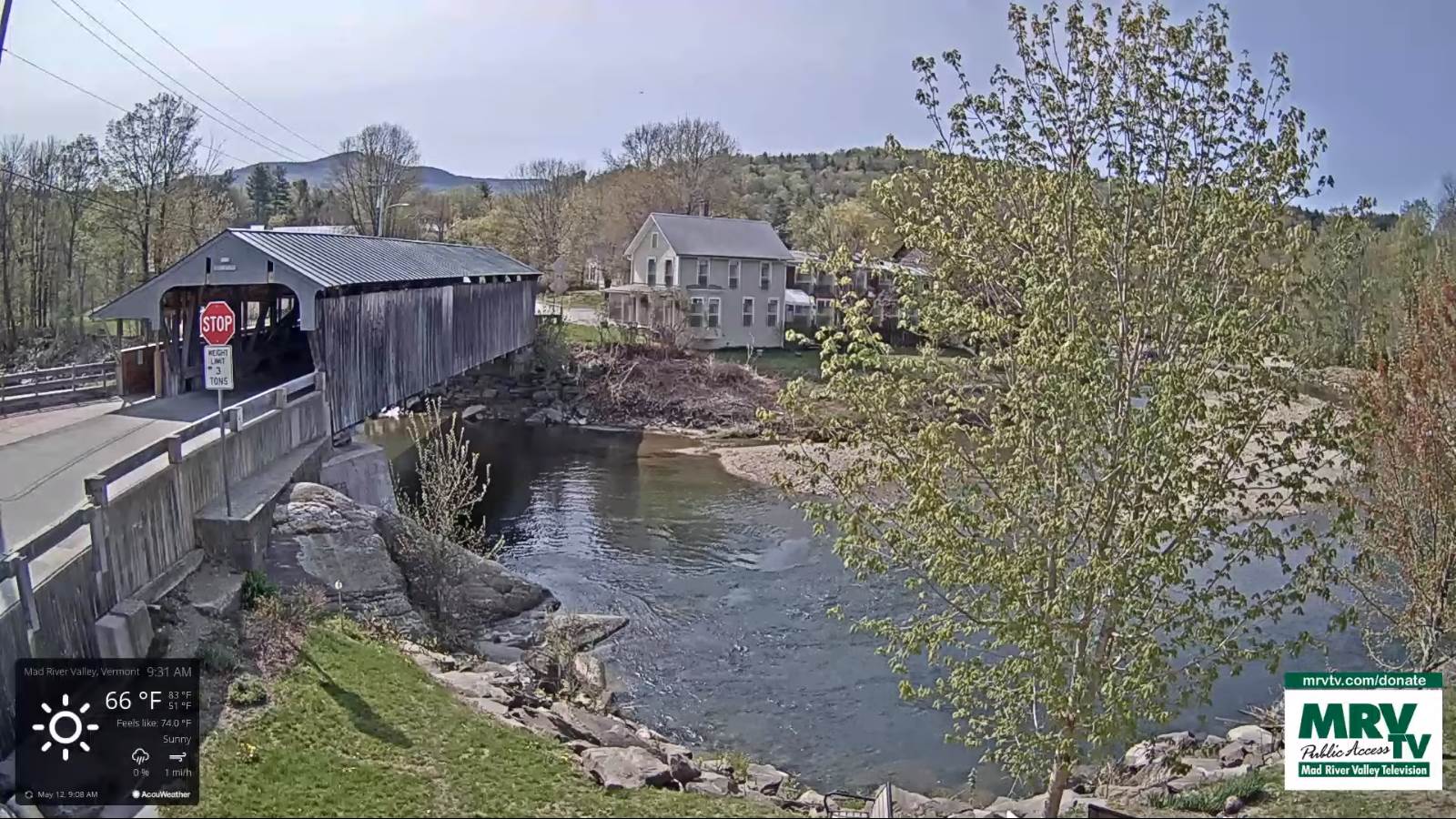
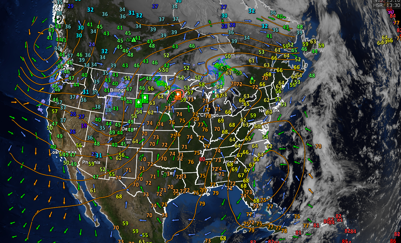
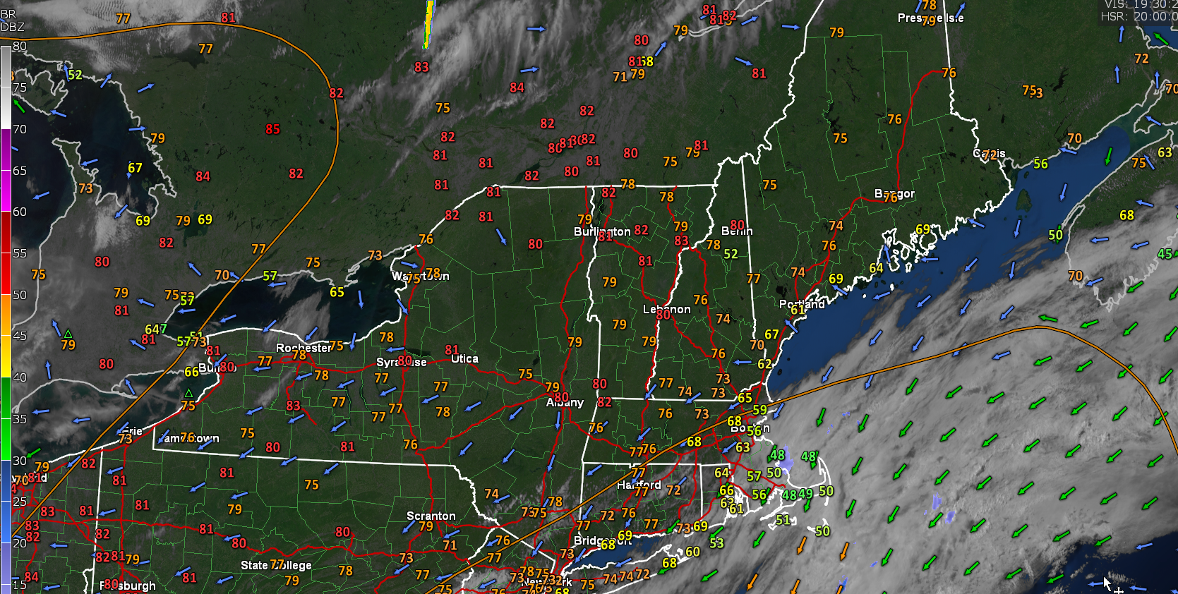
Updated Friday Morning Forecast — April 29th, 2022

TODAY: Variably cloudy north and east especially this afternoon, otherwise partly to mostly sunny. Blustery at times. A little milder. A high in the upper 40s to about 50. Northwest winds 10 to 20 mph.

TONIGHT: Cloudiness toward Northeast Kingdom otherwise mostly clear elsewhere. A low around 30. Light northwest winds.

SATURDAY: More clouds than sunshine. A high in the low 50s. North to northwest breeze 10 to 15 mph.

Looking further ahead…

SATURDAY NIGHT: Clear and starlit. A frosty low around 30.

SUNDAY: Lots of sunshine. Seasonal. A high in the low 60s.

MONDAY: High cloudiness thickening up late. A low around 35. Milder. A high near 65.

TUESDAY: Mostly cloudy. Isolated rain showers. A low around 45. A high in the low 60s.

WEDNESDAY: Mainly gray. Chance for rain showers. A low mid-40s. A high in the mid-60s.

Average lows ranging mid-30s to around 40. Average highs 60 to 65.

RH/4-28 forecast][end]

Updated Thursday Evening Forecast — April 28th, 2022

TONIGHT: Clear this evening with a few more clouds late Northeast Kingdom. A low mid to upper 20s. Northwest winds 10 mph.

TOMORROW: Clouds with breaks of sun north and east with an isolated flurry, partly sunny elsewhere. Blustery at times. A little milder. A high 45 to 50. Northwest winds 10 to 20 mph.

FRIDAY NIGHT: Cloudiness toward Northeast Kingdom otherwise mostly clear elsewhere. A low around 30. Light northwest winds.

SATURDAY: More clouds than sunshine. A high around 50. North to northwest breeze 10 to 15 mph.

Looking further ahead…

SATURDAY NIGHT: Clear and starlit. A frosty low around 30.

SUNDAY: Lots of sunshine. Seasonal. A high near 60.

MONDAY: High cloudiness thickening up late. A low 32 to 35. Milder. A high near 65.

TUESDAY: Mostly cloudy. Isolated rain showers. A low around 45. A high in the low 60s.

WEDNESDAY: Mainly gray. Chance for rain showers. A low 45 to 50. A high in the low to mid 60s.

Average lows ranging mid-30s to around 40. Average highs 60 to 65.

RH/4-27 forecast][end]

Updated Thursday morning Forecast — April 28th, 2022

TODAY: Clouds and lingering mountain flurries this morning, otherwise increasing late afternoon sunshine. Blustery. A high 40 to 45. Northwest winds 10 to 25 mph and gusty.

TONIGHT: A few wet snowflakes Northeast Kingdom early, otherwise considerable cloudiness. A low in the upper 20s. Northwest winds 10 mph.

FRIDAY: Clouds with breaks of sun northern areas with periods of sunshine south. Blustery at times. Slow warming trend. A high 45 to 50. Northwest winds 10 to 20 mph.

Looking further ahead…

FRIDAY NIGHT: Mostly cloudy Northeast Kingdom otherwise mostly clear elsewhere. A low near 30.

SATURDAY: Partly sunny. A high in the low 50s.

SUNDAY: Partly to mostly sunny. Milder. A low 32 to 35. A high in the upper 50s near 60.

MONDAY: Thickening clouds and milder, widely scattered late day showers. A low near 35. A high around 65.

TUESDAY: Mostly cloudy. Isolated rain showers. A low around 45. A high in the upper 50s to low 60s.

Average lows ranging mid-30s to around 40. Average highs 60 to 65.

RH/4-27 forecast][end]

Updated Wednesday Evening Forecast — April 27th, 2022

TONIGHT: Snow showers mixed with rain drops valley floors for a time this evening, a light coating on grassy surfaces…up to couple inches northern Greens Mountains. Otherwise lots of clouds. A low near 30. Northwest winds 10 mph.

TOMORROW: Clouds and a few stray flurries northern Greens early, otherwise, periods of afternoon sunshine developing. Blustery. A high in the low to mid 40s. Northwest winds 10 to 25 mph and gusty.

THURSDAY NIGHT: Evening clouds, slight chance for a few wet snowflakes Northeast Kingdom, and then clearing. A low near 30. Northwest winds 10 mph.

FRIDAY: Clouds with breaks of sun and at times blustery. A high 40 to 45. Northwest winds 10 to 20 mph.

Looking further ahead…

FRIDAY NIGHT: Partly cloudy Northeast Kingdom otherwise mostly clear. A low around 32.

SATURDAY: More clouds than sun. A high in the upper 40s to near 50.

SUNDAY: Mostly sunny and beauty. Milder. A low in the low 30s. A high in the upper 50s near 60.

MONDAY: High cloudiness gives way to scattered late day showers with a risk for thunder. A low 32 to 35. A high in the low to mid 60s.

Average lows ranging mid-30s to around 40. Average highs 60 to 65.

RH/4-27 forecast][end]

Updated Wednesday morning Forecast — April 27th, 2022

TODAY: Mainly gray. Occasional rain showers or sprinkles, mixing with wet snow flakes this afternoon, with some minor accumulations grassy surface late. A high in the mid-40s. Northwest winds pick up 10 to 15 mph.

TONIGHT: Showers of wet snow for a time this evening with a light coating on grassy surfaces…up to an inch or two in the northern Green Mountain summits. A low near 30. Northwest winds 10 mph.

THURSDAY: A stray flurry or sprinkle near the mountains in the morning. Blustery. A high in the low to mid 40s. Northwest winds 10 to 25 mph and gusty.

Looking further ahead…

THURSDAY NIGHT: Evening clouds, slight chance for a few wet snowflakes northeast Kingdom. Clearing overnight. A low 25 to 30.

FRIDAY: A few morning clouds, then mostly sunny and at times blustery. A high in the lower 40s.

SATURDAY: Partly to mostly cloudy. A low around 32. A high in the upper 40s.

SUNDAY: Morning sun, then thickening high clouds. Turing a little milder. A low in the low 30s. A high in the mid to upper 50s.

Average lows ranging mid-30s to around 40. Average highs 60 to 65.

RH/4-27 forecast][end]

Updated Friday Evening Forecast — April 15th, 2022

TONIGHT: Partly to mostly cloudy. Scattered sprinkles northern areas later this evening. Rain showers…overspreading the region after midnight, mixed with wet snow flakes high terrain. A low around 40. Southwest winds 10 mph.

TOMORROW: Gray. Periods of rain or rain showers mixing with wet snow late in the mountains. A high in the lower 40s. Light southwest winds.

SATURDAY NIGHT: Partly to mostly cloudy. A low in the upper 20s to about 30. Light northwest winds.

SUNDAY: Clouds with a few breaks sun. Turning blustery at times. Scattered rain & wet snow showers, some minor coatings on grassy surfaces. A high 40 to 45. Northwest winds 10 to 20 mph.

Looking further ahead…

Full Pink Moon 7:55 PM Sunday Evening…

SUNDAY NIGHT: Evening cloudiness then clearing. A low in the mid-20s.

MONDAY: Fog burns off to morning sunshine then clouding up in the afternoon. A high near 55.

TUESDAY: Gray. Chance for accumulating wet snow, mixed with valleys. Accumulation possibly few inches mid to upper slopes. A low around 35. A high in the low 40s.

WEDNESDAY: Morning clouds. Chance for morning snow showers or flurries…gives way to afternoon sunshine. A low 32 to 35. A high mid 40s.

Average lows ranging upper-20s to mid-30s. Average highs low to mid 50s.

RH/4-15 forecast][end]

Updated Friday Morning Forecast — April 15th, 2022

TODAY: Considerable valley fog will burn off to lots of morning sun. Increasing clouds this afternoon. Breezy to windy northern areas and above normal in temperature. A high around 60. Southwest winds 10 to 25 mph.

TONIGHT: Cloudy. Light showers or sprinkles develops this evening. Rain showers mixed with wet snow flakes high terrain northern areas. A low upper 30s to around 40. South to southwest winds 10 mph.

SATURDAY: Gray. Showers of rain mixed with wet snow above 1500 ft. A light coating grassy surfaces. A high in the low 40s. Light west winds.

Looking further ahead…

SATURDAY NIGHT: A stray mountain flurry, otherwise partly cloudy. A low in the mid-20s to about 30.

Full Pink Moon 7:55 PM Sunday Evening…

SUNDAY: Mostly cloudy. Scattered rain & wet snow showers, some minor coatings on grassy surfaces. A high

40 to 45.

MONDAY: Fog burns off to morning sunshine then clouding up in the afternoon. A low 25 to 30. A high pushing to near 55.

TUESDAY: Gray. Chance for accumulating wet snow, mixed with rain lower valleys. Accumulation possibly up to half foot. A low around 35. A high upper 30s to near 40.

WEDNESDAY: Morning clouds. Chance for morning snow showers or flurries…gives way to afternoon sunshine. A low near 32. A high around 50.

Average lows ranging upper-20s to mid-30s. Average highs low to mid 50s.

RH/4-15 forecast][end]

Updated Thursday Evening Forecast — April 14th, 2022

TONIGHT: Showers moderate to briefly heavy at times exiting later this evening. Maybe a rumble or two of thunder western and southern Vermont. Partial clearing after midnight with patchy valley fog. A low around 35. Light west winds.

TOMORROW: Early fog, then mostly sunny, before more clouds develop in the afternoon. A high around 60. Southwest winds 10 to 20 mph.

FRIDAY NIGHT: Cloudy. Light showers or sprinkles becoming likely. A low upper 30s to low 40s. South to southwest winds 10 mph.

SATURDAY: Gray. Showers of rain mixing with snow above 1500 ft. A light coating late. A high low 40s north, near 55 south. Light west winds.

Looking further ahead…

SATURDAY NIGHT: A stray mountain flurry, otherwise partly cloudy. A low about 30.

Full Pink Moon 7:55 PM Sunday Evening…

SUNDAY: Mostly cloudy. Scattered rain & wet snow showers, some minor coatings on grassy surfaces. A high

40 to 45.

MONDAY: Fog burns off to morning sunshine then partly in the afternoon. A low in the upper 20s. A high 50 to 55.

TUESDAY: Gray. Chance for snow, mixed with rain valley floors. A few inches elevated terrain possible. A low 32 to 35. A high around 40.

Average lows ranging upper-20s to mid-30s. Average highs low to mid 50s.

RH/4-14 forecast][end]

Updated Thursday morning Forecast — April 14th, 2022

TODAY: Maybe a sprinkle northern areas this morning. Otherwise lots of clouds with a few breaks of sun. A round of showers develops mid to late afternoon with a few embedded thunderstorms possible western and southern areas. A high ranging upper 50s northern areas to mid-60s, western and southern Vermont. Southeast winds 10 mph.

TONIGHT: An evening shower or two exiting. Clearing toward midnight. Considerable valley fog toward morning. A low around 35. Light west winds.

FRIDAY: Fog burns off to sunshine…before more afternoon clouds push in. A high in the low 60s. Southwest winds picking up in the afternoon 10 to 20 mph.

Looking further ahead…

FRIDAY NIGHT: Cloudy. Light showers or sprinkles becoming likely. A low in the low 40s.

SATURDAY: Gray. Showers likely, mixing with wet snow northern elevated terrain a light coating late. A high ranging lower 40s northern areas to mid-50s south.

Full Pink Moon 7:55 PM Sunday Evening…

SUNDAY: Mostly cloudy. Scattered rain & wet snow showers, some minor coatings on grassy surfaces. A low 30 to 35. A high near 45.

MONDAY: Fog burns off to morning sunshine then partly in the afternoon. A low around 30. A high 50 to 55.

TUESDAY: Gray. Chance for snow, mixed with rain valley floors. A few inches elevated terrain possible. A low around 32. A high 45 to 50.

Average lows ranging upper-20s to mid-30s. Average highs low to mid 50s.

RH/4-14 forecast][end]

Updated Wednesday Evening Forecast — April 13th, 2022

TONIGHT: Cloudy. Lingering rain shower activity, areas of fog. A low ranging thru the 40s. Light southeast winds.

TOMORROW: Morning rain showers exiting before another round of showers…moderate at times mid to late afternoon. A risk for thunder western and southern areas. Otherwise clouds with a few breaks of sun. A high ranging 55 to 65, warmest Champlain Valley. Southeast winds 10 mph.

THURSDAY NIGHT: Early evening showers, exit to clearing skies. Patchy valley fog overnight. A low mid to upper 30s. Light west winds.

FRIDAY: Morning fog, then mostly sunny before more afternoon clouds push in. A high in the mid-60s. Southwest winds picking up in the afternoon 10 to 20 mph.

Looking further ahead…

FRIDAY NIGHT: Clouding up. Slight chance for sprinkles. A low 40 to 45.

SATURDAY: Mostly cloudy. Showers likely mixed with wet snow flakes higher terrain. A high in the mid-50s.

SUNDAY: More clouds than sun. Widely scattered rain or wet snow showers, some minor coatings on grassy surfaces. A low upper 20s to mid-30s.. A high 40 to 45.

MONDAY: Patchy valley fog, then mostly sunny. A low near 30. A high 50 to 55.

Average lows ranging upper-20s to mid-30s. Average highs low to mid 50s.

RH/4-13 forecast][end]