Updated Tuesday Evening Forecast — May 2nd, 2023

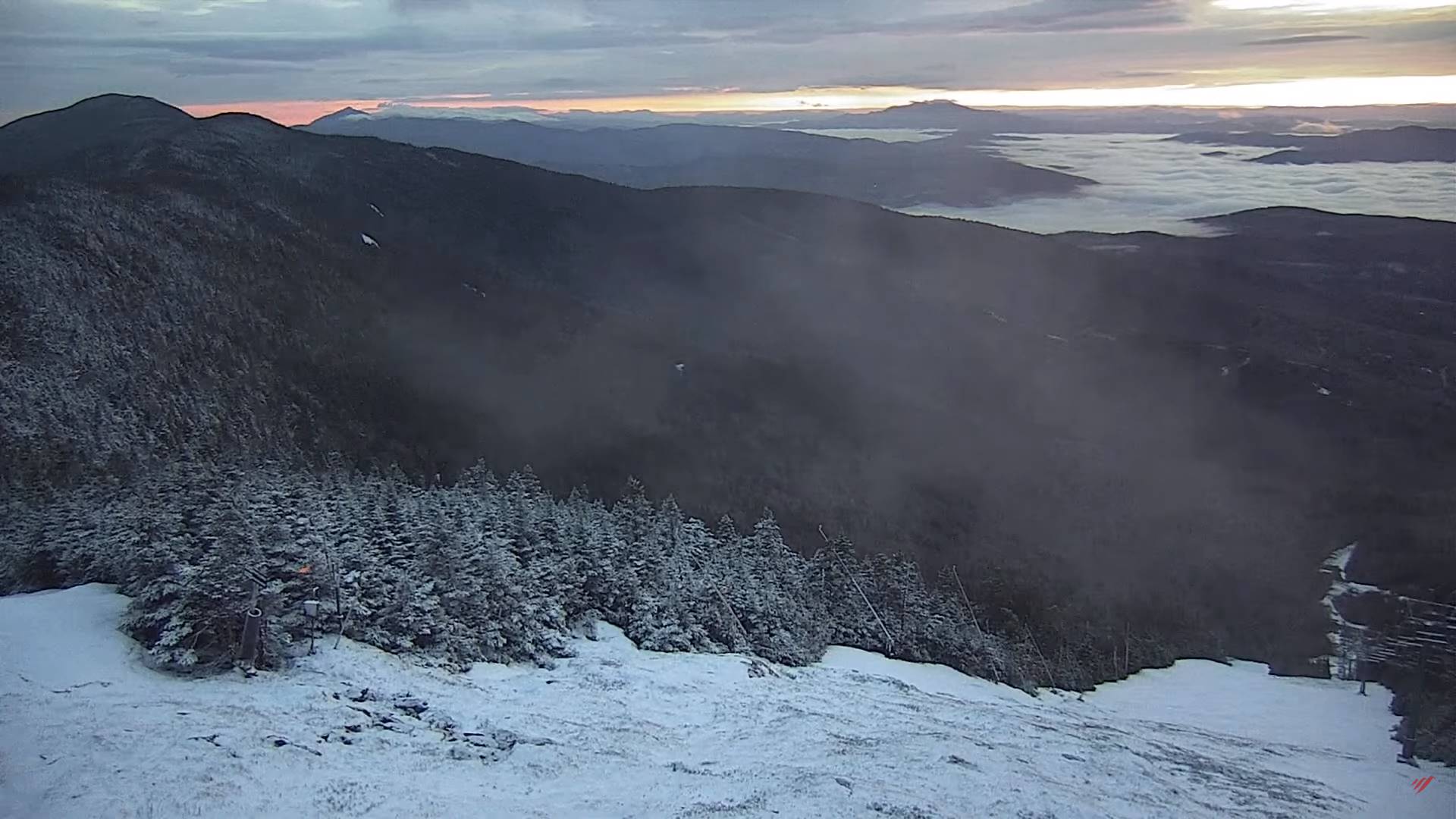
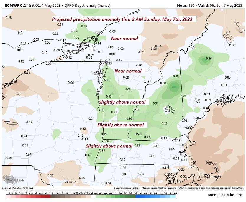
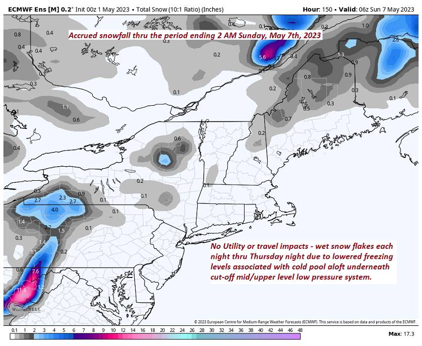
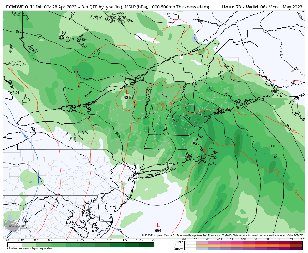
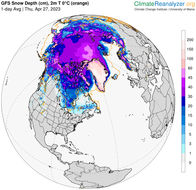
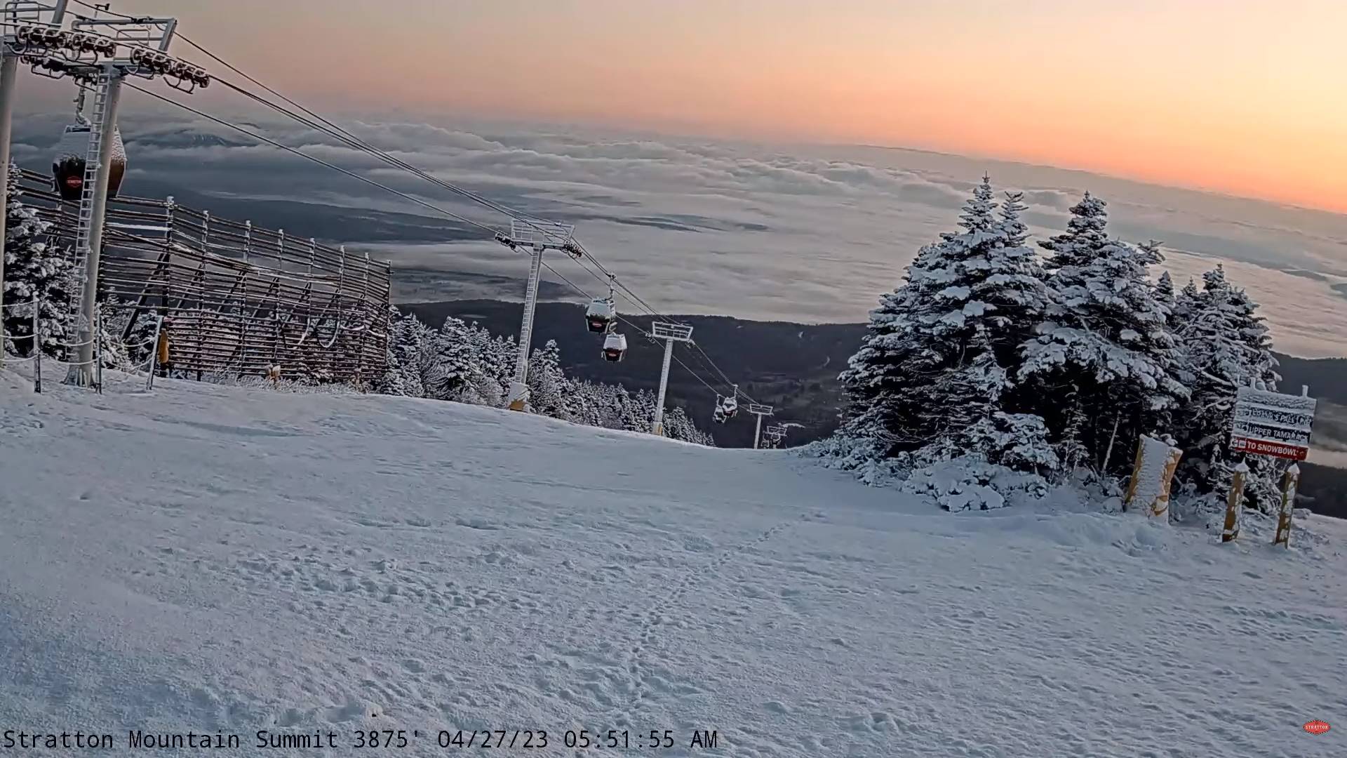
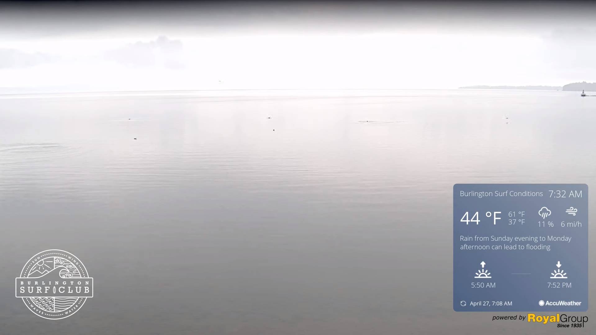
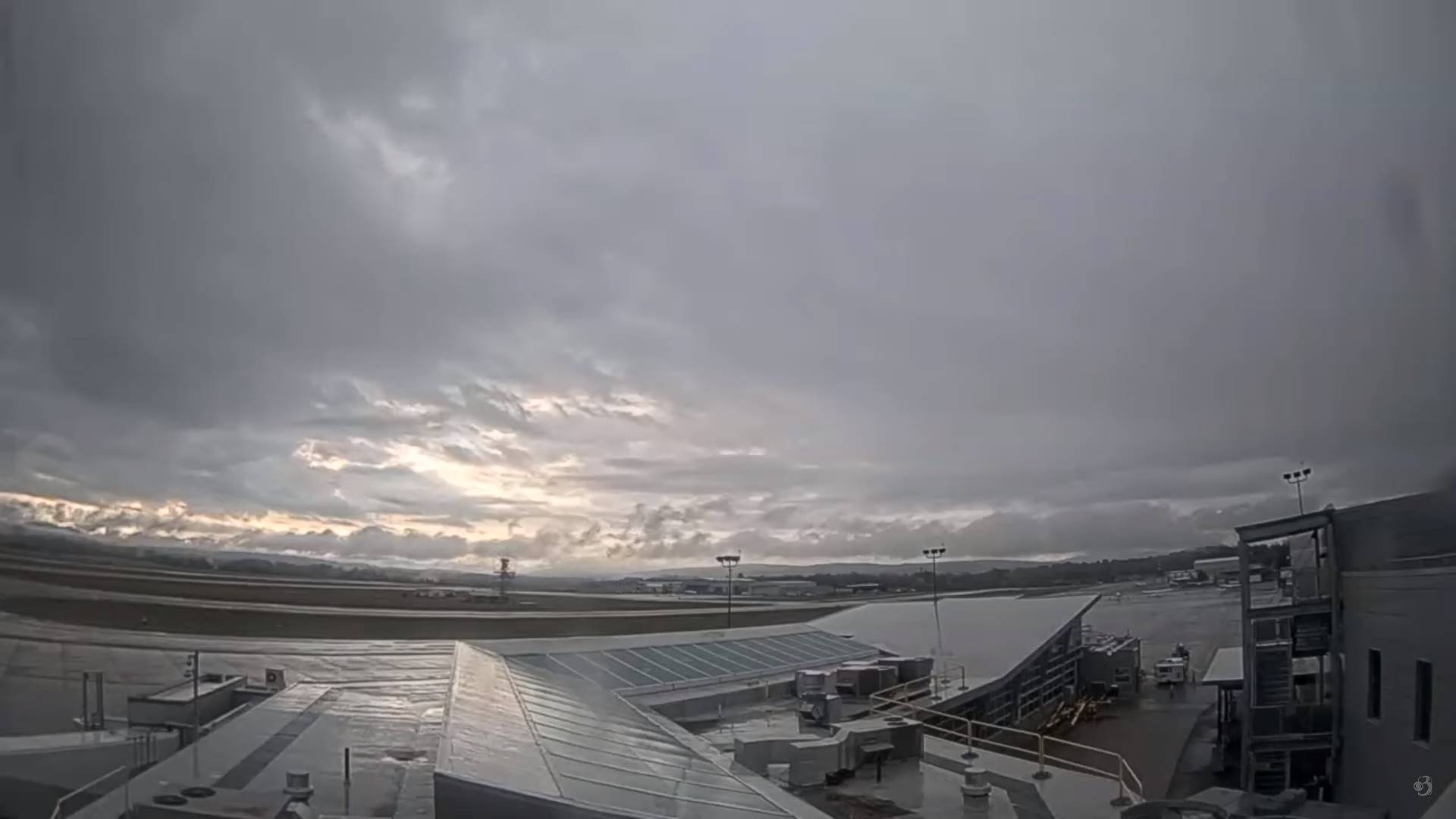
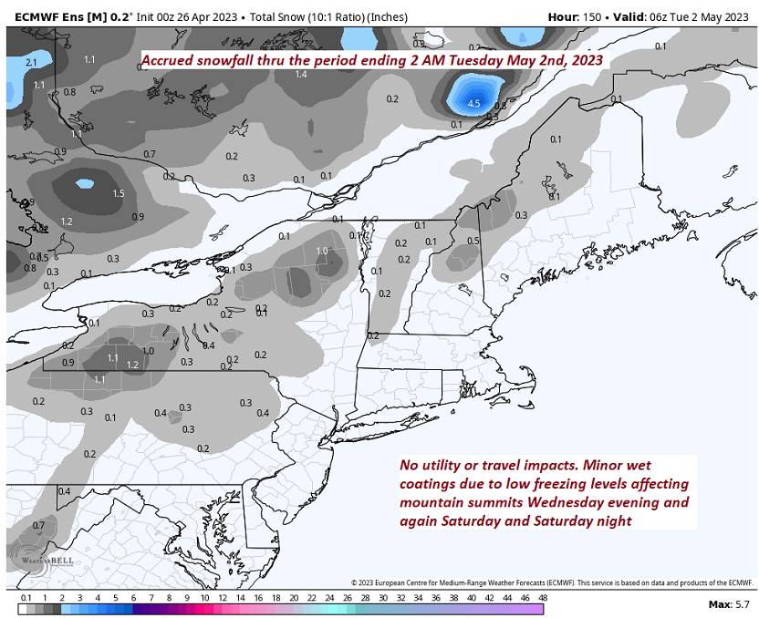
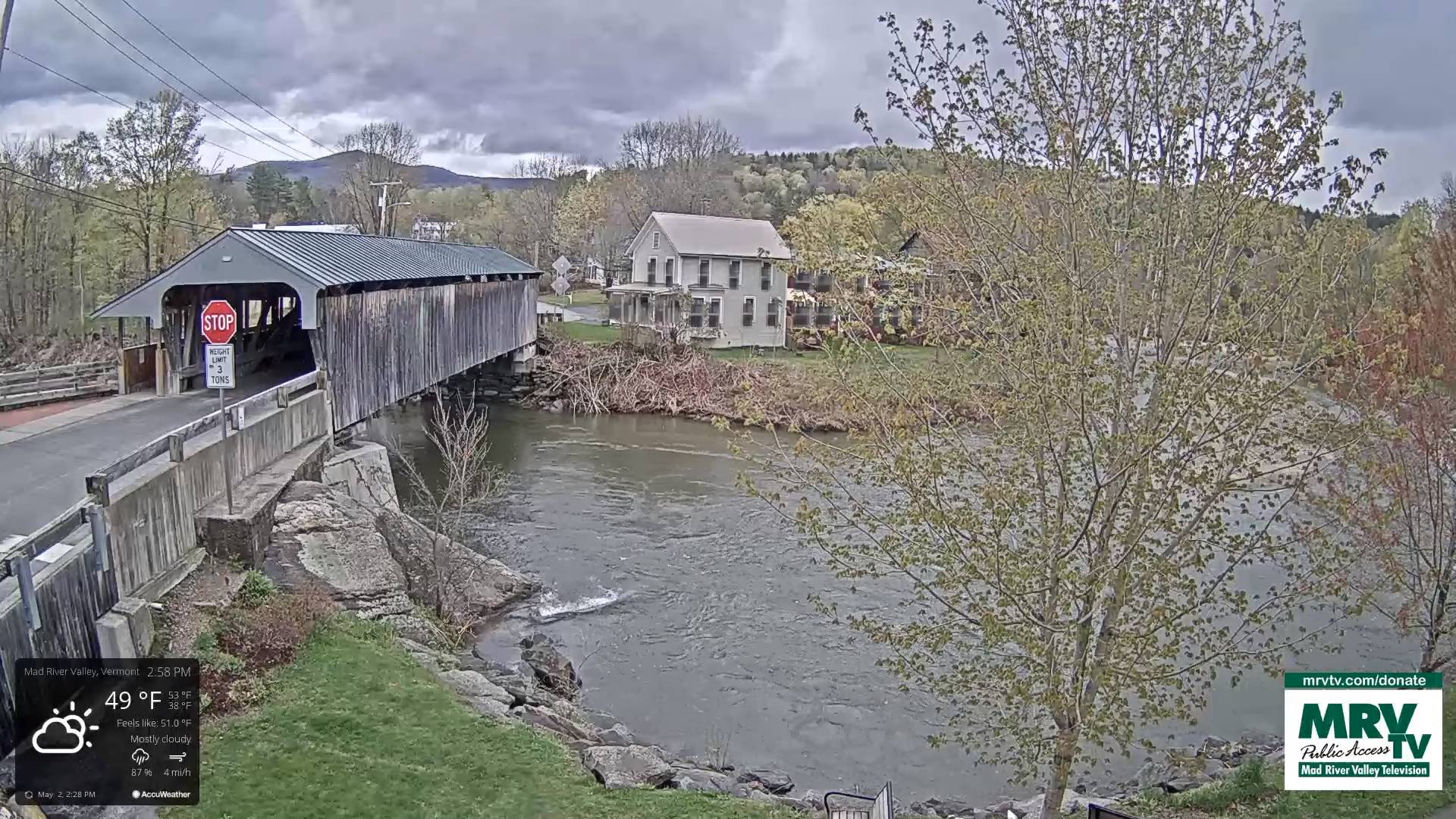
TONIGHT: Lots of clouds. Scattered evening showers with wet snowflakes summits, more isolated after midnight. A low in the lower 40s. Light northeast winds.

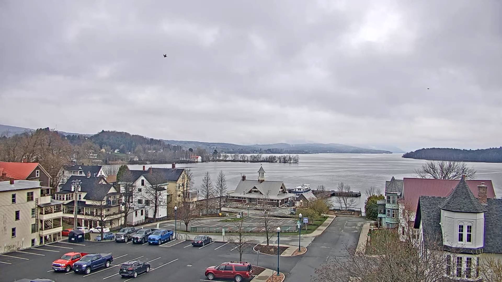
TOMORROW: Clouds & continued showery with occasional breaks of sun. A high about 50. Light east winds.

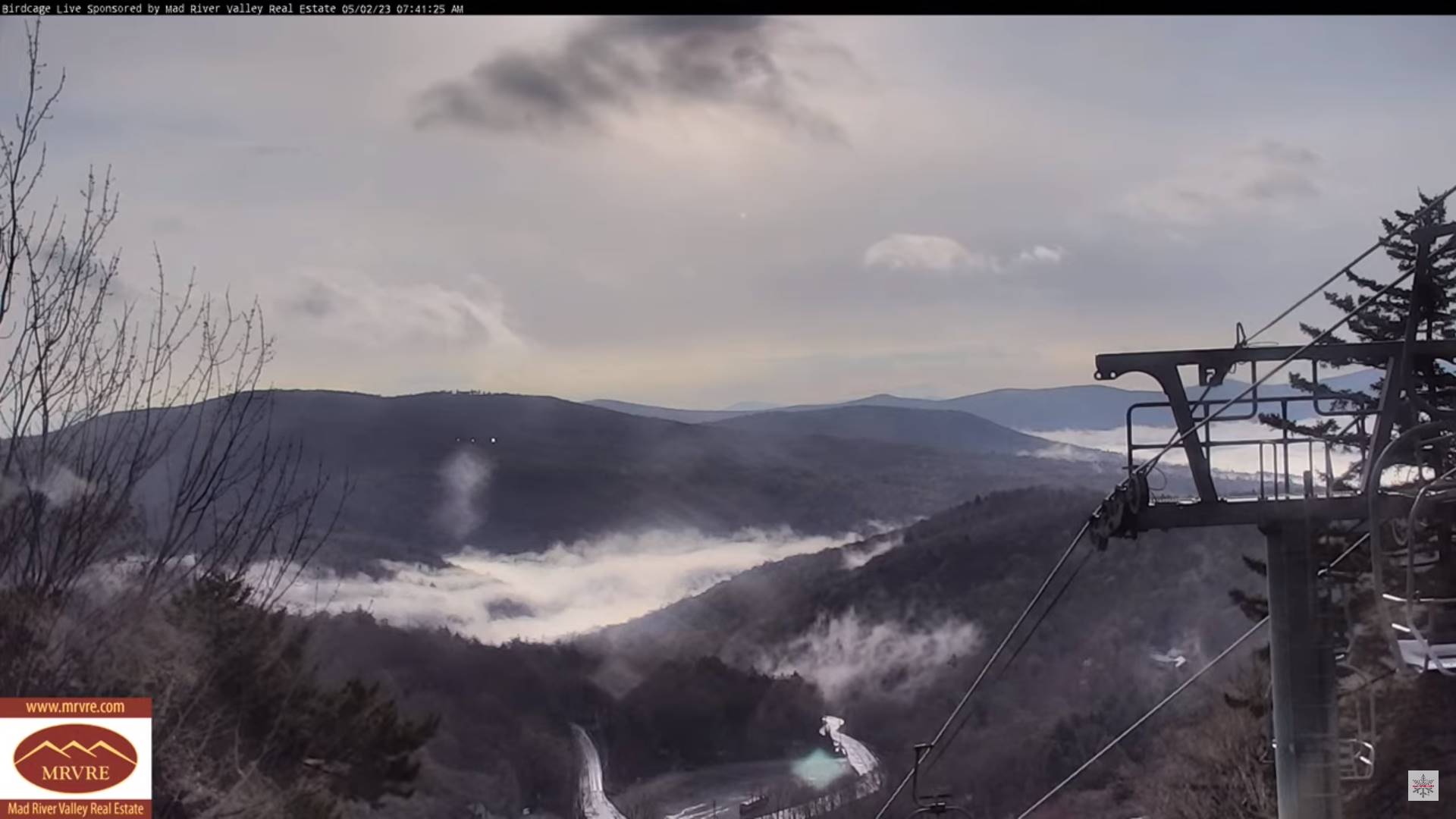
WEDNESDAY NIGHT: Overcast. Widely scattered showers mixed with wet snow flakes higher terrain winding down overnight. A low 35 to 40. Light northeast winds.

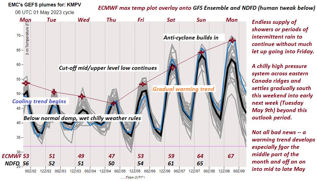
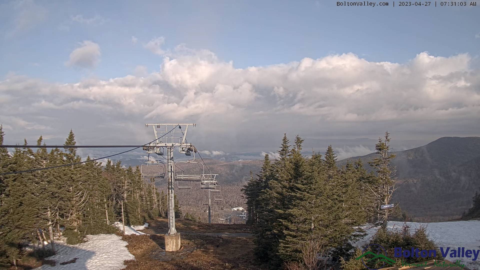
THURSDAY: Mainly cloudy. Isolated to widely scattered shower activity. Gradual day time warming trend begins. A high in the low 50s. Light north to northeast winds.

Looking further ahead

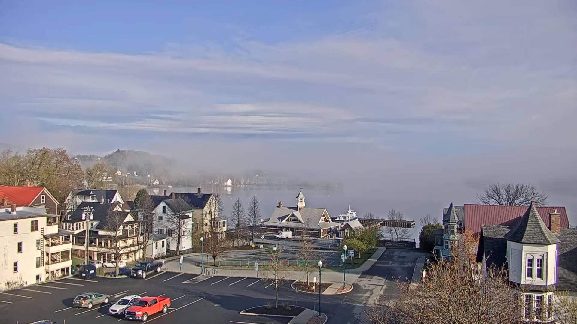
THURSDAY NIGHT: Evening clouds linger eastern areas, otherwise becoming mostly clear. Patchy dense valley fog. A low mid to upper 30s.

FRIDAY: More clouds than sun. Isolated mountain sprinkles. A high around 55.

SATURDAY: Morning sun then more clouds in the afternoon. A low around 40. A high in the low 60s.

SUNDAY: Sunshine gives way to afternoon cloudiness. A low 32 to 35. Milder. A high near 65.

Average lows ranging mid-30s to low 40s. Average highs 60 to 65.

Start of Meteorological summer June the 6th.

RH/5-1 forecast][end]

Updated Tuesday Morning Forecast — May 2nd, 2023

TODAY: Brief morning sun, areas of dense fog, then gray. Showers, with a few wet snow flakes mountain summits. Raw. A high in the lower 50s. Southeasterly breeze 10 mph.

TONIGHT: Lots of clouds. Scattered evening showers, more isolated overnight with wet snowflakes on the summits. A low around 40. Light southeast winds.

WEDNESDAY: Gray. Showers likely. A high in the low 50s. Light easterly winds.

Looking further ahead

WEDNESDAY NIGHT: Overcast. Widely scattered showers mixed with wet snow flakes higher terrain. A low 35 to 40.

THURSDAY: Mainly cloudy. Widely scattered shower activity. Gradual day time warming trend begins. A high in the low 50s.

FRIDAY: More clouds than sun. Isolated mountain showers/sprinkles mixed with wet snowflakes summits. A low

35 to 40. A high around 55.

SATURDAY: Morning sun then more clouds in the afternoon. A low 35 to 40. A high in the low 60s.

SUNDAY: Sunshine gives way to afternoon cloudiness. A low 32 to 35. Mild. A high around 65.

Average lows ranging mid-30s to low 40s. Average highs 60 to 65.

Start of Meteorological summer June the 6th.

RH/5-1 forecast][end]

Updated Monday Evening Forecast — May 1st, 2023

TONIGHT: A few showers early, drying up, otherwise a period of mostly clear skies this evening, before more clouds and showers develop later overnight mixed with wet snowflakes mountain tops. Areas of fog. A low around 40. Light south to southeast winds.

TOMORROW: Gray. Occasional showers, moderate at times…with a few wet snow flakes mountain summits. Raw. A high in the upper 40s. Southeasterly breeze 10 mph.

TUESDAY NIGHT: Lots of clouds. A shower or two likely, with wet snow flakes mountain summits. A low around 40. Light southeast winds.

WEDNESDAY: Gray. Good chance for more for showers or periods of rain. A high about 50. Light easterly winds.

Looking further ahead

WEDNESDAY NIGHT: Overcast. Good chance for more showers. A low 35 to 40.

THURSDAY: Overcast. Scattered showers mixed with wet snow flakes higher terrain. A high 45 to 50.

FRIDAY: More clouds than sun. Widely scattered showers. A few intervals of sunshine possible in the afternoon. A low upper 30s to around 40. A high 50 to 55.

SATURDAY: Morning sun then more clouds in the afternoon. A low 35 to 40. A high 60 to 65.

Average lows ranging mid-30s to low 40s. Average highs 60 to 65.

Start of Meteorological summer June the 6th.

RH/5-1 forecast][end]

Updated Monday morning Forecast — May 1st, 2023

TODAY: Cloudy, with occasional showers, drying up some this afternoon. Some breaks or intervals of sun. A high around 55. Southwest winds 10 to occasionally 20 mph.

TONIGHT: Mostly clear to partly cloudy for a time this evening, then clouding up. Rising chance for showers late overnight, mixed with wet snowflakes on the summits. A low around 40. Light south to southeast winds.

TUESDAY: Mainly cloudy. Occasional showers, moderate at times…with a few wet snow flakes mountain summits. A high upper 40s to near 50. Southeasterly breeze 10 to 15 mph.

Looking further ahead

TUESDAY NIGHT: Lots of clouds. Chance for a shower or two. A low in the lower 40s.

WEDNESDAY: Gray. Chance for showers or periods of rain. A high about 50.

THURSDAY: Overcast. Scattered showers mixed with wet snow flakes higher terrain. A low 35 to 40. A high 45 to 50.

FRIDAY: Cloudy skies with scattered showers. A few intervals of sunshine possible in the afternoon. A low upper 30s to around 40. A high 50 to 55.

Average lows ranging mid-30s to low 40s. Average highs 60 to 65.

Start of Meteorological summer June the 6th.

RH/5-1 forecast][end]

Updated Friday Evening Forecast — April 28th, 2023

TONIGHT: High cloudiness, thickening up later this evening. A low about 40. Light southeast winds.

TOMORROW: Gray & breezy. Showers likely late, mixed with wet snow flakes high terrain late. A high in the mid-50s. Southeast breeze 10 to 20 mph.

SATURDAY NIGHT: Overcast. Showers likely. A low around 40. Southeast winds 10 to 20 mph.

SUNDAY: Cloudy & breezy to windy. Occasional light showers especially southern and eastern areas. A high 50 to 55. East to southeast winds 10 to 20 mph with stronger gusts western slopes of the Green Mountains in the afternoon.

Looking further ahead

SUNDAY NIGHT: Breezy to windy. A low mid to upper 40s. Gusty southeasterly winds.

MONDAY: Chance for periods of rain early exiting as a few left-over sprinkles, Otherwise clouds give way to partly to mostly sunny skies. A high 55 to 60.

TUESDAY: Clouds with patchy valley fog. Chance for more rain or showers. A low upper 30s to near 40. A high

near 55.

WEDNESDAY: Clouds. Chance for more showers. A low in the mid to upper 30s. A high in the low 50s.

Average lows ranging thru the 30s. Average highs upper 50s to lower 60s.

Start of Meteorological summer June the 6th.

RH/4-28 forecast][end]

Updated Friday Morning Forecast — April 28th, 2023

TODAY: Pick of the week. Patchy valley fog otherwise lots of sunshine with some high clouds. Mild and pleasant. A high near 65. Light southeast winds.

TONIGHT: Thickening clouds. A low in the low 40s. Light southeast winds.

SATURDAY: Gray. Breezy at times. Showers becoming likely by late in the day, mixed with wet snow flakes high terrain late. A high in the mid-50s. Southeast breeze 10 to 20 mph.

Looking further ahead

SATURDAY NIGHT: Overcast. Showers likely. A low around 40.

SUNDAY: Cloudy & breezy to windy. Occasional light showers especially southern and eastern areas. A high 50 to 55.

MONDAY: Chance for periods of rain early exiting as a few left-over sprinkles, Otherwise clouds give way to partly to mostly sunny skies. A low in the upper 40s. A high in the upper 50s.

TUESDAY: Clouds with patchy valley fog. Chance for more rain or showers. A low upper 30s to near 40. A high near 55.

WEDNESDAY: Clouds. Chance for more showers. A low in the mid to upper 30s. A high in the low 50s

Average lows ranging thru the 30s. Average highs upper 50s to lower 60s.

Start of Meteorological summer June the 6th.

RH/4-27 forecast][end]

Updated Thursday Evening Forecast — April 27th, 2023

TONIGHT: Becoming mostly clear. Considerable dense valley fog developing. A low near 35 with a possible touch of frost. Light east winds.

TOMORROW: Pick of the week. Morning fog burns off to lots of sunshine with few high clouds. Mild and pleasant with a high reaching the mid-60s. Light southeast winds.

FRIDAY NIGHT: Thickening clouds. A low in the low 40s. Light southeast winds.

SATURDAY: Gray. Breezy to windy at times. Showers becoming likely in the afternoon…briefly moderate at times, mixed with wet snow flakes high terrain late. A high in the mid-50s. Southeast breeze 10 to 20 mph.

Looking further ahead

SATURDAY NIGHT: Overcast, areas of fog. Good chance for showers. A low near 40.

SUNDAY: Cloudy. Occasional misty showers with a few wet snow flakes high terrain early then a few leftover sprinkles. A high in the mid-50s.

MONDAY: Chance for periods of rain, moderate at times…tapering to scattered sprinkles, Otherwise lots of clouds give way to breaks of afternoon sun. A low near 45. A high in the low 50s.

TUESDAY: Clouds. Chance for more rain or showers. A low 35 to 40. A high near 55.

WEDNESDAY: Clouds. Chance for more showers. A low in the mid to upper 30s. A high in the low 50s

Average lows ranging thru the 30s. Average highs upper 50s to lower 60s.

Start of Meteorological summer June the 6th.

RH/4-27 forecast][end]

Updated Thursday morning Forecast — April 27th, 2023

TODAY: Intervals of sun especially in the afternoon. Otherwise clouds with isolated to widely scattered showers near the mountains. A high near 55. Light winds.

TONIGHT: Mostly clear. Considerable valley fog. A morning low 32 to 35 with possible frost. Little wind.

FRIDAY: Pick of the week. Morning fog, then sunshine with increasing high cloudiness in the afternoon. Milder with a high pushing 65. Light southeast winds.

Looking further ahead

FRIDAY NIGHT: Thickening clouds. A low in the low 40s.

SATURDAY: Gray. Breezy to windy at times. Showers becoming likely late…briefly moderate at times, mixed with wet snow flakes high terrain in the evening. A high in the mid-50s.

SUNDAY: Overcast. Occasional misty showers with a few wet snow flakes high terrain early. A low near 40. A high in the mid-50s.

MONDAY: Chance for periods of rain, moderate at times…tapering to scattered sprinkles, Otherwise lots of clouds give way to breaks of afternoon sun. A low near 45. A high in the low 50s.

TUESDAY: Clouds. Chance for more rain or showers. A low in the mid to upper 30s. A high near 55.

WEDNESDAY: Clouds. Chance for more showers. A low in the mid to upper 30s. A high 50 to 55.

Average lows ranging thru the 30s. Average highs upper 50s to lower 60s.

Start of Meteorological summer June the 6th.

RH/4-27 forecast][end]

Updated Wednesday evening Forecast — April 26th, 2023

TONIGHT: Lots of clouds, damp with areas of dense fog. Showers likely, mixed with wet snow elevated terrain minor coatings. A low 35 to 40. Little wind.

TOMORROW: Intervals of sun especially in the afternoon. Otherwise clouds with isolated to widely scattered showers near the mountains. A high near 55. Light winds.

THURSDAY NIGHT: Mostly clear. Considerable valley fog. A morning low 32 to 35 with possible frost. Little wind.

FRIDAY: Pick of the week. Morning fog, then sunshine with increasing high cloudiness in the afternoon. Milder with a high pushing 65. Light southeast winds.

Looking further ahead

FRIDAY NIGHT: Thickening clouds. A low 40 to 45.

SATURDAY: Gray. Showers becoming likely in the afternoon…briefly moderate at times, mixed with wet snow flakes high terrain. A high in the mid-50s.

SUNDAY: Morning showers exit to intervals of sunshine…before more clouds and a rising chance for more showers later on. A low near 40. A high in the mid to upper 50s.

MONDAY: Gray. Chance for periods of rain possibly moderate for a time. A low 40 to 45. A high in the low 50s.

Average lows ranging thru the 30s. Average highs upper 50s to lower 60s.

Start of Meteorological summer June the 6th.

RH/4-26 forecast][end]

Updated Wednesday morning forecast — April 26th, 2023

TODAY: Considerable valley fog especially east of the Green Mountains…burns off to periods of morning sun. Mainly cloudy this afternoon with showers likely. A high in the mid-50s. Light south winds.

TONIGHT: Mostly cloudy, damp with areas of dense fog. Showers likely mixed with wet snow elevated terrain. A low mid to upper 30s. Little wind.

THURSDAY: Variable cloudiness with intervals of sun especially in the afternoon. Scattered showers more numerous near the mountains. A high near 55. Light southeast breeze.

Looking further ahead

THURSDAY NIGHT: Mostly clear. Considerable valley fog. A morning low 32 to 35 with isolated frost possible.

FRIDAY: Pick of the week. Morning fog, then sunshine with increasing and thickening high cloudiness in the afternoon. Milder with a high 60 to 65.

SATURDAY: Gray. Showers or periods of rain becoming likely moderate at times. A low in the upper 30s. A high in the mid-50s.

SUNDAY: Morning showers exiting, then clouds with intervals of sunshine. A low near 40. A high in the mid to upper 50s.

MONDAY: Gray. Chance for periods of rain. A low 40 to 45. A high in the low 50s.

Average lows ranging thru the 30s. Average highs upper 50s to lower 60s.

Start of Meteorological summer June the 6th.

RH/4-26 forecast][end]