Category Archives: Quick Weather Updates
Quick, short updates
Soggy Pre-Christmas December Soaker! Pretty common these days in an overheating planet getting worse by El Nino natural effects adding to it. Hang onto your hats, and umbrellas, in the wind-blown rain.

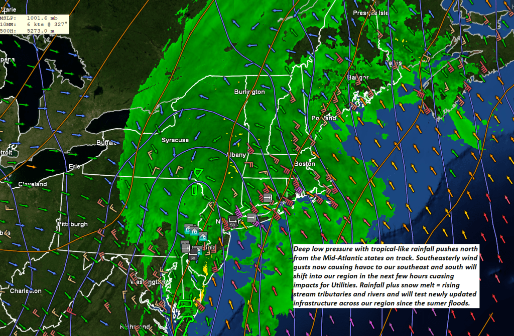
Rain…heavy at times, combined with snow melt with some major river rises down the road. High winds as well as interacting with terrain will impact utilities. Be prepared for power outages developing south to north this morning into the early afternoon.
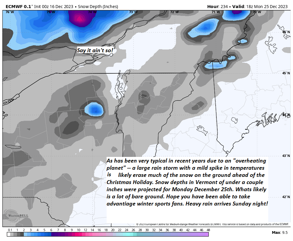
And post-storm flooding? Big chill down but much quieter going into the holiday, not much replacement snow opportunity.
The higher resolution modeling for tomorrow Monday shows the max wind gusts. Wind-blown rain and yes mild temps with lots of snow melt incoming.
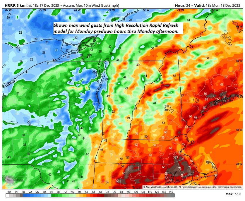
Higher resolution modeling showing where rain shadows may occur to the northwest of portions of the White and Green Mountains. these are also areas where downsloping wind gusts will be strongest typically, with the exception in the Champlain Valley this time around.

Heavy rainfall prospects combined with milder temperatures and added snow melt will make for more flooding as the incoming storm system pushes up from Florida into southeast Canada.
Deep low-pressure rides in with moisture levels loaded for bear to produce heavy rains and high winds. Additionally, the system originating in the Gulf of Mexico brings a mild shot. The combined effects all together is a recipe for some major flooding. “Keep informed on this significant storm system” especially in low lying areas.


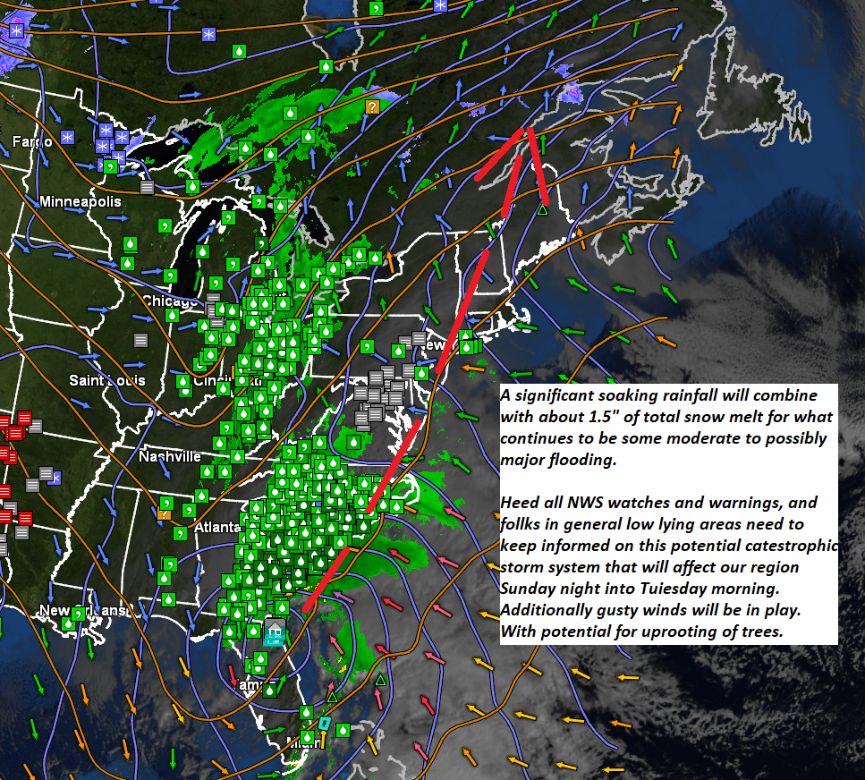
Pre-Christmas rainfall on track with potential for river rises and flooding — Sunday night into Monday. Additionally, gusty winds may be in play on mountain summits and western slopes of the Greens.