Weathering Heights, Roger Hill's weather forecasting service

Weathering Heights, Roger Hill's weather forecasting service

Menu

Skip to content
  • Home
  • About Roger Hill
  • Quick Weather Updates

Category Archives: Quick Weather Updates

Quick, short updates

Post navigation

← Older posts
Newer posts→

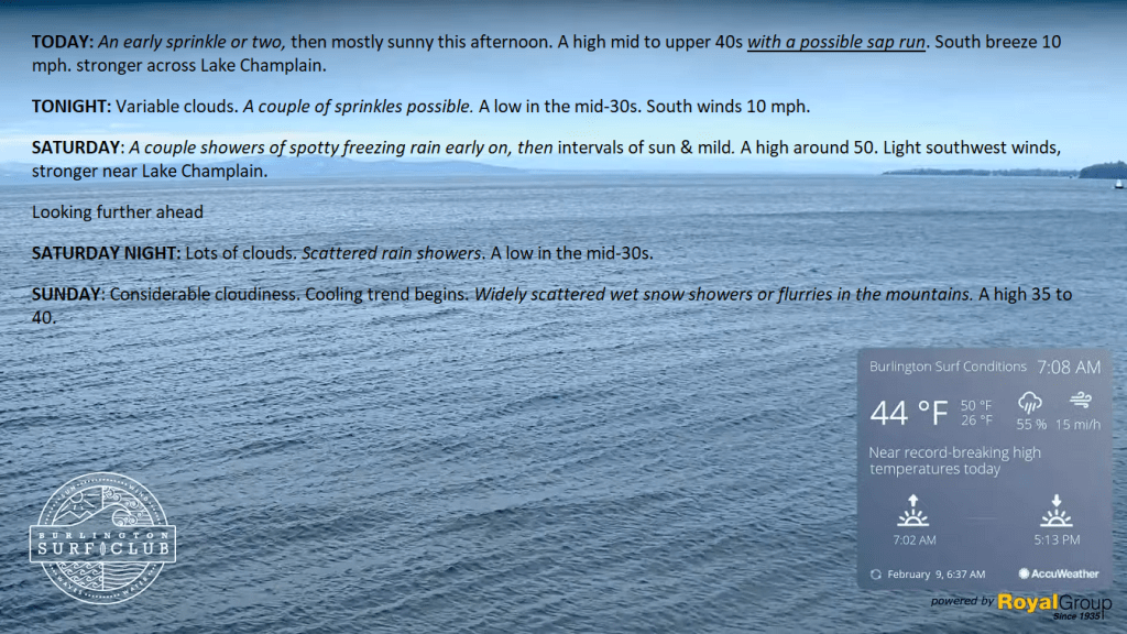
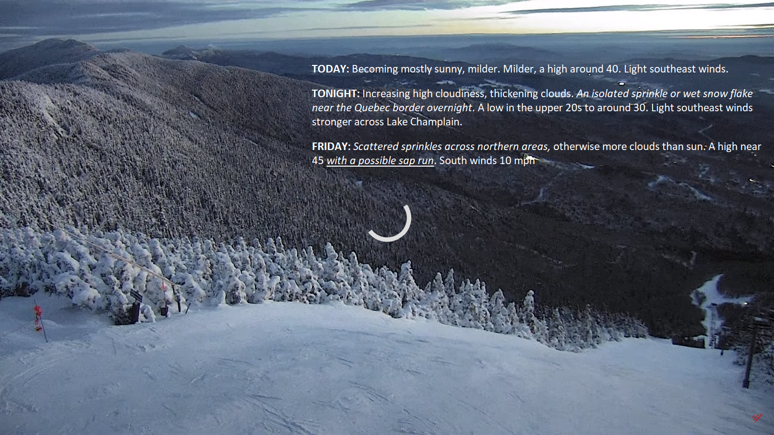
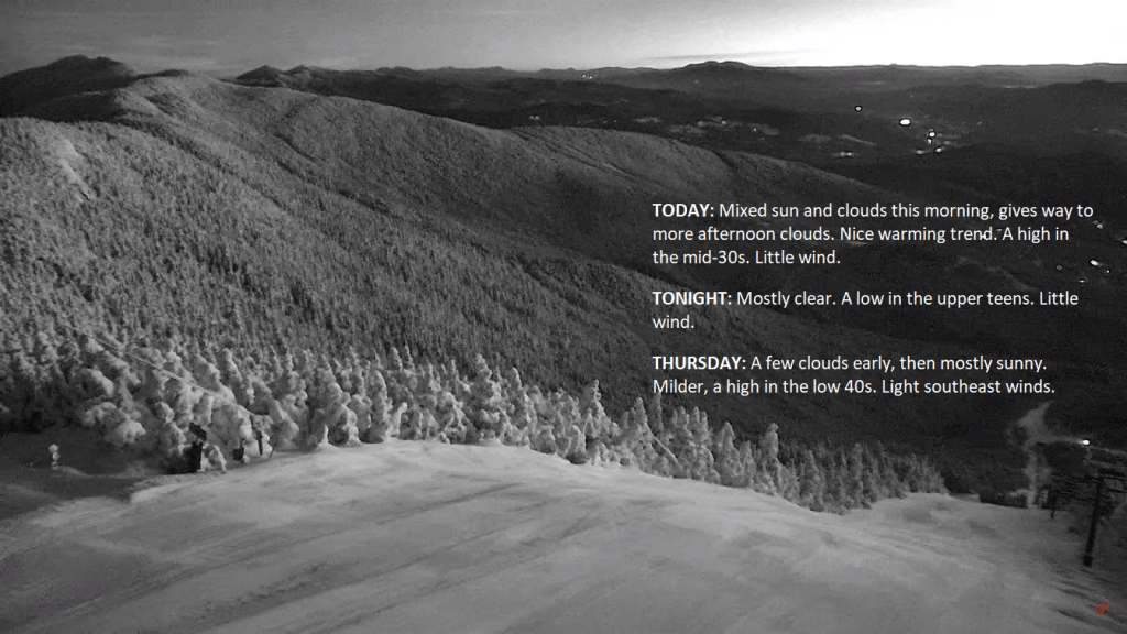
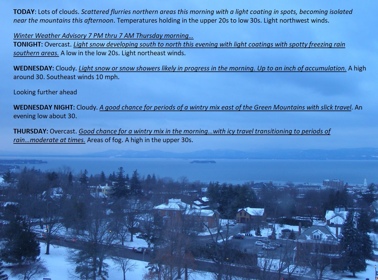
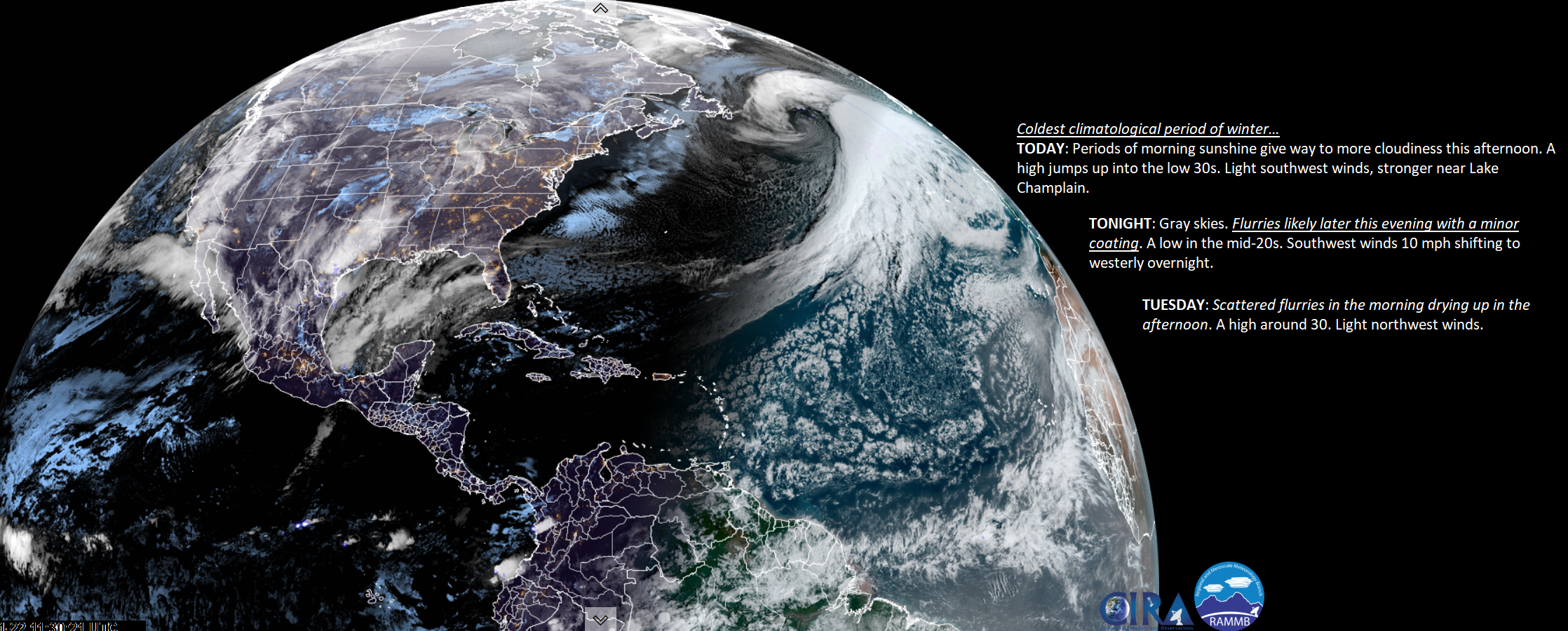
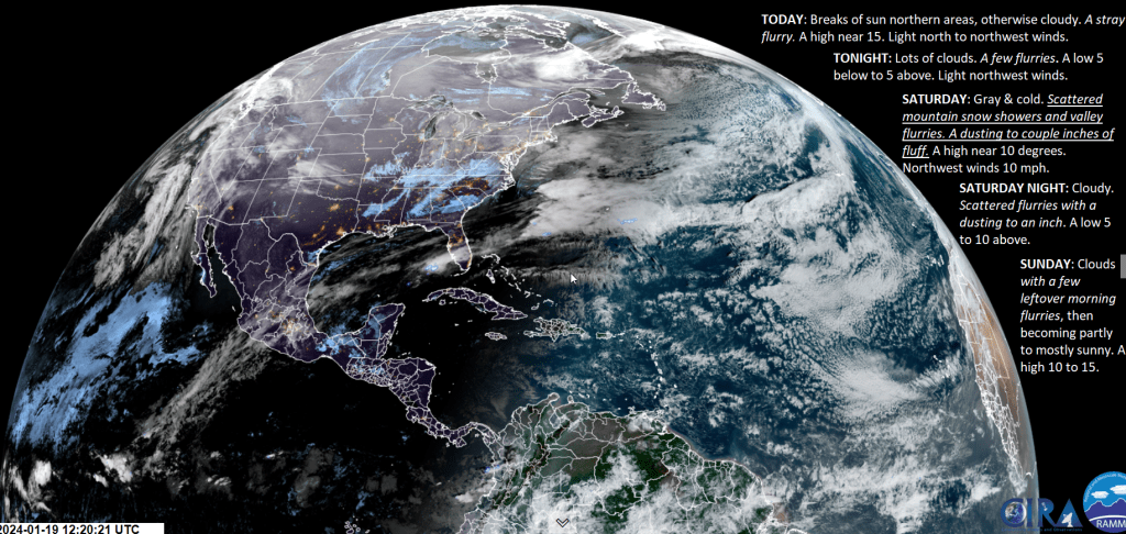
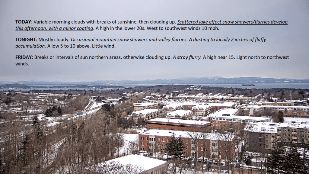
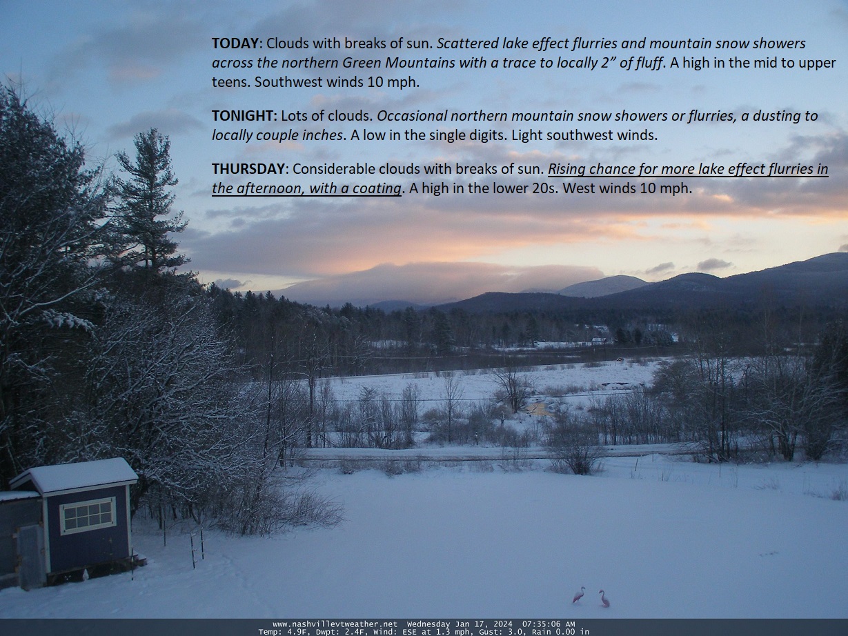
The shifty weather system to our south brings wintry precipitation to those areas frequently missed. Still, our region is to pick up a coating of snow later overnight into tomorrow morning from a separate windy disturbance.

Posted on February 13, 2024 by Weathering Heights
Posted in Quick Weather Updates

Back edge of morning cloudiness will shift eastward with lots of sunshine for this afternoon. the periodic cloud cover generally settles out to a more cloudier one Sunday, with colder temperature trends returning for next week.

Posted on February 9, 2024 by Weathering Heights
Posted in Quick Weather Updates

A skinny cloud-free slot should allow for mostly sunny skies today before more high cirrus and cirrostratus clouds work east and eventually thicken and lower, leading to a chance for a few wet snow flakes or sprinkles far north overnight

Posted on February 8, 2024 by Weathering Heights
Posted in Quick Weather Updates

Periodic cloud cover to push in today but skies open up again at times over the next 2 days. Eventually gray weather returns with some minor chancy rain showers. A warm-up continues with where temps could reach near 50 on Saturday…

Posted on February 7, 2024 by Weathering Heights
Posted in Quick Weather Updates

Gorgeous February sunshine today with still decent amounts of sun in the days to come with a warming trend. Next inclement bout of WX arrives Thursday night with possible mixed wet snow/freezing rain…by Friday morning.

Posted on February 6, 2024 by Weathering Heights
Posted in Quick Weather Updates

Warming winters also mean “persistent gloom” in the Green Mountain state but mixed precipitation types including rain will be more frequent in the future. Arctic shots of air more determined by high latitude blocking with big amplified waves.

Posted on January 23, 2024 by Weathering Heights
Posted in Quick Weather Updates

Pretty start to the day today, and dry with a major warm-up. Temperatures punch into the lower 30s today. A disturbance to our west across the Great Lakes region will track into Vermont this evening with a coating of snow tonight…

Posted on January 22, 2024 by Weathering Heights
Posted in Quick Weather Updates

Colder with occasional flurries and mountain snow showers until ridging of higher pressure works in Sunday afternoon for the best sunniest stretch of a few several hours Sunday afternoon. A warming trend after that…but unsettled.

Posted on January 19, 2024 by Weathering Heights
Posted in Quick Weather Updates

Incessant moisture streams from off the relatively warm waters of the Great Lakes will be in our future for many days to come. Occasionally, weak disturbances in the flow will enhance slightly more robust snowfalls of very fluffy crystals. Warmer next week.

Posted on January 18, 2024 by Weathering Heights
Posted in Quick Weather Updates

Some breaks or intervals of sun mainly this morning, before combined lake effect plumes of moisture spread in more snow showers/flurries targeting the northern mountains. Below normal temperatures going into the weekend, milder next week.

Posted on January 17, 2024 by Weathering Heights
Posted in Quick Weather Updates

Post navigation

← Older posts
Newer posts→
Top 100 Weather Blog

Weathering Heights is a Feedspot Top 100 Weather Blog

Climate Reanalyzer

Tools to Visualize Climate and Weather Forecast Models

Daily Climate Maps updated 10:30 AM (courtesy of NWS Burlington VT)

Daily Climate Maps courtesy NWS-Burlington

forecast condition a few hours from now

forecast condition a few hours from now...

Precipitation amount forecast today

Precipitation amount forecast today

Recent earthquakes

Recent earthquakes

30 day observation precipitation graph Burlington VT

30 day observation precipitation graph Burlington VT

Link to Burlington 90 precipitation plot

90 day observation precipitation graph Burlington VT

River Check

Northeast River Forecast Center

Sun - current solar activity

Sun - Current Solar Activity

My Tweets

Climate Notes

Web cam from Weathering Heights in Worcester, Vermont, looking south toward Montpelier

Weathering Heights Web Cam, looking south toward Montpelier and uptown Berlin (refresh browser to update)

Plymouth State Radar

Plymouth State Radar

Current northeast U.S. infrared and visual satellite

Road Conditions

VTrans Road Conditions

Flight Delays

Flight delays

link to www.co2.earth

CO2.earth

Current Arctic Ice

link to 3 to 7 day upcoming weather hazards

3 to 7 day upcoming Weather Hazards

Follow Weathering Heights, Roger Hill's weather forecasting service on WordPress.com
Plymouth State Radar

Plymouth State Radar

Blog at WordPress.com.
Weathering Heights, Roger Hill's weather forecasting service
Blog at WordPress.com.
  • Subscribe Subscribed
    • Weathering Heights, Roger Hill's weather forecasting service
    • Join 132 other subscribers
    • Already have a WordPress.com account? Log in now.
    • Weathering Heights, Roger Hill's weather forecasting service
    • Subscribe Subscribed
    • Sign up
    • Log in
    • Report this content
    • View site in Reader
    • Manage subscriptions
    • Collapse this bar
 

Loading Comments...