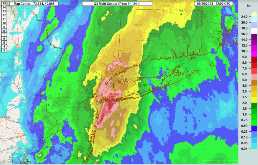
That’s a lot of rain for a metro area…with a super moist southeasterly flow, does this sound familiar. Synoptically it was all flow less an area of low pressure. 7.97″ fell in an urban area, and was the wettest day since 1948 for New york City.

Quick, short updates
That’s a lot of rain for a metro area…with a super moist southeasterly flow, does this sound familiar. Synoptically it was all flow less an area of low pressure. 7.97″ fell in an urban area, and was the wettest day since 1948 for New york City.

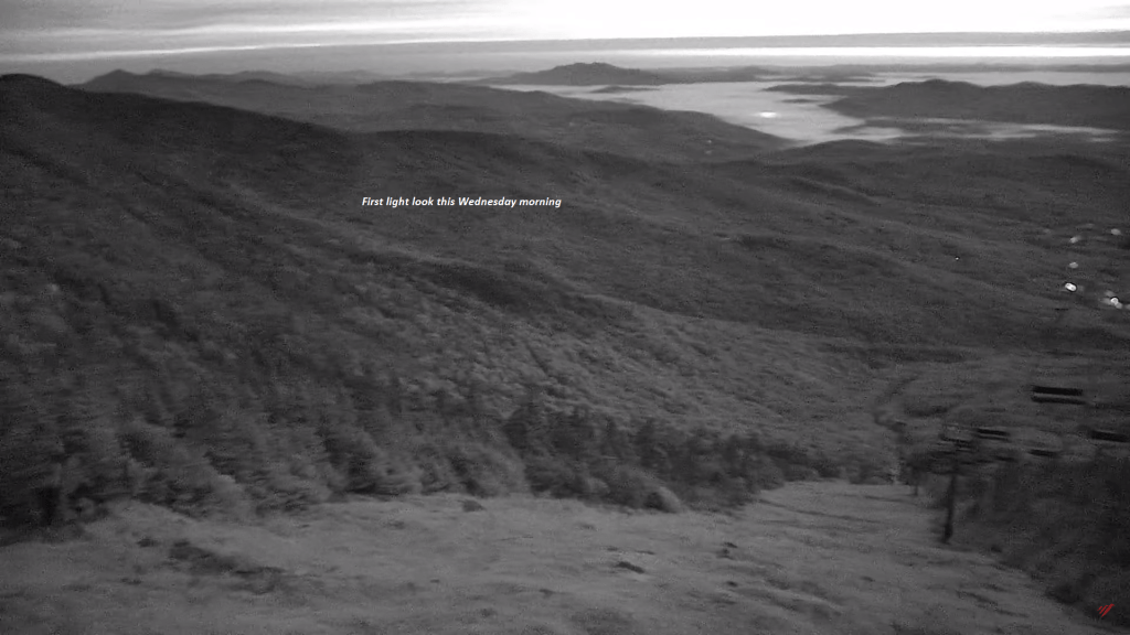
High cloudiness appears over the top of valley fogs across the #GreenMountainState.

Some high elevation snow was advertised for most of the western mountain elevations and even into the northern high plains, and across northern Canada coast to coast with a hint of some early winter that kicks in later this week with reinforcement of new snows further eastward eventually into northern Quebec into the second week of October. With a strong El Nino this appears to be its opposite to start winter and should not be confused.
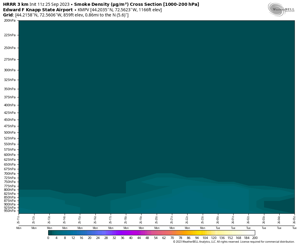
This cross-section shows a smoke layer down to the surface from thin but old wildfire smoke that originated in northern Alberta from fires that pulse off and on in the Boreal Forest region of Canada.
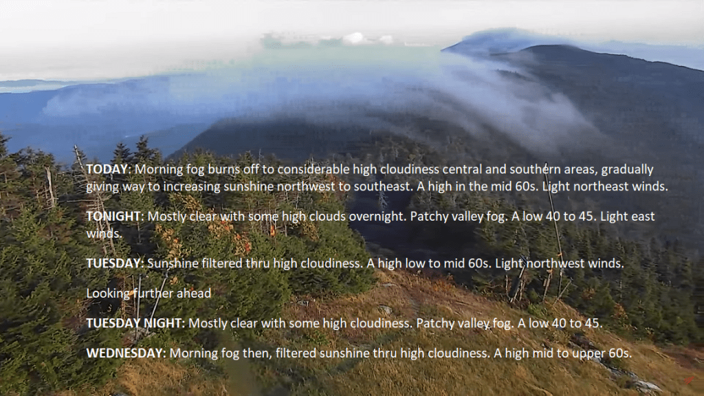
Foggy mornings and sunshine filtered thru high clouds will be the rule for the entire week and going into the weekend. #Dry #GreenMountains #Vermont #BlockingHigh Pressure
Not much to see here with this test.

Typical Valley fog also with a thin smoke layer elevated a couple thousand feet or higher across the region today, but sunshine will be the rule after the fog burns off. Our weather is controlled by high pressure but will be tested with Sub-Tropical moisture from the system well down the coast over this weekend. Moisture will spread northward and rain showers will reach into about the north-central Vermont region or about RT. 15 and points south. It should remain dry over the weekend across the far northern tier region.
