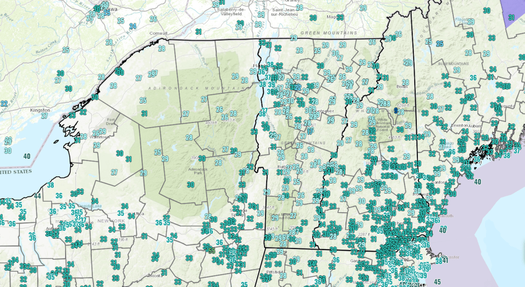
Watch it on area roadways this morning. Icy spots have developed with some stretches very icy. See current temperatures pre-dawn this morning. Posted on October 31, 2023 by Weathering Heights
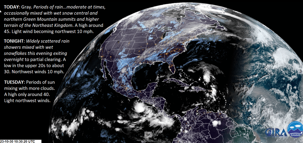
A long frontal boundary stretches from Texas to the Canadain Maritimes supplying moderate rain at times, and where terrain is high enough a little wet snow accumulation, but most of the area sees liquid precip. This will change this evening and mid-week with possible slick travel. Posted on October 30, 2023 by Weathering Heights
Incoming #clouds and eventually scattered #showers arrive this Saturday late morning into the afternoon before more clearing develops later today/this evening. We are now very much into #StickSeason. Posted on October 28, 2023 by Weathering Heights
Likely the warmest day we’ll see of this warm stretch which lasts into Saturday, before a colder air mass arrives incrementally over the next few days. Eventually, wet snowflakes at the mountain summits will come down the slopes in the middle of next week. Get those snow tires on! Posted on October 27, 2023 by Weathering Heights
Moisture stream continues without many breaks upstream to the west and southwest to bring considerable cloudiness, but a break of sun now and then. Posted on October 26, 2023 by Weathering Heights
Transitions to cloudier conditions with some morning fogs. Part 1. Posted on October 25, 2023 by Weathering Heights
A clear slot has moved in overnight and very quickly set up some valley fog. However mid and high-level moisture should quickly overwhelm central and northern areas even with a few light #showers or sprinkles moving in… Posted on October 25, 2023 by Weathering Heights
And just like that…a little freezing/frozen precipitation crossing in from New York on our coldest morning so far this season. Conditions should improve super quickly, but this morning just a preview of things to come in November. Posted on October 24, 2023 by Weathering Heights