Friday Night Forecast —

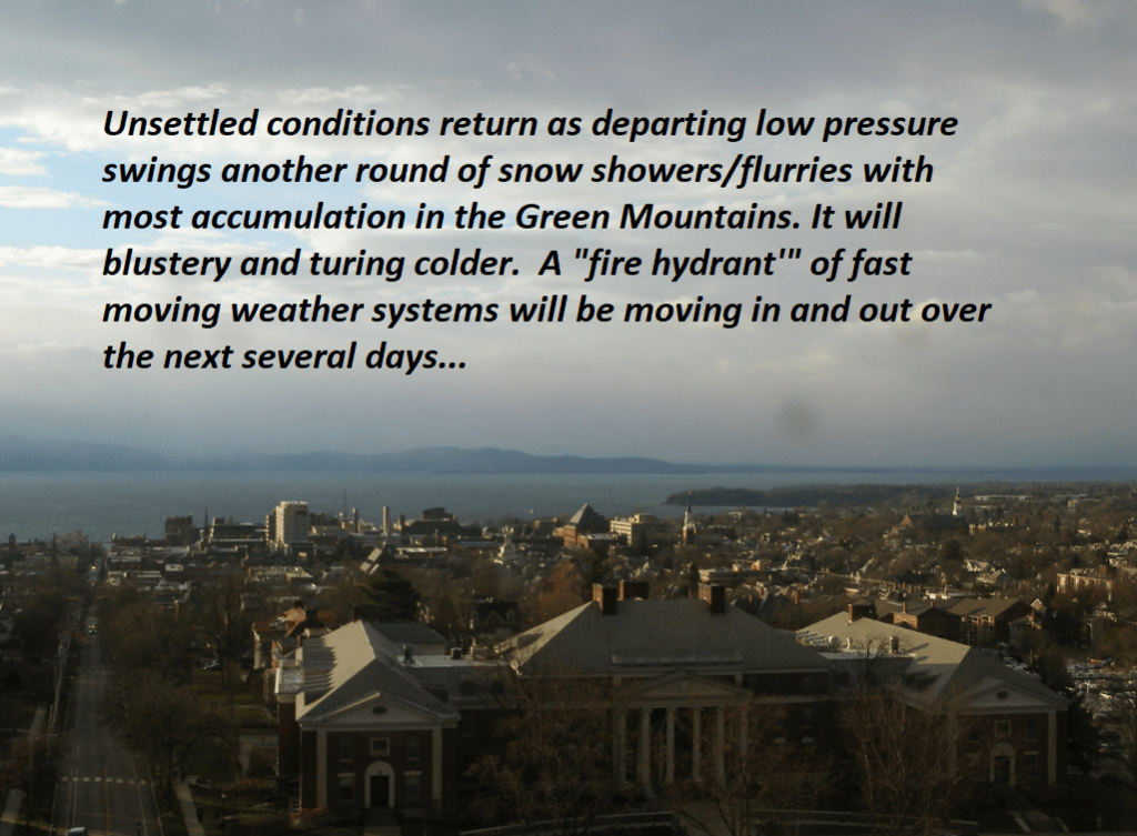
Roger Hill’s Radio Vermont forecast 3:00 PM Friday 12-6-24

TONIGHT: Becoming mostly cloudy. Scattered light snow showers or flurries after midnight. A dusting to an inch. An early evening low 10 to 15. Light southwest winds.

TOMORROW: Mainly cloudy & rather cold. Scattered flurries early then drying up. Little accumulation. Continued colder than normal. A high near 25. Light west winds becoming southerly late.

SATURDAY NIGHT: Cloudy. Periods of snow likely late evening on, possibly moderate at times. Accumulations around an inch. A low around 15. South breeze 10 to 15 mph.

SUNDAY: Gray. Scattered light snow showers early tapering to isolated sprinkles. …dusting to an inch northern areas. Seasonable temperatures. A high 35 to 40. Winds becoming west to northwest 10 to 15 mph.

Looking further ahead

SUNDAY NIGHT: Lots of clouds. A low around 15.

MONDAY: Thickening clouds. Chance for rain or mixed precipitation developing with minor coatings. A high around 35

TUESDAY: Cloudy. Chance for early mixed precipitation tapering to sprinkles. A low near 32. A high upper 30s near 40.

WEDNESDAY: Overcast. Periods of rain…possibly moderate at times. Milder. A low mid-30s. A high 40 to 45.

Average low mid-teens to low 20s. Average high 35 to 40

This forecast and to be issued – Monday thru Friday.

RH/12-6forecast][end]

Thursday Night Weather

Roger Hill’s Radio Vermont forecast 3:00 PM Thursday 12-5-24

TONIGHT: Lots of clouds & blustery. Accumulating snow showers near the Green Mountains with lighter snowfalls or flurries elsewhere winding down overnight. Accumulations of a dusting…to locally 3” northern Green Mountain Ski Resorts. A low-upper teens. Northwest winds 10 to 20 mph and gusty.

TOMORROW: Morning clouds giving way to intervals of sunshine. Blustery and cold. A high in the upper teens to low 20s. Northwest winds 10 to 20 mph.

FRIDAY NIGHT: Considerable cloudiness. Scattered light lake effect snow showers or flurries after midnight. Minor accumulation. An early evening low around 15. Light southwest winds.

SATURDAY: Mainly cloudy & rather cold. Scattered flurries early then drying up. Little accumulation. A high in the low 20s. Light west winds.

Looking further ahead

SATURDAY NIGHT: Cloudy. Good chance for snow showers developing overnight, with accumulations around an inch. A low 5 to 10 above.

SUNDAY: Gray. Chance for light snow showers…dusting to an inch northern areas. A high near 40

MONDAY: Increasing clouds. Chance for rain or mixed precipitation developing in the afternoon. A low around 30. A high around 40.

TUESDAY: Cloudy. Chance for rain or mixed precipitation…possibly significant amounts with slick travel. A low around 32. A high low to mid 40s.

Average low mid-teens to low 20s. Average high 35 to 40

*This forecast and to be issued – Monday thru Friday.

RH/12-5forecast][end]

Roger Hill’s Radio Vermont forecast 3:00 PM Wednesday 12-4-24

Winter Weather Advisory thru late Thursday night…for multiple rounds of accumulating snow & slippery travel…

TONIGHT: Overcast. Occasional light accumulating snow or snow showers. Accumulations of an inch or two”. A low around 25. South winds 10 mph but gustier Champlain Valley. 

TOMORROW: Gray & becoming blustery late. Occasional light accumulating snow or snow showers continues. Accumulation about dusting to 2”…most off the valley floors. A high 32 to 35. Light south winds shifting to westerly and increasing late.

THURSDAY NIGHT: Lots of clouds & blustery. Light accumulating snow or snow showers with additional accumulation of 1 to locally 3”…most western slopes of the Greens. A low 10 to 15. Northwest winds 10 to 20 mph and gusty.

FRIDAY: Morning clouds giving way to intervals of sunshine. Blustery and colder with temperatures in the teens. Northwest winds 10 to 20 mph.

Looking further ahead

FRIDAY NIGHT: Considerable cloudiness. Scattered light lake effect snow showers or flurries after midnight with minor accumulation. A low 5 to 15 above.

SATURDAY: Mainly cloudy & rather cold. Chance for accumulating “lake effect” snow showers.. A high low to mid 20s.

SUNDAY: Gray. Chance for morning snow showers or flurries exiting in the afternoon. A low in the 20s. A high near 40

MONDAY: Increasing clouds. Chance for rain developing in the afternoon. A low in the 30s, highs in the lower 40s.

Average low mid-teens to low 20s. Average high 35 to 40

*This forecast and to be issued – Monday thru Friday.

RH/12-4forecast][end]

Tuesday night Forecast —

Roger Hill’s Radio Vermont forecast was updated 4 PM Tuesday 12-3-24

TONIGHT: Occasional flurries and mountain snow showers with a dusting to an inch ending toward midnight. Otherwise becoming partly to mostly cloudy. Light west winds. 

Winter Weather Advisory Wednesday Afternoon lasting into late Thursday night…multiple rounds of snow…

TOMORROW: A few breaks of morning sun, then clouding up. A rising chance for light accumulating snow or snow showers. The high upper 20s about 30. Winds becoming southerly 10 mph higher near Lake Champlain.

WEDNESDAY NIGHT: Overcast. Occasional light accumulating snow with an inch or two. A low near 25. Blustery out of the south.

THURSDAY: Gray skies with a peek or two of dim sun. Occasional accumulating light wet snow with about 1 to 2 inches especially higher northern terrain. A high 32 to 35. South winds 10 to 15 mph. 

Looking further ahead

THURSDAY NIGHT: Cloudy. Light snow accumulation up to 2” likely. A low around 15.

FRIDAY: More sun than clouds. Colder & blustery. A high 20 to 25.

SATURDAY: Mainly cloudy & rather cold. Chance for accumulating “lake effect” snow showers. Frigid with a morning low near 5 above. A high mid-20s.

Average low mid-teens to low 20s. Average high 35 to 40

*This forecast and to be issued – Monday thru Friday.

RH/12-3forecast][end]

December 2nd forecast details

Roger Hill’s Radio Vermont forecast 2:30 PM Monday 12-2-24

THIS AFTERNOON: Clouds with a few intervals of sun away from the mountains. Widely scattered mountain flurries. A high near 30.

TONIGHT: Variable clouds. Scattered snow showers and flurries especially northwestern Vermont with a dusting to a couple fluffy inches western slopes of the Greens. A low mid-teens to near 20. Light northwest winds.

TOMORROW: Mainly gray. Chance for snow showers/flurries mainly Champlain Valley. A high upper 20s to around 30. Light west winds.

Looking further ahead

TUESDAY NIGHT: Partly cloudy. A low around 15.

WEDNESDAY: A few breaks of morning sun, then clouding up leading to a rising chance for light accumulating snow or snow showers.A high upper 20s about 30.

THURSDAY: Gray skies with a peek or two of dim sun. Occasional accumulating light wet snow showers. A low near 25. A high 32 to 35 & breezy out of south.  

FRIDAY: Northern cloudiness with intervals of sun away from the mountains otherwise. Colder & blustery. Temperatures around 20, falling into the teens.

THIS WEEKEND: Unsettled and cold. Chance for accumulating snow showers especially Saturday. Lows in the teens, with highs in the 20s.   

Average low mid-teens to low 20s. Average high 35 to 40

*This forecast and to be issued – Monday thru Friday.

RH/12-2forecast][end]