Utility Outlook for Vermont — valid rest of Sunday into Friday November 24th, 2023.

TONIGHT: Overcast. A period of rain developing early this evening from northwest to southeast, moderate at times. A low in the upper 30s. Winds shifting to northwesterly 10 mph.
TOMORROW: Early rain showers mixing with a little wet snow briefly before exiting to intervals of sunshine. Blustery and colder, temperatures falling into the mid-30s. Northwest winds 10 mph.
SATURDAY NIGHT: Mostly clear in the evening with more clouds overnight. Rising chance for a few mountain flurries far northern areas. A low around 25. Light southwest winds.
SUNDAY: Clouds with intervals of sun & turning blustery. Scattered snow showers mixed with rain warmer valleys. Some coatings of accumulation across elevated terrain. A high 35 to 40. Winds becoming west to northwesterly 10 to 15 mph.
Looking further ahead

SUNDAY NIGHT: A few northern clouds otherwise becoming mostly clear. A low 20 to 25.
MONDAY: Some clouds northern areas early, then sunny. A high in the lower 30s.
TUESDAY: Increasingly cloudy & becoming breezy. Rising chance for accumulating wet snow changing to rain, Accumulation of couple three inches more elevated terrain. A low in the upper teens. A high in the mid and upper 30s.

WEDNESDAY: Chance for rain & wet snow showers giving way to periods of sunshine. A low around 32. A high in the low 40s.
Average lows mid-20s to 30. Average highs low to mid 40s
RH/11-17forecast][end]
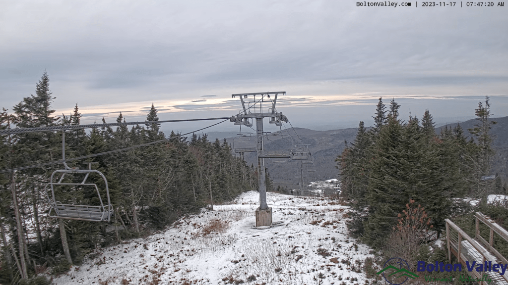
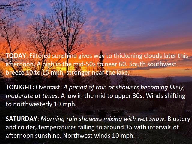
TODAY: Filtered sunshine gives way to thickening clouds later this afternoon. A high in the mid-50s to near 60. South southwest breeze 10 to 15 mph, stronger near the lake.
TONIGHT: Overcast. A period of rain or showers becoming likely, moderate at times. A low in the mid to upper 30s. Winds shifting to northwesterly 10 mph.
SATURDAY: Morning rain showers mixing with wet snow. Blustery and colder, temperatures falling to around 35 with intervals of afternoon sunshine. Northwest winds 10 mph.
Looking further ahead
SATURDAY NIGHT: Scattered clouds then clearing. A low around 25.
SUNDAY: Clouds with intervals of sun. Scattered snow showers or flurries with minor accumulations. A high 35 to 40.
MONDAY: Some clouds in northern areas early, then sunny. A low 20 to 25. A high in the lower 30s.
TUESDAY: Increasingly cloudy & becoming breezy. Rising chance for accumulating wet snow changing to rain, Accumulation of a couple/three inches…more elevated terrain. A low in the upper teens. A high in the mid and upper 30s.
WEDNESDAY: Chance for rain & wet snow showers giving way to periods of sunshine. A low around 32. A high in the low 40s.
Average lows are mid-20s to 30. Average highs low to mid-40s
RH/11-17forecast][end]

TONIGHT: Mostly clear with a couple high clouds. A low 32 to 35. Light south winds, stronger near Lake Champlain.
TOMORROW: Filtered sunshine to thickening clouds late. A high reaching into the mid-50s. South southwest breeze 10 to 15 mph, stronger near the lake.
FRIDAY NIGHT: Overcast. A period of rain or showers becoming likely, moderate at times. A low upper 30s to mid-40s. Winds shifting to northwesterly 10 mph.
SATURDAY: Morning rain showers mixing with wet snow. Blustery and sharply colder, temperatures falling to around 35 with intervals of afternoon sunshine. Northwest winds 10 mph.
Looking further ahead
SATURDAY NIGHT: Scattered clouds then clearing. A low 20 to 25.
SUNDAY: Clouds with intervals of sun. Scattered snow showers or flurries with minor coatings. A high mid to upper 30s.

MONDAY: Some clouds in northern areas early, then sunny. A low 20 to 25. A high of about 32 degrees.
TUESDAY: Increasingly cloudy & becoming breezy. Rising chance for accumulating wet snow & mixed precipitation. A low around 30. A high mid to upper 30s.
WEDNESDAY: Chance for rain or wet snow showers giving way to periods of sunshine. A low 25 to 30. A high in the low to mid-40s.
Average lows are mid-20s to 30. Average highs low to mid-40s
RH/11-16 forecast][end]
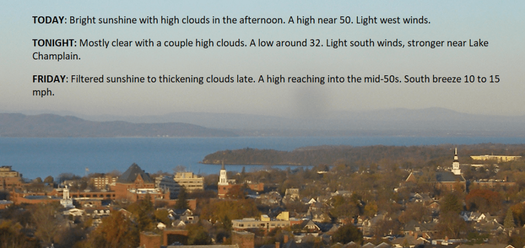
TODAY: Bright sunshine with high clouds in the afternoon. A high near 50. Light west winds.
TONIGHT: Mostly clear with a couple high clouds. A low around 32. Light south winds, stronger near Lake Champlain.
FRIDAY: Filtered sunshine to thickening clouds late. A high reaching into the mid-50s. South breeze 10 to 15 mph.
Looking further ahead
FRIDAY NIGHT: Overcast. A period of rain or showers becoming likely, moderate at times. A low 40 to 45.
SATURDAY: Morning rain showers mixing with wet snow, Blustery and sharply colder, with intervals of afternoon sunshine. Temperatures falling thru the 30s.
SUNDAY: Clouds with intervals of sun. Scattered snow showers or flurries with minor coatings. A low 20 to 25. A high mid to upper 30s.
MONDAY: Some clouds in northern areas early, then sunny. A low 20 to 25. A high of about 32 degrees.
TUESDAY: Increasingly cloudy & becoming breezy. Rising chance for accumulating wet snow & mixed precipitation. A low around 30. A high mid to upper 30s.
WEDNESDAY: Chance for rain or wet snow showers giving way to periods of sunshine. A low 25 to 30. A high in the low to mid-40s.
Average lows are mid-20s to 30. Average highs low to mid-40s
RH/11-16 forecast][end]

TONIGHT: Some cloudiness early, with a sprinkle Quebec border, then clear skies.A low in the lower 30s. Light southwest winds.
TOMORROW: Bright sunshine with a high clouds in the afternoon. A high near 50. Light west winds.
THURSDAY NIGHT: Mostly clear with a couple high clouds. A low around 32. Light south winds, stronger near Lake Champlain.

FRIDAY: Filtered sunshine to thickening clouds late. A high reaching into the mid-50s. South breeze 10 to 15 mph.
Looking further ahead
FRIDAY NIGHT: Overcast. A period of rain or showers likely, moderate at times beginning early. A low in the low 40s.
SATURDAY: Morning rain showers mixing with wet snow, Blustery and sharply colder, with intervals of afternoon sunshine. Temperatures falling thru the 30s.
SUNDAY: Clouds with intervals of sun. Scattered snow showers or flurries with minor coatings. A low 20 to 25. A high mid to upper 30s.

MONDAY: Partly cloudy northern areas early, then lots of sunshine. A low 20 to 25. A high about 32 degrees.
Average lows mid-20s to 30. Average highs low to mid 40s
RH/11-15 forecast][end]
TODAY: Sunshine filtered through high clouds, thickening at times this afternoon. A high near 45. South winds 10 mph, stronger near Lake Champlain.
TONIGHT: Partly cloudy.An isolated sprinkle near the Quebec border later this evening. A low 32 to 35. Light southwest winds.
THURSDAY: Sunshine filtered by high clouds. A high 45 to 50. Light west winds.
Looking further ahead
THURSDAY NIGHT: Mostly clear. A low around 30.
FRIDAY: Filtered sunshine thickening clouds late. A high reaching into the mid-50s.
SATURDAY: Widely scattered mountain flurries. Blustery and colder, with intervals of afternoon sunshine. Temperatures fall from the low 40s in the morning into the mid and upper 30s.
SUNDAY: Clouds with intervals of sun. Widely scattered flurries with minor coatings. A low 20 to 25. A high near 35.
MONDAY: Partly cloudy northern areas early, then lots of sunshine. A low in the low to mid-20s. A high near 32 degrees.
Average lows are mid-20s to 30. Average highs low to mid-40s
RH/11-15 forecast][end]

