Updated Wednesday Morning Forecast — November 29th, 2023

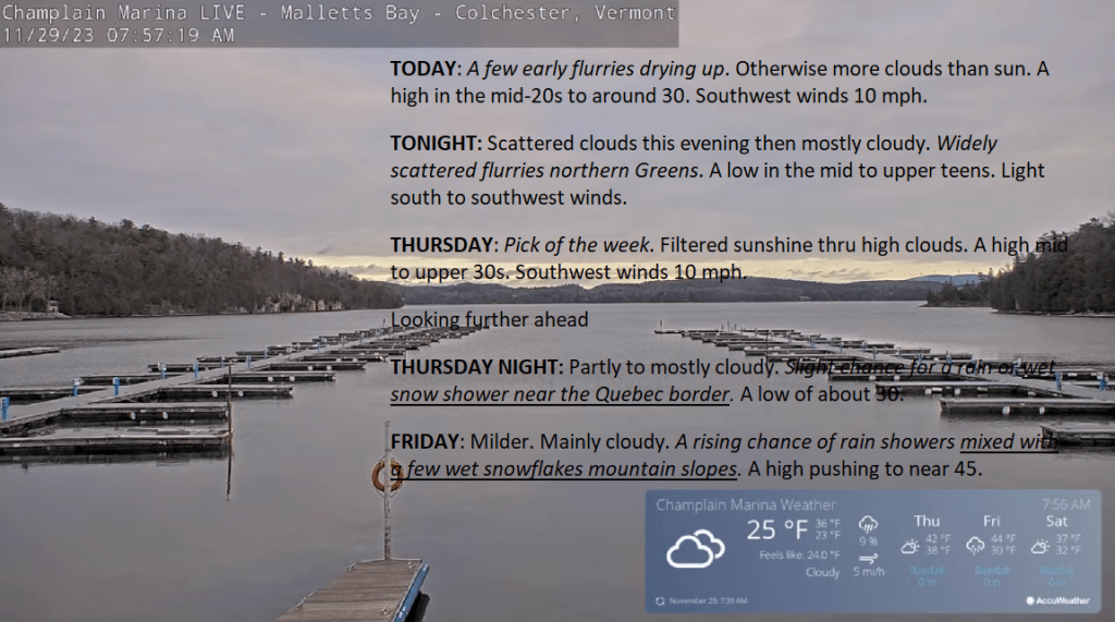
TODAY: A few early flurries drying up. Otherwise more clouds than sun. A high in the mid-20s to around 30. Southwest winds 10 mph.

TONIGHT: Scattered clouds this evening then mostly cloudy. Widely scattered flurries northern Greens. A low in the mid to upper teens. Light south to southwest winds.

THURSDAY: Pick of the week. Filtered sunshine thru high clouds. A high mid to upper 30s. Southwest winds 10 mph.

Looking further ahead

THURSDAY NIGHT: Partly to mostly cloudy.Slight chance for a rain or wet snow shower near the Quebec border.A low of about 30.
FRIDAY: Milder. Mainly cloudy. A rising chance of rain showers mixed with a few wet snowflakes mountain slopes. A high pushing to near 45.

SATURDAY: Mostly cloudy. An occasional rain shower mixed with wet snow in the higher terrain. A low 25 to 30. A high around 35.

SUNDAY: Gray. Chance for rain showers or a wintry mix mainly higher terrain. A low around 30. A high near 35.

MONDAY: Cloudy. Chance for wet snow or snow showers possibly significant…trending toward rain mid-morning on. A low upper 20s. A high in the mid-30s.

Average lows upper teens to mid-20s. Average highs mid-30s to around 40.

RH/11-27forecast][end]
Updated Tuesday Evening Forecast — November 28th, 2023

TONIGHT: Variable clouds northern areas, with a dusting to locally an inch from mountain lake effect flurries. Mostly clear with moonlit skies southern areas. A low in the teens. West winds 10 mph.

TOMORROW: Sun and clouds. A high in the mid to upper 20s. Southwest winds 10 mph.

WEDNESDAY NIGHT: Cloudy periods. A low in the mid to upper teens. Light south to southwest winds.

THURSDAY: Pick of the week. Bright sunshine becoming filtered thru high clouds in the afternoon. A high mid to upper 30s. Southwest winds 10 mph.

Looking further ahead

THURSDAY NIGHT: Partly to mostly cloudy.A low in the low 30s.

FRIDAY: Milder. Thickening clouds. A rising chance of rain showers mixing with wet snowflakes high terrain late. A high pushing to near 45.

SATURDAY: Clouds with intervals of sun. A low around 15. A high in the mid-30s.

SUNDAY: Gray. Chance for rain showers mixed with wet snow higher elevations. A low 15 to 20. A high in the mid-30s.

Average lows upper teens to mid-20s. Average highs mid-30s to around 40.

RH/11-27forecast][end]
Updated Tuesday morning Forecast — November 28th, 2023

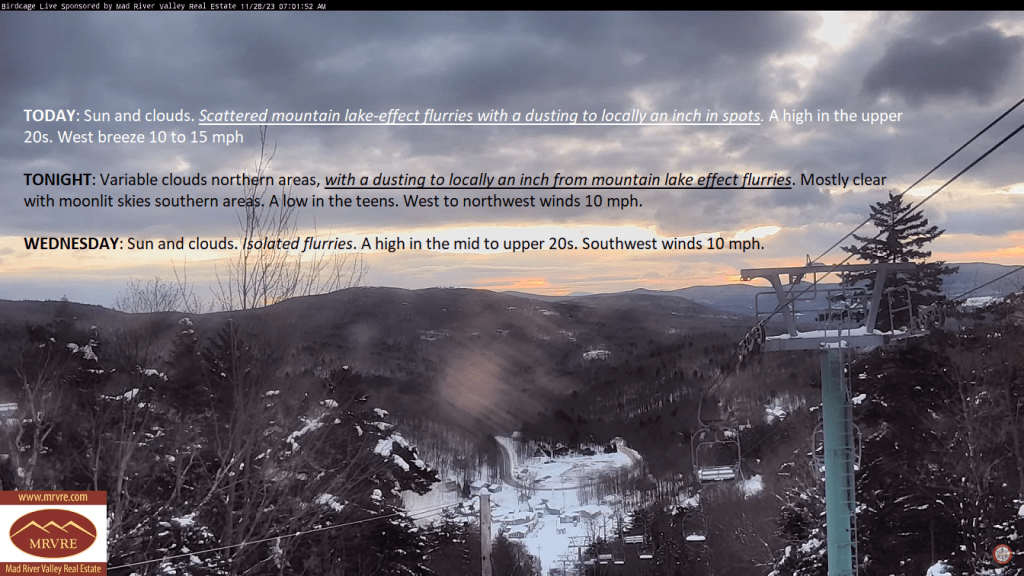
TODAY: Sun and clouds. Scattered mountain lake-effect flurries with a dusting to locally an inch in spots. A high in the upper 20s. West breeze 10 to 15 mph

TONIGHT: Variable clouds in northern areas, with a dusting to locally an inch from mountain lake effect flurries. Mostly clear with moonlit skies in southern areas. A low in the teens. West to northwest winds 10 mph.

WEDNESDAY: Sun and clouds. Isolated flurries. A high in the mid to upper 20s. Southwest winds 10 mph.

Looking further ahead

WEDNESDAY NIGHT: Cloudy periods. A low in the mid to upper teens.

THURSDAY: Pick of the week. Bright sunshine becomes filtered through high clouds in the afternoon. A high mid to upper 30s.

FRIDAY: Milder. Thickening clouds. A rising chance of rain showers mixing with wet snowflakes on high terrain late. A low around 30. A high pushing to near 45.

SATURDAY: Clouds with intervals of sun. A low around 15. A high in the mid-30s.

SUNDAY: Gray. Chance for rain showers mixed with wet snow at higher elevations. A low 15 to 20. A high in the mid-30s.

Average lows upper teens to mid-20s. Average highs are mid-30s to around 40.

RH/11-27forecast][end]
Updated Monday Evening Forecast — November 27th, 2023

TONIGHT: Scattered clouds & partially moonlit. Widely scattered flurries mainly central and northern Green Mountains with a minor coating. A low ranging mid to upper 20s. West to southwest winds 10 mph.

TOMORROW: Sun and clouds. Scattered mountain lake-effect flurries with minor coatings. A high upper 20s. West breeze 10 to 15 mph

TUESDAY NIGHT: Variable clouds northern areas. Moonlit skies southern areas. Isolated flurries. A low in the teens. West to northwest winds 10 mph.

WEDNESDAY: Sun and clouds. Isolated flurries. A high in the mid to upper 20s. Southwest winds 10 mph.

Looking further ahead

WEDNESDAY NIGHT: Cloudy periods. Isolated flurries. A low in the mid to upper teens.

THURSDAY: Pick of the week. Bright sun with few high clouds late. A high mid to upper 30s.

FRIDAY: Mainly gray. Scattered rain showers mixed with wet snowflakes high terrain. A low around 30. A high 40 to 45.

SATURDAY: Mixed clouds and sun. A low 15 to 20. A high in the mid-30s.

Average lows upper teens to mid-20s. Average highs mid-30s to around 40.

RH/11-27forecast][end]