TONIGHT: High cloudiness thickening up overnight. A low in the upper 20s. Light winds, becoming southeasterly 10 mph stronger Lake Champlain.
TOMORROW: Cloudy & gray. A high 40 to 45. Southeast winds 10 to 20 mph.
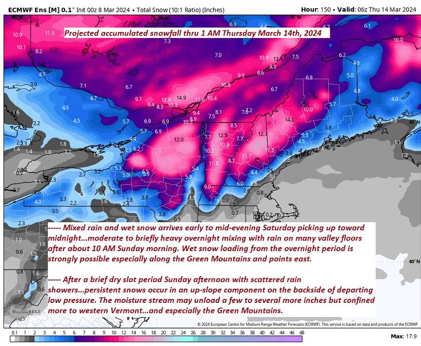
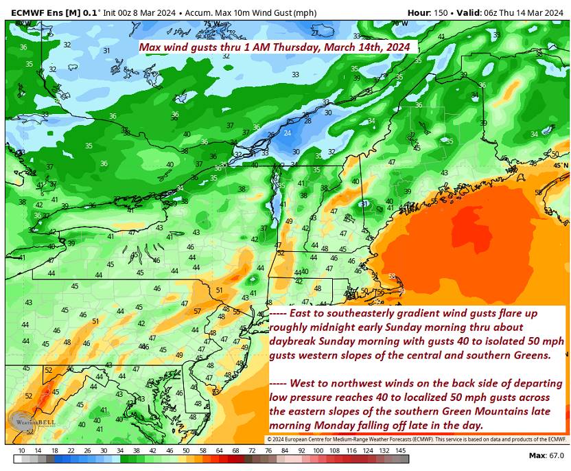
SATURDAY NIGHT: Overcast. Accumulating wet snow or a wintry mix…moderate to briefly heavy overnight. Rain and wet snow combination across western valley floors. A low 30 to 32. East to southeast winds 10 to 20 mph overnight strongest across central and southern Green Mountain western slopes.
SUNDAY: Cloudy. Wet snow…mixing with rain valley floors. Accumulations of a few to several slushy inches elevated terrain with lesser amounts many valley floors. An afternoon high in the upper 30s. Light north winds, becoming westerly 10 to 15 mph.
Looking further ahead
SUNDAY NIGHT: Lots of clouds. Mixed rain and wet snow showers changing to snow and especially western slope of the Green Mountains with a few additional inches locally.Blustery and colder.A low around 25.
MONDAY: Mainly cloudy. Chance for lingering snow showers with some additional accumulation. A high near freezing or 32 degrees. Gusty northwesterly winds.
TUESDAY: Some morning clouds then increasing sunshine. A low upper teens to mid-20s. A high in the upper 30s.
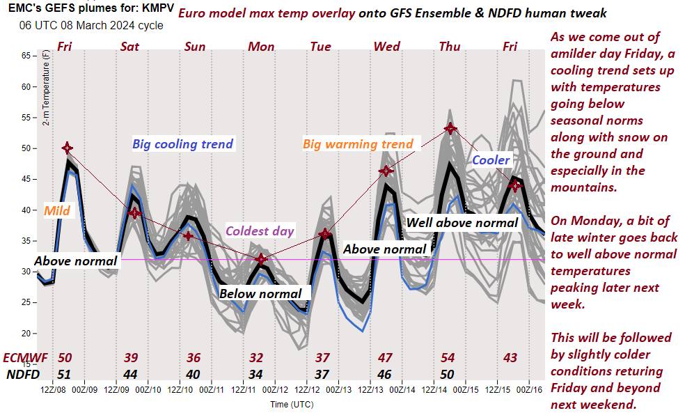
WEDNESDAY: Sunshine mixing with more clouds. A low near 10. A high 45 to 50.
Average lows ranges thru the teens. Average highs mid-30s to around 40.
RH/3-8forecast][end]