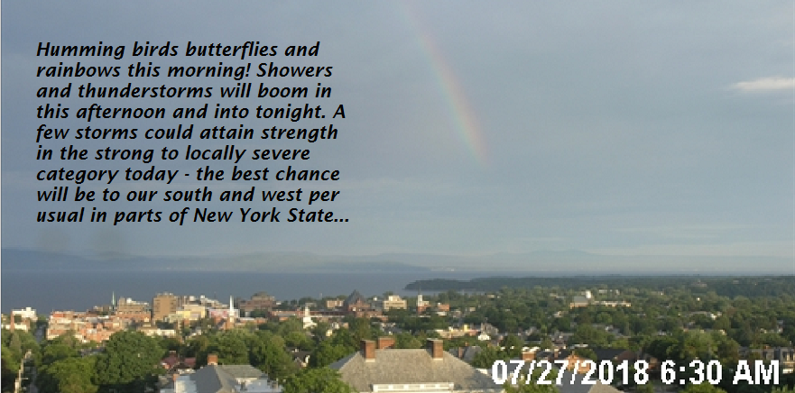
Updated Friday morning Forecast — July 27th, 2018

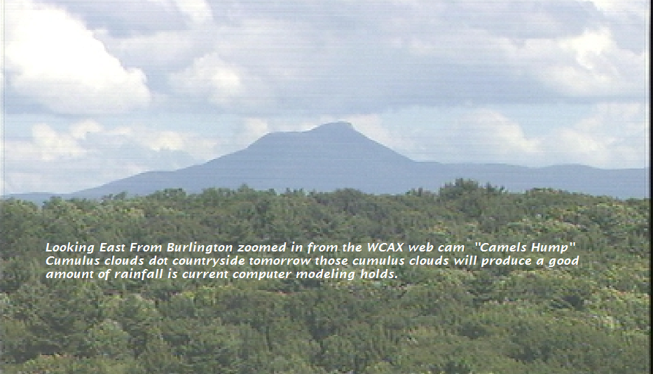
TODAY: Variably cloudy. A few showers toward the Champlain valley this morning. Partly sunny, warm and humid this afternoon. Showers and scattered thunderstorms, a few could be strong to locally severe. A high 80 to 85. Southwest breeze 10 to 20 mph

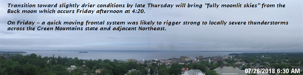
Full Buck Moon 4:20 PM Friday

TONIGHT: Chance for a few leftover shower and thunderstorms, Otherwise scattered clouds and moonlit skies. A low 60 to 65.. Light southwest winds.

SATURDAY: Sunshine mixing with afternoon clouds. A couple showers and thunderstorms with best chance toward eastern Vermont. A high 75 to 80. Southwest breeze 10 to 15 mph.

Looking further ahead…

SATURDAY NIGHT: A few clouds otherwise moistly clear and fully moonlit.

A low 55 to 60.

SUNDAY: Partly sunny. A high in the mid 70s.

MONDAY: Partly to mostly sunny. A low in the mid 50s. A high near 80.

TUESDAY: Sunshine giving way to high cloudiness. A low in the mid 50s. A high 80 to 85

WEDNESDAY & THURSDAY: Variably cloudy and sticky. Chance for afternoon showers and thunderstorms. Lows in the 60s. Highs in the 80s.

Average lows in the upper 50s to low 60s, Normal highs in the upper70s to low 80s.

RH/7-26[end]

Virus-free. www.avast.com

Updated Thursday Evening forecast — July 26th, 2018

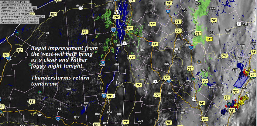
TONIGHT: Becoming mostly clear and fully moonlit. Patchy valley fog. A low near 60. Light southwest winds.

TOMORROW: Partly to mostly sunny, warm and humid. Widely scattered afternoon and early evening showers and thunderstorms, some could be strong. A high 80 to 85. Southwest breeze 10 to 20 mph

Full Buck Moon 4:20 PM Friday

FRIDAY NIGHT: Chance for an evening shower or storm , then just scattered clouds and moonlit skies. A low 60 to 65.. Light southwest winds.

SATURDAY: Sunshine mixing with afternoon clouds. A couple isolated showers possible. A high 75 to 80. Southwest breeze 10 to 15 mph.

Looking further ahead…

SATURDAY NIGHT: A few clouds otherwise moistly clear and fully moonlit.

A low 55 to 60.

SUNDAY: Partly sunny. A high in the mid 70s.

MONDAY: Partly to mostly sunny. A low in the mid 50s. A high 75 to 80.

TUESDAY: Sunshine giving way to high cloudiness. A low in the mid 50s. A high 80 to 85

WEDNESDAY: Variably cloudy. Chance for showers and afternoon thunderstorms. A low in the mid 60s. A high around 85.

Average lows in the upper 50s to low 60s, Normal highs in the upper70s to low 80s.

RH/7-26[end]

Virus-free. www.avast.com

Updated Thursday morning Forecast — July 26th, 2018

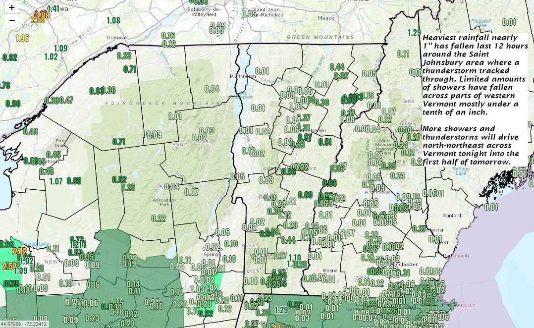
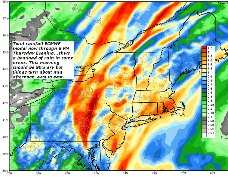
TODAY: Periods of rain this morning …becoming more showery. Chance for isolated to widely scattered showers and thunderstorms this afternoon with intervals of sunshine developing. Still muggy. A high around 80. Southwest breeze 10 mph.

TONIGHT: Evening clouds then mostly clear and fully moonlit. Patchy valley fog. A low near 60. Light southwest winds.

FRIDAY: Partly to mostly sunny, warm and humid. Widely scattered afternoon and early evening showers and thunderstorms, some could be strong. A high in the low 80s. Southwest breeze 10 to 15 mph.

Looking further ahead…

Full Buck Moon 4:20 PM Friday

FRIDAY NIGHT: Chance for an evening shower or storm , then just scattered clouds and moonlit skies. A low in the in the low 60s.

SATURDAY: Partly sunny. Maybe an isolated afternoon shower. A high 75 to 80.

SUNDAY: Partly to mostly sunny. A low in the mid to upper 50s. A high in the mid 70s.

MONDAY: Mixed clouds and sun. A low in the mid 50s. A high around 80.

TUESDAY: Mixed sun and clouds. A chance for showers and possible thunderstorms. A low in the mid 50s. A high 80 to 85

WEDNESDAY: Partly to mostly cloudy. Chance for showers and afternoon thunderstorms. A low in the 60s. A high in the 80s.

Average lows in the upper 50s to low 60s, Normal highs in the upper70s to mid 80s.

RH/7-26[end]

Virus-free. www.avast.com

Updated Wednesday Evening forecast — July 25th, 2018

TONIGHT: Mostly cloudy. Showers and embedded thunderstorms…some with heavy rainfall. A low 65 to 70. South breeze 10 mph.

TOMORROW: Showers with a chance for thunderstorms becoming isolated in the afternoon with partial sunshine. A high upper 70s to around 80. Southwest breeze 10 mph.

THURSDAY NIGHT: Mostly clear and fully moonlit. Patchy valley fog. A low 60 to 65. Light southwest winds.

Full Buck Moon 4:20 PM Friday

FRIDAY: Partly to mostly sunny warm and humid. Widely scattered afternoon and early evening showers and thunderstorms, some could be strong. A high in the low 80s. Southwest breeze 10 to 15 mph.

Looking further ahead…

FRIDAY NIGHT: Chance for an evening shower or storm , then just scattered clouds. A low in the upper 50s to low 60s.

SATURDAY: Partly sunny. Maybe an isolated afternoon shower. A high 75 to 80.

SUNDAY: Partly to mostly sunny. A low in the mid to upper 50s. A high in the mid to upper 70s.

MONDAY: Mixed clouds and sun. A low in the mid 50s. A high around 80.

TUESDAY: Increasingly cloudy. A chance for showers and possible thunderstorms. A low around 60. A high 75 to 80.

Average lows in the upper 50s to low 60s, Normal highs in the upper70s to mid 80s.

RH/7-25[end]

Virus-free. www.avast.com

Updated Wednesday morning forecast — July 25th, 2018

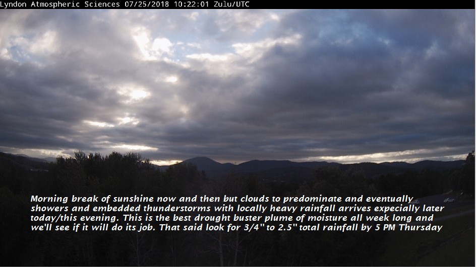
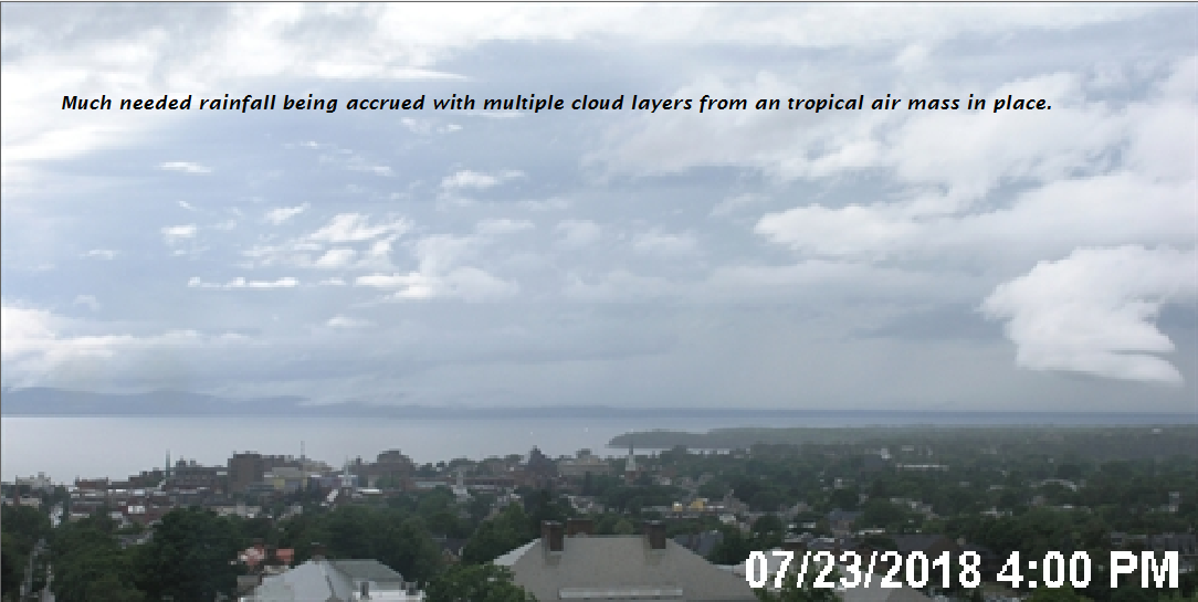
TODAY: A few breaks in the clouds this morning, otherwise mainly cloudy and continued muggy. A rising chance for showers and a few embedded thunderstorms developing this afternoon…some locally heavy. A high 75 to 80. Stiff south breeze 10 to 25 mph with a few higher gusts.

TONIGHT: Mostly cloudy. Showers and embedded thunderstorms…some with heavy rainfall. A low 65 to 70. South winds 10 to 15 mph

THURSDAY: Showers with a chance for thunderstorms in the morning becoming widely scattered in the afternoon with breaks of sunshine. A high 75 to 80. Southwest breeze 10 mph.

Looking further ahead…

THURSDAY NIGHT: Mostly clear and fully moonlit. Patchy valley fog. A low 60 to 65.

Full Buck Moon 4:20 PM Friday

FRIDAY: Partly to mostly sunny warm and humid. Widely scattered afternoon and early evening showers and thunderstorms, some could be strong. A high in the low 80s.

SATURDAY: Partly sunny. Widely scattered afternoon showers and thunderstorms. A low in the upper 50s to low 60s. A high 75 to 80.

SUNDAY: Partly sunny. A low in the mid to upper 50s. A high in the mid to upper 70s.

MONDAY: Mixed clouds and sun. A low in the mid 50s. A high around 80.

TUESDAY: Mostly cloudy. A chance for showers and possible thunderstorms. A low around 60. A high 75 to 80.

Average lows in the upper 50s to low 60s, Normal highs in the upper70s to mid 80s.

RH/7-25[end]

Virus-free. www.avast.com

Updated Tuesday Evening Forecast — July 24th, 2018

TONIGHT: Partly cloudy this evening with more clouds overnight . Very muggy. Patchy valley fog overnight. A low around 70. Southeast breeze 10 to 15 mph across the hills.

TOMORROW: Sunshine giving way to lots of afternoon clouds. Scattered late afternoon showers and thunderstorms, some locally heavy. A high in the low 80s. South breeze 10 to 20 mph.

WEDNESDAY NIGHT: Mostly cloudy. Showers and evening thunderstorms…some with heavy rainfall. A low 65 to 70. South winds 10 to 15 mph

THURSDAY: Showers with a chance for thunderstorms in the morning becoming widely scattered in the afternoon with breaks of sunshine. A high 75 to 80. Southwest breeze 10 mph.

Looking further ahead…

THURSDAY NIGHT: Becoming mostly clear. Patchy valley fog. A low around 60.

FRIDAY: Partly to mostly sunny warm and sticky. Widely scattered late afternoon and evening showers and thunderstorms, some could be strong. A high 80 to 85.

SATURDAY: Partly sunny. Isolated afternoon showers and thunderstorms. A low in the upper 50s to low 60s. A high 75 to 80.

SUNDAY: Partly sunny. A low in the 50s. A high in the 70s.

Average lows in the upper 50s to low 60s, Normal highs in the upper70s to mid 80s.

RH/7-23[end]

Virus-free. www.avast.com

Updated Tuesday morning Forecast — July 24th, 2018

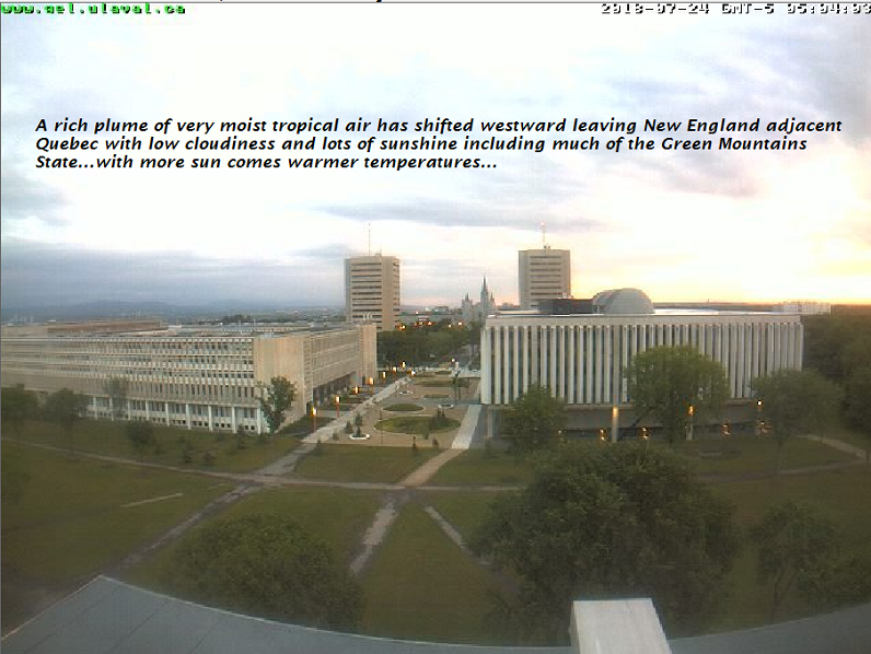
TODAY: Mixed clouds and sun. Maybe an isolated shower southern Green Mountains. Warmer and very sultry with a high around 85. South breeze 10 to 20 mph.

TONIGHT: Partly cloudy. Patchy valley fog. A low upper 60s to low 70s. Southeast breeze 10 to 15 mph.

WEDNESDAY: Sunshine giving way to lots of afternoon clouds. Scattered late afternoon showers and thunderstorms, some locally heavy. A high in the low 80s. South breeze 10 to 20 mph.

Looking further ahead…

WEDNESDAY NIGHT: Mostly cloudy. Showers and evening thunderstorms…some with heavy rainfall. A low 65 to 70.

THURSDAY: Showers with a chance for thunderstorms in the morning becoming widely scattered in the afternoon with breaks of sunshine. A high 75 to 80.

FRIDAY: Partly to mostly sunny warm and sticky. Widely scattered late afternoon and evening showers and thunderstorms, some could be strong. A low around 60. A high 80 to 85.

SATURDAY: Partly sunny. Isolated afternoon showers and thunderstorms. A low in the upper 50s to low 60s. A high 75 to 80.

SUNDAY: Morning sunshine gives way to afternoon cloudiness. A low in the 50s. A high in the 70s.

Average lows in the upper 50s to low 60s, Normal highs in the upper70s to mid 80s.

RH/7-23[end]

Virus-free. www.avast.com

Updated Monday Evening Forecast — July 23rd, 2018

TONIGHT: Chance for early evening showers, otherwise partly to mostly cloudy. A lowin the upper 60s to around 70. Southeast breeze 10 mph.

TOMORROW: Morning fog burns to a mix of clouds and sunshine. An isolated afternoon shower possible toward southern areas. A high around 85. South breeze 10 to 20 mph.

TUESDAY NIGHT: Partly cloudy. Patchy valley fog. A low upper 60s to low 70s. Southeast breeze 10 to 15 mph.

WEDNESDAY: Morning fog, then sunshine giving way to afternoon clouds. Widely scattered late afternoon showers and thunderstorms. Some locally heavy. A high 80 to 85. South breeze 10 to 20 mph.

Looking further ahead…

WEDNESDAY NIGHT: Variable clouds. Chance for showers and evening thunderstorms…some locally heavy. A low 65 to 70.

THURSDAY: Morning clouds giving way to partial afternoon sunshine. Chance for showers and isolated thunderstorms. A high in the low 80s.

FRIDAY: Partly to mostly sunny warm and sticky. Scattered late afternoon and evening showers and thunderstorms, some could be strong. A low 60 to 65. A high 80 to 85.

SATURDAY: Partly sunny. A low in the upper 50s to low 60s. A high 75 to 80.

Average lows in the upper 50s to low 60s, Normal highs in the upper70s to mid 80s.

RH/7-23[end]

Virus-free. www.avast.com

Updated Monday morning forecast — July 23rd, 2018

TODAY: Considerable cloudiness with an occasional break of sun. Muggy. Scattered showers with an isolated thunderstorm or two especially southern Vermont this afternoon. A high 75 to 80. South to southeast winds 10 to 15 mph.

TONIGHT: Chance for an early evening shower or storm, Otherwise mostly cloudy and sticky. Lows in the upper 60s to around 70. Southeast breeze 10 mph.

TUESDAY: Morning fog then mixed clouds and sunshine. Slight chance for a shower. A high around 85. South breeze 10 to 15 mph.

Looking further ahead…

TUESDAY NIGHT: Partly cloudy. Patchy valley fog. A low around 70.

WEDNESDAY: Morning fog, then sunshine giving way to afternoon clouds. Widely scattered late afternoon & evening showers and thunderstorms. Some locally heavy. A high 80 to 85.

THURSDAY: Lots of with chance for showers and thunderstorms some locally heavy. A low 65 to 70. A high upper 70s to low 80s.

FRIDAY: More sun than clouds continued warm and sticky. Scattered late afternoon and evening showers and thunderstorms. A low 60 to 65. A high in the upper 70s to mid 80s.

Average lows in the upper 50s to low 60s, Normal highs in the upper70s to mid 80s.

RH/7-23[end]

Virus-free. www.avast.com

Updated Friday Evening forecast — July 20th, 2018

TONIGHT: Clear a little humid. A low upper 50s to around 60. Light southeast winds.

TOMORROW: Sunshine through mid afternoon then thickening high clouds. A high near 85. Southeast winds 10 mph.

SATURDAY NIGHT: Thickening clouds…leading to a chance for showers toward daybreak. A low around 60. Southeast breeze 10 mph.

Halfway point of meteorological summer July 22nd Sunday…

SUNDAY: Clouds with a few intervals of sunshine. Humid and breezy at times. Chance for showers with isolated afternoon thunderstorms. A high mid to upper 70s. Southeast breeze 10 to 20 mph.

Looking further ahead…

SUNDAY NIGHT: Variably cloudy with slight chance for a shower. A low in the low 60s.

MONDAY: Partly sunny after morning fog. Scattered showers and afternoon thunderstorms some locally heavy. A high in the mid 70s.

TUESDAY: Morning fog then partly to mostly sunny. Widely scattered afternoon & early evening showers and thunderstorms. Lows in the upper 60s. A high near 80.

WEDNESDAY: Morning fog, then more sunshine than clouds. widely scattered afternoon & early evening showers and thunderstorms. Lows near 70. A high in the mid to upper 70s.

THURSDAY: Morning fog burns off to lots of clouds. Chance for showers and thunderstorms. A low 65 to 70. A high in the mid 70s.

Average lows in the upper 50s to low 60s, Normal highs in the upper70s to mid 80s.

RH/7-20[end]

Virus-free. www.avast.com