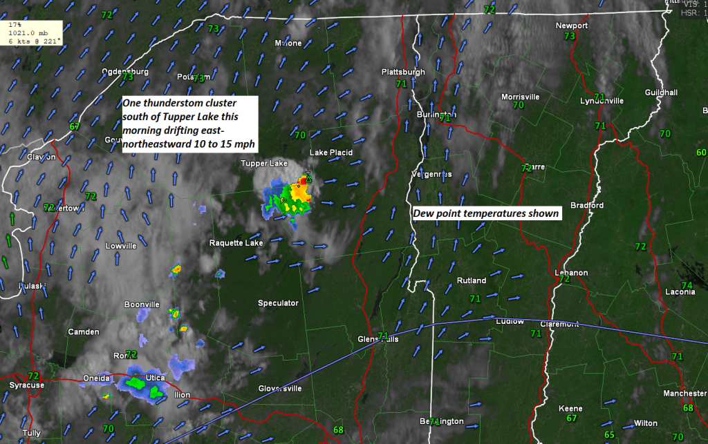
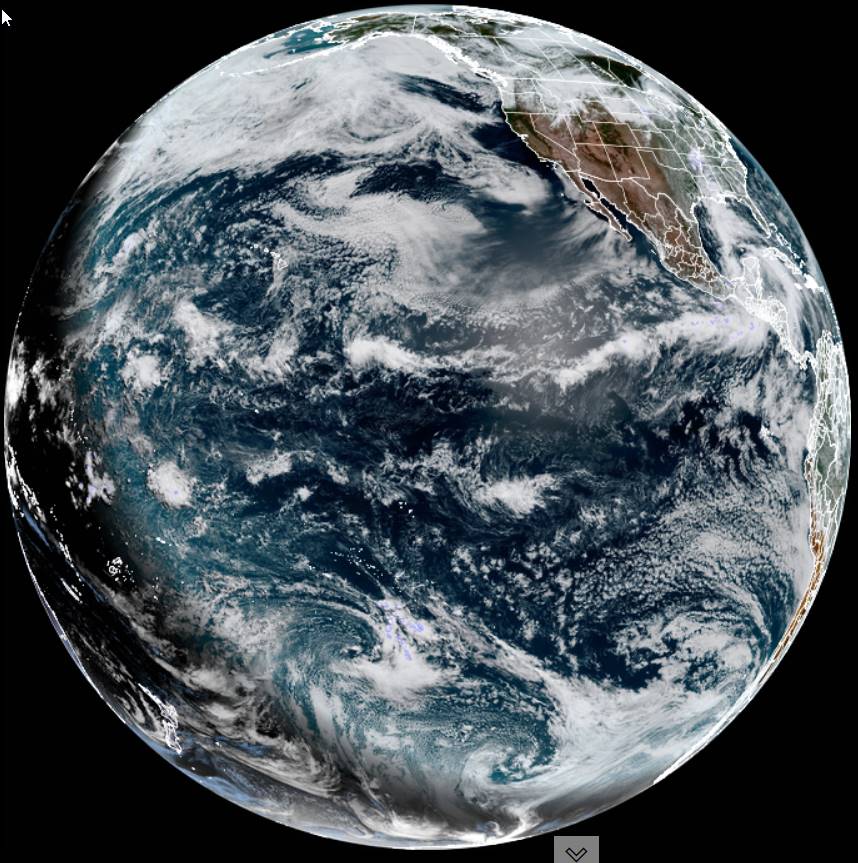
Thunderstorm cluster in the ‘Dacks will slowly work toward the southern Champlain valley but could dissipate well before reaching.

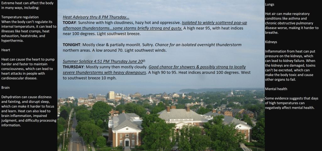
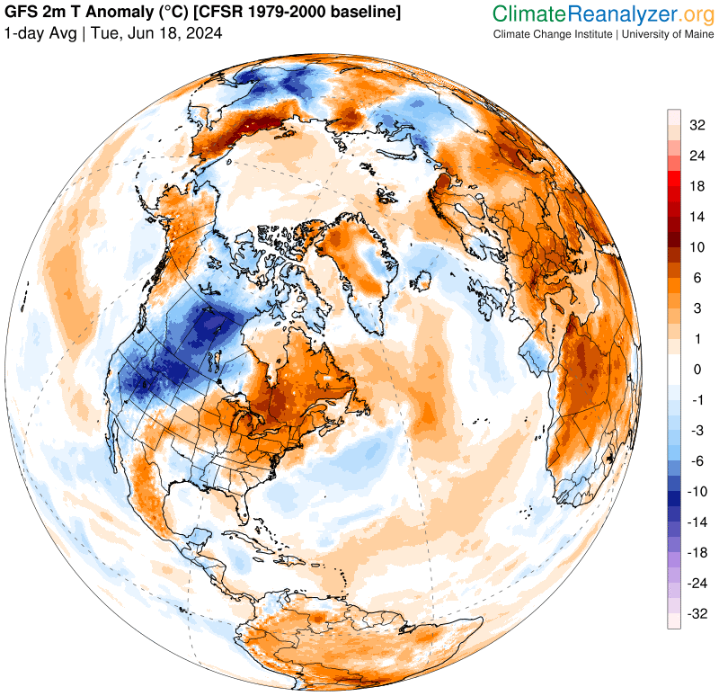
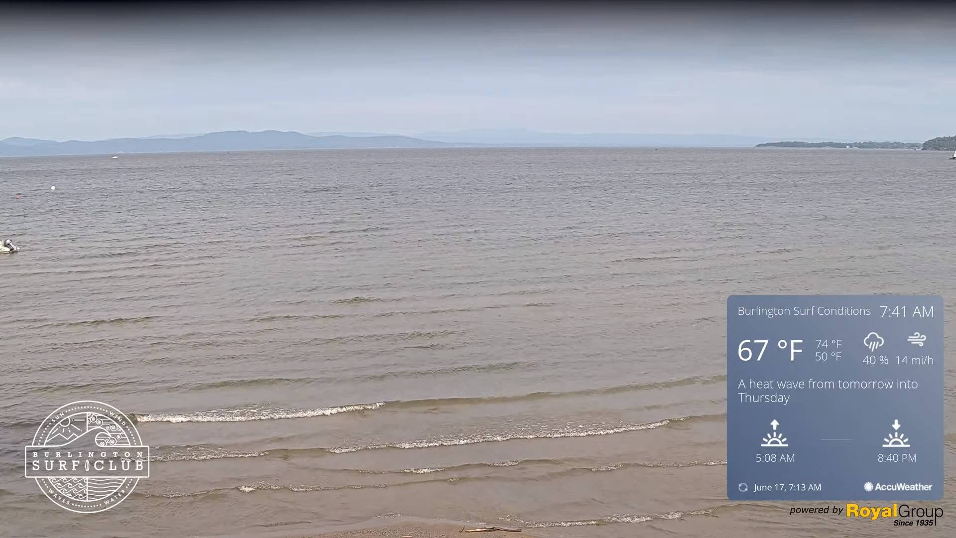
Heat Advisory thru 8 PM Thursday…
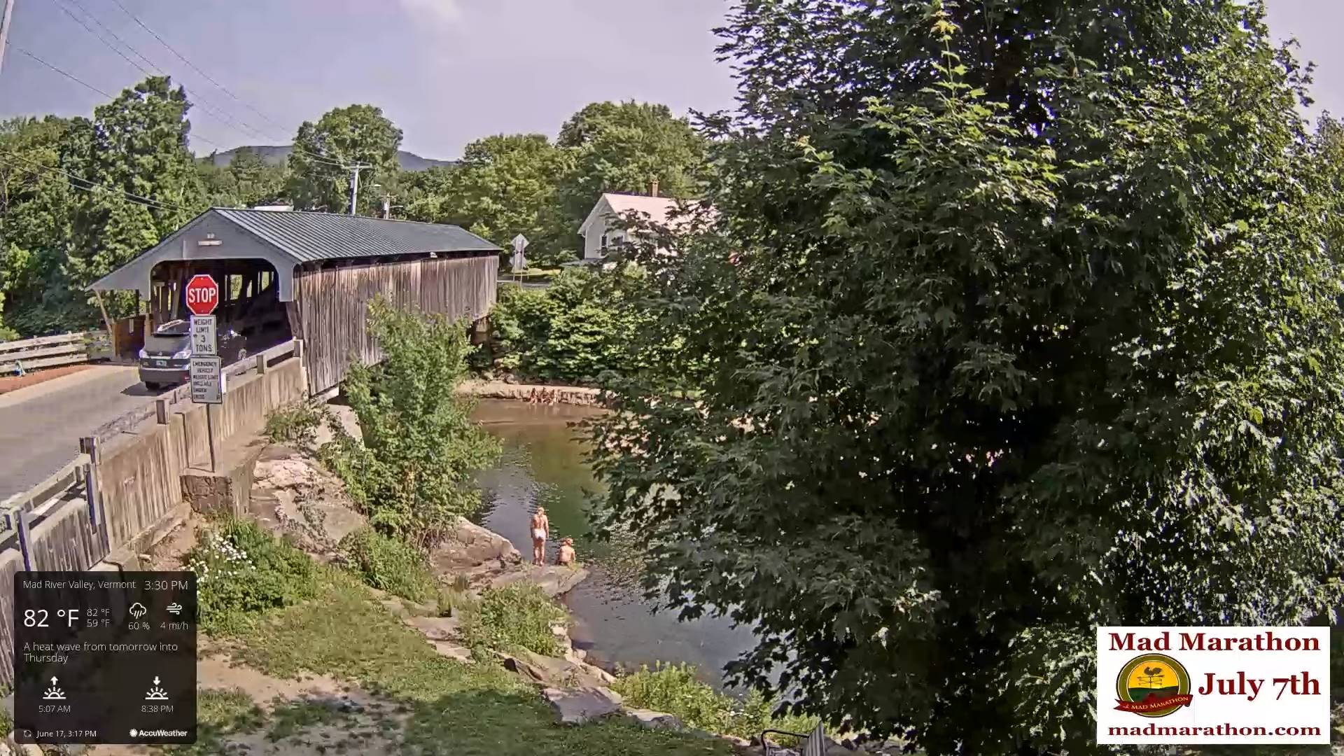
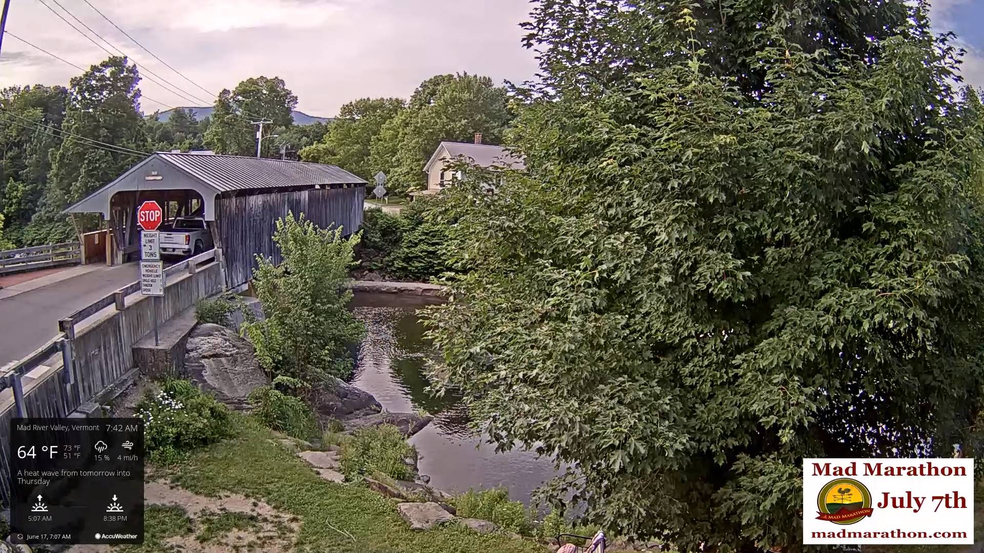
TODAY: Sunshine with high cloudiness, hazy hot and oppressive. Isolated to widely scattered pop-up afternoon thunderstorms…some storms briefly strong and gusty. A high near 95, with heat indices near 100 degrees. Light southwest breeze.
TONIGHT: Mostly clear & partially moonlit. Sultry. Chance for an isolated overnight thunderstorm northern areas. A low around 70. Light southwest winds.
Summer Solstice 4:51 PM Thursday June 20th
THURSDAY: Mostly sunny then mostly cloudy. Good chance for showers & possibly strong to locally severe thunderstorms with heavy downpours. A high 90 to 95. Heat indices around 100 degrees. West to southwest breeze 10 mph.
Looking further ahead
THURSDAY NIGHT: Partly to mostly cloudy. Scattered evening showers and thunderstorms becoming isolated overnight. A low 65 to 70.
Full Strawberry Moon 9:08 PM Friday evening
FRIDAY: Mostly cloudy, not as hot, but still sticky. Good chance for morning showers and thunderstorms lingering into the afternoon southern areas. Some partial late afternoon sun north. A high upper 70s near 80.
SATURDAY: Considerable cloudiness cooler, and refreshingly less humid. Chance for showers late western areas. A low mid-50s. A high upper 70s.
SUNDAY: More clouds than sun. Scattered showers & possible afternoon thunder. A low around 60. A high near 80.
Average lows in the low to mid 50s. Average high mid to upper 70s
RH/6-17forecast][end]
Heat Advisory thru 8 PM Thursday…
TONIGHT: Some high cloudiness, otherwise mostly clear warm and sticky. A low mid to upper 60s & around 70 to 75 Champlain Valley. Light south to southwest winds.
TOMORROW: Sunshine with more afternoon clouds, hazy hot and very oppressive. Widely scattered pop-up afternoon thunderstorms northern ½ of the state. Some storms briefly strong. A high near 95, with heat indices near 100 degrees. Light southwest breeze.
WEDNESDAY NIGHT: Mostly clear & partially moonlit. Sultry. Chance for an isolated overnight thunderstorm northern areas. A low around 70. Light southwest winds.

Summer Solstice 4:51 PM Thursday June 20th
THURSDAY: Mostly sunny then mostly cloudy. Good chance for showers & possibly strong to locally severe thunderstorms with heavy downpours. A high 90 to 95. Heat indices around 100 degrees. West to southwest breeze 10 mph.
Looking further ahead

THURSDAY NIGHT: Partly to mostly cloudy. Scattered evening showers and thunderstorms becoming isolated overnight. A low 65 to 70.
Full Strawberry Moon 9:08 PM Friday evening
FRIDAY: Mostly cloudy, not as hot, but still sticky. Good chance for morning showers and thunderstorms lingering into the afternoon southern areas. Some partial late afternoon sun north. A high upper 70s near 80.
SATURDAY: Considerable cloudiness cooler, and refreshingly less humid. Chance for showers late western areas. A low mid-50s. A high upper 70s.

SUNDAY: More clouds than sun. Scattered showers & possible afternoon thunder. A low around 60. A high near 80.
Average lows in the low to mid 50s. Average high mid to upper 70s

RH/6-17forecast][end]
Heat Advisory Noon today thru 8 PM Thursday…
TODAY: Sunshine with high clouds, hot and sticky. Isolated afternoon pop-up thunderstorms northwestern and southeastern Vermont. A high 90 to 95, heat indices nearing 100 degrees. Southwest breeze 10 mph.
TONIGHT: Some high cloudiness, otherwise mostly clear warm and sticky. A low mid to upper 60s & around 70 to 75 Champlain Valley. Light south to southwest winds.
WEDNESDAY: Sunshine with more afternoon clouds, hazy hot and very oppressive. Widely scattered pop-up afternoon thunderstorms northern ½ of the state. Some storms briefly strong. A high about 95, with heat indices near 100 degrees. Light southwest breeze.
Looking further ahead
WEDNESDAY NIGHT: Mostly clear & partially moonlit. Sultry. Chance for an isolated overnight thunderstorm northern areas. A low about 70.
Summer Solstice 4:51 PM Thursday June 20th
THURSDAY: Mostly sunny with afternoon clouds. Good chance for showers & possibly strong to locally severe thunderstorms with heavy downpours. A high near 95. Heat indices around 100 degrees.
Full Strawberry Moon 9:08 PM Friday evening
FRIDAY: Mostly cloudy, not as hot, but still sticky. Good chance for morning showers and thunderstorms lingering into the afternoon southern areas. Some partial late afternoon sun north. A low upper 60s around 70. A high upper 70s around 80.
SATURDAY: Considerable mid and high cloudiness otherwise fair, dry, and refreshingly less humid. A low around 55. A high around 75.
Average lows in the low to mid 50s. Average high mid to upper 70s
RH/6-17forecast][end]

TONIGHT: A few high clouds, otherwise mostly clear & muggy. A low in the mid-60s. Light south winds.
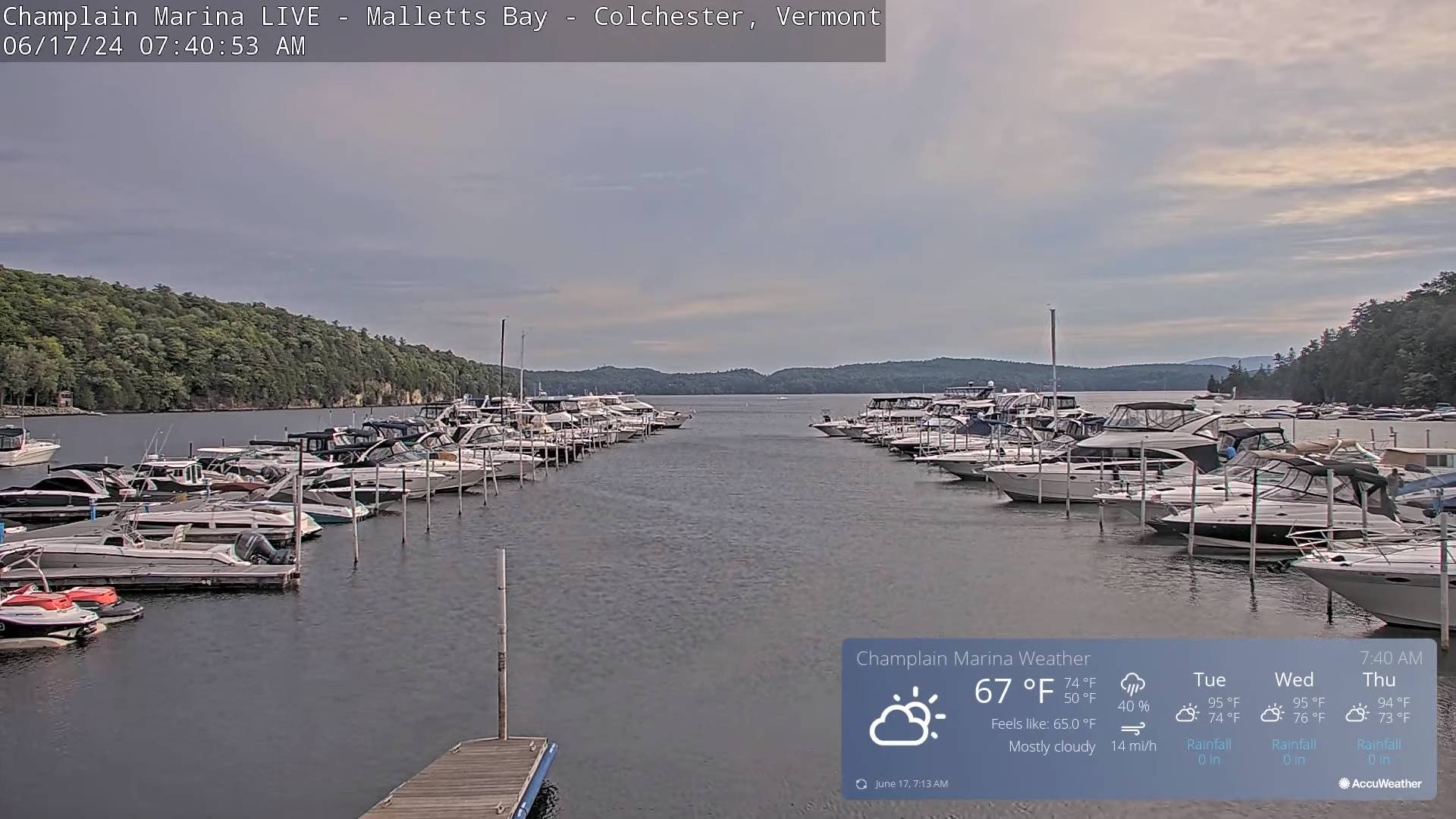
Heat Advisories…Noon Tuesday thru Thursday…
TOMORROW: Mostly sunny, hazy hot and humid. Maybe an isolated afternoon thunderstorm far northwest & far southeast Vermont. A high in the low 90s, heat indices near 100 degrees. Southwest breeze 10 mph.
TUESDAY NIGHT: Some high cloudiness, otherwise mostly clear warm and sticky. A low 65 to 70. Light south to southwest winds.
WEDNESDAY: Sunshine with more afternoon clouds, hazy hot and very oppressive. Widely scattered afternoon thunderstorms develop Champlain Valley and northern ½ of the state. A high about 95, with heat indices near 100 degrees. Light southwest breeze.
Looking further ahead
WEDNESDAY NIGHT: Mostly clear & partially moonlit. Sultry. Slight chance for an isolated overnight thunderstorm north. A low about 70.
Summer Solstice 4:51 PM Thursday June 20th
THURSDAY: Mostly sunny with afternoon clouds. Good chance for showers strong thunderstorms locally heavy. A high near 95. Heat indices around 100 degrees.
Full Strawberry Moon 9:08 PM Friday evening
FRIDAY: Mostly cloudy, not as hot but still very muggy. Widely scattered showers and afternoon thunderstorms mainly southern areas. Some partial late afternoon sun north. A low upper 60s around 70. A high upper 70s around 80.
SATURDAY: Considerable mid and high cloudiness otherwise fair, dry, and refreshingly less humid. A low around 55. A high around 75.
Average lows in the low to mid 50s. Average high mid to upper 70s
RH/6-17forecast][end]
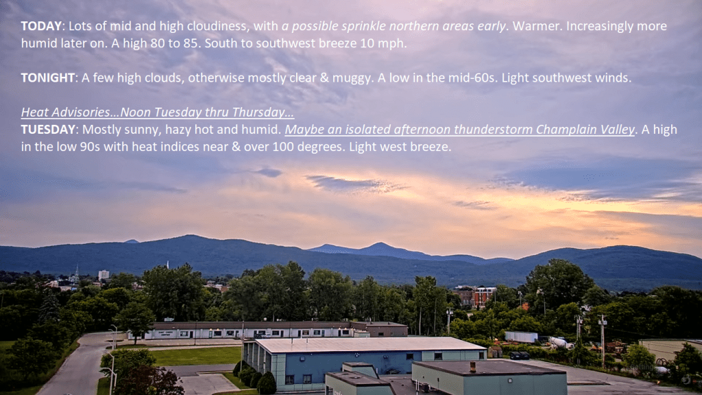
TODAY: Lots of mid and high cloudiness, with a possible sprinkle northern areas early. Warmer. Increasingly more humid later on. A high 80 to 85. South to southwest breeze 10 mph.
TONIGHT: A few high clouds, otherwise mostly clear & muggy. A low in the mid-60s. Light southwest winds.
Heat Advisories…Noon Tuesday thru Thursday…
TUESDAY: Mostly sunny, hazy hot and humid. Maybe an isolated afternoon thunderstorm Champlain Valley. A high in the low 90s with heat indices near & over 100 degrees. Light west breeze.
Looking further ahead’
TUESDAY NIGHT: A few high clouds, otherwise mostly clear warm and sticky. A low 65 to 70.
WEDNESDAY: Mixed clouds and hazy sunshine. Hot and oppressive. Maybe an isolated thunderstorm Champlain Valley. A low mid to upper 60s. A high around 95, with heat indices over 100 degrees.
Summer Solstice 4:51 PM Thursday June 20th
THURSDAY: Mostly sunny with afternoon clouds. Widely scattered afternoon thunderstorms. A low around 70. A high in the mid-90s. Heat indices over 100 degrees.
FRIDAY: Becoming partly to mostly cloudy, not as hot but still muggy. Widely scattered showers and afternoon thunderstorms. A low 65 to 70. A high in the low 80s.
Average lows in the low to mid 50s. Average high mid to upper 70s
Full Strawberry Moon 9:08 PM Friday June 21st…
RH/6-17forecast][end]