TODAY: Overcast with areas of dense fog and patchy drizzle this morning. More showers southern areas this afternoon spreading north late. A high mid-50s to low 60s. Little wind.
TONIGHT: Cloudy. Rain showers, moderate at times. Areas of fog. A low around 45. Light winds.
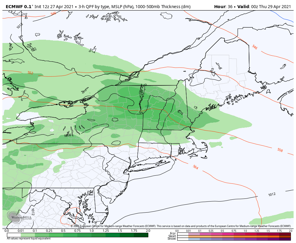
FRIDAY: Mainly cloudy with a few breaks of sun, blustery to windy at times and colder. Occasional rain showers…mixed with wet snow accumulation across the high terrain late. A high 50 to 55. West winds 10 to 20 mph…stronger southern Green Mountains.
Looking further ahead…
FRIDAY NIGHT: Cloudy. Rain…transitions to wet accumulating snow briefly moderate at times…coating higher terrain roads, especially grassy surfaces down to valley floors. Pockets of slippery slushy travel. A low 32 to 35.
SATURDAY: Any isolated mountain snow showers exiting. Blustery at times. A high upper 40s to around 50.
SUNDAY: Clouds mixing with periods of sunshine, and a little milder. A low around 35. A high near 60.
MONDAY: Mixed clouds and sun. Maybe a late day shower. A low around 45. A high near 65.
Average low 35 to 40. Average highs upper 50s to low 60s.
Start of Meteorological Summer June 6th… Summer peaks approx.. July 22nd based off local climatology.
RH/4-29category forecast][end]