Updated Monday Evening Forecast — July 18th, 2022

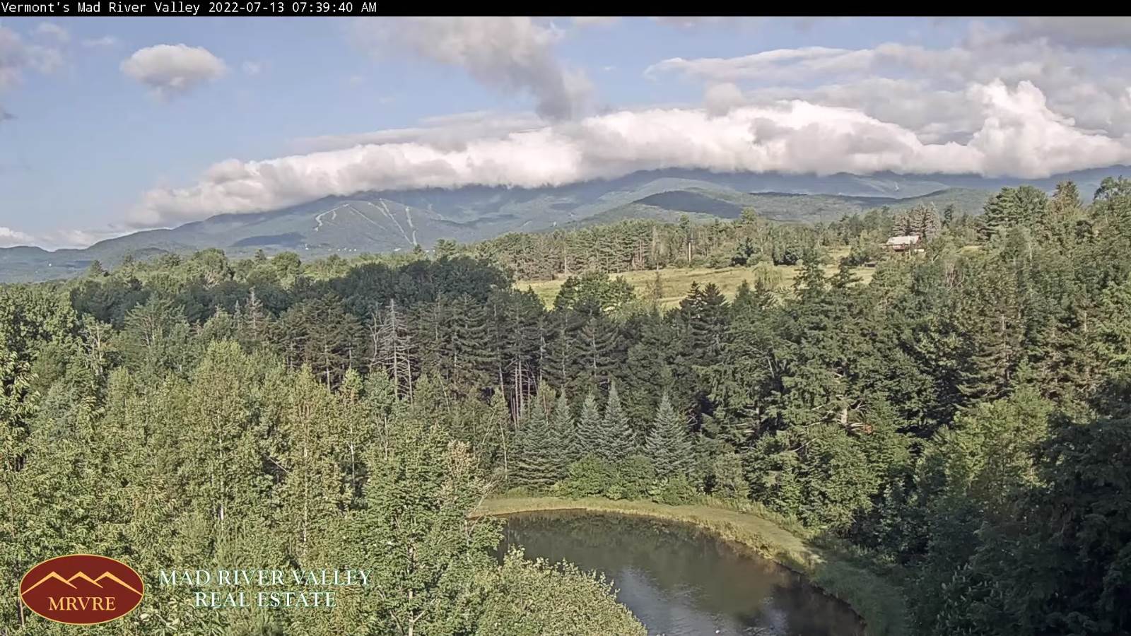
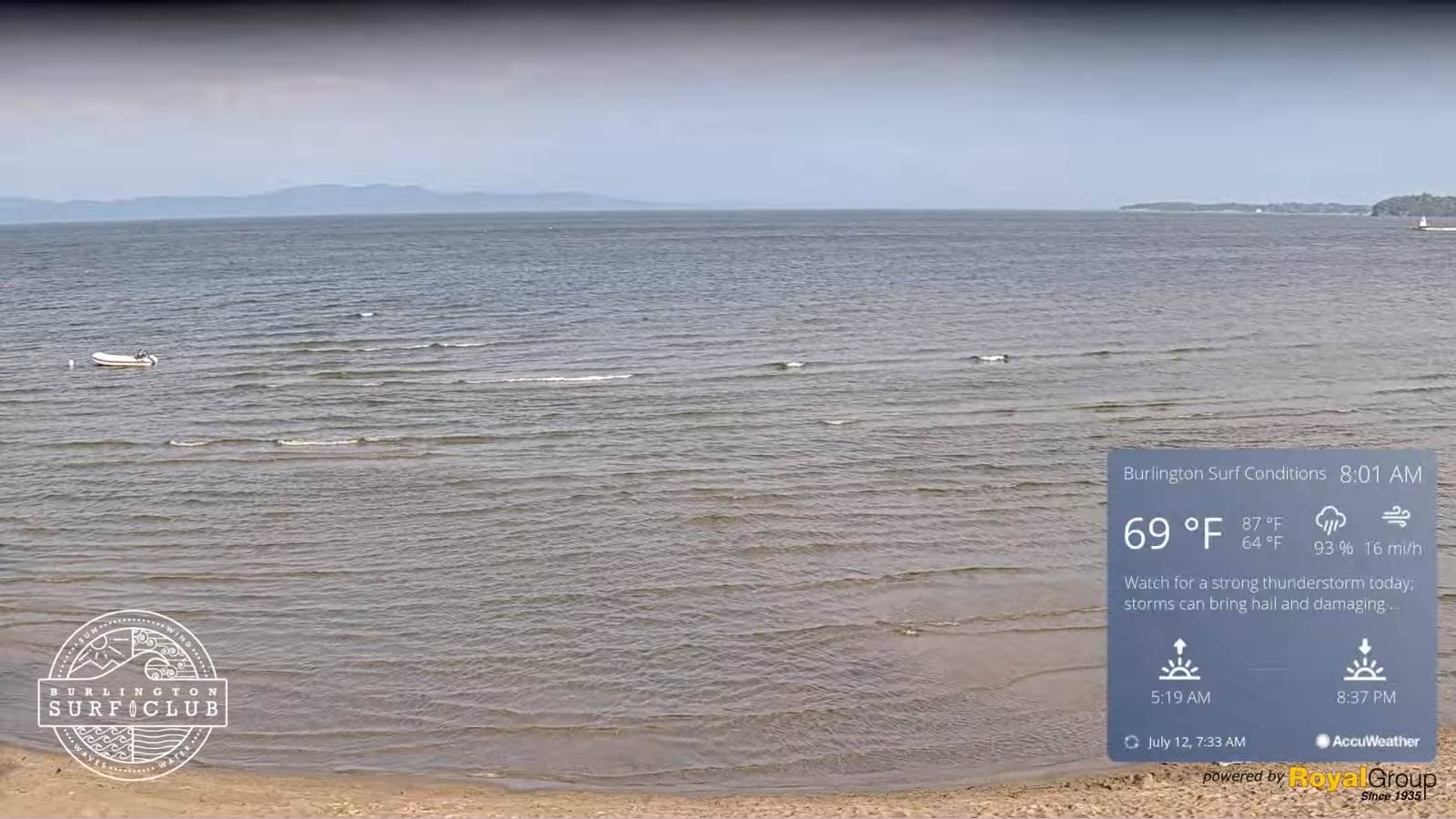
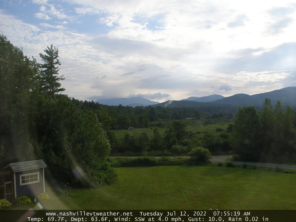
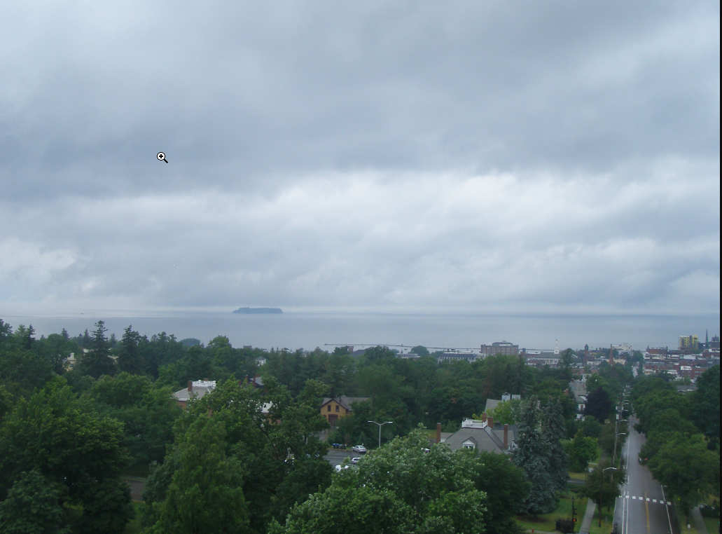
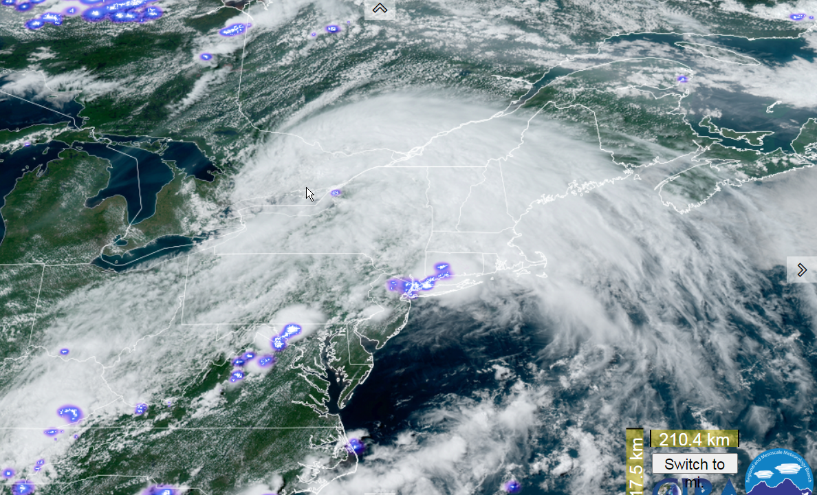
TONIGHT: Considerable cloudiness. Showers, with an embedded thunderstorm possible for a time this evening. A low

around 65. West to southwest breeze 10 to 15 mph.

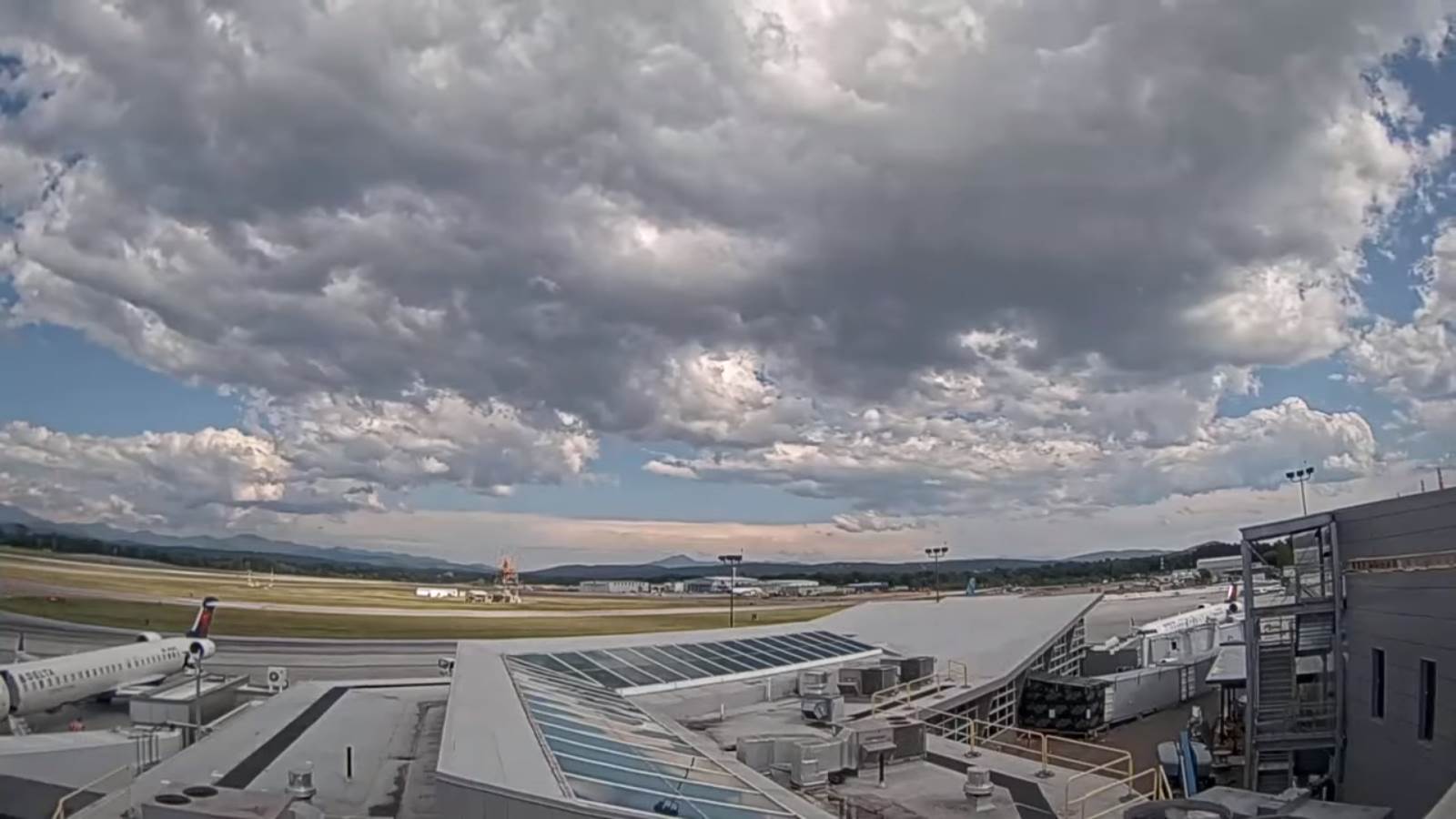
TOMORROW: Lots of morning clouds, then periods of afternoon sunshine. Widely scattered showers and thunderstorms mainly northern, and eastern areas. One or two storms possibly strong and locally heavy. A high 80 to 85. West breeze 10 to 20 mph.

TUESDAY NIGHT: Scattered cloudswith a leftover shower or thunderstorm. Patchy valley fog. A low 60 to 65.Light southwest winds.

WEDNESDAY: Partly sunny after morning fog. Maybe a late day thunderstorm far western areas. A high upper 80s to around 90.Light southwest breeze.

Looking Further Ahead…

WEDNESDAY NIGHT: Scattered clouds. A low around 70.

THURSDAY: Variably cloudy. Scattered afternoon and evening showers and thunderstorms…some could be strong to locally severe. A high in the mid-80s.

Approximate peak of climatological summer, or half way point…

FRIDAY: Pick of the week. Lots of sunshine. A low in the lower 60s. A high around 85.

SATURDAY: Partly sunny. Slight chance for shower or storm. A low 60 to 65. A high near 85.

Average lows 60 to 65. Average highs upper-70s to low 80s. Peak of summer

RH/7-15[forecast][end]

Updated Monday morning Forecast — July 18th, 2022

TODAY: Thickening clouds, leading to periods of rain this early afternoon, moderate at times with a rumble of thunder possible late toward Rutland. A high in the upper 70s. Southwest 10 mph.

TONIGHT: Considerable clouds. Showers, with an embedded thunderstorm possible. A low around 65. Winds becoming westerly 10 to 20 mph overnight and gusty.

TUESDAY: Lots of morning clouds, then periods of afternoon sunshine. Widely scattered showers and thunderstorms mainly northern, and eastern areas. One or two storms possibly strong and locally heavy. A high 80 to 85. West breeze 10 to 15 mph.

Looking Further Ahead…

TUESDAY NIGHT: Scattered cloudswith a leftover shower or thunderstorm. Patchy valley fog. A low 60 to 65.

WEDNESDAY: Partly to mostly sunny. Maybe a late day thunderstorm far western areas. A high around 90.

THURSDAY: Mixed sun and clouds. Scattered afternoon and evening showers and thunderstorms…some could be strong to locally severe. A low in the upper 60s to around 70. A high in the mid to upper 80s.

FRIDAY: Mostly sunny and a beauty warm summer day. A low near 60. A high in the mid to upper 80s.

SATURDAY: Partly sunny. Slight chance for shower or storm. A low around 60. A high 80 to 85.

Average lows mid-50s to low 60s. Average highs upper-70s to low 80s.

RH/7-15[forecast][end]

Updated Friday Evening Forecast — July 15th, 2022

TONIGHT: Fair early then increasing/thickening high clouds. A low near 55. Light southeast winds.

TOMORROW: High cloudiness early, gives way to lots of afternoon sunshine central and northern areas. Warmer & more humid. A high 80 to 85. Southwest breeze 10 mph.

SATURDAY NIGHT: Mostly clear with some high cloudiness. A low 55 to 60. Light south winds.

SUNDAY: Sunshine with some high cloudiness. Humid. An isolated shower or thunderstorm. Warmer. A high around 85. West to northwest breeze 10 mph.

Looking further ahead…

SUNDAY NIGHT: Mostly clear. A low in the lower 60s.

MONDAY: Filtered sun then variable cloudiness and muggy. Showers & thunderstorms developing in the afternoon into Monday night…possibly heavy at times A high in the upper 80s to near 90.

TUESDAY: Sunshine mixing with afternoon clouds. Widely scattered afternoon showers and thunderstorms. A low in the

mid-60s. A high 80 to 85.

WEDNESDAY: Morning clouds then partly sunny Kind of muggy. A low in the low 60s. A high near 85.

Average lows mid-50s to low 60s. Average highs upper-70s to low 80s.

RH/7-15[forecast][end]

Updated Friday Morning Forecast — July 15th, 2022

TODAY: Morning fog burns off to a beauty. Sunshine with some afternoon clouds. Comfortable. A high mid to upper 70s. Light northwest winds.

TONIGHT: Fair early then thickening high clouds. A low in the mid-50s. Light southeast winds.

SATURDAY: High cloudiness early, gives way to lots of afternoon sunshine. A high 80 to 85. Southwest breeze 10 mph.

Looking further ahead…

SATURDAY NIGHT: Variable high cloudiness. A low upper 50s to around 60.

SUNDAY: Sunshine with some high cloudiness. Humid. An isolated shower or thunderstorm. Warmer. A high 85 to 90.

MONDAY: Partly sunny and muggy. Isolated thunderstorms late. A low in the mid-60s. A high in the upper 80s to near 90.

TUESDAY: Sunshine mixing with afternoon clouds. Isolated afternoon showers and thunderstorms. A low in the mid-60s. A high 80 to 85.

WEDNESDAY: Morning clouds then partly sunny, maybe an isolated thunderstorm. Kind of muggy. A low in the low 60s. A high 80 to 85.

Average lows mid-50s to low 60s. Average highs upper-70s to low 80s.

RH/7-15[forecast][end]

Updated Thursday Night Forecast — July 14th, 2022

TONIGHT: A few evening clouds then mostly clear and moonlit. Patchy valley fog. A low 50 to 55. Light northwest winds.

TOMORROW: Mostly sunny with some afternoon clouds. Comfortable. A high mid to upper 70s. Light northwest winds.

FRIDAY NIGHT: Fair early then thickening high clouds. A low in the mid-50s. Light southeast winds.

SATURDAY: A few clouds early, then lots of sunshine. A high near 85. Southwest breeze 10 mph.

Looking further ahead…

SATURDAY NIGHT: Variable high cloudiness. A low in the upper 50s.

SUNDAY: Sunshine with some high cloudiness & moderately humid. Scattered afternoon thunderstorm southern areas. Warmer. A high 85 to 90.

MONDAY: Partly sunny and more humid. Isolated thunderstorms mainly southern areas. A low in the mid-60s. A high in the upper 80s.

TUESDAY: Sunshine mixing with more clouds. Scattered afternoon showers and thunderstorms. A low 60 to 65. A high 80 to 85.

WEDNESDAY: Morning clouds then partly sunny. Moderately humid. A low 55 to 60. A high in the mid-80s.

Average lows mid-50s to low 60s. Average highs upper-70s to low 80s

RH/7-14[forecast][end]

Updated Thursday morning Forecast — July 14th, 2022

TODAY: Clouds this morning, giving way to periods of sunshine. Scattered showers and an isolated afternoon thunderstorms. A high reaching the mid-70s. Northwest breeze 10 mph this afternoon.

TONIGHT: An early evening shower possible, otherwise partly cloudy. A low near 55. Light northwest winds.

FRIDAY: Mostly sunny with some afternoon clouds. Comfortable. A high mid to upper 70s. Light northwest winds.

Looking further ahead…

FRIDAY NIGHT: Fair early then thickening high clouds. A low in the mid-50s.

SATURDAY: A few clouds early, then lots of sunshine. A high near 85.

SUNDAY: Sunshine with some high cloudiness & moderately humid. Threat of a late day thunderstorm far south. A low in the upper 50s. A high mid to upper 80s.

MONDAY: Partly sunny and more humid. Chance for afternoon and evening showers and thunderstorms. A low 60 to 65. A high upper 80s pushing 90.

TUESDAY: Sunshine mixing with more clouds. Isolated afternoon showers and thunderstorms. A low 60 to 65. A high 80 to 85.

WEDNESDAY: Morning clouds then partly sunny. Moderately humid. A low 55 to 60. A high in the mid-80s.

Average lows mid-50s to low 60s. Average highs upper-70s to low 80s

RH/7-14[forecast][end]

Updated Wednesday Evening Forecast — July 13th, 2022

TONIGHT: Mostly clear and fully moonlit this evening. More clouds overnight, leading to scattered showers around daybreak. Isolated valley fog. A low in the mid-50s. Little wind.

TOMORROW: More sun than clouds. A bit muggier but also cooler. Widely scattered showers and isolated late afternoon thunderstorms eastern areas. A high near 75. Northwest breeze 10 mph in the afternoon.

THURSDAY NIGHT: An early evening shower possible, otherwise partly cloudy. A low near 55. Light northwest winds.

FRIDAY: Mostly sunny with some afternoon clouds. Comfortable. A high mid to upper 70s. Light northwest winds.

Looking further ahead…

FRIDAY NIGHT: Fair early then thickening high clouds. A low in the mid-50s.

SATURDAY: A few clouds early, then lots of sunshine. A high 80 to 85.

SUNDAY: Sunshine with some high cloudiness & moderately humid. A low in the upper 50s. A high mid to upper 80s.

MONDAY: Partly to mostly sunny and muggier. A low 60 to 65. A high in the upper 80s pushing 90.

TUESDAY: Sunshine mixing with more clouds. Scattered late day showers and thunderstorms far northern areas. A low 60 to 65. A high upper 80s to near 90.

Average lows mid-50s to low 60s. Average highs upper-70s to low 80s

RH/7-13[forecast][end]

Updated Wednesday morning Forecast — July 13th, 2022

Full Buck Moon 2:37 PM

TODAY: Partly sunny & moderately humid. A high in the upper 70s. Light northwest winds.

TONIGHT: Mostly clear and fully moonlit this evening. More clouds developing overnight, leading to scattered showers around daybreak. Isolated valley fog. A low about 55. Little wind.

THURSDAY: More sun than clouds. A bit muggier. Widely scattered showers and isolated late afternoon thunderstorms. A high near 75. Light northwest wind.

Looking further ahead…

THURSDAY NIGHT: An early evening shower possible then partial clearing. A low 50 to 55.

FRIDAY: Mostly sunny and comfortable. A high mid to upper 70s.

SATURDAY: A few clouds early, then lots of sunshine. A low near 55. A high 80 to 85.

SUNDAY: Sunshine with some high cloudiness & moderately humid. A low in the mid-50s. A high mid to upper 80s.

MONDAY: Partly to mostly sunny and muggier. A low 60 to 65. A high mid to upper 80s.

TUESDAY: Clouds & sun. Scattered late day showers and thunderstorms far northern areas. A low in the mid-60s. A high in the 80s.

Average lows mid-50s to low 60s. Average highs upper-70s to low 80s

RH/7-13[forecast][end]

Updated Tuesday Evening Forecast — July 12th, 2022

TONIGHT: Isolated leftover shower or thunderstorm this evening eastern and northern areas, exiting to partially moonlit skies. Patchy valley fog. A low in the upper 50s to around 60. Light west winds.

Full Buck Moon 2:37 PM Wednesday

TOMORROW: Partly sunny & moderately humid. Maybe a brief late day sprinkle. A high in the upper 70s. Light northwest winds.

WEDNESDAY NIGHT: Mostly clear and moonlit in the evening. More clouds overnight with a rising chance for a shower around daybreak. Isolated valley fog. A low mid-50s.

THURSDAY: More sun than clouds. Moderately humid. Widely scattered showers, maybe a rumble of thunder. A high about 75.

Looking further ahead…

THURSDAY NIGHT: Slight chance for an evening showers then gradual clearing. A low in the mid-50s.

FRIDAY: Partly to mostly sunny. Moderately humid. A high in the upper 70s.

SATURDAY: Mostly sunny and gorgeous. A low near 55. A high near 85.

Average lows mid-50s to low 60s. Average highs upper-70s to low 80s

RH/7-12[forecast][end]

Updated Tuesday Morning Forecast — July 12th, 2022

TODAY: A few showers arrive this morning, especially northern areas. Intervals of hazy sunshine this afternoon. Isolated to widely scattered afternoon thunderstorms redeveloping…one or two strong to locally severe with briefly heavy downpours. Muggy. A high 80 to 85. Southwest breeze 10 to 20 mph.

TONIGHT: Isolated leftover showers or thunderstorms this evening eastern and northern areas, exiting to partially moonlit skies. Patchy valley fog. A low in the upper 50s to around 60. Light west winds.

Full Buck Moon 2:37 PM Wednesday

WEDNESDAY: Partly sunny & moderately humid. Maybe a brief late day sprinkle. A high in the upper 70s. Light northwest winds.

Looking further ahead…

WEDNESDAY NIGHT: Mostly clear and moonlit. Isolated valley fog. A low near 55.

THURSDAY: More sun than clouds. Moderately humid. Widely scattered showers, maybe a rumble of thunder. A high mid-70s.

FRIDAY: Partly to mostly sunny. Moderately humid. A low in the mid-50s. A high in the upper 70s.

SATURDAY: Mostly sunny and gorgeous. A low near 55. A high near 85.

Average lows mid-50s to low 60s. Average highs upper-70s to low 80s

RH/7-12[forecast][end]