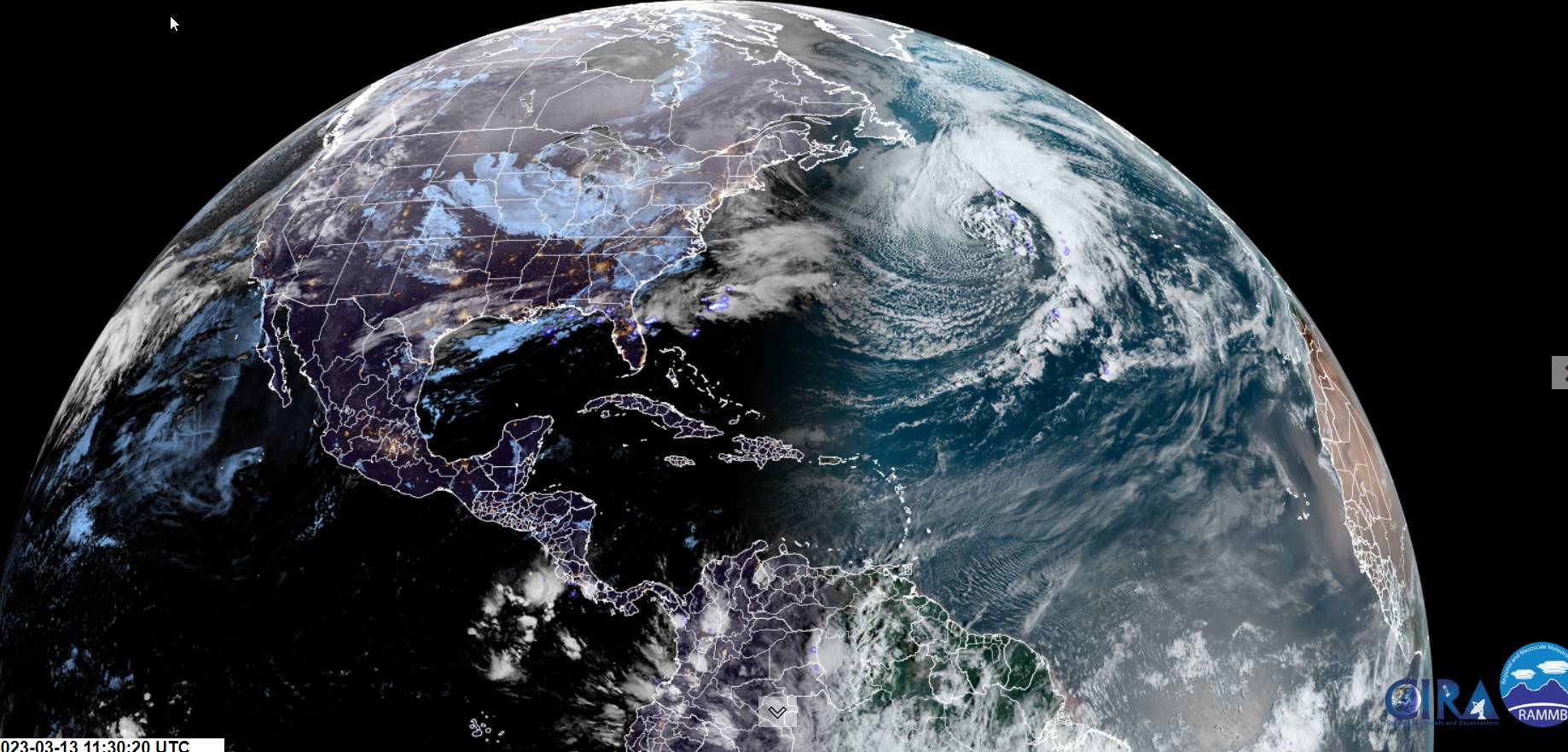
TONIGHT: Scattered light rain showers or sprinkles dries up then partial clearing overnight. Watch for icy spots east of the Green Mountains. A low upper 20s to low 30s. Southwest winds shifting to westerly overnight 10 mph.
TOMORROW: A few clouds early, then partly to mostly sunny. A high around 40. Light west to northwest winds. (Possible sap run)
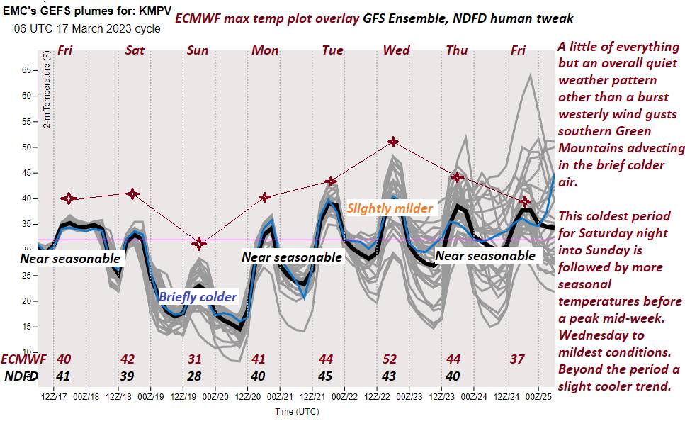
SATURDAY NIGHT: Mostly cloudy. Good chance for flurries developing with minor accumulation in the mountains. A low around 20. West winds 10 mph.
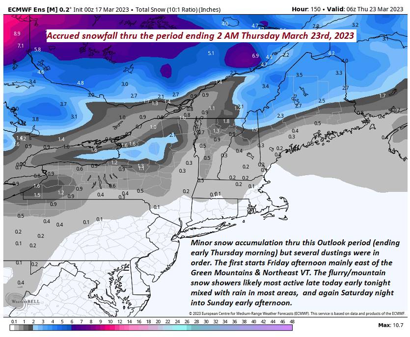
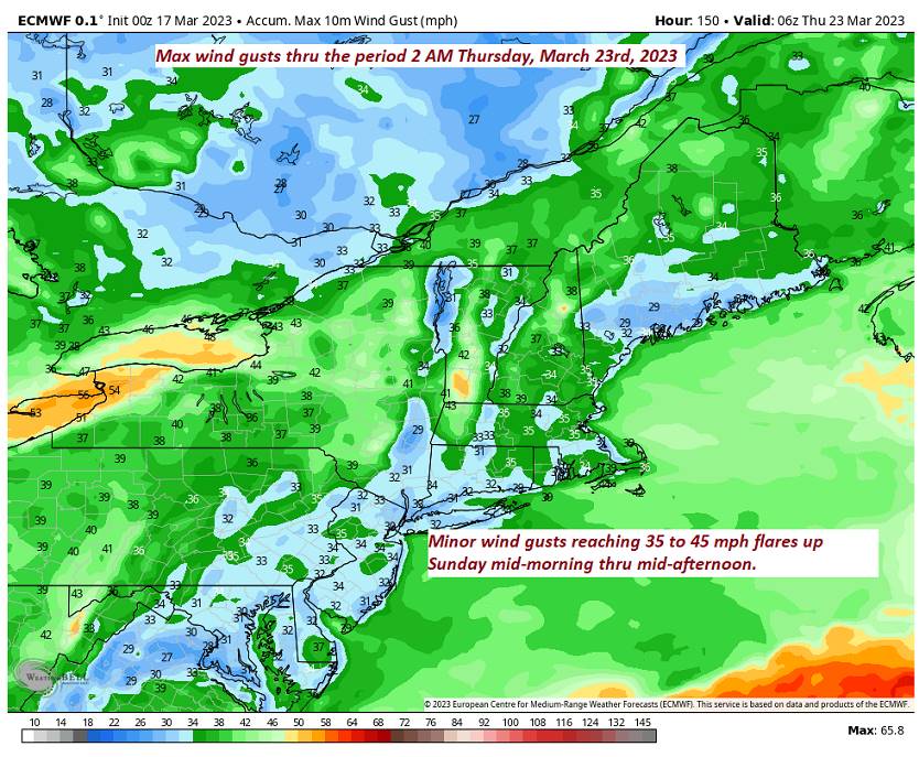
SUNDAY: Mostly cloudy, blustery and colder. Scattered mountain snow showers and valley flurries with a light coating in spots mainly northern areas. A high in the upper 20s to about 30. West winds 10 to 25 mph and gusty.
Looking further ahead
SUNDAY NIGHT: Mostly clear with a few high clouds. A low 15 to 20.
MONDAY: Sunshine mixing with a few clouds. A high mid to upper 30s.
TUESDAY: Partly sunny. A low in the mid to upper teens. A high around 45. (Sap run?)
WEDNESDAY: Sunshine filtered by high clouds. A low upper 20s to low 30s. A high mid-40s to near 50. (Sap run?)
Average lows mid-teens to lower 20s. Average highs mid-30s to low 40s.
Vernal Equinox March 20th Start of Meteorological summer arrives June 6th.
RH/3-17 forecast][end]