
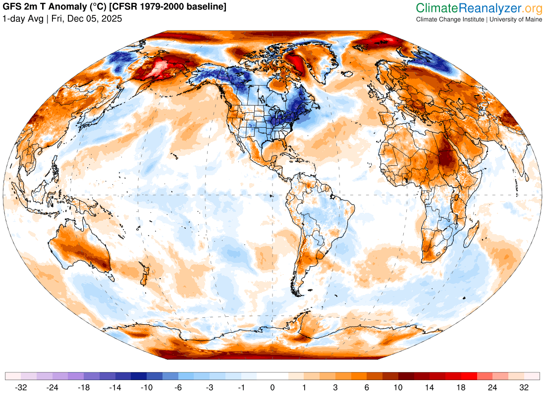
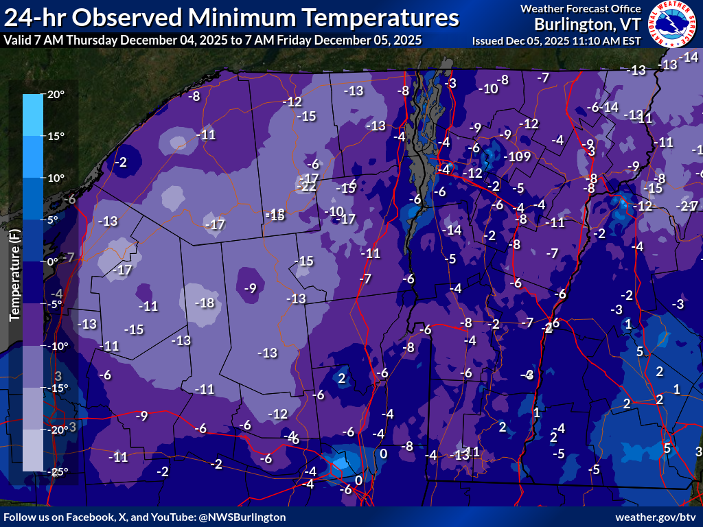
Roger Hill’s Radio Vermont Forecast 3:00 PM FRIDAY 12-5-25
TONIGHT: Mostly clear. An early low ranging from zero to 15 above, coldest northeast valleys. Light south winds stronger near Lake Champlain with lowered wind chills

TOMORROW: More clouds than sun. Blustery at times. Widely scattered afternoon flurries far northern high terrain. A high reaching the low 30s. South to southwest winds 10 to 15 mph.
SATURDAY NIGHT: Mostly cloudy. Widely scattered flurries northern areas. Dusting in spots. A low 5 to 15 above. South to southwest winds 10 to 15 mph.
SUNDAY: Considerable cloudiness. Rising chance for a few snow showers or flurries later in the afternoon with little accumulation. A high around 20. Southwest winds 10 to 15 mph.
Looking further ahead
SUNDAY NIGHT: Mainly cloudy. Chance for a round of snow showers or flurries. a dusting to an inch in spots A low zero to 10 above.
MONDAY: Any morning flurries exit early to bright sun and blue skies. Cold. Highs just 10 to 15.
TUESDAY: Gray skies. Chance for flurries with up to an inch of fluff. Continued frigid. Lows zero to ten below. Highs upper teens near 20.

WEDNESDAY: Overcast. Chance for accumulating wet snow showers with couple/few inches of slush. An early low upper teens. Highs near 32 degrees.
Average low: upper teens to mid-20s Average high: 35 to 40
Meteorological winter (coldest 90 days) begins December 12th

Winter Solstice 3:03 PM Saturday December 21st
RH/12-5-25/forecast][end] Fox Trot Delta Tango
