

Roger Hill’s Radio Vermont Forecast 3:00 PM FRIDAY 9-5-25
TONIGHT: Fair early, then clouding up. A rising chance for light showers or sprinkles. Damp, Patchy valley fog. A low in the lower 60s. Southwest winds 10 mph.
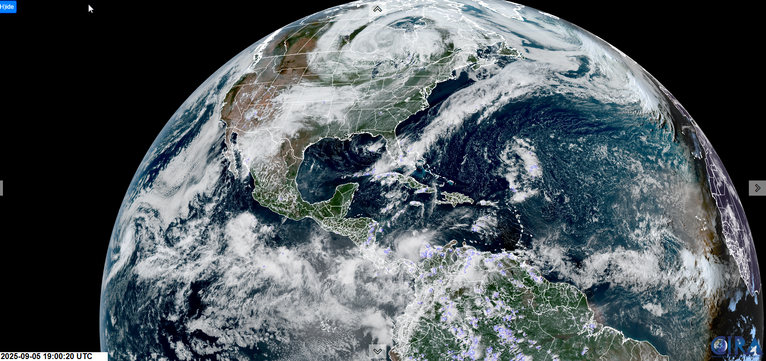
TOMORROW: Gray. Periods of rain developing…moderate at times in the afternoon…with thunderstorms southern areas. Wet and clammy. An early high upper 60s warmer south. Light southwest winds becoming northwesterly in the afternoon.
SATURDAY NIGHT: Mostly cloudy. A few lingering light showers. Areas of fog. Lows 50 to 55. Light west winds.

Full Harvest Moon 2:09 PM…
SUNDAY: Mixed sun & clouds. Maybe a sprinkle northern areas. A high in the mid-60s. West to southwest winds 10 mph.
Looking further ahead
SUNDAY NIGHT: Clear, cool and fully moonlit. Patchy valley fog. Lows mid-40s.
MONDAY: Valley fog then partly to mostly sunny. Highs 60 to 65.
TUESDAY: Sunny after morning fog. Lows 40 to 45. Highs upper 60s near 70.
WEDNESDAY: Sunshine with high cloudiness. Lows mid-40s. Pleasant. Highs low 70s.

Average low: upper 40s to mid-50s. Average highs: 70 to 75
Autumnal Equinox September 22nd.
Meteorological winter begins December 12th

RH/9-2/forecast][end]
