

Roger Hill’s Radio Vermont Forecast 3:00 PM MONDAY 6-30-25
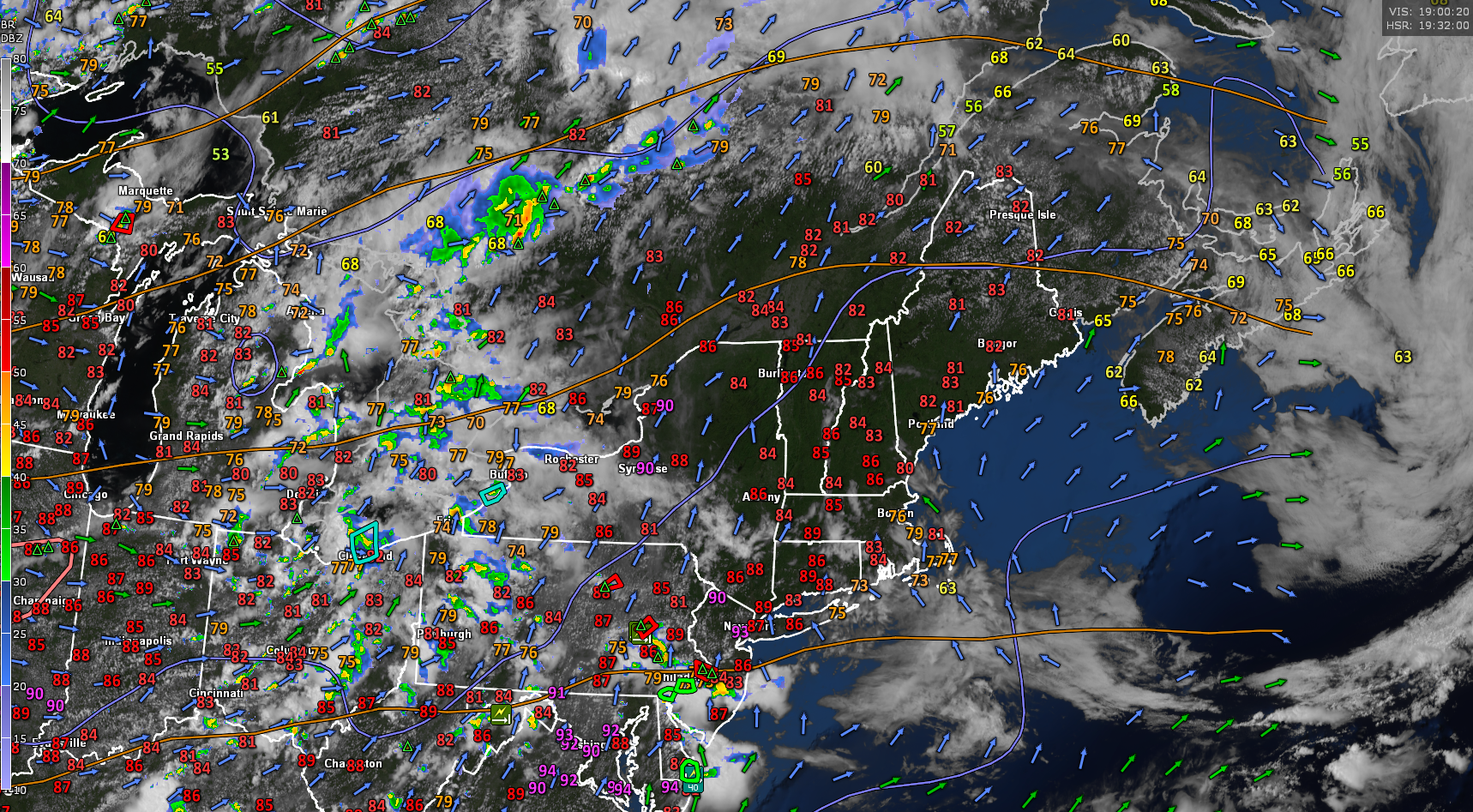
TONIGHT: Highs clouds early thickening overnight. Showers becoming likely overnight, maybe a rumble of thunder around or after daybreak. A low in the mid to upper 60s. Light south winds stronger near Lake Champlain.
TOMORROW: Variable clouds. Showers and a few briefly heavy thunderstorms likely in the morning, isolated in the afternoon. Oppressively warm & humid. A high 80 to 85. Southwest breeze 10 to 15 mph.
TUESDAY NIGHT: Maybe an early shower northern areas. Otherwise partial clearing, muggy. A low in the mid-60s. Light southwest winds.
WEDNESDAY: Sunshine filtered thru high clouds. A high in the lower 80s. Light west winds.

Looking further ahead
WEDNESDAY NIGHT: Mostly clear.A low 60 to 65.
THURSDAY: Sunshine gives way to lots of clouds.Rising chance for showers & thunderstorms in the afternoon. Muggy. A high around 80.

FRIDAY 4TH OF JULY: Sun mixing with clouds.Maybe a few passing mountain sprinkles.Much cooler & less humid. Lows 50 to 55. Highs around 65.
SATURDAY: Partly to mostly sunny.Lows 50 to 55. Highs around 80.
Average low: low to mid-50s. Average highs: upper 70s to low 80s.
Peak of Meteorological Summer July 22nd.
Admin: Summer Vacation 1 month after 4th of July. Fox Trot Delta Tango

RH/6-26[forecast][end]
