
-

- i m a g e 1 0 0
-
- i m a g e 1 0 1
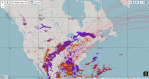
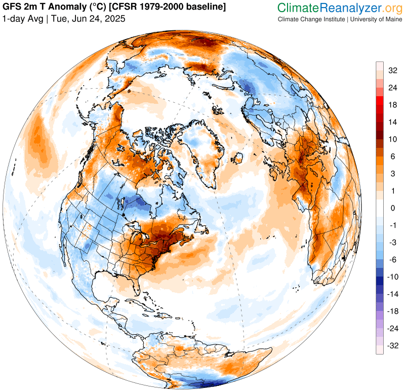
Roger Hill’s Radio Vermont Forecast 3:00 PM TUESDAY 6-24-25
Extreme Heat Warning and Heat Advisories into this evening…
TONIGHT: Mostly clear to partly cloudy warm and oppressive. Isolated showers and thunderstorms western areas. A low in the upper 60s/around 70. Light west to northwest winds.

TOMORROW: Lots of sunshine.Not as hot and less humid with a high in the low 80s. Isolated afternoon thunderstorms far south. Light north to northwest winds.
WEDNESDAY NIGHT: Mostly clear early then more clouds. Cooler and much less humid. A low upper 50s around 60. Light north to northeast winds.
THURSDAY: Considerable cloudiness. Maybe a southern Vermont sprinkle. Cool. A high around 70. Light north to northeast winds.

Looking further ahead
THURSDAY NIGHT: Clearing northern areas, otherwise partly cloudy. Comfortable. Lows 50 to 55.
FRIDAY: Partial morning sun then clouding up. Comfortable. Highs in the low 70s.
SATURDAY: Chance for showers and possible thunderstorms in the morning…some heavy exiting. Otherwise partial afternoon sun but noticeably more humid again. Lows 55 to 60. Highs in the mid-70s.
SUNDAY: Morning clouds then mostly sunny. Moderately humid. A low in the mid-60s. Highs near 80.

Average low: low to mid-50s. Average highs: 75 to 80
Peak of Meteorological Summer July 22nd.
Admin: Summer Vacation 1 month after 4th of July. Fox Trot Delta Tango
RH/6-23[forecast][end]
