

Roger Hill’s Radio Vermont Forecast 3:00 PM FRIDAY 3-28-25
Winter Weather Advisory 8 PM this evening thru 8 PM Sunday…
TONIGHT: Overcast. Periods of accumulating snow north developing…moderate at times. A wintry mix central and freezing rain southern areas. Accumulation ranging 2 to 6” of some sleet & snow about Barre-Montpelier north…with snow covered roads…and predominantly freezing rain southern half of the state, up to a third of an inch of glazing overnight. Expect poor travel developing. A low ranging mid-20s to low 30s north to south. Light north to northeast winds.

TOMORROW: Gray. Periods of snow and sleet across northern areas with an additional inch…then winding down. Occasional rain & freezing rain lingers southern areas changing to rain. A high near 35. Light northeast winds.
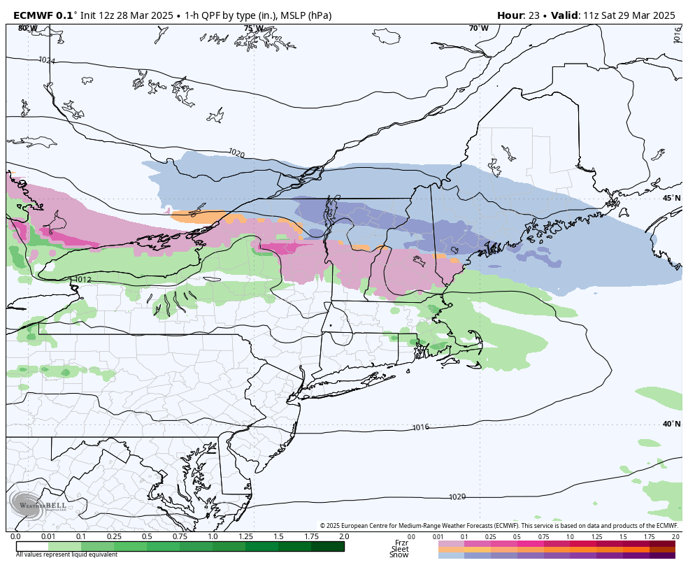
SATURDAY NIGHT: Lots of clouds. Periods of light freezing rain far southern areas with light glazing…spreading north across all of Vermont overnight. Lows upper 20s to low 30s. Light southeast winds.
SUNDAY: Cloudy. Chance for freezing rain east of the Greens to start, then chance for rain or rain showers in the afternoon. Highs mid-30s. Southeast winds 10 mph in the afternoon.
Looking further ahead

SUNDAY NIGHT: Overcast. Chance for yet more light freezing rain east of Greens with some glazing and just rain elsewhere. Lows 32 to 35.
MONDAY: Gray. Chance for periods of rain moderate at times in the afternoon. Areas of fog, but much milder. A high ranging low 60s Champlain Valley, to upper 50s eastern areas.
TUESDAY: Morning sprinkles or flurries, then increasingly sunny but blustery. A low around 32. A high around 35.
WEDNESDAY: Filtered sunshine. Lows upper teens. Highs close to 40.
Average low: low to mid-20s. Average high mid to upper 40s.

RH/3-28[forecast][end]
