
TONIGHT: Thickening clouds.Scattered rain showers developing later this evening exiting before daybreak.A low near 40.South breeze 10 mph.
TOMORROW: Mainly gray. Occasional rain showers late morning on. Rising streams and rivers due to snow melt. A high in the low 50s. Southeast winds 10 to 15 mph.
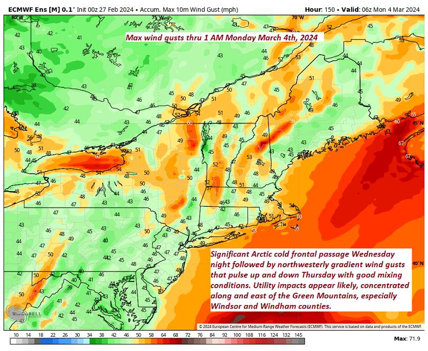
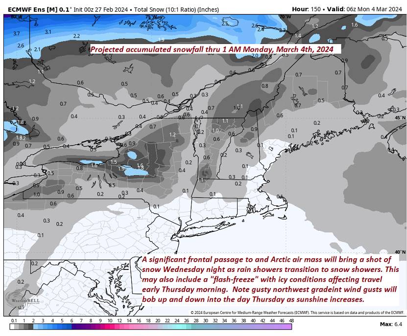
WEDNESDAY NIGHT: Overcast.Rain showers likely moderate at times…changing to snow showers, with up to an inch of accumulation. Blustery to windy. An eventual low ranging 5 to 15 by daybreak with icy spots and slick travel. South winds shifting to northwesterly and increasing to 10 to 25 mph with higher gusts east of the Green Mountains
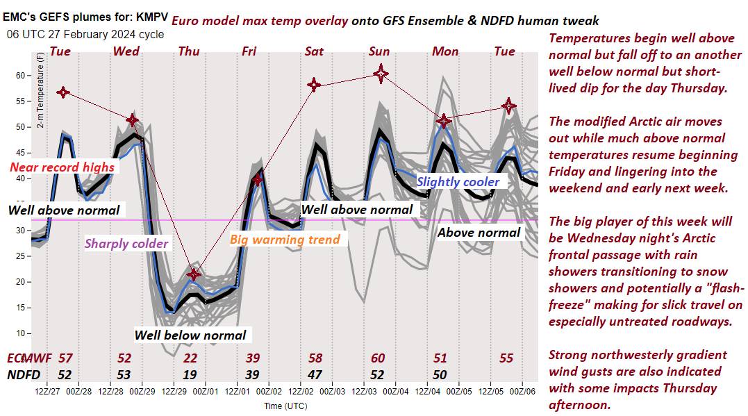
THURSDAY: More sun than clouds, blustery to windy & colder. A high in the low 20s. Northwest winds 10 to 25 mph with higher gusts near the mountains.
Looking further ahead
THURSDAY NIGHT: Mostly clear and partially moonlit. More clouds late. A low ranging near zero far north, to around 15 above western Vermont valleys.
FRIDAY: Cloudiness gives way to partial afternoon sun. A high in the lower 40s.
SATURDAY: Lots of sunshine and a beauty. A low upper 20s. A high around 50.
SUNDAY: Mostly sunny. A low near 32 with a high mid to upper 50s.
Average lows upper-single digits to upper-teens. Average highs mid to upper 30s.
RH/2-26forecast][end]
