
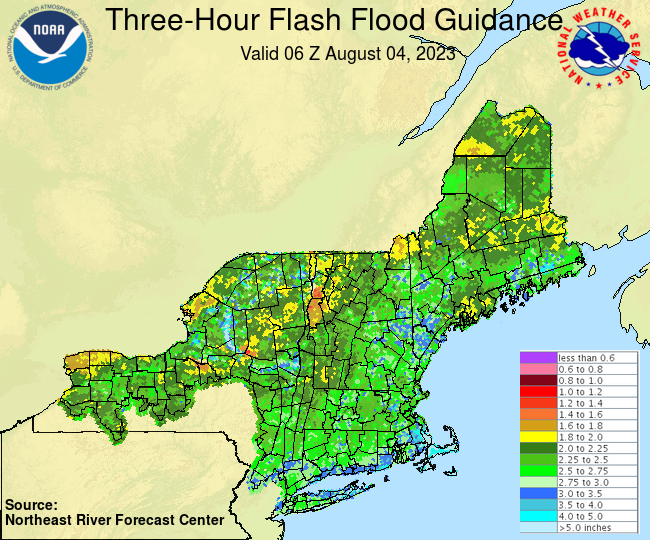
Flood Watch is in effect thru 9 PM this evening…
TODAY: Lot of clouds mixing with a few intervals of sun. Showers and mainly afternoon thunderstorms, some strong and locally heavy. Humid. A high upper 60s to around 70. Light southwest breeze.
TONIGHT: A few showers and heavy thunderstorms exiting to partial clearing. Valley fog overnight. A low around 55. Light southwest winds.
SATURDAY: Morning fog & low cloudiness, gradually gives way to partly to mostly sunny skies. Less humid. A high 70 to 75. Light northwest breeze.
Looking further ahead
SATURDAY NIGHT: Mostly clear. Patchy valley fog. A low in the low to mid 50s.
SUNDAY: Morning fog gives way to filtered sunshine thru high cloudiness. A high near 75.
MONDAY: Sunshine with some high cloudiness. Clouding up late. A rising chance for showers and possible thunderstorms toward evening. A low 50 to 55. A high upper 70s to near 80.
TUESDAY: Mixed clouds and sun. Scattered morning showers and isolated thunderstorms. Muggy. A low 60 to 65. A high in the mid-70s.
WEDNESDAY: Morning fog and low clouds, give way to partly to mostly sunny skies. A low around 60. A high
75 to 80.
Average lows 55 to 60. Average high mid-70s to around 80.
RH/8-4 forecast][end]
