
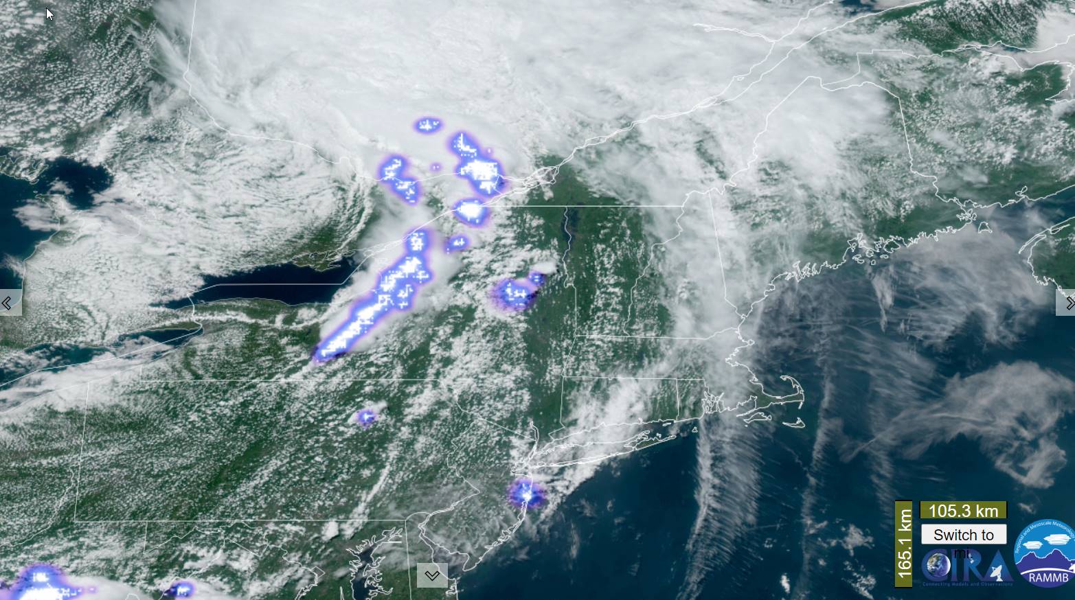
Flood Watch into tonight…Severe Thunderstorm Watch thru 8 PM.
TONIGHT: Showers and thunderstorms likely, some strong to severe with gusty winds, hail and briefly heavy rainfall this evening. Otherwise, gradual clearing giving way to low clouds and valley fog. A low 60 to 65. Light south to southwest breeze.
TOMORROW: Intervals of sunshine mixing with more afternoon clouds. Rising chance for showers and a few locally heavy thunderstorms. A high in the mid to upper 70s. Light south winds.
FRIDAY NIGHT: Partial clearing in the evening, giving way to lots of low clouds and valley fog forming overnight. A low mid-60s. Light southeast winds.
SATURDAY: Patchy valley fog, then then sunshine filtered by high clouds. A high lower 80s. Light southwest winds.
Looking further ahead
SATURDAY NIGHT: Mostly clear, before more clouds overnight. A low near 65.
SUNDAY: Gray skies. Chance for light rain or showers, maybe a rumble of thunder. A high in the mid to upper 70s.
MONDAY: Morning fog with light sprinkles or patchy drizzle gives way to lots of afternoon sunshine, and pleasant. A low in the mid-60s. A high 80 to 85.
TUESDAY: Patchy fog burns off to intervals of sunshine then more clouds. Chance for afternoon showers and thunderstorms…some possibly heavy. A low in the low 60s. A high in the low 80s.
Average lows 55 to 60. Average high upper 70s to low 80s.
Summer temps peak July 22nd
RH/7-13 forecast][end]
