
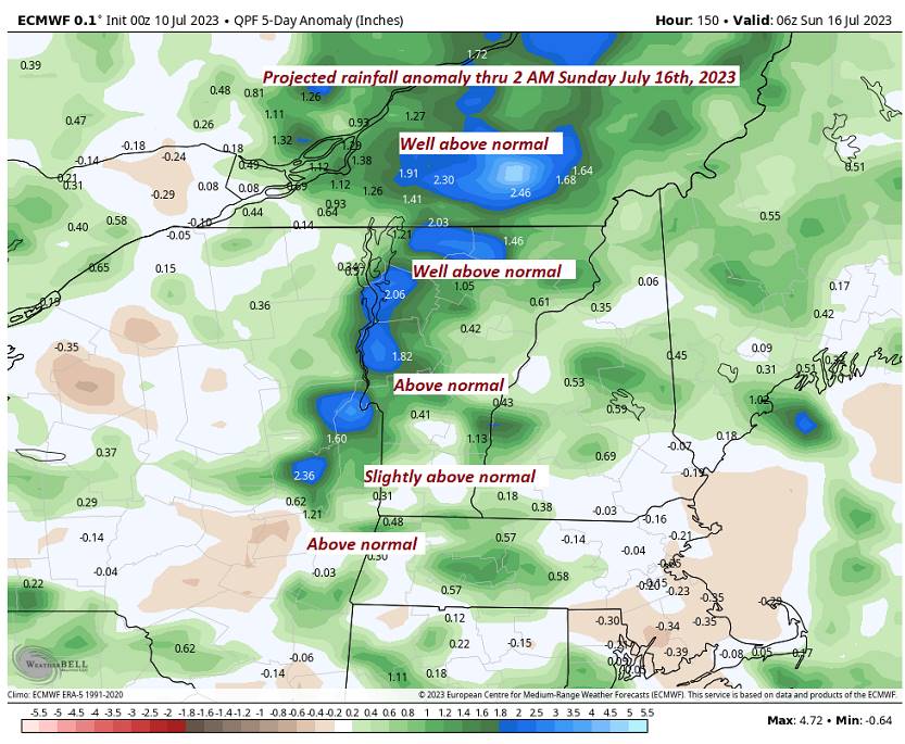
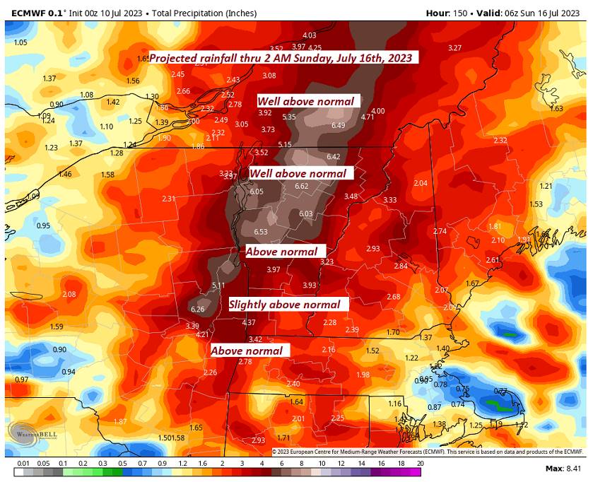
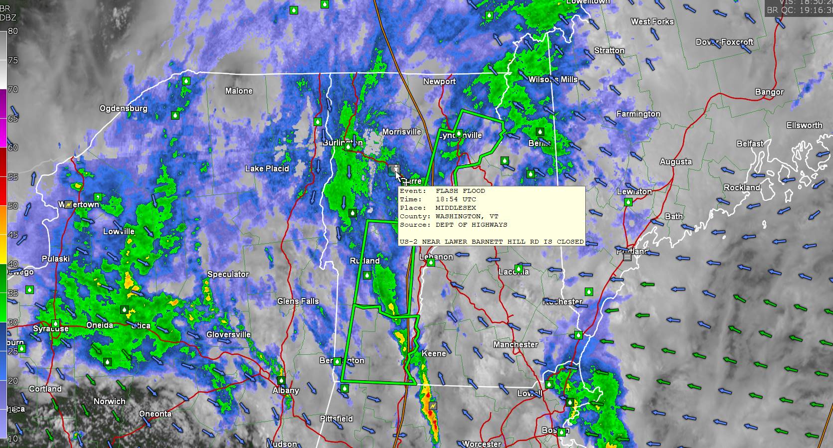
Flood Watch thru Tuesday evening. Flood Warnings for large parts of Vermont ongoing into Tuesday morning with river rises reaching catastrophic flooding in some areas.
TONIGHT: Mainly cloudy. Showers…moderate to heavy. Maybe a rumble of thunder this evening. A low about 60. West to northwest winds 10 mph.
TOMORROW: Clouds with leftover showers early…giving way to periods of afternoon sun. Chance for late afternoon showers and thunderstorms, one or two possibly strong & again locally heavy. A high upper 70s to about 80. West to southwest breeze 10 mph.
TUESDAY NIGHT: Mostly clear setting up dense valley fog. A low in the low 60s. Light southwest winds.
WEDNESDAY: Partly sunny. Isolated mainly afternoon showers with a rumble of thunder. A high in the low 80s. West breeze 10 mph.
Looking further ahead
WEDNESDAY NIGHT: Fair with variable high cloudiness. Patchy valley fog. A low in the low 60s.
THURSDAY: Mixed sun and clouds. Chance for late afternoon showers and thunderstorms. A high in the upper 70s
FRIDAY: Mostly cloudy. Chance for showers and a few afternoon thunderstorms. A low in the low 60s. A high about 80.
SATURDAY: Patchy valley fog, then mostly sunny and pleasant. A low 60 to 65. A high about 80.
Average lows 55 to 6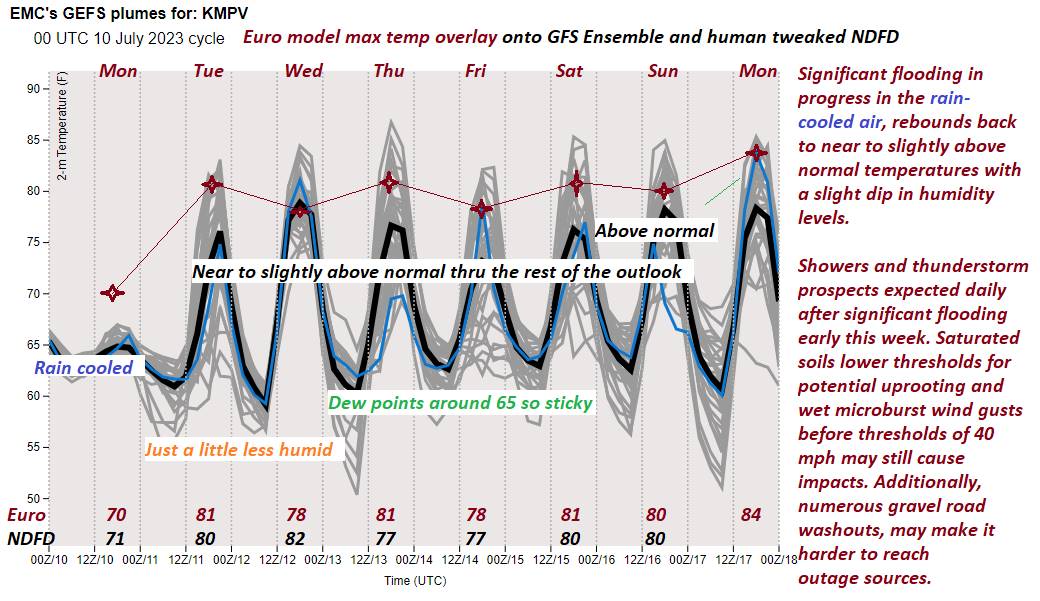
0. Average high upper 70s to low 80s.
Summer temps peak July 22nd
RH/7-10 forecast][end]
