
TONIGHT: Mostly clear and partially moonlit. Considerable valley fog. A low in the mid-60s. Light south winds.
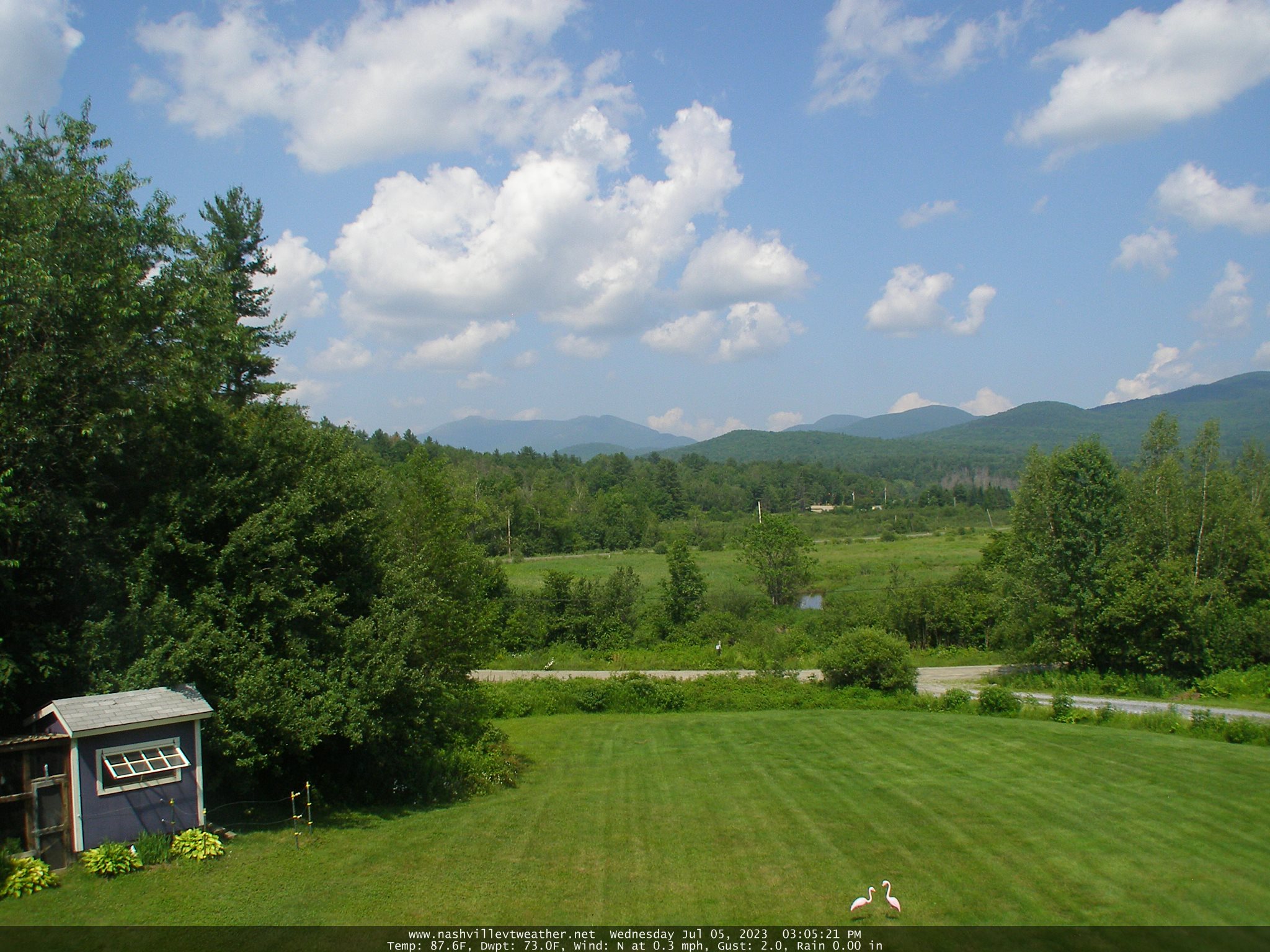
TOMORROW: Patchy valley fog burns off to mostly sunny skies. Isolated pop-up showers & thunderstorms. Hot and sticky. A high upper 80s to around 90. Light south winds.
THURSDAY NIGHT: Mostly clear with patchy valley fog. A few high clouds overnight. A low in the upper 60s. Light south winds.
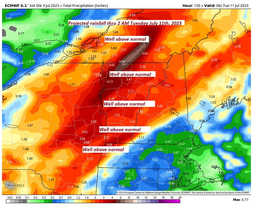
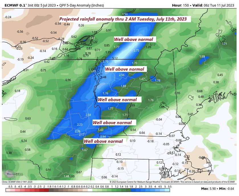
FRIDAY: Some partial morning sunshine, then mostly cloudy. Good chance for a round or two of showers and thunderstorms in the afternoon, some possibly strong & locally heavy. Sultry. A high in the low 80s. Light southwest winds.
Looking further ahead
FRIDAY NIGHT: Chance for a leftover shower or thunderstorm southern areas, otherwise clearing promoting low clouds and fog overnight. A low in the mid-60s.
SATURDAY: Sunshine filtered through high clouds. Less humid. A high around 80 north and near 85 south.
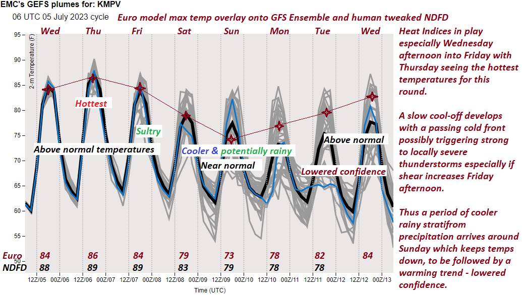
SUNDAY: Clouding up. Rising chance for periods of rain or showers in the afternoon, maybe a rumble of thunder. A low in the lower 60s, and highs in the mid-70s.
MONDAY: Clouds with a chance for morning showers give way to clearing skies. A low in the low to mid-60s. A high mid to upper 70s.
Average lows 55 to 60. Average high upper 70s around 80.
Summer temps peak July 22nd
RH/7-5 forecast][end]
