
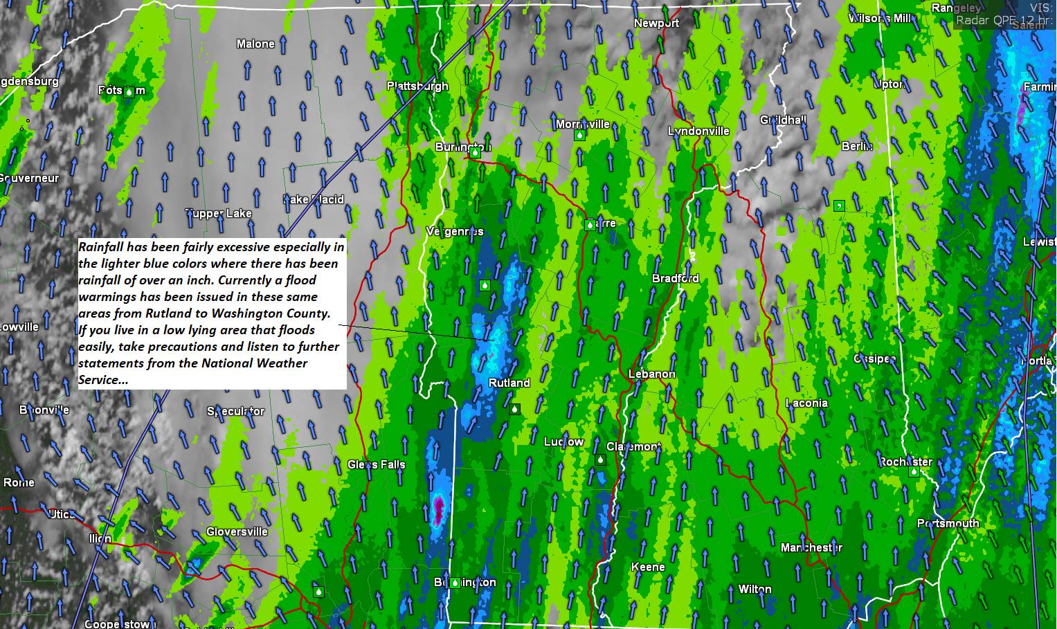
Flood warning in effect for portion of the central Green Mountains Rutland County to Washington County…
TONIGHT: Mostly cloudy. Showers, some persistent and heavy, with rising stream and rivers…maybe a rumble of thunder. A low in the lower 60s. Light southeast winds.
TOMORROW: Mainly cloudy. Isolated showers then more numerous mid to late afternoon with a few rumbles of thunder. A high near 75. South breeze 10 mph.

WEDNESDAY NIGHT: Mostly cloudy. Isolated showers maybe a thunderstorm. A low around 60. Light southeast winds.
THURSDAY: Partly sunny. Widely scattered afternoon & early evening showers and thunderstorms. A high 70 to 75. Light south to southwest breeze.
Looking further ahead
THURSDAY NIGHT: Clear in the evening the scattered clouds later on. A low upper 50s to around 60.
FRIDAY: Pick of the week. Morning clouds then increasingly sunny. A high about 80.
SATURDAY: Mostly cloudy. Chance for numerous showers and afternoon thunderstorms. A low around 60. A high 75 to 80.
SUNDAY: Mostly cloudy. Widely scattered showers and afternoon thunderstorms. A low 60 to 65. A high 70 to 75.
MONDAY: Chance for showers. Otherwise, lots of clouds giving way to partial sunshine. A low near 60. A high 70
to 75.
Average lows mid to upper 50s. Average mid-70s to around 80.
Approximate Peak of summer July 22nd
RH/6-27 forecast][end]
