
TONIGHT: Mostly clear with low clouds and patchy valley fog overnight. A low in the lower 50s. Light southeast winds.
Summer Solstice 10:57 AM
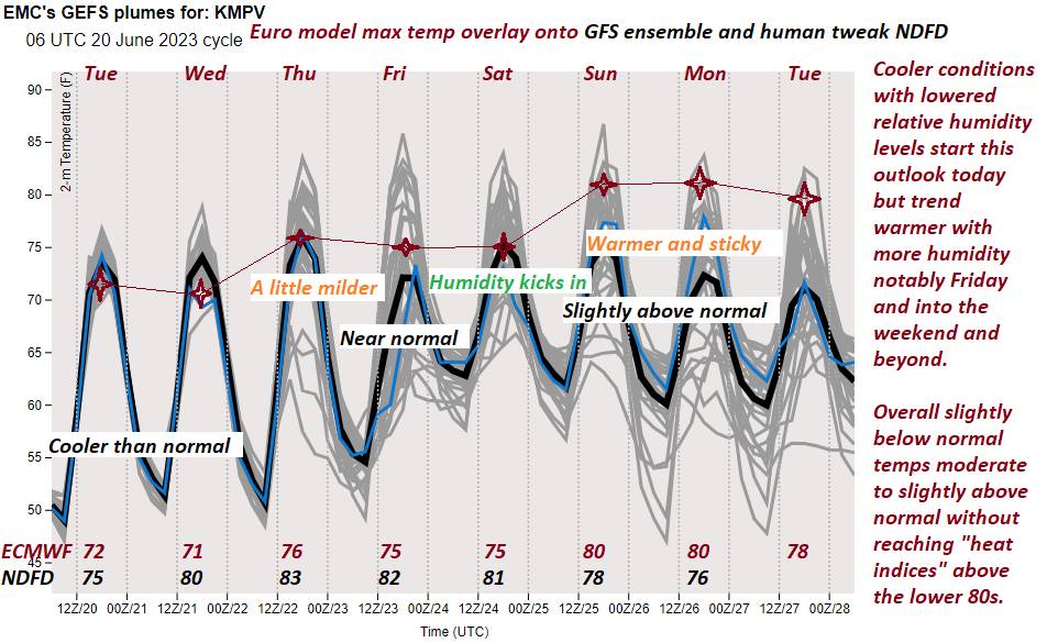
TOMORROW: Periods of sun with few afternoon clouds. A high 70 to 75. Light southeast winds.
WEDNESDAY NIGHT: Mostly clear. Patchy valley fog. A low 50 to 55. Light southeast winds.
THURSDAY: Lots of sunshine with more clouds developing late. Moderately humid. A high mid to upper 70s. Light winds southeasterly.
Looking further ahead
THURSDAY NIGHT: Cloudy. Maybe a sprinkle toward Rutland. A low mid to upper 50s.
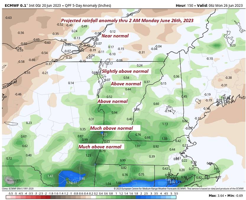
FRIDAY: Mainly cloudy. Muggy. A rising chance for showers south to north. A high 75 to 80.
SATURDAY: Clouds with a few hints of sunshine. Sticky. Rising chance for afternoon showers & thunderstorms.
A low in the low to mid 60s. Highs around 80.
SUNDAY: Partial morning sun then afternoon clouds. Scattered afternoon showers and thunderstorms. A low 60 to 65. A high around 80.
Average lows mid to upper 50s. Average highs 75 to 80.
Approximate Peak of summer July 22nd
RH/6-20 forecast][end]
