
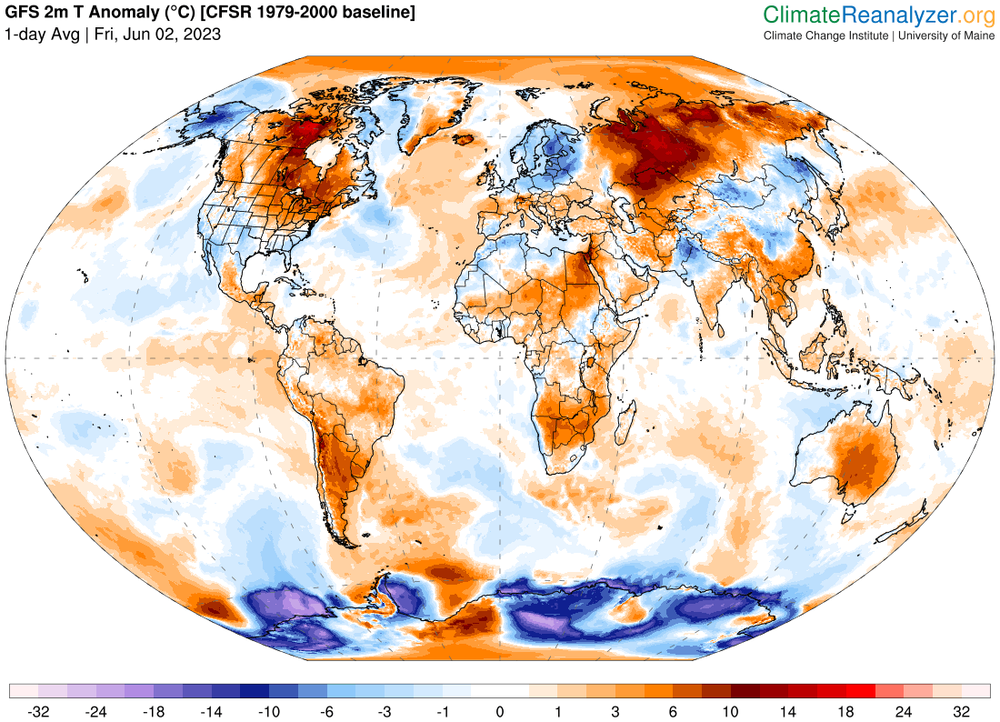
TODAY: Morning sun, then partly sunny and more humid. Showers and thunderstorms likely mid- afternoon…one or two strong and locally heavy. Record to near record warmth and muggy this afternoon. A high 85 to 90. North breeze 10 mph.
TONIGHT: Variable cloudiness. Isolated mainly evening showers and thunderstorms. A low 50 to 55. Northeast winds 10 mph.

SATURDAY: Lots of clouds with a few showers central and southern areas. Intervals of afternoon sunshine much cooler with below normal temperatures.A high mid to upper 60s. Northeast breeze 10 to 15 mph.
Looking further ahead
Full strawberry Moon 11:42 PM Saturday…
SATURDAY NIGHT: Partial clearing east of the Greens, mostly clear elsewhere and “fully moonlit”. A low
around 45.

SUNDAY: Morning sun then lots of clouds. A high around 65.
MONDAY: Considerable cloudiness. A low in the 40s. A high upper 60s.
Approximate start of meteorological summer…
TUESDAY: Gray skies. Scattered showers with partial clearing developing later on. A low 45 to 50. A high near 65.
WEDNESDAY: Lots of clouds northern areas. Partial afternoon sunshine southerly areas. A low in the 40s. A high around 65.
Average lows ranging 45 to 50. Average highs 70 to 75
Start of Meteorological summer this next Tuesday June 6th Summer Solstice hits June 21st
RH/6-1 forecast][end]
