
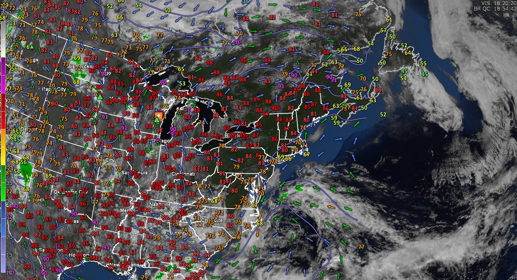
TONIGHT: Clear & starlit. A low near 55. Little wind.
TOMORROW: Sunny with a few afternoon clouds. A high in the lower 90s. Light northwest winds.
THURSDAY NIGHT: Clear & starlit. Not as cool. A low down to around 60. Little wind.
FRIDAY: Morning sun then partly sunny and a tad more humid. Showers and thunderstorms likely…one or two strong and locally heavy. A high 85 to 90. North to northwest winds 10 mph.
Looking further ahead
FRIDAY NIGHT: Mostly cloudy. Scattered showers and isolated thunderstorms. A low around 55.
SATURDAY: Considerable cloudiness and much cooler with below normal temperatures. Chance for showers especially eastern and southern areas. A high in the low to mid-60s.
SUNDAY: Lots of clouds. Chance for showers eastern areas. A low in the mid-40s. A high 65 to 70.
MONDAY: Sun then partly to mostly cloudy. Maybe a shower late. A low in the mid to upper 40s. A high upper 60s.
Approximate start of meteorological summer…
TUESDAY: Mixed sun and clouds. Isolated showers or thunderstorm possible. A low around 50. A high around 70.
Average lows ranging 45 to 50. Average highs 70 to 75
Start of Meteorological summer this next Tuesday June 6th Summer Solstice hits June 21st
RH/5-31 forecast][end]
