
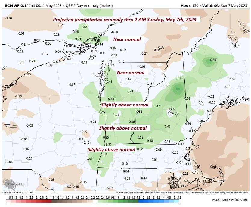
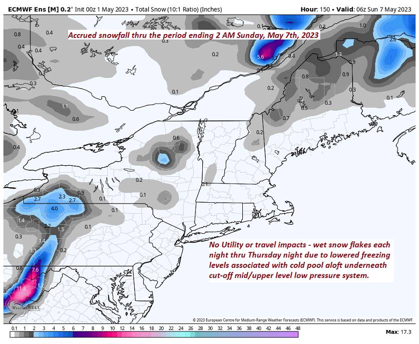
TODAY: Brief morning sun, areas of dense fog, then gray. Showers, with a few wet snow flakes mountain summits. Raw. A high in the lower 50s. Southeasterly breeze 10 mph.
TONIGHT: Lots of clouds. Scattered evening showers, more isolated overnight with wet snowflakes on the summits. A low around 40. Light southeast winds.
WEDNESDAY: Gray. Showers likely. A high in the low 50s. Light easterly winds.
Looking further ahead
WEDNESDAY NIGHT: Overcast. Widely scattered showers mixed with wet snow flakes higher terrain. A low 35 to 40.
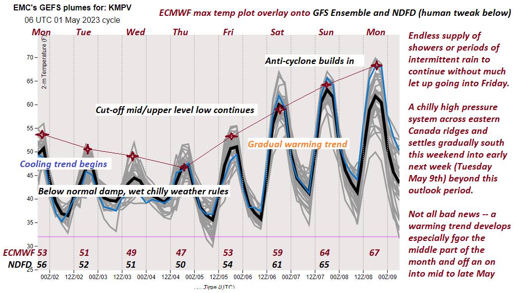
THURSDAY: Mainly cloudy. Widely scattered shower activity. Gradual day time warming trend begins. A high in the low 50s.
FRIDAY: More clouds than sun. Isolated mountain showers/sprinkles mixed with wet snowflakes summits. A low
35 to 40. A high around 55.
SATURDAY: Morning sun then more clouds in the afternoon. A low 35 to 40. A high in the low 60s.
SUNDAY: Sunshine gives way to afternoon cloudiness. A low 32 to 35. Mild. A high around 65.
Average lows ranging mid-30s to low 40s. Average highs 60 to 65.
Start of Meteorological summer June the 6th.
RH/5-1 forecast][end]
