
TONIGHT: High cloudiness, thickening up later this evening. A low about 40. Light southeast winds.
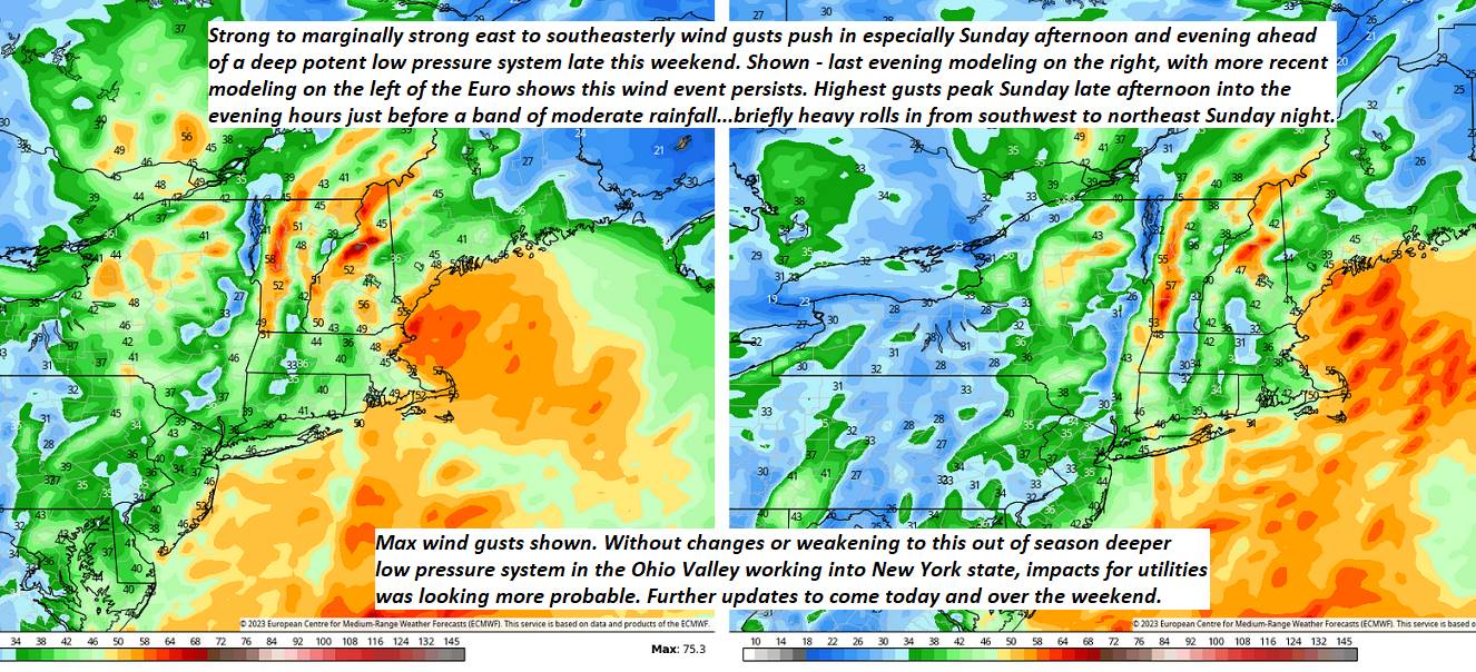
TOMORROW: Gray & breezy. Showers likely late, mixed with wet snow flakes high terrain late. A high in the mid-50s. Southeast breeze 10 to 20 mph.
SATURDAY NIGHT: Overcast. Showers likely. A low around 40. Southeast winds 10 to 20 mph.
SUNDAY: Cloudy & breezy to windy. Occasional light showers especially southern and eastern areas. A high 50 to 55. East to southeast winds 10 to 20 mph with stronger gusts western slopes of the Green Mountains in the afternoon.
Looking further ahead
SUNDAY NIGHT: Breezy to windy. A low mid to upper 40s. Gusty southeasterly winds.
MONDAY: Chance for periods of rain early exiting as a few left-over sprinkles, Otherwise clouds give way to partly to mostly sunny skies. A high 55 to 60.
TUESDAY: Clouds with patchy valley fog. Chance for more rain or showers. A low upper 30s to near 40. A high
near 55.
WEDNESDAY: Clouds. Chance for more showers. A low in the mid to upper 30s. A high in the low 50s.
Average lows ranging thru the 30s. Average highs upper 50s to lower 60s.
Start of Meteorological summer June the 6th.
RH/4-28 forecast][end]
