
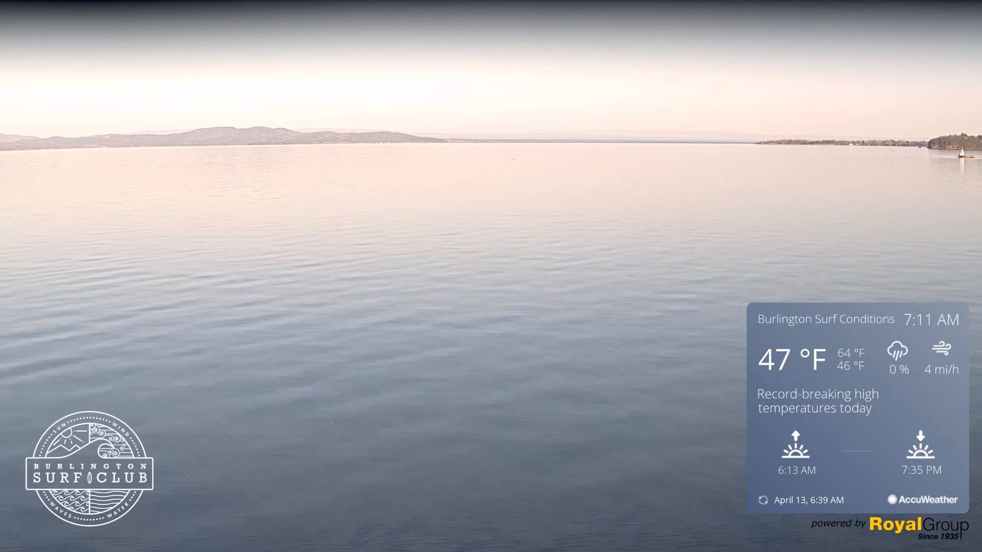
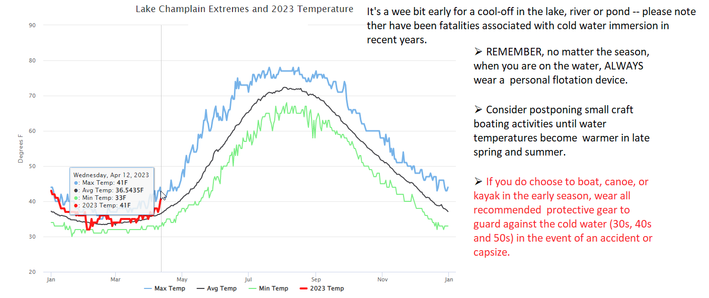
TODAY: Pick of the week. Sunny, with a taste of early summer. A record high upper 70s to low 80s western Vermont low humidity levels and still high fire danger. West breeze 10 mph.
TONIGHT: Mostly clear with a few high clouds & mild.A low ranging 45 to 55. Light southwest winds.
FRIDAY: Lots of sunshine with a few high clouds. A high in the upper 70s. Wind becoming light and westerly.
Looking further ahead
FRIDAY NIGHT: Mostly clear. A low in the 40s.
SATURDAY: Filtered sun thru high cloudiness. Again very mild. A high near 75.
SUNDAY: Some periods of sunshine northern areas. Thickening clouds southern areas with a few spotty afternoon showers or sprinkles, areas of drizzle. A low around 50. A high 65 to 70.
MONDAY: Cloudy damp and cooler. Good chance for rain showers…moderate at times. A low around 45. A high 50 to 55.
TUESDAY: Gray, damp but seasonal in temperature. Scattered rain showers with wet snow flakes returning upper mountain slopes. A low upper 30s. A high 50 to 55.
Average lows 30 to 35. Average highs low to mid 50s.
Start of Meteorological summer June the 6th.
RH/4-13 forecast][end]
